dry air cannot get into a storm if there is no shear
the stratocu deck is well to the north, that's not an issue.
I wish we had some obs... I'd love to see a sounding to check the lapse rate
EPAC : TROPICAL DEPRESSION CARLOS (04E)
Moderator: S2k Moderators
-
Iceman56
Re: EPAC : TROPICAL STORM CARLOS (04E)
Dry air can't get into a storm if there is no shear? Huh?
How do you explain the myriad of outflow boundaries earlier this morning. You don't create outflow boundaries in a deep, moist, high theta-e environment. But a TC can most certainly import higher or lower theta-e air from the surrounding environment it moves into, shear or not.
How do you explain the myriad of outflow boundaries earlier this morning. You don't create outflow boundaries in a deep, moist, high theta-e environment. But a TC can most certainly import higher or lower theta-e air from the surrounding environment it moves into, shear or not.
0 likes
-
cycloneye

- Admin

- Posts: 149727
- Age: 69
- Joined: Thu Oct 10, 2002 10:54 am
- Location: San Juan, Puerto Rico
Re: EPAC : TROPICAL STORM CARLOS (04E)
00 UTC Best Track
Down to 50 kts,994 mbs.
EP, 04, 2009071300, , BEST, 0, 102N, 1223W, 50, 994, TS
What happened that suddenly,Carlos went downhill? They said at discussion its a mystery the weakening.
Down to 50 kts,994 mbs.
EP, 04, 2009071300, , BEST, 0, 102N, 1223W, 50, 994, TS
What happened that suddenly,Carlos went downhill? They said at discussion its a mystery the weakening.
0 likes


-
Ed Mahmoud
Re: EPAC : TROPICAL STORM CARLOS (04E)
Iceman56 wrote:Dry air can't get into a storm if there is no shear? Huh?
How do you explain the myriad of outflow boundaries earlier this morning. You don't create outflow boundaries in a deep, moist, high theta-e environment. But a TC can most certainly import higher or lower theta-e air from the surrounding environment it moves into, shear or not.
I can't promise Derek is right about that, but he did write his Master's thesis on the very subject.
Do to sparseness of actual data points, it would seem the idea of mid level shear might be a better explanation.
I wonder if anyone has a clue when a G-IV might fly a high level mission to try to get more data from the models. I'm sure someone knows, but are they S2K members?
0 likes
-
cycloneye
- Admin
- Posts: 149727
- Age: 69
- Joined: Thu Oct 10, 2002 10:54 am
- Location: San Juan, Puerto Rico
Re: EPAC : TROPICAL STORM CARLOS (04E)
I wonder if anyone has a clue when a G-IV might fly a high level mission to try to get more data from the models. I'm sure someone knows, but are they S2K members?
pojo may have the answer.
0 likes
-
Aric Dunn
- Category 5

- Posts: 21238
- Age: 43
- Joined: Sun Sep 19, 2004 9:58 pm
- Location: Ready for the Chase.
- Contact:
sorry did not feel like reading all the posts .. but the likely cause of the weakening is the fact that the invest area to the east is inhibiting the inflow on the SE and east side of carlos. you only need to look at the visible loop to see this. i would not be surprised to see even more weakening and possibly get absorbed into the extremely large circulation of the invest or just interacting till tll they both weaken. That of course hinges upon the invest developing and deepening.
http://www.ssd.noaa.gov/goes/flt/t7/loop-rgb.html
http://www.ssd.noaa.gov/goes/flt/t7/loop-rgb.html
Last edited by Aric Dunn on Sun Jul 12, 2009 8:30 pm, edited 1 time in total.
0 likes
-
Ed Mahmoud
Re: EPAC : TROPICAL STORM CARLOS (04E)
cycloneye wrote:I wonder if anyone has a clue when a G-IV might fly a high level mission to try to get more data from the models. I'm sure someone knows, but are they S2K members?
pojo may have the answer.
But the G-IV is NOAA/Department of Commerce, and the Hurricane Hunters are USAFR/DoD, so I didn't know if she'd be aware of their tasking.
Nothing from the NHC POD for tomorrow.
0 likes
-
Ed Mahmoud
Re:
Aric Dunn wrote:sorry did not feel like reading all the posts .. but the likely cause of the weakening is the fact that the invest area to the east is inhibiting the inflow on the SE and east side of carlos. you only need to look at the visible loop to see this. i would not be surprised to see even more weakening and possibly get absorbed into the extremely large circulation of the invest or just interacting till tll they both weaken. That of course hinges upon the invest developing and deepening.
http://www.ssd.noaa.gov/goes/flt/t7/loop-rgb.html
It has an orange probability area, but I don't see it at NRL or on the Active Systems map.
0 likes
-
Aric Dunn
- Category 5
- Posts: 21238
- Age: 43
- Joined: Sun Sep 19, 2004 9:58 pm
- Location: Ready for the Chase.
- Contact:
Re: Re:
Ed Mahmoud wrote:Aric Dunn wrote:sorry did not feel like reading all the posts .. but the likely cause of the weakening is the fact that the invest area to the east is inhibiting the inflow on the SE and east side of carlos. you only need to look at the visible loop to see this. i would not be surprised to see even more weakening and possibly get absorbed into the extremely large circulation of the invest or just interacting till tll they both weaken. That of course hinges upon the invest developing and deepening.
http://www.ssd.noaa.gov/goes/flt/t7/loop-rgb.html
It has an orange probability area, but I don't see it at NRL or on the Active Systems map.
right i guess i could have called and a area of disturbed weather.. lol but invest is more accurate even though no NRL invest is up ..
0 likes
-
Ed Mahmoud
Re:
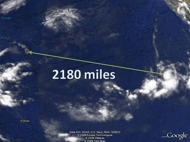
HURAKAN wrote:Unless Carlos becomes a menace to Hawaii, I feel doing a mission is completely unnecessary.
No doubt, but it could be as little as a week away from the islands, the G-IV crew would probably need about 2 days to prepare, fly to Hawai'i, then rest up before a dropsonde mission, and I'd think CPHC would want good data in the models before they throw up a hurricane/tropical storm watch, so I'd guesstimate by Tuesday or Wednesday they'd have to make the decision.
Not the same thing as tasking a mission in the Gulf or off the East Coast.
Similar timing on the WC-130Js, I'd guess.
0 likes
-
Aric Dunn
- Category 5
- Posts: 21238
- Age: 43
- Joined: Sun Sep 19, 2004 9:58 pm
- Location: Ready for the Chase.
- Contact:
Re: Re:
\\Ed Mahmoud wrote:HURAKAN wrote:13/0000 UTC 10.3N 122.9W T2.5/3.5 CARLOS -- East Pacific
Dvorak not treating Carlos very well.
Recent burst very near the center, I think the weakening trend may have stopped.
highly doubtful with that system near, the inflow is severely limited on the east side..
0 likes
-
Ed Mahmoud
Re: Re:
Aric Dunn wrote:\\Ed Mahmoud wrote:HURAKAN wrote:13/0000 UTC 10.3N 122.9W T2.5/3.5 CARLOS -- East Pacific
Dvorak not treating Carlos very well.
Recent burst very near the center, I think the weakening trend may have stopped.
highly doubtful with that system near, the inflow is severely limited on the east side..
I could be wrong, but I don't think it is close enough to cause a hurricane to barf outflow boundaries and get downgraded to a tropical storm.
Should be an official invest soon, if I had to guess...

0 likes
-
Iceman56
Re: EPAC : TROPICAL STORM CARLOS (04E)
Ed Mahmoud wrote:I can't promise Derek is right about that, but he did write his Master's thesis on the very subject.
I read Mr. Ortt's thesis and I believe it is a leap of faith to say:
"The convective activity prevents the dry air from intruding as the processes of entrainment and detrainment result in modification of the dry air as it is entrained into the circulation. When the convective activity is disrupted by the shear, the dry air can reach the core, causing weakening of the TC."
I do not believe this has been definitively proven. For instance, why would there only be modification of dry air, and not modification of moist air, particularly in a small system like Carlos? Why would convective activity act as a barrier to dry air? Doesn't convection tend to flourish in a high CAPE environment when you have dry air over a moist boundary layer? Outflow boundaries near the cyclone are a sign that dry air is present at some level, because you have evaporatively cooled downdraft air.
I think convective processes within the core of a developing tropical cyclone can *eventually* form a self-sustaining core that is resistant to dry air intrusion, but I think this is a process that takes some time. Until the cyclone reaches that point, it's particularly vulnerable to intrusions of low-theta e air from it's environment.
0 likes

-
cycloneye
- Admin
- Posts: 149727
- Age: 69
- Joined: Thu Oct 10, 2002 10:54 am
- Location: San Juan, Puerto Rico
Re: EPAC : TROPICAL STORM CARLOS (04E)
That disturbance east of Carlos (Future invest 96E) is so big in area that it has been slow to organize and that is why is not a invest yet,but if you ask me,it will be tommorow that 96E will be up.
0 likes
-
Ed Mahmoud
Re: EPAC : TROPICAL STORM CARLOS (04E)
I read Mr. Ortt's thesis as well, and heck, he could be wrong. I have a BS in petroleum engineering, helps reading scientific material, but I make no claim of being able to critically debunk one. BTW, did you notice Chris Landsea was on his committee?
Now, if you're also working on a PhD in Met or have been working as a professional met, either with a degree or military or NOAA training, you should e-mail the admins, and when proof (not sure of their standard of proof) is submitted, you get a cool blue and bolded nic.
Now, if you're also working on a PhD in Met or have been working as a professional met, either with a degree or military or NOAA training, you should e-mail the admins, and when proof (not sure of their standard of proof) is submitted, you get a cool blue and bolded nic.
0 likes
Who is online
Users browsing this forum: No registered users and 28 guests