ATL : INVEST 93L

Moderator: S2k Moderators

Message
Author
User avatar
southerngale
Retired Staff
Retired Staff
Posts: 27418
Joined: Thu Oct 10, 2002 1:27 am
Location: Southeast Texas (Beaumont area)

Re: ATL : INVEST 93L

#241 Postby southerngale » Sat Jun 27, 2009 11:04 am

Duddy wrote:So I'm looking at the models, but how reliable are they considering the storm doesn't actually exist yet? Should we wait until the runs tomorrow when it's in the Gulf?


Well, they're pretty much in agreement that whatever it is will head toward Florida. In my untrained opinion, I see nothing to change that.
0 likes   

User avatar
dizzyfish
S2K Supporter
S2K Supporter
Posts: 1519
Joined: Fri Sep 16, 2005 7:56 am
Location: New Port Richey, FL

Re: ATL : INVEST 93L

#242 Postby dizzyfish » Sat Jun 27, 2009 11:05 am

Duddy wrote:So I'm looking at the models, but how reliable are they considering the storm doesn't actually exist yet? Should we wait until the runs tomorrow when it's in the Gulf?


Not very reliable at all really. There needs to be something that the models can hook onto and there doesn't appear to be anything yet - maybe not ever.
0 likes   

Derek Ortt

Re: ATL : INVEST 93L

#243 Postby Derek Ortt » Sat Jun 27, 2009 11:07 am

dizzyfish wrote:
Duddy wrote:So I'm looking at the models, but how reliable are they considering the storm doesn't actually exist yet? Should we wait until the runs tomorrow when it's in the Gulf?


Not very reliable at all really. There needs to be something that the models can hook onto and there doesn't appear to be anything yet - maybe not ever.


the models are very reliable now. They do not need a LLC to carry rainfall or the vort max into Florida

I am not sure why some insist that the models need a LLC to be reliable. The equations of motion do not really care if there is a LLC or not
0 likes   

Nederlander
S2K Supporter
S2K Supporter
Posts: 1248
Joined: Sat Jul 19, 2008 4:28 pm
Location: Conroe, TX

Re: ATL : INVEST 93L

#244 Postby Nederlander » Sat Jun 27, 2009 11:09 am

Without a LLC its still somewhat of a guessing game.. The strength will play a big role if it ever even develops a LLC.. And that's a big if right now.. If it stays a wave then rain to florida is likely.. If it develops then the models will shift accordingly.. Looks like texas will stay dry from this though with the ridge on steroids over us..

This is an amateur opinion and should not be used as a forecast....

Edit: refer to Dereks comments above
Last edited by Nederlander on Sat Jun 27, 2009 11:15 am, edited 1 time in total.
0 likes   

User avatar
cycloneye
Admin
Admin
Posts: 143871
Age: 68
Joined: Thu Oct 10, 2002 10:54 am
Location: San Juan, Puerto Rico

Re: ATL : INVEST 93L

#245 Postby cycloneye » Sat Jun 27, 2009 11:12 am

The Tropical Cyclone Plan of the day (TCPOD) for today still has not been released at this hour.IMO,they are waiting for more organization and at the same time they may be doing the coordination for the future missions,if they ever get off the ground.
0 likes   

User avatar
dizzyfish
S2K Supporter
S2K Supporter
Posts: 1519
Joined: Fri Sep 16, 2005 7:56 am
Location: New Port Richey, FL

Re: ATL : INVEST 93L

#246 Postby dizzyfish » Sat Jun 27, 2009 11:22 am

Derek Ortt wrote:
dizzyfish wrote:
Duddy wrote:So I'm looking at the models, but how reliable are they considering the storm doesn't actually exist yet? Should we wait until the runs tomorrow when it's in the Gulf?


Not very reliable at all really. There needs to be something that the models can hook onto and there doesn't appear to be anything yet - maybe not ever.


the models are very reliable now. They do not need a LLC to carry rainfall or the vort max into Florida

I am not sure why some insist that the models need a LLC to be reliable. The equations of motion do not really care if there is a LLC or not


Thank you. I will be sure to remember that later in the season when everyone is saying the models don't have a clue because there isn't an LLC or anything. In fact, I may just save your reply to remind others later. :wink:
0 likes   

User avatar
AdamFirst
S2K Supporter
S2K Supporter
Posts: 2491
Age: 36
Joined: Thu Aug 14, 2008 10:54 am
Location: Port Saint Lucie, FL

#247 Postby AdamFirst » Sat Jun 27, 2009 11:25 am

Activity seems to be picking up around the "key" area near the Yucatan...could be another blow up, or could be the start of something more?
0 likes   

User avatar
HURAKAN
Professional-Met
Professional-Met
Posts: 46086
Age: 38
Joined: Thu May 20, 2004 4:34 pm
Location: Key West, FL
Contact:

#248 Postby HURAKAN » Sat Jun 27, 2009 11:43 am

Image
0 likes   

User avatar
Extremeweatherguy
Category 5
Category 5
Posts: 11095
Joined: Mon Oct 10, 2005 8:13 pm
Location: Florida

Re: ATL : INVEST 93L

#249 Postby Extremeweatherguy » Sat Jun 27, 2009 11:43 am

Latest images...

Lower-level convergence:
Image

Upper-level divergence:
Image
0 likes   

Frank2
Category 5
Category 5
Posts: 4061
Joined: Mon Jul 25, 2005 12:47 pm

#250 Postby Frank2 » Sat Jun 27, 2009 11:57 am

Yesterday and last evening it looked like it might be of concern - today, well...
0 likes   

Sanibel
Category 5
Category 5
Posts: 10375
Joined: Mon Aug 30, 2004 11:06 pm
Location: Offshore SW Florida

Re: ATL : INVEST 93L

#251 Postby Sanibel » Sat Jun 27, 2009 11:58 am

That escaping mid vortex could be the forming system having its top blasted off. If so that could be it.
0 likes   

Aric Dunn
Category 5
Category 5
Posts: 21238
Age: 42
Joined: Sun Sep 19, 2004 9:58 pm
Location: Ready for the Chase.
Contact:

Re: ATL : INVEST 93L

#252 Postby Aric Dunn » Sat Jun 27, 2009 12:06 pm

latest 925 mb vort map

Image
0 likes   

Ed Mahmoud

Re: ATL : INVEST 93L

#253 Postby Ed Mahmoud » Sat Jun 27, 2009 12:23 pm

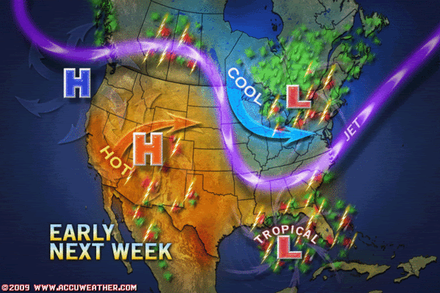
Sprinkler going in the front yard, again, and even with 2 and 3 time a week long soakings, the ground quickly becomes dusty and cracked.

I was so hoping for a nice tropical storm, a little excitement, no need to borrow mi suegro's power drill and board windows, or spend lots of money on water and batteries, and have the added benefit of a good soaking.


Well, at least grass fires won't postpone the Coca Cola 400 from Daytona next Saturday. The rain is appreciated wherever it goes, and I know MiamiWxSensis keeps a close eye on Lake Okeechobee levels.

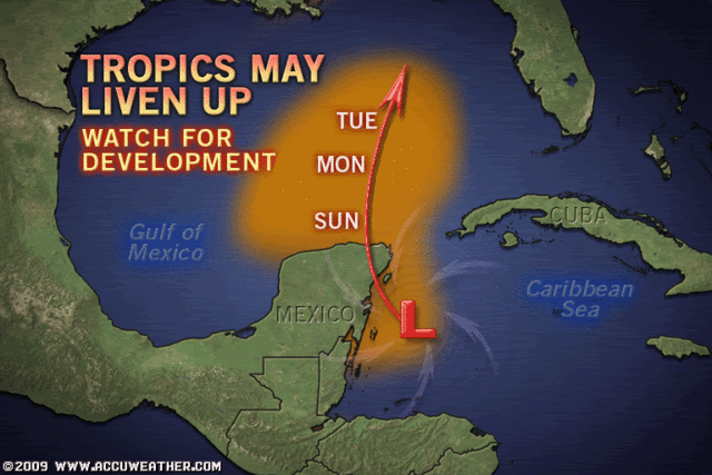
Looks a little more active on my customized home made NASA visible floater, but in no hurry to develop.

Re: pro met and poker/open wheel racing fan Derek Ortt's opinion on yellow vs orange. I, in my unofficial and amateur opinion, agreed with the upgrade to orange yesterday, but by last night, page 5 or 6, I thought it merited yellow. It isn't dead yet, I, in my unprofessional and unofficial opinion, would keep a risk area and the invest going, but I'm leaning with the pro-mets, at least 3 so far, not terribly bullish on development.
0 likes   

Derek Ortt

Re: ATL : INVEST 93L

#254 Postby Derek Ortt » Sat Jun 27, 2009 12:27 pm

dizzyfish wrote:
Thank you. I will be sure to remember that later in the season when everyone is saying the models don't have a clue because there isn't an LLC or anything. In fact, I may just save your reply to remind others later. :wink:


the only time a vortex matters if for SHIPS (as it assumes the system is already a depression or a storm), and SOMETIMES the HWRF/GFDL. However, that is only due to the FORTRAN code and how the moving nest system works. The moving nest needs a center to track, or else the model crashes (and the storm dissipates by default)
0 likes   

Dean4Storms
S2K Supporter
S2K Supporter
Posts: 6358
Age: 62
Joined: Sun Aug 31, 2003 1:01 pm
Location: Miramar Bch. FL

#255 Postby Dean4Storms » Sat Jun 27, 2009 12:29 pm

It has some chances at development, I just don't think it is at 30-50% right now. IMO it is more like 20%, a one in five chance. It must become more persistent with deep convection and that has lacked so far. At this point if the convection took off and persisted the rest of today and overnight it could develop a LLC tomorrow once in the Gulf, but the clock is ticking!!!!!
0 likes   

User avatar
HURAKAN
Professional-Met
Professional-Met
Posts: 46086
Age: 38
Joined: Thu May 20, 2004 4:34 pm
Location: Key West, FL
Contact:

#256 Postby HURAKAN » Sat Jun 27, 2009 12:30 pm

Image

Image

Accuweather.
0 likes   

Derek Ortt

#257 Postby Derek Ortt » Sat Jun 27, 2009 12:31 pm

I think Accuwx needs to check the global models. They are showing decent northerly shear in the GOM
0 likes   

Ed Mahmoud

Re: ATL : INVEST 93L

#258 Postby Ed Mahmoud » Sat Jun 27, 2009 12:32 pm

I think the GFS' recurrent MDR storm warrants about as much interest as this.

Not dead yet, and close to home, but...
0 likes   

Ed Mahmoud

Re: ATL : MODELS : INVEST 93L

#259 Postby Ed Mahmoud » Sat Jun 27, 2009 12:37 pm

I don't see 6Z hurricane models at the FSU site. If the 12Z also doesn't show up, I'd suspect the powers that be are losing interest...

Ah, I see a 12Z GFDL on the Ohio State site. Dissipates in 6 hours...
0 likes   

Dean4Storms
S2K Supporter
S2K Supporter
Posts: 6358
Age: 62
Joined: Sun Aug 31, 2003 1:01 pm
Location: Miramar Bch. FL

#260 Postby Dean4Storms » Sat Jun 27, 2009 12:39 pm

The Euro doesn't dig the trough down as deep, so I bet Accu-weather is basing off the Euro for synoptics.
0 likes   


Return to “2009”

Who is online

Users browsing this forum: No registered users and 37 guests