[/i]otowntiger wrote:gatorcane wrote:wxman57 wrote:12Z GFS actually has a weak low approaching the FL Keys then turning northward as an upper trof across the SE U.S. approaches. It has high pressure (500mb) across the Gulf, high pressure east of the Bahamas and a trof southward through Florida next Tue/Wed.
who would have thought this could be a Florida storm at this point? Unbelievable.
Looked like a shoe-in recurve east of the Bahamas yesterday. What will be track tomorrow?
Correction: Who would have thought this would have been a Florida "[i]Wave"?
ATL : TROPICAL DEPRESSION ERIKA (06L)
Moderator: S2k Moderators
-
otowntiger
- Category 5

- Posts: 1932
- Joined: Tue Aug 31, 2004 7:06 pm
Re: ATL : TROPICAL STORM ERIKA - Computer Models
0 likes
-
somethingfunny

- ChatStaff

- Posts: 3926
- Age: 37
- Joined: Thu May 31, 2007 10:30 pm
- Location: McKinney, Texas
Re: ATL : TROPICAL STORM ERIKA - Computer Models
Re: HWRF
Uh yeah....35mb in 30 hours time is a big drop for any cyclone....and about as likely for Erika as it is that Danny will loop south from Greenland and come back to life as a Category 9 Hurricane striking Bermuda from the north. That's a whole new level of garbage run.
Uh yeah....35mb in 30 hours time is a big drop for any cyclone....and about as likely for Erika as it is that Danny will loop south from Greenland and come back to life as a Category 9 Hurricane striking Bermuda from the north. That's a whole new level of garbage run.
0 likes


-
Aric Dunn
- Category 5
- Posts: 21238
- Age: 43
- Joined: Sun Sep 19, 2004 9:58 pm
- Location: Ready for the Chase.
- Contact:
gfdl.. take it across DR heading towards SF..
lol
http://moe.met.fsu.edu/cgi-bin/gfdltc2. ... =Animation
lol
http://moe.met.fsu.edu/cgi-bin/gfdltc2. ... =Animation
0 likes
-
wxman57

- Moderator-Pro Met

- Posts: 23171
- Age: 68
- Joined: Sat Jun 21, 2003 8:06 pm
- Location: Houston, TX (southwest)
Re: ATL : TROPICAL STORM ERIKA (06L)
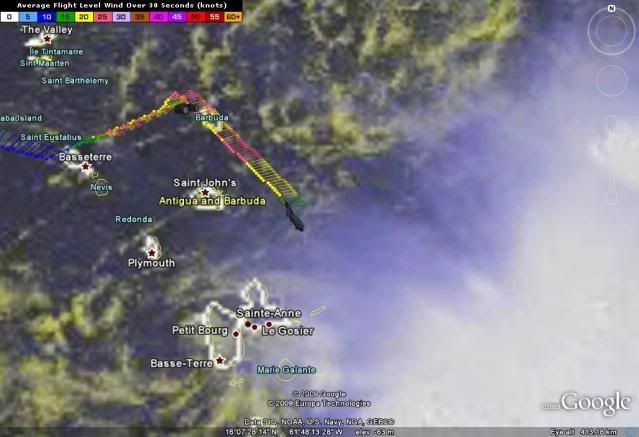
That Guadeloupe radar image does suggest that there is only one remaining center. Al the showers seem to be streaming in toward that center. No evidence of anything farther east or northeast closer to the convection. Surface obs support that as the center.
Last edited by wxman57 on Wed Sep 02, 2009 12:34 pm, edited 1 time in total.
0 likes

Re: ATL : TROPICAL STORM ERIKA - Computer Models
The Canadians are jealous of the weather in Miami...
http://moe.met.fsu.edu/cgi-bin/cmctc2.cgi?time=2009090200&field=Sea+Level+Pressure&hour=Animation
http://moe.met.fsu.edu/cgi-bin/cmctc2.cgi?time=2009090200&field=Sea+Level+Pressure&hour=Animation
0 likes

Re: ATL : TROPICAL STORM ERIKA (06L)
That swirl to the SW of Guadeloupe was visible since early morning when recon was flying around and they still found the dominant LLC under the convection. I still think radar shows alot of southerly inflow into the area under the convection.
Still, when looking at visible loops, it's hard to imagine that the swirl to the SW of Gaudeloupe is not the main LLC
Still, when looking at visible loops, it's hard to imagine that the swirl to the SW of Gaudeloupe is not the main LLC
Last edited by EyELeSs1 on Wed Sep 02, 2009 12:35 pm, edited 1 time in total.
0 likes
-
Weatherboy1

- Category 5
- Posts: 1190
- Age: 50
- Joined: Mon Jul 05, 2004 1:50 pm
- Location: Jupiter/Sarasota, FL
I'm confused in general about the shear situation. I mean, isn't shear decreasing in the area (though still somewhat elevated to the NW)?
http://cimss.ssec.wisc.edu/tropic2/real ... oom=&time=
http://cimss.ssec.wisc.edu/tropic2/real ... oom=&time=
0 likes
Re: ATL : TROPICAL STORM ERIKA - Computer Models
When GFDL and CMC home in like that the possibility of a minor cyclone in Florida comes up.
0 likes
-
Derek Ortt
http://cimss.ssec.wisc.edu/tropic2/real ... oom=&time=
strong mid level shear. far more destructive than upper shear
strong mid level shear. far more destructive than upper shear
0 likes
-
tolakram
- Admin

- Posts: 20176
- Age: 62
- Joined: Sun Aug 27, 2006 8:23 pm
- Location: Florence, KY (name is Mark)
Re:
Weatherboy1 wrote:I'm confused in general about the shear situation. I mean, isn't shear decreasing in the area (though still somewhat elevated to the NW)?
http://cimss.ssec.wisc.edu/tropic2/real ... oom=&time=
Someone talked about a small area of shear that doesn't show up on the shear maps. It's in a narrow range and very strong.
0 likes
-
Aric Dunn
- Category 5
- Posts: 21238
- Age: 43
- Joined: Sun Sep 19, 2004 9:58 pm
- Location: Ready for the Chase.
- Contact:
Re:
Weatherboy1 wrote:I'm confused in general about the shear situation. I mean, isn't shear decreasing in the area (though still somewhat elevated to the NW)?
http://cimss.ssec.wisc.edu/tropic2/real ... oom=&time=
that is a average of the layers in the atmosphere..
right now the shear is in a small layer but is significant enough to cause the disruption..
just does not show up on that map
0 likes
-
otowntiger
- Category 5
- Posts: 1932
- Joined: Tue Aug 31, 2004 7:06 pm
Re:
Frank2 wrote:Looks like an outflow boundary too - all of the above makes for a weakening system:
http://www.ssd.noaa.gov/goes/flt/t2/vis-l.jpg
Thats' what we heard yesterday at about this same time.
0 likes
-
wxman57
- Moderator-Pro Met
- Posts: 23171
- Age: 68
- Joined: Sat Jun 21, 2003 8:06 pm
- Location: Houston, TX (southwest)
Re:
Weatherboy1 wrote:I'm confused in general about the shear situation. I mean, isn't shear decreasing in the area (though still somewhat elevated to the NW)?
http://cimss.ssec.wisc.edu/tropic2/real ... oom=&time=
One problem, as the NHC discussion attempted to say, is that those shear charts represent too broad of a range of heights. They don't pick up on small pockets of high shear between the listed levels. So the AVERAGE shear between two levels may not be very high, but the shear across a narrow part of that broad range could be quite strong.
0 likes
-
Dave

- Retired Staff

- Posts: 13442
- Age: 75
- Joined: Tue Aug 01, 2006 3:57 pm
- Location: Milan Indiana
- Contact:
URNT15 KNHC 021738
AF309 0306A ERIKA HDOB 09 20090902
172830 1721N 06135W 9595 00433 0082 +231 +181 070026 026 031 000 00
172900 1720N 06134W 9595 00433 0082 +230 +181 071025 025 031 000 00
172930 1719N 06133W 9594 00434 0082 +230 +181 072024 025 032 000 03
173000 1718N 06132W 9593 00435 0082 +229 +181 072024 025 032 000 00
173030 1717N 06131W 9597 00432 0082 +230 +181 072023 024 031 000 00
173100 1716N 06130W 9593 00434 0081 +229 +182 073022 023 032 000 00
173130 1715N 06129W 9593 00434 0081 +229 +182 073022 022 030 000 00
173200 1714N 06128W 9596 00431 0080 +230 +182 075021 022 031 000 00
173230 1713N 06127W 9595 00432 0080 +230 +182 076022 023 032 000 00
173300 1712N 06126W 9594 00434 0080 +230 +183 077021 021 030 000 00
173330 1711N 06124W 9593 00433 0079 +230 +183 076021 022 030 000 00
173400 1710N 06123W 9593 00432 0079 +228 +183 076021 021 031 000 00
173430 1709N 06122W 9592 00433 0078 +230 +182 078022 022 026 003 00
173500 1708N 06121W 9593 00432 0078 +230 +181 077021 021 029 002 00
173530 1707N 06120W 9596 00429 0078 +230 +182 079020 021 030 000 00
173600 1706N 06119W 9593 00432 0077 +230 +182 081021 022 030 000 00
173630 1704N 06118W 9594 00430 0076 +231 +183 079019 021 030 001 00
173700 1703N 06117W 9596 00428 0077 +230 +184 079018 018 029 000 00
173730 1702N 06116W 9594 00429 0076 +230 +184 076018 019 029 000 00
173800 1701N 06115W 9593 00430 0076 +230 +184 083018 019 028 000 00
$$
;
0 likes
-
deltadog03

- Professional-Met

- Posts: 3580
- Joined: Tue Jul 05, 2005 6:16 pm
- Location: Macon, GA
Re:
Aric Dunn wrote:gfdl.. take it across DR heading towards SF..
lol
http://moe.met.fsu.edu/cgi-bin/gfdltc2. ... =Animation
To be honest, I think that is one of best runs we have seen from the GFDL...Seems pretty realistic.
0 likes
-
Aric Dunn
- Category 5
- Posts: 21238
- Age: 43
- Joined: Sun Sep 19, 2004 9:58 pm
- Location: Ready for the Chase.
- Contact:
Re: Re:
deltadog03 wrote:Aric Dunn wrote:gfdl.. take it across DR heading towards SF..
lol
http://moe.met.fsu.edu/cgi-bin/gfdltc2. ... =Animation
To be honest, I think that is one of best runs we have seen from the GFDL...Seems pretty realistic.
yep .. just not the surviving DR..
0 likes
-
somethingfunny
- ChatStaff
- Posts: 3926
- Age: 37
- Joined: Thu May 31, 2007 10:30 pm
- Location: McKinney, Texas
Re: Re:
wxman57 wrote:Weatherboy1 wrote:I'm confused in general about the shear situation. I mean, isn't shear decreasing in the area (though still somewhat elevated to the NW)?
http://cimss.ssec.wisc.edu/tropic2/real ... oom=&time=
One problem, as the NHC discussion attempted to say, is that those shear charts represent too broad of a range of heights. They don't pick up on small pockets of high shear between the listed levels. So the AVERAGE shear between two levels may not be very high, but the shear across a narrow part of that broad range could be quite strong.
This seems to have been the issue all season. Undetected shear weakens or inhibits everything that's formed so far. The models don't have observations to get a handle on the shear so it seems that fairly educated guesses based on experience and a hunch may be the best forecasting method this year.
For instance both the GFDL and the CMC are keeping Erika weak until it reaches the Bahamas, and then she begins deepening rather quickly over the home stretch towards Florida. Both of them have me worried but I wonder if there is yet another as-yet-undetected pocket of shear sitting over the Bahamas. The HWRF on the other hand brings Erika to 970mb by 30 hours near Puerto Rico.
I think Erika will eventually find that sweet spot which allows her to become a minimal Cat1 but overall conditions won't allow for much more than that regardless of where the final track takes her. I'll pre-heat the oven for my crow pie now.
0 likes

Who is online
Users browsing this forum: No registered users and 14 guests