WPAC: Ex-Typhoon KOMPASU (1007/08W)
Moderator: S2k Moderators
-
senorpepr

- Military Met/Moderator

- Posts: 12542
- Age: 43
- Joined: Fri Aug 22, 2003 9:22 pm
- Location: Mackenbach, Germany
- Contact:
Of course in the near term we're watching the effects of 08W on Kadena, but also looking downrange (according to the JTWC forecast), Shanghai is about 22 mi (35 km) W of the 34 kt radii and the potential news maker will be landfall in North Korea (near Ongjin, DPRK). As for the forecast lies, Pyongyang is approx 10 mi (16 km) W of the forecast track. It'll be interesting to see what impacts to North Korea occur from 08W.
0 likes


JTWC's forecast is for it to be extratropical or becoming extratropical by then so NK would be feeling the effects in advance of any landfall. The last major tropical cyclone to affect the DPRK was Typhoon Ewiniar in 2006, which left 60,000 homeless, at least 141 dead, and another 10,000 to 55,000 feared dead.
0 likes


-
StormingB81

- S2K Supporter

- Posts: 5676
- Age: 44
- Joined: Thu Aug 27, 2009 1:45 am
- Location: Rockledge, Florida
Re: Re:
Infdidoll wrote:Come on out, Typhoon Hunter! You've got friends here.
Saw this on another forum, Storming, and thought you would enjoy this - it's about the truth:
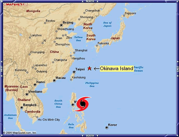
Taiwan: The typhoon magnet.
LOL!! Oh yea....well last year we had 3 go around us..thats why I said I will believe it when I see it.
0 likes
-
StormingB81
- S2K Supporter
- Posts: 5676
- Age: 44
- Joined: Thu Aug 27, 2009 1:45 am
- Location: Rockledge, Florida
-
Typhoon Hunter
- WesternPacificWeather.com

- Posts: 1222
- Joined: Wed Oct 11, 2006 11:37 am
- Location: Tokyo
- Contact:
Re: WPAC: Tropical Depression 08W
Haha funny stuff, love that graphic! 
I'm going to get up early tomorrow, 7am local time and see what the situation with Kompasu will be (I'm guessing it will be upgraded by JMA at 12z today.) JMA actually forecasting the forward speed to slow to 8kts so if that verifies I personally believe Okinawa may well be impacted slightly later if.
Intensifying lower category storms can be a lot more ferocious than decaying higher category storms. Case in point was Koppu last year at 65kts when its closest point of approach was about 130 miles yet we had one hell of a ride here in Hong Kong. I measured gust of 85kts and this video shows nicely what conditions were like:
http://www.youtube.com/watch?v=o01gzkZ4O54
If Kompasu-to-be ramps up overnight I'll look to get to Naha, via Tapei and should arrive around 6pm local.
Any of you military guys got a spare armored Humvee I can borrow....
0 likes
-
StormingB81
- S2K Supporter
- Posts: 5676
- Age: 44
- Joined: Thu Aug 27, 2009 1:45 am
- Location: Rockledge, Florida
-
Typhoon Hunter
- WesternPacificWeather.com
- Posts: 1222
- Joined: Wed Oct 11, 2006 11:37 am
- Location: Tokyo
- Contact:
Re: WPAC: Tropical Depression 08W
Thanks for the heads up Mike.
Here's JTWC's take on it at the moment:
TPPN12 PGTW 291211
A. TROPICAL STORM 08W (SE OF OKINAWA)
B. 29/1132Z
C. 21.5N
D. 134.4E
E. FOUR/MTSAT
F. T3.0/3.0/D2.0/24HRS STT: D0.5/06HRS
G. IR/EIR
H. REMARKS: 13A/PBO TIGHTLY CURVED BANDING/ANMTN. CNVCTN WRAP
OF .60 ON LOG10 SPIRAL YIELDS A DT OF 3.0. PT AGREES. MET YIELDS
A 2.5. DBO DT.
I. ADDITIONAL POSITIONS:
29/0749Z 21.5N 135.1E SSMI
29/0849Z 21.3N 134.7E WIND
0 likes
-
StormingB81
- S2K Supporter
- Posts: 5676
- Age: 44
- Joined: Thu Aug 27, 2009 1:45 am
- Location: Rockledge, Florida
-
Typhoon Hunter
- WesternPacificWeather.com
- Posts: 1222
- Joined: Wed Oct 11, 2006 11:37 am
- Location: Tokyo
- Contact:
Re:
StormingB81 wrote:Im just curious when I wake up what the winds are give us a godo indication what we might see tomorrow
Going by experience they will be exactly the same as today. You won't start seeing winds increasing for a while yet but you could see subtle shift in wind direction once you enter the circulation of the storm...
0 likes
-
StormingB81
- S2K Supporter
- Posts: 5676
- Age: 44
- Joined: Thu Aug 27, 2009 1:45 am
- Location: Rockledge, Florida
Re: WPAC: Tropical Depression 08W
I've got a meeting at 0930 tomorrow. I just hope they talk REALLY fast because I'm going to be wanting to get back home so I can check radar, data, analysis, etc.
0 likes
-
StormingB81
- S2K Supporter
- Posts: 5676
- Age: 44
- Joined: Thu Aug 27, 2009 1:45 am
- Location: Rockledge, Florida
-
senorpepr
- Military Met/Moderator
- Posts: 12542
- Age: 43
- Joined: Fri Aug 22, 2003 9:22 pm
- Location: Mackenbach, Germany
- Contact:
WTJP23 RJTD 291200
WARNING 291200.
WARNING VALID 301200.
WARNING IS UPDATED EVERY 6 HOURS.
GALE WARNING.
TROPICAL STORM 1007 KOMPASU (1007) UPGRADED FROM TROPICAL DEPRESSION
1000 HPA
AT 21.2N 134.4E SEA SOUTH OF JAPAN MOVING WEST 10 KNOTS.
POSITION FAIR.
MAX WINDS 35 KNOTS NEAR CENTER.
RADIUS OF OVER 30 KNOT WINDS 150 MILES NORTHEAST SEMICIRCLE AND 100
MILES ELSEWHERE.
FORECAST POSITION FOR 301200UTC AT 23.1N 131.7E WITH 70 MILES RADIUS
OF 70 PERCENT PROBABILITY CIRCLE.
992 HPA, MAX WINDS 45 KNOTS NEAR CENTER.
EXTENDED OUTLOOK.
FORECAST POSITION FOR 311200UTC AT 25.2N 128.6E WITH 110 MILES RADIUS
OF 70 PERCENT PROBABILITY CIRCLE.
985 HPA, MAX WINDS 50 KNOTS NEAR CENTER.
FORECAST POSITION FOR 011200UTC AT 28.7N 126.0E WITH 160 MILES RADIUS
OF 70 PERCENT PROBABILITY CIRCLE.
980 HPA, MAX WINDS 55 KNOTS NEAR CENTER.
JAPAN METEOROLOGICAL AGENCY.=
0 likes
-
Typhoon Hunter
- WesternPacificWeather.com
- Posts: 1222
- Joined: Wed Oct 11, 2006 11:37 am
- Location: Tokyo
- Contact:
Re: WPAC: Tropical Storm KOMPASU (1007/08W)
Officially Kompasu now, just upgraded by JMA. They are much more modest with intensity forecast which is no surprise, they always are.
They forecast direct hit on Okinawa at 50kts in the early hours of Wednesday morning.
Here's link to their warning page:
http://www.jma.go.jp/en/typh/1007c.html
They forecast direct hit on Okinawa at 50kts in the early hours of Wednesday morning.
Here's link to their warning page:
http://www.jma.go.jp/en/typh/1007c.html
0 likes
-
StormingB81
- S2K Supporter
- Posts: 5676
- Age: 44
- Joined: Thu Aug 27, 2009 1:45 am
- Location: Rockledge, Florida
-
Typhoon Hunter
- WesternPacificWeather.com
- Posts: 1222
- Joined: Wed Oct 11, 2006 11:37 am
- Location: Tokyo
- Contact:
Re:
StormingB81 wrote:SO now we may not even get typhoon strength winds here..See who is right the 50-55 knot people or the 75-80 knots people...lol
Well it's still forecast to be over 48 hours away so it might not even hit Okinawa, the cone of error is there for a reason. If it did hit at 50kts you'd get gusts to typhoon strength.
0 likes
-
StormingB81
- S2K Supporter
- Posts: 5676
- Age: 44
- Joined: Thu Aug 27, 2009 1:45 am
- Location: Rockledge, Florida
Who is online
Users browsing this forum: No registered users and 57 guests