GFDL Brings it in the Gulf of Mexico. But with the High pressure there I dont see that happening. I think it heads west
Personal Forecast Disclaimer:
The posts in this forum are NOT official forecast and should not be used as such. They are just the opinion of the poster and may or may not be backed by sound meteorological data. They are NOT endorsed by any professional institution or storm2k.org. For official information, please refer to the NHC and NWS products.
ATL: RICHARD - Remnant Low - Discussion
Moderator: S2k Moderators
-
StormingB81

- S2K Supporter

- Posts: 5676
- Age: 44
- Joined: Thu Aug 27, 2009 1:45 am
- Location: Rockledge, Florida
-
StormingB81
- S2K Supporter
- Posts: 5676
- Age: 44
- Joined: Thu Aug 27, 2009 1:45 am
- Location: Rockledge, Florida
Also from the USNO:
2. REMARKS: CURRENT MODEL GUIDANCE IS DEPICTING GRADUAL INTENSIFICATION
OF A LOW SITUATED OVER THE NORTHWESTERN CARIBBEAN. THIS SYSTEM IS MOVING NORTH AT APPROXIMATELY 9 KNOTS. THIS SYSTEM IS CENTERED OVER WARM SEA SURFACE TEMPERATURES OF 85 TO 90 DEGREES FAHRENHEIT, WEAK VERTICAL WIND SHEAR, AND UNDER THE WESTERN PORTION OF AN UPPER LEVEL ANTICYCLONE WHICH SHOULD HELP TO ENHANCE THE DEVELOPMENT OF THIS TROPICAL FEATURE.
0 likes

Personal Forecast Disclaimer:
The posts in this forum are NOT official forecast and should not be used as such. They are just the opinion of the poster and may or may not be backed by sound meteorological data. They are NOT endorsed by any professional institution or storm2k.org. For official information, please refer to the NHC and NWS products.
 Hmmmm, does not seem that too many in here are seeing the BAMD as the realistic solution as this system plays out. Well, just to throw my 2cents in..... Am assuming that recon will confirm a better organized system with perhaps a slightly lower pressure of 1006/1007mb and NHC will pull the "trigger" on depression by 8:00am. I also beleive NHC will indicate that the mostly stationary center has "reformed" a little to the north and east, however I do believe that the BAMD solution makes the best case, and a continued slow N.E. motion will ensue. Would not surprise me if we have Richard named by late today.
The posts in this forum are NOT official forecast and should not be used as such. They are just the opinion of the poster and may or may not be backed by sound meteorological data. They are NOT endorsed by any professional institution or storm2k.org. For official information, please refer to the NHC and NWS products.
Hmmmm, does not seem that too many in here are seeing the BAMD as the realistic solution as this system plays out. Well, just to throw my 2cents in..... Am assuming that recon will confirm a better organized system with perhaps a slightly lower pressure of 1006/1007mb and NHC will pull the "trigger" on depression by 8:00am. I also beleive NHC will indicate that the mostly stationary center has "reformed" a little to the north and east, however I do believe that the BAMD solution makes the best case, and a continued slow N.E. motion will ensue. Would not surprise me if we have Richard named by late today.
0 likes
Andy D
(For official information, please refer to the NHC and NWS products.)
(For official information, please refer to the NHC and NWS products.)
-
wxman57

- Moderator-Pro Met

- Posts: 23172
- Age: 68
- Joined: Sat Jun 21, 2003 8:06 pm
- Location: Houston, TX (southwest)
Re: ATL : INVEST 99L - Discussion
SHIPS indicates shear 20-25 kts for the next day or two, then very light shear. Clearly, the LLC is now displaced well west of the convection, so shear is definitely a factor. But surface obs in the area indicate the circulation is stronger than yesterday. Should be classified later today. And if the shear is as light as is forecast in a few days, then I wouldn't discount the GFDL's intensity forecast for a Cat 3-4.
0 likes

Re: ATL : INVEST 99L - Discussion
Looks really good
MIMIC-TPW roll
http://cimss.ssec.wisc.edu/tropic/real- ... t72hrs.gif
Anti-cyclone over head
Cold cloud tops
Well defined 850mb vorticity
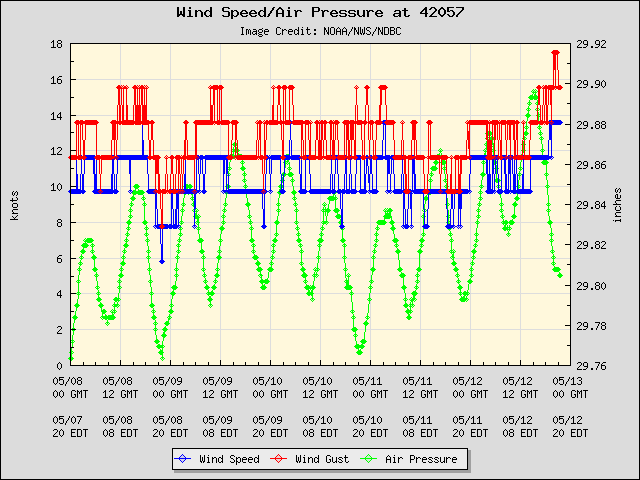
Closest buoy pressure taking a nose dive with increasing winds.


MIMIC-TPW roll
http://cimss.ssec.wisc.edu/tropic/real- ... t72hrs.gif
Anti-cyclone over head
Cold cloud tops
Well defined 850mb vorticity
Closest buoy pressure taking a nose dive with increasing winds.
0 likes


Shear from that anticyclone is clearly present as Wxman57 said but the actual circulation looks pretty solid, just may need slightly closer convection for the NHC to go and upgrade it.
I'm a bit uncertain of the track, I suspect something maybe like Roxanne with it getting close to the Gulf but bending back west into the Yucatan. If shear is lighter by then a hurricane is certainly possible but thats a little way down the road yet.
I'm a bit uncertain of the track, I suspect something maybe like Roxanne with it getting close to the Gulf but bending back west into the Yucatan. If shear is lighter by then a hurricane is certainly possible but thats a little way down the road yet.
0 likes
Personal Forecast Disclaimer:
The posts in this forum are NOT official forecast and should not be used as such. They are just the opinion of the poster and may or may not be backed by sound meteorological data. They are NOT endorsed by any professional institution or storm2k.org. For official information, please refer to the NHC and NWS products
The posts in this forum are NOT official forecast and should not be used as such. They are just the opinion of the poster and may or may not be backed by sound meteorological data. They are NOT endorsed by any professional institution or storm2k.org. For official information, please refer to the NHC and NWS products
-
cycloneye

- Admin

- Posts: 149275
- Age: 69
- Joined: Thu Oct 10, 2002 10:54 am
- Location: San Juan, Puerto Rico
Re: ATL : INVEST 99L - Discussion
TWOAT
TROPICAL WEATHER OUTLOOK
NWS TPC/NATIONAL HURRICANE CENTER MIAMI FL
800 AM EDT WED OCT 20 2010
FOR THE NORTH ATLANTIC...CARIBBEAN SEA AND THE GULF OF MEXICO...
A LOW PRESSURE SYSTEM CENTERED ABOUT 150 MILES SOUTHWEST OF GRAND
CAYMAN IS DRIFTING EASTWARD. ALTHOUGH STRONG UPPER-LEVEL WINDS ARE
CURRENTLY INHIBITING SIGNIFICANT DEVELOPMENT...THESE WINDS ARE
EXPECTED TO BECOME MORE FAVORABLE FOR A TROPICAL DEPRESSION TO FORM
DURING THE NEXT DAY OR SO. AN AIR FORCE RESERVE RECONNAISSANCE
AIRCRAFT IS SCHEDULED TO INVESTIGATE THIS SYSTEM LATER THIS
MORNING. INTERESTS IN THE NORTHWESTERN CARIBBEAN SEA SHOULD
CONTINUE TO MONITOR THE PROGRESS OF THIS DISTURBANCE. THERE IS A
HIGH CHANCE...70 PERCENT...OF THIS SYSTEM BECOMING A TROPICAL
CYCLONE DURING THE NEXT 48 HOURS. REGARDLESS OF DEVELOPMENT...HEAVY
RAINFALL IS POSSIBLE OVER THE CAYMAN ISLANDS AND JAMAICA DURING THE
NEXT COUPLE OF DAYS.
ELSEWHERE...TROPICAL CYCLONE FORMATION IS NOT EXPECTED DURING THE
NEXT 48 HOURS.
$$
FORECASTER CANGIALOSI/STEWART
0 likes
Visit the Caribbean-Central America Weather Thread where you can find at first post web cams,radars
and observations from Caribbean basin members Click Here
and observations from Caribbean basin members Click Here
-
Blown Away

- S2K Supporter
- Posts: 10253
- Joined: Wed May 26, 2004 6:17 am
Re: ATL : INVEST 99L - Discussion

TAFB keeping 99L offshore and a "Possible Cyclone" in 72 hours.
Interesting the 8am update says eastward drift. IMO, the farther north and east 99L gets from CA the less land interaction will occur when 99L begins the loop. IMO, we could have a very strong cane as indicated by a few models.
Last edited by Blown Away on Wed Oct 20, 2010 6:49 am, edited 1 time in total.
0 likes
Hurricane Eye Experience: David 79, Irene 99, Frances 04, Jeanne 04, Wilma 05… Hurricane Brush Experience: Andrew 92, Erin 95, Floyd 99, Matthew 16, Irma 17, Ian 22, Nicole 22…
-
cycloneye
- Admin
- Posts: 149275
- Age: 69
- Joined: Thu Oct 10, 2002 10:54 am
- Location: San Juan, Puerto Rico
Re: ATL : INVEST 99L - Discussion
0 likes
Visit the Caribbean-Central America Weather Thread where you can find at first post web cams,radars
and observations from Caribbean basin members Click Here
and observations from Caribbean basin members Click Here
-
wxman57
- Moderator-Pro Met
- Posts: 23172
- Age: 68
- Joined: Sat Jun 21, 2003 8:06 pm
- Location: Houston, TX (southwest)
Re: ATL : INVEST 99L - Discussion
Right, more time over water may mean a stronger storm. In our best analog year, 1998, Cat 5 Mitch developed not far from where 99L is on October 22nd, just 2 days from now. And the eastward drift farther from CA and the Yucatan may increase the risk it'll stay offshore longer. That also means it may be out there long enough to be picked up by a passing trof to the north, perhaps steered north and northeastward. Florida and the Bahamas are not out of the woods yet.
As for today, look at a WV loop and you'll see that trof digging down into the NW Caribbean producing moderate SW-W winds across 99L. It'll be hard for it to develop convection near the center with such strong shear. But once the trof passes in 24-36 hours or so, a ridge builds to the north. That should provide quite favorable conditions for development/intensification.
As for today, look at a WV loop and you'll see that trof digging down into the NW Caribbean producing moderate SW-W winds across 99L. It'll be hard for it to develop convection near the center with such strong shear. But once the trof passes in 24-36 hours or so, a ridge builds to the north. That should provide quite favorable conditions for development/intensification.
0 likes
Re: ATL : INVEST 99L - Discussion
12Z best track
AL, 99, 2010102012, , BEST, 0, 177N, 825W, 30, 1007, LO,
AL, 99, 2010102012, , BEST, 0, 177N, 825W, 30, 1007, LO,
0 likes
Re: ATL : INVEST 99L - Discussion
Excellent point about the trof.
Should have checked WV, can see it clearly.
http://www.goes.noaa.gov/HURRLOOPS/huwvloop.html
Should have checked WV, can see it clearly.
http://www.goes.noaa.gov/HURRLOOPS/huwvloop.html
0 likes
Re: ATL : INVEST 99L - Discussion
Pretty good overshooting tops on VIS.
Looks like UL winds are mostly around 10 knots.

Looks like UL winds are mostly around 10 knots.
0 likes


-
wxman57
- Moderator-Pro Met
- Posts: 23172
- Age: 68
- Joined: Sat Jun 21, 2003 8:06 pm
- Location: Houston, TX (southwest)
Re: ATL : INVEST 99L - Discussion
Recon won't tell us anything we don't already know from satellite and surface obs. There's a well-defined LLC with winds in the 25-30 kt range east of the center. It looks more impressive than Fiona did for the 2 days it was still carried as a TS before it was declared a remnant low. I suppose that the plane could find that winds in the squalls to the east are even stronger than 30 kts. If there is some kind of rule as to how close the convection needs to be to a center for a system to be classified, then why was Fiona a TS with a single thunderstorm about 100 miles from the center for several days?
0 likes
-
jconsor
- Professional-Met

- Posts: 578
- Joined: Mon Jun 30, 2008 9:31 pm
- Location: Jerusalem, Israel
- Contact:
Re: ATL : INVEST 99L - Discussion
As I believe you've pointed out before, NHC tends to be more strict on convection and other criteria when determining whether to upgrade a disturbance to a TD/TS, than when you have a system that's already classified. This seems inconsistent to me, but I can understand why they don't want to declassify a system, only to reclassify it 6-12 hours later.
Fiona and Paula from 2010, and Fay from 2008 are good examples of that paradigm.
Also, I've noticed that NHC tends to be more liberal on keeping systems as a TD and upgrading them to a TD in the post-season analysis than they are operationally.
Fiona and Paula from 2010, and Fay from 2008 are good examples of that paradigm.
Also, I've noticed that NHC tends to be more liberal on keeping systems as a TD and upgrading them to a TD in the post-season analysis than they are operationally.
wxman57 wrote:Recon won't tell us anything we don't already know from satellite and surface obs. There's a well-defined LLC with winds in the 25-30 kt range east of the center. It looks more impressive than Fiona did for the 2 days it was still carried as a TS before it was declared a remnant low. I suppose that the plane could find that winds in the squalls to the east are even stronger than 30 kts. If there is some kind of rule as to how close the convection needs to be to a center for a system to be classified, then why was Fiona a TS with a single thunderstorm about 100 miles from the center for several days?
0 likes

Re: ATL : INVEST 99L - Discussion
The NHC has been slow upgrading Paula and now 99L I wonder why? I know Recon is the best way to get data from a tropical cyclone but as wxman57 said there are enough observations and imagery to upgrade it.
0 likes
Re: ATL : INVEST 99L - Discussion
Looks like the convection was firing off high rain-rate for about 2 hours SW of Jamaica.

0 likes
-
wzrgirl1

- S2K Supporter
- Posts: 1360
- Joined: Sat Sep 04, 2004 6:44 am
- Location: Pembroke Pines, Florida
Re: ATL : INVEST 99L - Discussion
Macrocane wrote:The NHC has been slow upgrading Paula and now 99L I wonder why? I know Recon is the best way to get data from a tropical cyclone but as wxman57 said there are enough observations and imagery to upgrade it.
Maybe because it is not a threat to land at this point and they want to be sure. Who knows....

0 likes
Who is online
Users browsing this forum: No registered users and 21 guests