CIMSS also carries this system. I'm very happy to see more coverage on the South Atlantic disturbances
Moderator: S2k Moderators


KWT wrote:It looks pretty good there Hurakan I have to say, you can see the LLC is a touch exposed on the northern flank but other then that it looks pretty impressive there!

HURAKAN wrote:KWT wrote:It looks pretty good there Hurakan I have to say, you can see the LLC is a touch exposed on the northern flank but other then that it looks pretty impressive there!
We also judge based on other basins characteristics but if we think about how rare this is, IT LOOKS AMAZING!!!


wxman57 wrote:NHC has no jurisdiction off Brazil. I did hear that the NHC is working with the Brazilian Met agency as far as the analysis of this storm. But there's no naming convention down there and this storm will not impact any land areas, so it'll likely just stay unnamed.
Cryomaniac wrote:wxman57 wrote:NHC has no jurisdiction off Brazil. I did hear that the NHC is working with the Brazilian Met agency as far as the analysis of this storm. But there's no naming convention down there and this storm will not impact any land areas, so it'll likely just stay unnamed.
Isn't there a bit of a case for extending the Atlantic naming conventions to the S.Atlantic? Obviously not for this system, but in the future.
CrazyC83 wrote:I'm sure there were other tropical storms - and probably other hurricane-strength storms - in the South Atlantic before the satellite era though. I'd be curious to see how that area would be re-analyzed.


[/quote][/b]Posted by: JeffMasters, 3:09 PM GMT on March 11, 2010
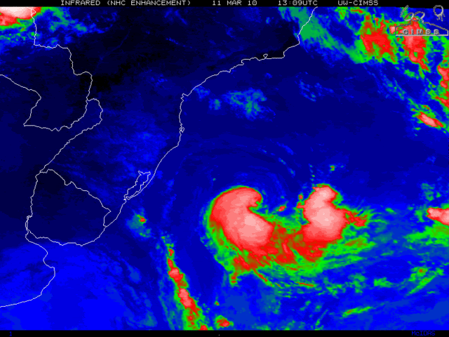
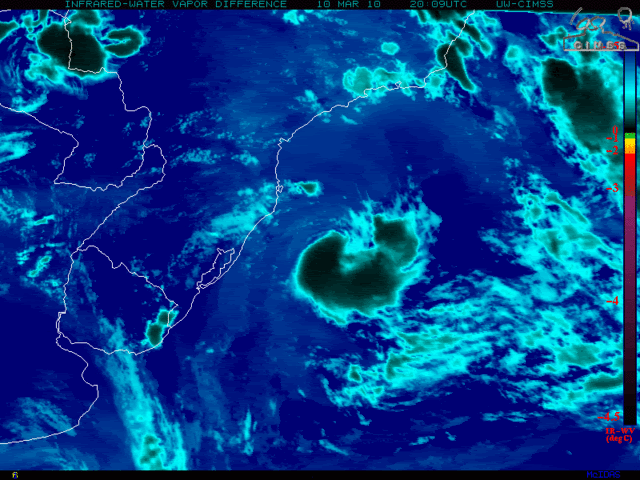
The unnamed South Atlantic tropical/subtropical cyclone (90Q) off the coast of Brazil continues to spin slowly out to sea, and is not a threat to any land areas. The storm, just the 7th tropical or subtropical cyclone on record in the South Atlantic, has a well-defined surface circulation, top wind speeds near minimum tropical storm force (40 mph), a surface pressure near 1004 mb, and a modest amount of heavy thunderstorm activity on its south side. Strong upper-level winds from the northeast are creating about 20 knots of wind shear over the storm, keeping the northeast side of the circulation exposed to view. Sea surface temperatures are about 25.5°C, which is about 1°C below what is typically needed to support a tropical storm. The storm is headed southeastward out to sea at about 10 mph, and will lose its tropical characteristics and get absorbed by a frontal system by Saturday.
Figure 1. Morning visible satellite image of the Brazilian unnamed tropical/subtropical storm.
When the storm formed two days ago, it began as a cold-cored system aloft, with a warm core at the surface, making it a hybrid subtropical storm. Yesterday, the entire core of the storm warmed enough for it to be worthy of consideration for tropical storm status. Tropical and subtropical storms are so rare in the South Atlantic that there is no official naming of depressions or storms done. The cyclone had top winds of at least 35 mph this morning at 7am EST as seen on an ASCAT pass, and satellite estimates of the storm's intensity have held steady at 40 mph (minimum subtropical storms strength) for the past 12 hours. ASCAT winds tend to be biased a little low at this speed range, so 40 mph--minimum tropical storm strength--is probably the best estimate of the winds. Phase space diagrams from Florida State University are showing that the storm has grown less tropical (warm-cored) in nature over the past 12 hours. When compared to similar systems that have developed in the North Atlantic that have been named, I definitely think today's storm deserves a name. The World Meteorological Organization should act to come up with a list of names for the South Atlantic, since these storms have the potential to cause considerable death and destruction along the South American coast, and deserve to receive the extra attention naming would provide.
Users browsing this forum: No registered users and 11 guests