ATL : HARVEY - Tropical Depression - Discussion

Moderator: S2k Moderators

Message
Author
lonelymike
S2K Supporter
S2K Supporter
Posts: 634
Joined: Sat Jul 26, 2008 10:12 am
Location: walton county fla

Re: Re:

#1001 Postby lonelymike » Tue Aug 16, 2011 6:35 pm

no it will weaken and even move west....give it another week...[/quote]
THE UPPER LEVEL RIDGE OF HIGH PRESSURE WILL DOMINATE THE WEATHER
ACROSS SE TX THROUGH AT LEAST EARLY NEXT WEEK. THE END RESULT WILL
BE A CONTINUATION OF THE VERY HOT AND DRY CONDITIONS OVER THE
AREA. HAVE KEPT THE MENTION OF PRECIP OUT OF THE FORECAST FOR
WEDNESDAY AS PWS REMAIN IN THE 1.4-1.6 INCH RANGE. MOISTURE LEVELS
INCREASE SOMEWHAT OVER THE EASTERN ZONES AND TOWARD THE COAST
BEGINNING THURSDAY (PWS 1.7-1.9 INCHES). WILL HAVE 20 POPS
MENTIONED OVER THE SOUTHEAST THIRD EACH DAY BEGINNING THURSDAY FOR
THE POSSIBILITY OF ISOLATED DIURNAL CONVECTIVE DEVELOPMENT ALONG
THE SEABREEZE. EVEN THESE 20 POPS WILL PROBABLY BE GENEROUS ON
SOME OF THE DAYS. NHC IS MONITORING A TROPICAL WAVE OVER THE
EASTERN CARIBBEAN SEA FOR POSSIBLE DEVELOPMENT (INVEST 93L).
NHC/HPC ARE FORECASTING THIS SYSTEM TO TRACK WEST OVER THE
YUCATAN PENINSULA AND BAY OF CAMPECHE THIS WEEKEND INTO EARLY NEXT
WEEK WITH THE UPPER RIDGE KEEPING IT WELL SUPPRESSED SOUTH OF THE
AREA. IN FACT IF THE SYSTEM DEVELOPS FURTHER THE SUBSIDENCE AROUND
IT WILL LIKELY HELP STRENGTHEN THE UPPER RIDGE OVER THE AREA EVEN
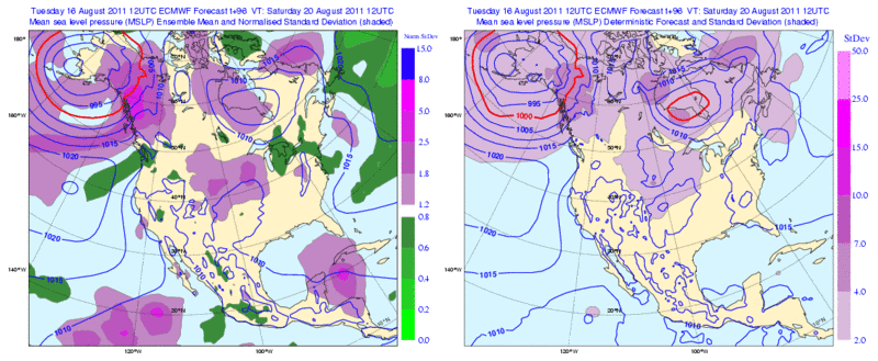
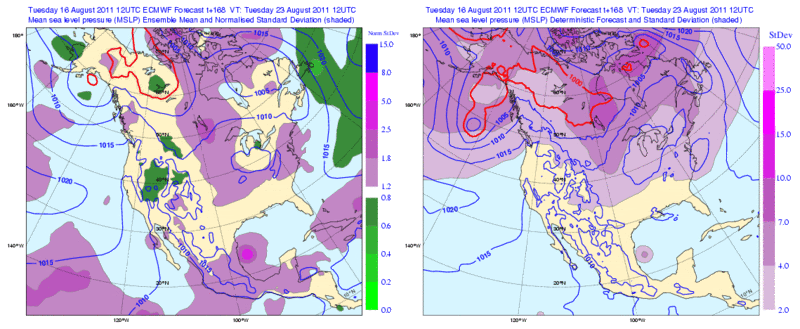
FURTHER. AS FAR AS THE UPPER RIDGE...THE MODELS HAD BEEN SHOWING
IT SHIFTING WEST OF THE AREA BY THE MIDDLE OF NEXT WEEK.
UNFORTUNATELY THOUGH THE 12Z RUNS HAVE BACKED OFF THIS SOLUTION

Houston Afternoon Discussion 4:40 P.M.

Looking like either scenario looking less likely for our area at this time.
Beneficial rains from a weak Tropical system, or, this ridge shifting WWD at time of this Discussion.


The posts in this forum are NOT official forecast and should not be used as such. They are just the opinion of the poster and may or may not be backed by sound meteorological data. They are NOT endorsed by any professional institution or storm2k.org. For official information, please refer to the NHC and NWS products.
Follow us on
Twitter[/quote]


like a said give it another week.... :wink:[/quote]


Rock you love your treated sewage water admit it :D
0 likes   


GO SEMINOLES

User avatar
SouthDadeFish
Professional-Met
Professional-Met
Posts: 2835
Joined: Thu Sep 23, 2010 2:54 pm
Location: Miami, FL
Contact:

#1002 Postby SouthDadeFish » Tue Aug 16, 2011 6:38 pm

8pm TWO sounds pretty copy and paste to me... With the vorticity we got going on down there I think this is worthy of code orange...
0 likes   

User avatar
Gustywind
Category 5
Category 5
Posts: 12334
Joined: Mon Sep 03, 2007 7:29 am
Location: Baie-Mahault, GUADELOUPE

Re:

#1003 Postby Gustywind » Tue Aug 16, 2011 6:50 pm

KWT wrote:Nope Gustywind, just being observing lots!

Looking better tonight, may well get recon in tomorrow if this trend continues...I think there is a pretty good chance we make it 8/0/0....though obviously if it can pull up enough and escape CA and hit N.Belize or Yucatan then who knows.

I knew that :D , but you have a very nice level of observation glad to see that. One thing for sure the Lesser Antilles have been recently well shaked with Emily and now this huge twave in less than two weeks, that's enough for us after this rainy year who is not ended :eek:
0 likes   

AHS2011
Tropical Storm
Tropical Storm
Posts: 134
Joined: Sun Jun 05, 2011 7:39 am

Re: ATL : INVEST 93L - Discussion

#1004 Postby AHS2011 » Tue Aug 16, 2011 6:53 pm

Is invest 93l absorbing the energy to the east?
0 likes   
"People might not get all they work for in this world, but they must certainly work for all they get."- Frederick Douglass

User avatar
ROCK
Category 5
Category 5
Posts: 9484
Age: 54
Joined: Tue Aug 17, 2004 7:30 am
Location: Kemah, Texas

Re: ATL : INVEST 93L - Discussion

#1005 Postby ROCK » Tue Aug 16, 2011 7:04 pm

convection waning but a hot tower right where I would put a center.....
0 likes   

User avatar
ROCK
Category 5
Category 5
Posts: 9484
Age: 54
Joined: Tue Aug 17, 2004 7:30 am
Location: Kemah, Texas

Re: ATL: INVEST 93L - Models

#1006 Postby ROCK » Tue Aug 16, 2011 7:06 pm

yeah it is always good to shower in treated sewage....

However I must point out the NAM has nailed this so far.....edit the 18Z keeps it weak....

BTW---the ridge aint going anywhere...

http://www.nco.ncep.noaa.gov/pmb/nwprod ... 0_084l.gif
0 likes   

User avatar
TropicalAnalystwx13
Category 5
Category 5
Posts: 2109
Age: 27
Joined: Tue Jul 19, 2011 8:20 pm
Location: Wilmington, NC
Contact:

#1007 Postby TropicalAnalystwx13 » Tue Aug 16, 2011 7:16 pm

Invest 93L's pros:

* Low wind shear
* Moistening environment
* High Sea Surface Temperatures
* High Tropical Cyclone Heat Potential
* Piling of air on top of 93L

Invest 93L's cons:

* Forward speed (Should slow down soon)
* Time??
0 likes   

lonelymike
S2K Supporter
S2K Supporter
Posts: 634
Joined: Sat Jul 26, 2008 10:12 am
Location: walton county fla

Re: ATL : INVEST 93L - Discussion

#1008 Postby lonelymike » Tue Aug 16, 2011 7:17 pm

ROCK wrote:convection waning but a hot tower right where I would put a center.....


A true believer to the bitter end :P
0 likes   


GO SEMINOLES

User avatar
cycloneye
Admin
Admin
Posts: 145336
Age: 68
Joined: Thu Oct 10, 2002 10:54 am
Location: San Juan, Puerto Rico

Re: ATL : INVEST 93L - Discussion

#1009 Postby cycloneye » Tue Aug 16, 2011 7:43 pm

00z Best Track

AL, 93, 2011081700, , BEST, 0, 145N, 695W, 25, 1010, DB
0 likes   
Visit the Caribbean-Central America Weather Thread where you can find at first post web cams,radars
and observations from Caribbean basin members Click Here

User avatar
cycloneye
Admin
Admin
Posts: 145336
Age: 68
Joined: Thu Oct 10, 2002 10:54 am
Location: San Juan, Puerto Rico

Re: ATL: INVEST 93L - Models

#1010 Postby cycloneye » Tue Aug 16, 2011 7:55 pm

00z Tropical Models.

Code: Select all

X01 KWBC 170035
CHGHUR
TROPICAL CYCLONE GUIDANCE MESSAGE
NWS NATIONAL HURRICANE CENTER MIAMI FL
0035 UTC WED AUG 17 2011
 
DISCLAIMER...NUMERICAL MODELS ARE SUBJECT TO LARGE ERRORS.
PLEASE REFER TO NHC OFFICIAL FORECASTS FOR TROPICAL CYCLONE
AND SUBTROPICAL CYCLONE INFORMATION.
 
ATLANTIC OBJECTIVE AIDS FOR
 
DISTURBANCE INVEST (AL932011) 20110817 0000 UTC
 
        ...00 HRS...   ...12 HRS...   ...24 HRS. ..   ...36 HRS...
        110817  0000   110817  1200   110818  0000   110818  1200
 
         LAT    LON     LAT    LON     LAT    LON     LAT    LON
BAMS    14.5N  69.5W   15.2N  72.6W   15.9N  75.6W   16.5N  78.6W
BAMD    14.5N  69.5W   15.2N  72.4W   15.8N  75.1W   16.2N  77.6W
BAMM    14.5N  69.5W   15.1N  72.3W   15.6N  74.9W   16.1N  77.5W
LBAR    14.5N  69.5W   15.4N  73.1W   16.3N  76.6W   17.2N  79.7W
SHIP        25KTS          30KTS          37KTS          47KTS
DSHP        25KTS          30KTS          37KTS          47KTS
 
        ...48 HRS...   ...72 HRS...   ...96 HRS. ..   ..120 HRS...
        110819  0000   110820  0000   110821  0000   110822  0000
 
         LAT    LON     LAT    LON     LAT    LON     LAT    LON
BAMS    17.0N  81.1W   17.6N  85.4W   18.2N  89.9W   19.0N  94.6W
BAMD    16.6N  79.9W   17.1N  84.1W   17.3N  88.6W   17.1N  93.8W
BAMM    16.5N  79.9W   17.2N  84.1W   17.8N  88.7W   18.3N  93.8W
LBAR    18.2N  82.6W   20.2N  87.2W   22.1N  91.0W   23.3N  95.2W
SHIP        57KTS          79KTS          92KTS          96KTS
DSHP        57KTS          79KTS          72KTS          37KTS
 
         ...INITIAL CONDITIONS...
LATCUR =  14.5N LONCUR =  69.5W DIRCUR = 280DEG SPDCUR =  20KT
LATM12 =  13.8N LONM12 =  65.4W DIRM12 = 276DEG SPDM12 =  20KT
LATM24 =  13.6N LONM24 =  61.3W
WNDCUR =   25KT RMAXWD =   70NM WNDM12 =   25KT
CENPRS = 1010MB OUTPRS = 1012MB OUTRAD =  150NM SDEPTH =   M
RD34NE =    0NM RD34SE =    0NM RD34SW =    0NM RD34NW =   0NM
 

Image

Uploaded by Imageshack.us
0 likes   
Visit the Caribbean-Central America Weather Thread where you can find at first post web cams,radars
and observations from Caribbean basin members Click Here

User avatar
Rgv20
S2K Supporter
S2K Supporter
Posts: 2466
Age: 38
Joined: Wed Jan 05, 2011 5:42 pm
Location: Edinburg/McAllen Tx

#1011 Postby Rgv20 » Tue Aug 16, 2011 8:53 pm

Its probably a long shot but some of the 12zEuro Ensembles still show a more northward (represented by the purple colors) track for 93L

Forecast valid for 96hrs (Saturday 12z)
Image


Forecast valid for 168hrs (Tuesday 12z)
Image
0 likes   
The following post is NOT an official forecast and should not be used as such. It is just the opinion of the poster and may or may not be backed by sound meteorological data. It is NOT endorsed by any professional institution including storm2k.org For Official Information please refer to the NHC and NWS products.

underthwx
Category 5
Category 5
Posts: 2360
Joined: Sat Jul 30, 2011 2:14 pm
Location: Brazoria County Texas

Re: ATL : INVEST 93L - Discussion

#1012 Postby underthwx » Tue Aug 16, 2011 9:06 pm

Do yall feel the rapid forward speed of 93L is the main reason, among all the factors combined, it hasnt had a chance for further development so far? Thanks.
Last edited by underthwx on Tue Aug 16, 2011 9:23 pm, edited 1 time in total.
0 likes   

User avatar
Fyzn94
Tropical Storm
Tropical Storm
Posts: 190
Joined: Thu Jul 07, 2011 10:00 pm
Location: Central AR, USA

Re: ATL : INVEST 93L - Discussion

#1013 Postby Fyzn94 » Tue Aug 16, 2011 9:13 pm

Either this blob is getting its act together or my eyes are deceiving me.
0 likes   
NOTICE: I cannot give an expert analysis. Most of my "observations" are made visually with the help of only vital information provided by public advisories.

BigB0882
S2K Supporter
S2K Supporter
Posts: 2284
Joined: Thu Jul 03, 2003 12:08 am
Location: Baton Rouge, LA
Contact:

Re: ATL: INVEST 93L - Models

#1014 Postby BigB0882 » Tue Aug 16, 2011 9:24 pm

ROCK wrote:
BTW---the ridge aint going anywhere...

http://www.nco.ncep.noaa.gov/pmb/nwprod ... 0_084l.gif


You don't say... :lol:
0 likes   

Jag95
Category 1
Category 1
Posts: 438
Joined: Sat Aug 15, 2009 8:43 pm
Location: Mobile, AL

Re: ATL : INVEST 93L - Discussion

#1015 Postby Jag95 » Tue Aug 16, 2011 9:34 pm

It does look like might be a little better organized as of late. That's not saying much though...still a long way to go.
0 likes   

ozonepete
Professional-Met
Professional-Met
Posts: 4743
Joined: Mon Sep 07, 2009 3:23 pm
Location: From Ozone Park, NYC / Now in Brooklyn, NY

Re: ATL : INVEST 93L - Discussion

#1016 Postby ozonepete » Tue Aug 16, 2011 9:48 pm

underthwx wrote:Do yall feel the rapid forward speed of 93L is the main reason, among all the factors combined, it hasnt had a chance for further development so far? Thanks.


Generally speaking it is a pretty negative factor because it's hard for a low and mid-level center to spin up and close off at high forward speeds. But it is not always a negative factor. While I don't know offhand the speeds of faster moving waves that have developed, I know that some have developed at a pretty good clip. At any rate, this one is forecast to slow down as soon as tomorrow, and that should give it a better chance.
0 likes   

underthwx
Category 5
Category 5
Posts: 2360
Joined: Sat Jul 30, 2011 2:14 pm
Location: Brazoria County Texas

Re: ATL : INVEST 93L - Discussion

#1017 Postby underthwx » Tue Aug 16, 2011 9:58 pm

ozonepete wrote:
underthwx wrote:Do yall feel the rapid forward speed of 93L is the main reason, among all the factors combined, it hasnt had a chance for further development so far? Thanks.


Generally speaking it is a pretty negative factor because it's hard for a low and mid-level center to spin up and close off at high forward speeds. But it is not always a negative factor. While I don't know offhand the speeds of faster moving waves that have developed, I know that some have developed at a pretty good clip. At any rate, this one is forecast to slow down as soon as tomorrow, and that should give it a better chance.

thanks for the reply, im treadin treated sewage water here....(dont live too far from Rock)
0 likes   

ozonepete
Professional-Met
Professional-Met
Posts: 4743
Joined: Mon Sep 07, 2009 3:23 pm
Location: From Ozone Park, NYC / Now in Brooklyn, NY

Re: ATL : INVEST 93L - Discussion

#1018 Postby ozonepete » Tue Aug 16, 2011 10:04 pm

:uarrow: Sorry to hear that. But you know we're gettin' to the point where something, either a tropical system or a dip in the jet stream, will bring you guys relief. Hopefully it will come in stages instead of a Texas sized deluge.
0 likes   

User avatar
Gustywind
Category 5
Category 5
Posts: 12334
Joined: Mon Sep 03, 2007 7:29 am
Location: Baie-Mahault, GUADELOUPE

#1019 Postby Gustywind » Tue Aug 16, 2011 10:07 pm

Since 5PM things have return to normal. We can have a good breathe for now, thanks :). Hope that the night will be calm but that's another story.
0 likes   

underthwx
Category 5
Category 5
Posts: 2360
Joined: Sat Jul 30, 2011 2:14 pm
Location: Brazoria County Texas

Re: ATL : INVEST 93L - Discussion

#1020 Postby underthwx » Tue Aug 16, 2011 10:08 pm

ozonepete wrote::uarrow: Sorry to hear that. But you know we're gettin' to the point where something, either a tropical system or a dip in the jet stream, will bring you guys relief. Hopefully it will come in stages instead of a Texas sized deluge.

hope so to OP.........
0 likes   


Return to “2011”

Who is online

Users browsing this forum: No registered users and 3 guests