ATL: IRENE - Remnants - Discussion

Moderator: S2k Moderators

Message
Author
GTStorm
Tropical Storm
Tropical Storm
Posts: 225
Joined: Sat Sep 04, 2004 8:44 pm
Location: Savannah

Re: ATL: IRENE - Tropical Storm - Discussion

#2701 Postby GTStorm » Sun Aug 21, 2011 9:55 pm

CronkPSU wrote:up to 70 mph winds at 11...993 mb

and the cone is right of the 5pm cone...good call guys, i was wrong

Image


landfall at Jacksonville ????? Really ????? Wow.
0 likes   

User avatar
gatorcane
S2K Supporter
S2K Supporter
Posts: 23691
Age: 47
Joined: Sun Mar 13, 2005 3:54 pm
Location: Boca Raton, FL

#2702 Postby gatorcane » Sun Aug 21, 2011 9:56 pm

Cone moved exactly like I thought it would
0 likes   

User avatar
Swimdude
Category 5
Category 5
Posts: 2270
Joined: Mon Jul 26, 2004 11:57 am
Location: Houston, TX

Re: ATL: IRENE - Tropical Storm - Discussion

#2703 Postby Swimdude » Sun Aug 21, 2011 9:56 pm

And flirting with Cat 2 at the 96 hour mark. Can't say I'm surprised, but that 90mph wind forecast (bumped up from 85mph at 96hr last advisory) at 96hrs just made me realize how serious this might be.
0 likes   

maxintensity
Tropical Storm
Tropical Storm
Posts: 165
Joined: Tue Aug 02, 2011 9:54 pm

Re: ATL: IRENE - Tropical Storm - Discussion

#2704 Postby maxintensity » Sun Aug 21, 2011 9:57 pm

Interesting the NHC still only expects a cat 1 out of this. I think the forecasters over there might be in for some shock and awe if GFS/Hwrf/Ecmwf/GFDL/CMC are correct on intensity.
0 likes   

User avatar
NDG
S2K Supporter
S2K Supporter
Posts: 15446
Joined: Sun Jul 09, 2006 10:14 pm
Location: Orlando, FL

#2705 Postby NDG » Sun Aug 21, 2011 9:57 pm

Image
0 likes   

ozonepete
Professional-Met
Professional-Met
Posts: 4743
Joined: Mon Sep 07, 2009 3:23 pm
Location: From Ozone Park, NYC / Now in Brooklyn, NY

Re:

#2706 Postby ozonepete » Sun Aug 21, 2011 9:58 pm

gatorcane wrote:Cone moved exactly like I thought it would


Yep. I expected that too. And it won't be the last shift eastward. :wink:
0 likes   

cpdaman
Category 5
Category 5
Posts: 3131
Joined: Sat Jun 10, 2006 11:44 am
Location: SPB county (gulf stream)

Re: ATL: IRENE - Tropical Storm - Discussion

#2707 Postby cpdaman » Sun Aug 21, 2011 9:58 pm

I think theres lots of q's to be answerd still. The slowing tonite imo is gonna cause her to spend 2x longer over puerto rico and i think it will be a Weak t.s when it exits the nw side of puerto rico tomm. Seems no one really thinks 4000 foot mountains at about 10 mph movement across the length of p.r will substatially weaken her. Lol. I Wish i could wager a bet on these sort of things
0 likes   

User avatar
Tampa_God
Category 1
Category 1
Posts: 333
Age: 35
Joined: Wed May 31, 2006 7:27 pm
Location: New Port Richey/Trinity, FL

Re: ATL: IRENE - Tropical Storm - Discussion

#2708 Postby Tampa_God » Sun Aug 21, 2011 9:58 pm

maxintensity wrote:Interesting the NHC still only expects a cat 1 out of this. I think the forecasters over there might be in for some shock and awe if GFS/Hwrf/Ecmwf/GFDL/CMC are correct on intensity.

Agreed, especially if it is only over N. Hispaniola for a short period of time.
0 likes   

User avatar
DESTRUCTION5
Category 5
Category 5
Posts: 4423
Age: 43
Joined: Wed Sep 03, 2003 11:25 am
Location: Stuart, FL

Re:

#2709 Postby DESTRUCTION5 » Sun Aug 21, 2011 9:58 pm

gatorcane wrote:Cone moved exactly like I thought it would


Still landfall in PBC just last point east in Jax rather than Orlando
0 likes   
GATOR NATION IS E V E R Y W H E R E !

User avatar
Kohlecane
Category 2
Category 2
Posts: 593
Age: 33
Joined: Sun Jul 31, 2011 11:03 pm
Location: Beaufort, SC

Re: ATL: IRENE - Tropical Storm - Discussion

#2710 Postby Kohlecane » Sun Aug 21, 2011 9:58 pm

GTStorm wrote:
CronkPSU wrote:up to 70 mph winds at 11...993 mb

and the cone is right of the 5pm cone...good call guys, i was wrong

Image


landfall at Jacksonville ????? Really ????? Wow.

kinda weird how this keeps it fairly weak
0 likes   
Once I see the REDS and GREENS Converge on a Base Velocity. ... I'm There!!

This is NOT an Official Forecast....Just my Opinion. For official information, please refer to the NHC and NWS products.
HIGHLIGHTS : '13 El Reno Tornado : 2013 Storm Chaser Tour, Joaquin; SC flood event, Matthew '16, Lowcountry Snow storm Jan '18

User avatar
Dave
Retired Staff
Retired Staff
Posts: 13442
Age: 74
Joined: Tue Aug 01, 2006 3:57 pm
Location: Milan Indiana
Contact:

#2711 Postby Dave » Sun Aug 21, 2011 9:58 pm

Image
0 likes   
This post is NOT AN OFFICIAL FORECAST and should not be used as such. It is just the opinion of the poster and may or may not be backed by sound meteorological data. It is NOT endorsed by any professional institution including storm2k.org. For Official Information please refer to the NHC and NWS products.

User avatar
JtSmarts
S2K Supporter
S2K Supporter
Posts: 1437
Age: 39
Joined: Thu Jul 10, 2003 1:29 pm
Location: Columbia, South Carolina

Re: ATL: IRENE - Tropical Storm - Discussion

#2712 Postby JtSmarts » Sun Aug 21, 2011 9:59 pm

maxintensity wrote:Interesting the NHC still only expects a cat 1 out of this. I think the forecasters over there might be in for some shock and awe if GFS/Hwrf/Ecmwf/GFDL/CMC are correct on intensity.


It's difficult because Hispaniola will play such a HUGE role in Irene's future intensity. I think the NHC has the right idea in trying to balance between a weaker storm that travels nearly straight across HISP and struggles and a monster that clears the island.
0 likes   

User avatar
northjaxpro
S2K Supporter
S2K Supporter
Posts: 8900
Joined: Mon Sep 27, 2010 11:21 am
Location: Jacksonville, FL

Re: ATL: IRENE - Tropical Storm - Discussion

#2713 Postby northjaxpro » Sun Aug 21, 2011 9:59 pm

GTStorm wrote:
CronkPSU wrote:up to 70 mph winds at 11...993 mb

and the cone is right of the 5pm cone...good call guys, i was wrong

Image


landfall at Jacksonville ????? Really ????? Wow.


Yeah, GTStorm, I see that on the latest projected 11p.m. track. We just have to see how this evolves, but no doubt this is going to be some very tense times ahead for the next 4-5 days I can tell you that for sure.
0 likes   
NEVER, EVER SAY NEVER in the tropics and weather in general, and most importantly, with life itself!!

________________________________________________________________________________________

Fay 2008 Beryl 2012 Debby 2012 Colin 2016 Hermine 2016 Julia 2016 Matthew 2016 Irma 2017 Dorian 2019

User avatar
gatorcane
S2K Supporter
S2K Supporter
Posts: 23691
Age: 47
Joined: Sun Mar 13, 2005 3:54 pm
Location: Boca Raton, FL

Re: Re:

#2714 Postby gatorcane » Sun Aug 21, 2011 9:59 pm

DESTRUCTION5 wrote:
gatorcane wrote:Cone moved exactly like I thought it would


Still landfall in PBC just last point east in Jax rather than Orlando


Yeah maybe in Jupiter it looks like
0 likes   

User avatar
vacanechaser
Category 5
Category 5
Posts: 1461
Joined: Wed Dec 03, 2003 9:34 pm
Location: Portsmouth, Va
Contact:

Re:

#2715 Postby vacanechaser » Sun Aug 21, 2011 10:00 pm

gatorcane wrote:Cone moved exactly like I thought it would


couldnt agree more gator!

i would suspect that will continue if the eastward trend sustains itself..


Jesse V. Bass III
http://www.vastormphoto.com
Hurricane Intercept Research Team
0 likes   
Jesse V. Bass III
http://www.vastormphoto.com
Hurricane Intercept Research Team

User avatar
Swimdude
Category 5
Category 5
Posts: 2270
Joined: Mon Jul 26, 2004 11:57 am
Location: Houston, TX

Re: ATL: IRENE - Tropical Storm - Discussion

#2716 Postby Swimdude » Sun Aug 21, 2011 10:01 pm

maxintensity wrote:Interesting the NHC still only expects a cat 1 out of this. I think the forecasters over there might be in for some shock and awe if GFS/Hwrf/Ecmwf/GFDL/CMC are correct on intensity.


I think you're right. And what's even more of a concern is that the current forecast only barely takes Irene over the Northern edge of Dominican Rep / Haiti. Good news for those folks of course, but that could easily mean a Cat 3-4 for the East coast instead of a Cat 1.

Let's put it this way--if the track shifts HALF as much to the North at the next advisory as it did between 5:00 and 11:00 today, this storm will miss DR/Haiti and we'll likely have something ugly on our hands.
0 likes   

ozonepete
Professional-Met
Professional-Met
Posts: 4743
Joined: Mon Sep 07, 2009 3:23 pm
Location: From Ozone Park, NYC / Now in Brooklyn, NY

Re: ATL: IRENE - Tropical Storm - Discussion

#2717 Postby ozonepete » Sun Aug 21, 2011 10:01 pm

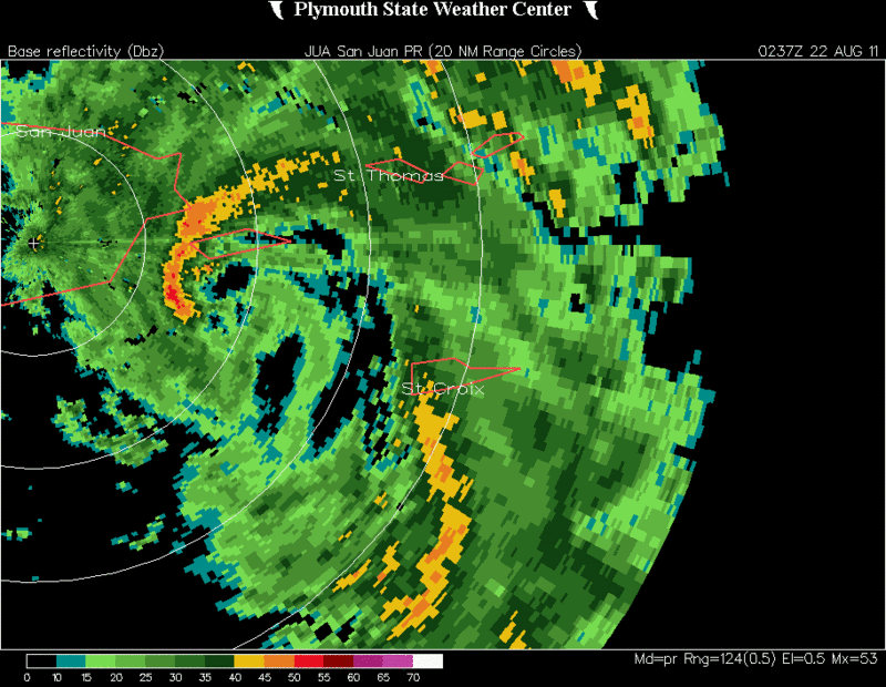
cpdaman wrote:I think theres lots of q's to be answerd still. The slowing tonite imo is gonna cause her to spend 2x longer over puerto rico and i think it will be a Weak t.s when it exits the nw side of puerto rico tomm. Seems no one really thinks 4000 foot mountains at about 10 mph movement across the length of p.r will substatially weaken her. Lol. I Wish i could wager a bet on these sort of things


The reason it won't weaken substantially is because the island is small. For most of tonight's crossing there will probably still be some part of the inner core over water, and there will be a moisture feed at low levels from all quadrants.
0 likes   

User avatar
summersquall
Tropical Storm
Tropical Storm
Posts: 230
Joined: Wed Jun 16, 2010 11:23 am
Location: Jensen Beach FL 27°N 80°W (roughly)

Re: ATL: IRENE - Tropical Storm - Discussion

#2718 Postby summersquall » Sun Aug 21, 2011 10:01 pm

Swimdude wrote:And flirting with Cat 2 at the 96 hour mark. Can't say I'm surprised, but that 90mph wind forecast (bumped up from 85mph at 96hr last advisory) at 96hrs just made me realize h I96hr how serious this might be.

My thoughts exactly. This will be my first storm down here (me and my dog). Intensity/probabilty peaks at the 96hr mark. http://www.nhc.noaa.gov/refresh/graphic ... e#contents
0 likes   
My posts should NEVER, EVER, EVER be construed as an official forecast as I know virtually nada respecting the finer points of meteorology. Consequently, my posts are obviously NOT endorsed by any professional institution or the good folks at storm2k.org. For official information please refer to the weather gurus at the NHC and NWS.

GTStorm
Tropical Storm
Tropical Storm
Posts: 225
Joined: Sat Sep 04, 2004 8:44 pm
Location: Savannah

Re:

#2719 Postby GTStorm » Sun Aug 21, 2011 10:01 pm

gatorcane wrote:Cone moved exactly like I thought it would


are thinking more eastward shifts? when it is all said and done, I see this trending towards an upper SC / Wilmington NC landfall. Seems like for storms in the past, once the models latched onto a weakness in the ridge, it got stronger as each run progresses and the track shifted accordingly. Maybe that's just perception. Any current data out there to support a trend like this for Irene?
0 likes   

CrazyC83
Professional-Met
Professional-Met
Posts: 34002
Joined: Tue Mar 07, 2006 11:57 pm
Location: Deep South, for the first time!

#2720 Postby CrazyC83 » Sun Aug 21, 2011 10:02 pm

000
URNT15 KNHC 220259
AF302 0309A IRENE HDOB 30 20110822
024900 1634N 06529W 8433 01564 0099 +160 //// 275013 014 014 000 01
024930 1634N 06527W 8431 01568 0099 +161 //// 270014 015 013 000 01
025000 1634N 06525W 8432 01565 0095 +165 //// 264016 016 012 000 01
025030 1634N 06523W 8434 01563 0095 +165 +164 259016 016 014 000 00
025100 1634N 06521W 8432 01565 0094 +158 //// 239016 017 029 011 01
025130 1634N 06519W 8455 01541 //// +145 //// 240015 020 033 011 01
025200 1634N 06518W 8433 01565 0097 +157 //// 259020 023 026 007 01
025230 1634N 06516W 8429 01569 0095 +165 +163 250020 021 015 001 00
025300 1634N 06514W 8434 01563 0096 +165 //// 243019 020 014 000 01
025330 1634N 06512W 8433 01564 0096 +165 //// 238019 020 015 000 01
025400 1634N 06510W 8436 01561 0096 +165 +164 236021 021 015 000 00
025430 1634N 06509W 8434 01565 0098 +163 //// 236022 022 014 000 01
025500 1634N 06507W 8436 01563 0097 +165 //// 233021 021 015 000 01
025530 1634N 06505W 8433 01565 0097 +165 +163 228021 021 017 000 00
025600 1634N 06503W 8434 01565 0097 +166 +160 222021 021 014 000 00
025630 1634N 06501W 8437 01562 0095 +170 +156 220022 022 014 000 00
025700 1634N 06459W 8430 01568 0097 +167 +158 220023 023 013 000 00
025730 1634N 06458W 8434 01565 0098 +167 +155 213024 025 010 000 00
025800 1634N 06456W 8432 01569 0098 +167 +154 209024 025 011 000 00
025830 1634N 06454W 8433 01567 0099 +165 +153 207025 026 010 001 00
$$
;
0 likes   


Return to “2011”

Who is online

Users browsing this forum: No registered users and 7 guests