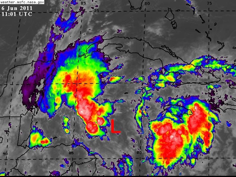
gatorcane wrote:SFLcane wrote:The strong mid/upper level circ is displaced at least 100 nmi east of the LLCC. That is severe decoupling. Perhaps the M/U circ can bore down to the surface, but it isn't likely. My thinking is the 400 mb flow (still nwly at 12Z at Cayman) to turn easterly for about 12 hr or so on Monday afternoon and evening, which would allow for the two circs to become aligned before the mid to upper flow turns back swly north of 20N and shears the system apart with the remnant LLCC moving nnwd just west of FL...which will FINALLY kick in the rainy season.
Your thinking is reasonable. We do need a kick to the rainy season as dew points at the major terminals in south Florida are still below 70f. I think that this system may give it a kick and deep se flow will setup. The convection should stay well to the northeast as sw shear will impact the system as it moves north. Here in the Bahamas, things are very dry so rains from 94L will be welcome.
As far as the rainy season start, yes dewpoints have been lower than normal, which of course we don't expect to see this time of year. We have already had a few periods of higher dewpoints going back to mid-April which have lasted several days in a row, but mixed in with these late dry periods. The start of the rainy season can be modified after the fact, it's not something that is set in stone once it's "officially" declared. Some years it's easy, some it's hard (like this year). In the end, it's not really that big of a deal to try to pin down the exact date it starts, but its impacts once it does start.
BTW, the 70 degree dewpoint criteria is one that was never proven scientifically in my opinion. We have to think of these things scientifically, and it's probable that a dewpoint of 67 or 68 could be just as important as 70. That's why I don't place great emphasis on the 70 degree dewpoints. Insteadweed should start to look at other things such as precipitable water in the lower levels of the atmosphere, instability, sea surface temperatures, etc.