
ATL: EMILY - Remnants
Moderator: S2k Moderators
-
Aric Dunn
- Category 5

- Posts: 21238
- Age: 43
- Joined: Sun Sep 19, 2004 9:58 pm
- Location: Ready for the Chase.
- Contact:
Re: Re:
hurricanefloyd5 wrote:Aric Dunn wrote:Finally the radar is back !!!moving basically west 275 to 280 and seems to be developing a small inner core..
Dosethis mean it is well on its way of becoming a Hurricane aric or no?
just means it could be better organized..
0 likes
Note: If I make a post that is brief. Please refer back to previous posts for the analysis or reasoning. I do not re-write/qoute what my initial post said each time.
If there is nothing before... then just ask
Space & Atmospheric Physicist, Embry-Riddle Aeronautical University,
I believe the sky is falling...
If there is nothing before... then just ask
Space & Atmospheric Physicist, Embry-Riddle Aeronautical University,
I believe the sky is falling...
Re: ATL: EMILY - Tropical Storm - Discussion
SJU radar is down at the moment - here's a partial loop:
http://radar.weather.gov/ridge/radar.ph ... 1&loop=yes
http://radar.weather.gov/ridge/radar.ph ... 1&loop=yes
0 likes

Re: ATL: EMILY - Tropical Storm - Discussion
That OT this morning was a high rain-rate cu-nim; could even have been a hot-tower.
Emily has responded very well and microwave is showing that a strong core cell has formed as a result.
Too bad I can't get an up-to-date AMSU sounding to see what the core temp looks like.

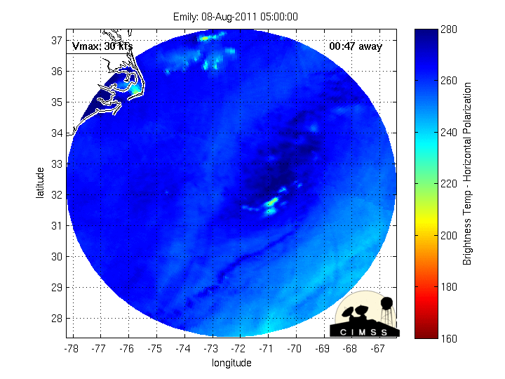
Emily has responded very well and microwave is showing that a strong core cell has formed as a result.
Too bad I can't get an up-to-date AMSU sounding to see what the core temp looks like.
0 likes
-
HURAKAN

- Professional-Met

- Posts: 46084
- Age: 39
- Joined: Thu May 20, 2004 4:34 pm
- Location: Key West, FL
- Contact:
904
URNT15 KNHC 021736
AF309 0605A EMILY HDOB 07 20110802
172600 1625N 06351W 9771 00280 0087 +241 +200 106034 036 035 000 03
172630 1624N 06352W 9769 00280 0086 +242 +200 110034 035 035 000 03
172700 1623N 06353W 9770 00279 0085 +241 +200 110034 036 036 000 03
172730 1622N 06354W 9770 00279 0085 +241 +200 110034 036 035 001 03
172800 1621N 06356W 9770 00278 0085 +240 +201 112034 037 036 000 03
172830 1619N 06357W 9771 00278 0084 +240 +201 112035 035 036 000 03
172900 1618N 06358W 9768 00279 0084 +240 +201 114035 036 037 000 03
172930 1617N 06359W 9768 00277 0084 +240 +200 113036 037 037 000 03
173000 1616N 06401W 9771 00275 0083 +240 +200 111035 037 037 001 03
173030 1615N 06402W 9769 00276 0083 +238 +199 112036 037 037 001 03
173100 1614N 06403W 9773 00274 0082 +236 +199 112038 039 039 000 00
173130 1612N 06404W 9769 00275 0081 +235 +198 109040 042 041 000 03
173200 1611N 06405W 9774 00269 0080 +235 +198 107040 041 039 002 03
173230 1610N 06407W 9771 00272 0080 +235 +197 106041 042 041 000 03
173300 1609N 06408W 9766 00276 0080 +232 +196 106041 042 041 002 00
173330 1608N 06409W 9772 00270 0079 +233 +195 110041 042 040 001 03
173400 1607N 06410W 9764 00277 0079 +223 +193 108043 045 042 002 03
173430 1605N 06412W 9775 00265 0078 +217 +189 111045 047 045 005 00
173500 1604N 06413W 9772 00268 0079 +204 +184 114048 051 049 011 03
173530 1603N 06414W 9765 00272 0077 +205 +177 114047 051 047 007 00
$$
;
48 knots FL
0 likes
-
Evil Jeremy

- S2K Supporter

- Posts: 5463
- Age: 32
- Joined: Mon Apr 10, 2006 2:10 pm
- Location: Los Angeles, CA
-
Aric Dunn
- Category 5
- Posts: 21238
- Age: 43
- Joined: Sun Sep 19, 2004 9:58 pm
- Location: Ready for the Chase.
- Contact:
Re: ATL: EMILY - Tropical Storm - Discussion
Frank2 wrote:SJU radar is down at the moment - here's a partial loop:
http://radar.weather.gov/ridge/radar.ph ... 1&loop=yes
I got a couple images on GR. still coming in just spaced out.
121 image
0 likes
Note: If I make a post that is brief. Please refer back to previous posts for the analysis or reasoning. I do not re-write/qoute what my initial post said each time.
If there is nothing before... then just ask
Space & Atmospheric Physicist, Embry-Riddle Aeronautical University,
I believe the sky is falling...
If there is nothing before... then just ask
Space & Atmospheric Physicist, Embry-Riddle Aeronautical University,
I believe the sky is falling...
-
SouthFloridawx

- S2K Supporter
- Posts: 8346
- Age: 47
- Joined: Tue Jul 26, 2005 1:16 am
- Location: Sarasota, FL
- Contact:
Re: ATL: EMILY - Tropical Storm - Discussion
Looks like the winds have definitely increased looking at recon.
0 likes

-
cycloneye

- Admin

- Posts: 149473
- Age: 69
- Joined: Thu Oct 10, 2002 10:54 am
- Location: San Juan, Puerto Rico
Re: ATL: EMILY - Tropical Storm - Discussion
051 047
51kts at flight level and 47kts at SMFR. Is good data.
51kts at flight level and 47kts at SMFR. Is good data.
0 likes
Visit the Caribbean-Central America Weather Thread where you can find at first post web cams,radars
and observations from Caribbean basin members Click Here
and observations from Caribbean basin members Click Here
-
chris_fit

- Category 5
- Posts: 3261
- Age: 43
- Joined: Wed Sep 10, 2003 11:58 pm
- Location: Tampa Bay Area, FL
Re: ATL: EMILY - Tropical Storm - Discussion
Appears to be strengthening some... 47 SFMR - 51 flt lvl
0 likes
-
Aric Dunn
- Category 5
- Posts: 21238
- Age: 43
- Joined: Sun Sep 19, 2004 9:58 pm
- Location: Ready for the Chase.
- Contact:
Re: ATL: EMILY - Tropical Storm - Discussion
SouthFloridawx wrote:Looks like the winds have definitely increased looking at recon.
yeah with the the last image at 121 from radar I could see what appeared to be a little inner core starting..
0 likes
Note: If I make a post that is brief. Please refer back to previous posts for the analysis or reasoning. I do not re-write/qoute what my initial post said each time.
If there is nothing before... then just ask
Space & Atmospheric Physicist, Embry-Riddle Aeronautical University,
I believe the sky is falling...
If there is nothing before... then just ask
Space & Atmospheric Physicist, Embry-Riddle Aeronautical University,
I believe the sky is falling...
-
AdamFirst

- S2K Supporter
- Posts: 2490
- Age: 36
- Joined: Thu Aug 14, 2008 10:54 am
- Location: Port Saint Lucie, FL
Re: ATL: EMILY - Tropical Storm - Discussion
I am woman, hear me roar!
I believe Emily has finally arrived....as a legit storm anyway.
I believe Emily has finally arrived....as a legit storm anyway.
0 likes
Dolphins Marlins Canes Golden Panthers HEAT
Andrew 1992 - Irene 1999 - Frances 2004 - Jeanne 2004 - Wilma 2005 - Fay 2008 - Isaac 2012 - Matthew 2016 - Irma 2017 - Dorian 2019 - Ian 2022 - Nicole 2022 - Milton 2024
Andrew 1992 - Irene 1999 - Frances 2004 - Jeanne 2004 - Wilma 2005 - Fay 2008 - Isaac 2012 - Matthew 2016 - Irma 2017 - Dorian 2019 - Ian 2022 - Nicole 2022 - Milton 2024
-
Aric Dunn
- Category 5
- Posts: 21238
- Age: 43
- Joined: Sun Sep 19, 2004 9:58 pm
- Location: Ready for the Chase.
- Contact:
pressure already below last fix and they are not to center yet..
0 likes
Note: If I make a post that is brief. Please refer back to previous posts for the analysis or reasoning. I do not re-write/qoute what my initial post said each time.
If there is nothing before... then just ask
Space & Atmospheric Physicist, Embry-Riddle Aeronautical University,
I believe the sky is falling...
If there is nothing before... then just ask
Space & Atmospheric Physicist, Embry-Riddle Aeronautical University,
I believe the sky is falling...

Re: ATL: EMILY - Tropical Storm - Discussion
Hurricane by day's end?
0 likes
"People might not get all they work for in this world, but they must certainly work for all they get."- Frederick Douglass


Re: ATL: EMILY - Tropical Storm - Discussion
17:15 Funktop (Developed by Ted Funk for assistance with precipitation analysis)

0 likes
-
SouthFloridawx
- S2K Supporter
- Posts: 8346
- Age: 47
- Joined: Tue Jul 26, 2005 1:16 am
- Location: Sarasota, FL
- Contact:
Re: ATL: EMILY - Models
underthwx wrote:is emily still stationary?
We'll find out soon enough.
0 likes
-
AdamFirst
- S2K Supporter
- Posts: 2490
- Age: 36
- Joined: Thu Aug 14, 2008 10:54 am
- Location: Port Saint Lucie, FL
Re: ATL: EMILY - Tropical Storm - Discussion
Think NHC stays with 40 MPH at 2 PM?
0 likes
Dolphins Marlins Canes Golden Panthers HEAT
Andrew 1992 - Irene 1999 - Frances 2004 - Jeanne 2004 - Wilma 2005 - Fay 2008 - Isaac 2012 - Matthew 2016 - Irma 2017 - Dorian 2019 - Ian 2022 - Nicole 2022 - Milton 2024
Andrew 1992 - Irene 1999 - Frances 2004 - Jeanne 2004 - Wilma 2005 - Fay 2008 - Isaac 2012 - Matthew 2016 - Irma 2017 - Dorian 2019 - Ian 2022 - Nicole 2022 - Milton 2024
-
Evil Jeremy
- S2K Supporter
- Posts: 5463
- Age: 32
- Joined: Mon Apr 10, 2006 2:10 pm
- Location: Los Angeles, CA
Who is online
Users browsing this forum: No registered users and 62 guests