

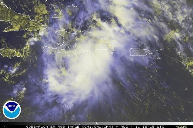
tolakram wrote:Ok, sticking to the MIMIC-TPW again,
Personal Forecast Disclaimer:
The posts in this forum are NOT official forecast and should not be used as such. They are just the opinion of the poster and may or may not be backed by sound meteorological data. They are NOT endorsed by any professional institution or storm2k.org. For official information, please refer to the NHC and NWS products.
http://cimss.ssec.wisc.edu/tropic/real- ... t72hrs.gif
Looks like Emily has collapsed and the best rotation is now moving over Hispaniola, or maybe the eastern tip of Cuba. A MESS!
Wow! Definitely seems that way!


