ATL: IRENE - Remnants - Discussion
Moderator: S2k Moderators
-
brunota2003

- S2K Supporter

- Posts: 9476
- Age: 35
- Joined: Sat Jul 30, 2005 9:56 pm
- Location: Stanton, KY...formerly Havelock, NC
- Contact:
-
NC George

- Category 2

- Posts: 635
- Age: 56
- Joined: Sun Sep 14, 2003 11:44 am
- Location: Washington, NC, USA
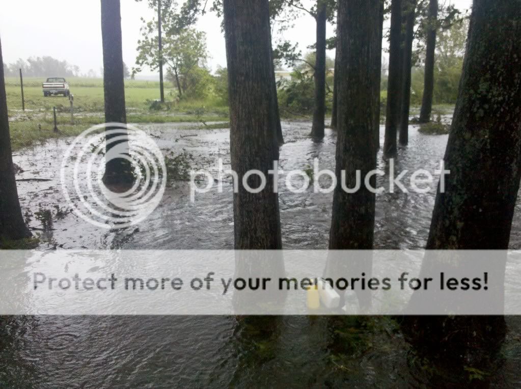
Stuck under a merciless rainband here. Water had stopped rising for awhile, but it's started going back up again. Still have winds, gusts not quite as strong as a couple of hours ago. Approx 12" rain in the bucket, pressure slowly rising.
0 likes
Bertha '96, Fran '96, Bonnie '98, Dennis '99, Floyd '99  , Isabel '03, Irene '11, Matthew '16, Isaias '20, PTC16????
Avatar is heading into Florence 2018, moving friend's boat, only land between us and Hurricane Florence is Ocracoke Island!
Avatar is heading into Florence 2018, moving friend's boat, only land between us and Hurricane Florence is Ocracoke Island!

Re: ATL: IRENE - Hurricane - Discussion
From Dr. Jeff Masters' WunderBlog:
Getting a 4.6 out of 6 seems worse than 5-6 feet surge. What are your thoughts on the scale and why it changed slightly from yesterday (Irene still has almost just as large a windfield as yesterday)?
Irene's storm surge damage potential has dropped to 4.3 on a scale of 0 to 6, down from a high of 5.1 yesterday.
Getting a 4.6 out of 6 seems worse than 5-6 feet surge. What are your thoughts on the scale and why it changed slightly from yesterday (Irene still has almost just as large a windfield as yesterday)?
wxman57 wrote:Mark wrote:Can Long Island and NYC still expect to see the category 2 storm surge many on this board were predicting?? After all, storm surge is the biggest threat and I heard many here say that even if Irene weakens to a category 1, because of the size there would still be storm surge to the extent of a 5 (on a 0-6 scale).
The answer is absolutely not. A Cat 1 cannot produce a Cat 2 surge, because storm surge is not a function of SS category. A Cat 1 can produce little or no storm surge or it could produce a 20+ ft storm surge, depending on factors other than the SS category.
People have to stop associating potential surge with the SS category. A hurricane produces a surge based upon its wind field size, NOT the peak wind speed that might occur only over a few square miles (the SS category).
As for the possible surge into NY, see the latest projections on the NHC FTP site:
ftp://ftp.tpc.ncep.noaa.gov/surge/Latest/
They seem to have taken down the graphics from the 15Z advisory, which I hope means they're about to be updated with the 21Z advisory.
We're expecting about 5-6 ft surge into "The Battery" in addition to the tides being about 3ft above MSL when Irene hits.
0 likes
-
cycloneye

- Admin

- Posts: 149431
- Age: 69
- Joined: Thu Oct 10, 2002 10:54 am
- Location: San Juan, Puerto Rico
Re: ATL: IRENE - Advisories
BULLETIN
HURRICANE IRENE ADVISORY NUMBER 30
NWS NATIONAL HURRICANE CENTER MIAMI FL AL092011
500 PM EDT SAT AUG 27 2011
...IRENE ABOUT TO RE-EMERGE OVER THE ATLANTIC WATERS...
SUMMARY OF 500 PM EDT...2100 UTC...INFORMATION
----------------------------------------------
LOCATION...36.2N 76.0W
ABOUT 50 MI...80 KM SSE OF NORFOLK VIRGINIA
ABOUT 340 MI...545 KM SSW OF NEW YORK CITY
MAXIMUM SUSTAINED WINDS...80 MPH...130 KM/H
PRESENT MOVEMENT...NNE OR 15 DEGREES AT 13 MPH...20 KM/H
MINIMUM CENTRAL PRESSURE...950 MB...28.05 INCHES
WATCHES AND WARNINGS
--------------------
CHANGES IN WATCHES AND WARNINGS WITH THIS ADVISORY...
THE HURRICANE WARNING HAS BEEN DISCONTINUED SOUTH OF CAPE FEAR NORTH
CAROLINA.
SUMMARY OF WATCHES AND WARNINGS IN EFFECT...
A HURRICANE WARNING IS IN EFFECT FOR...
* CAPE FEAR NORTH CAROLINA NORTHWARD TO SAGAMORE BEACH
MASSACHUSETTS...INCLUDING THE PAMLICO...ALBEMARLE...AND CURRITUCK
SOUNDS...DELAWARE BAY...CHESAPEAKE BAY SOUTH OF DRUM POINT...NEW
YORK CITY...LONG ISLAND...LONG ISLAND SOUND...COASTAL CONNECTICUT
AND RHODE ISLAND...BLOCK ISLAND...MARTHAS VINEYARD AND NANTUCKET
A TROPICAL STORM WARNING IS IN EFFECT FOR...
* CHESAPEAKE BAY FROM DRUM POINT NORTHWARD AND THE TIDAL POTOMAC
* NORTH OF SAGAMORE BEACH TO EASTPORT MAINE
* UNITED STATES/CANADA BORDER NORTHEASTWARD TO FORT LAWRENCE
INCLUDING GRAND MANAN
* SOUTH COAST OF NOVA SCOTIA FROM FORT LAWRENCE TO PORTERS LAKE
INTERESTS ELSEWHERE IN EASTERN CANADA SHOULD MONITOR THE PROGRESS OF
IRENE.
FOR STORM INFORMATION SPECIFIC TO YOUR AREA IN THE UNITED
STATES...INCLUDING POSSIBLE INLAND WATCHES AND WARNINGS...PLEASE
MONITOR PRODUCTS ISSUED BY YOUR LOCAL NATIONAL WEATHER SERVICE
FORECAST OFFICE. FOR STORM INFORMATION SPECIFIC TO YOUR AREA OUTSIDE
THE UNITED STATES...PLEASE MONITOR PRODUCTS ISSUED BY YOUR NATIONAL
METEOROLOGICAL SERVICE.
DISCUSSION AND 48-HOUR OUTLOOK
------------------------------
AT 500 PM EDT...2100 UTC...THE CENTER OF HURRICANE IRENE WAS LOCATED
NEAR LATITUDE 36.2 NORTH...LONGITUDE 76.0 WEST. IRENE IS MOVING
TOWARD THE NORTH-NORTHEAST NEAR 13 MPH...20 KM/H...AND THIS MOTION
ACCOMPANIED BY A FASTER FORWARD SPEED IS EXPECTED DURING THE NEXT
DAY OR SO. ON THE FORECAST TRACK...THE CENTER OF IRENE WILL MOVE
NEAR OR OVER THE MID-ATLANTIC COAST TONIGHT...AND MOVE OVER
SOUTHERN NEW ENGLAND ON SUNDAY. IRENE IS FORECAST TO MOVE INTO
EASTERN CANADA SUNDAY NIGHT.
MAXIMUM SUSTAINED WINDS ARE NEAR 80 MPH...130 KM/H...WITH HIGHER
GUSTS. IRENE IS FORECAST TO REMAIN A HURRICANE AS IT MOVES NEAR OR
OVER THE MID-ATLANTIC COAST AND APPROACHES NEW ENGLAND. THE
HURRICANE IS FORECAST TO WEAKEN AFTER LANDFALL AND BECOME A
POST-TROPICAL CYCLONE SUNDAY NIGHT OR EARLY MONDAY.
IRENE IS A LARGE TROPICAL CYCLONE. HURRICANE-FORCE WINDS EXTEND
OUTWARD UP TO 85 MILES...140 KM...FROM THE CENTER...AND
TROPICAL-STORM-FORCE WINDS EXTEND OUTWARD UP TO 290 MILES...465 KM.
A NATIONAL OCEAN SERVICE OBSERVING SITE AT OREGON INLET NORTH
CAROLINA RECENTLY REPORTED A SUSTAINED WIND OF 59 MPH...WITH A
GUST TO 81 MPH. A SUSTAINED WIND OF 58 MPH WITH A GUST TO 74 MPH
WAS RECENTLY MEASURED AT MANTEO NORTH CAROLINA.
THE LATEST MINIMUM CENTRAL PRESSURE REPORTED BY AN AIR FORCE RESERVE
HURRICANE HUNTER AIRCRAFT WAS 950 MB...28.05 INCHES.
HAZARDS AFFECTING LAND
----------------------
WIND...TROPICAL-STORM-FORCE WINDS WILL SPREAD NORTHWARD ALONG THE
MID-ATLANTIC COAST THIS EVENING WITH HURRICANE CONDITIONS EXPECTED
TONIGHT. TROPICAL STORM CONDITIONS ARE EXPECTED TO REACH SOUTHERN
NEW ENGLAND LATE THIS EVENING WITH HURRICANE CONDITIONS EXPECTED BY
SUNDAY MORNING. WINDS AFFECTING THE UPPER FLOORS OF HIGH-RISE
BUILDINGS WILL BE SIGNIFICANTLY STRONGER THAN THOSE NEAR
GROUND-LEVEL.
STORM SURGE...AN EXTREMELY DANGEROUS STORM TIDE WILL RAISE WATER
LEVELS BY AS MUCH AS 5 TO 9 FEET ABOVE GROUND LEVEL IN THE
HURRICANE WARNING AREA IN NORTH CAROLINA...INCLUDING THE ALBEMARLE
AND PAMLICO SOUNDS. STORM SURGE WILL RAISE WATER LEVELS BY AS MUCH
AS 4 TO 8 FEET ABOVE GROUND LEVEL WITHIN THE HURRICANE WARNING AREA
FROM THE NORTH CAROLINA/VIRGINIA BORDER NORTHWARD TO CAPE COD
INCLUDING SOUTHERN PORTIONS OF THE CHESAPEAKE BAY AND ITS
TRIBUTARIES. NEAR THE COAST...THE SURGE WILL BE ACCOMPANIED BY
LARGE...DESTRUCTIVE...AND LIFE-THREATENING WAVES. HIGHER THAN
NORMAL ASTRONOMICAL TIDES ARE OCCURRING THIS WEEKEND. COASTAL AND
RIVER FLOODING WILL BE HIGHEST IN AREAS WHERE THE PEAK SURGE OCCURS
AROUND THE TIME OF HIGH TIDE. STORM TIDE AND SURGE VALUES ARE VERY
LOCATION-SPECIFIC...AND USERS ARE URGED TO CONSULT PRODUCTS ISSUED
BY THEIR LOCAL NATIONAL WEATHER SERVICE OFFICES.
RAINFALL...IRENE IS EXPECTED TO PRODUCE RAINFALL ACCUMULATIONS OF
6 TO 12 INCHES...WITH ISOLATED MAXIMUM AMOUNTS OF 20 INCHES...FROM
EASTERN NORTH CAROLINA NORTHWARD THROUGH THE MID-ATLANTIC STATES
INTO EASTERN NEW YORK AND INTERIOR NEW ENGLAND. THESE RAINS...
COMBINED WITH HEAVY RAINS OVER THE PAST FEW WEEKS...COULD CAUSE
WIDESPREAD FLOODING...LIFE-THREATENING FLASH FLOODS...AND
SIGNIFICANT UPROOTING OF TREES DUE TO RAIN-SOFTENED GROUNDS.
SURF...LARGE SWELLS GENERATED BY IRENE ARE AFFECTING MUCH OF THE
EAST COAST OF THE UNITED STATES. THESE SWELLS WILL CAUSE
LIFE-THREATENING SURF AND RIP CURRENT CONDITIONS.
TORNADOES...ISOLATED TORNADOES ARE POSSIBLE ALONG THE COAST OF
MARYLAND...DELAWARE...AND NEW JERSEY THROUGH TONIGHT.
NEXT ADVISORY
-------------
NEXT INTERMEDIATE ADVISORIES...700 PM EDT AND 900 PM EDT.
NEXT COMPLETE ADVISORY...1100 PM EDT.
$$
FORECASTER BROWN
0 likes
Visit the Caribbean-Central America Weather Thread where you can find at first post web cams,radars
and observations from Caribbean basin members Click Here
and observations from Caribbean basin members Click Here
-
ncweatherwizard
- Professional-Met

- Posts: 1243
- Joined: Wed Sep 03, 2003 9:45 am
- Location: Ft. Collins, CO
Re: ATL: IRENE - Hurricane - Discussion
Does anyone know why NHC is determining how often they put out intermediate advisories based on radar presentation?
0 likes
Re: ATL: IRENE - Hurricane - Discussion
ncweatherwizard wrote:Does anyone know why NHC is determining how often they put out intermediate advisories based on radar presentation?
I was wondering the same thing. I thought radar presentation was determinative in the issuance of Tropical Cyclone Position Estimate issuance but irrelevant to intermediate advisories.
0 likes
-
maxintensity
- Tropical Storm

- Posts: 165
- Joined: Tue Aug 02, 2011 9:54 pm
Re: ATL: IRENE - Hurricane - Discussion
I was shocked when I read that as well? Maybe a policy change since max mayfield left?ncweatherwizard wrote:Does anyone know why NHC is determining how often they put out intermediate advisories based on radar presentation?
0 likes
-
summersquall

- Tropical Storm
- Posts: 230
- Joined: Wed Jun 16, 2010 11:23 am
- Location: Jensen Beach FL 27°N 80°W (roughly)
For some real time updates on damages and conditions:
http://www.weather.com...
(For others like me without TWC.)
http://www.weather.com...
(For others like me without TWC.)
0 likes
My posts should NEVER, EVER, EVER be construed as an official forecast as I know virtually nada respecting the finer points of meteorology. Consequently, my posts are obviously NOT endorsed by any professional institution or the good folks at storm2k.org. For official information please refer to the weather gurus at the NHC and NWS.
-
SNOW_JOKE
- Tropical Depression

- Posts: 98
- Age: 42
- Joined: Mon Aug 01, 2011 7:47 pm
- Location: United Kingdom
Re: ATL: IRENE - Hurricane - Discussion
Chesapeake Bridge tidal gauge with heights.
http://tidesandcurrents.noaa.gov/data_m ... =Tide+Data
http://tidesandcurrents.noaa.gov/data_m ... =Tide+Data
0 likes
For Official Information please refer to the NHC and NWS Websites.


-
itglobalsecure

- S2K Supporter
- Posts: 20
- Joined: Mon May 31, 2010 7:55 pm
- Location: Madison, WI
Re: ATL: IRENE - Hurricane - Discussion
Lothianjavert - I am over here north of Denton on the Shore. I would not go over the Bay bridge. They said they plan to close it when it gets to 55 (winds in Caroline Cty currently steady at 33MPH with higher gusts). You'd get over and not able to get back.
0 likes
-
brunota2003
- S2K Supporter
- Posts: 9476
- Age: 35
- Joined: Sat Jul 30, 2005 9:56 pm
- Location: Stanton, KY...formerly Havelock, NC
- Contact:
-
summersquall
- Tropical Storm
- Posts: 230
- Joined: Wed Jun 16, 2010 11:23 am
- Location: Jensen Beach FL 27°N 80°W (roughly)
For real time buoy data, the Chesepeake Bay Buoy System:
http://buoybay.noaa.gov/observations/data-snapshot.html
"First Landing is closest to the Bay Bridge.
First Landing Wind Direction 68 degrees 2011-08-27 17:30 1 7 30
First Landing Wind Speed 34.2 knots 2011-08-27 17:30 1 7 30
First Landing Wind Gust 43.3 knots 2011-08-27 17:30 1 7 30
http://buoybay.noaa.gov/observations/data-snapshot.html
"First Landing is closest to the Bay Bridge.
First Landing Wind Direction 68 degrees 2011-08-27 17:30 1 7 30
First Landing Wind Speed 34.2 knots 2011-08-27 17:30 1 7 30
First Landing Wind Gust 43.3 knots 2011-08-27 17:30 1 7 30
Last edited by summersquall on Sat Aug 27, 2011 4:39 pm, edited 1 time in total.
0 likes
My posts should NEVER, EVER, EVER be construed as an official forecast as I know virtually nada respecting the finer points of meteorology. Consequently, my posts are obviously NOT endorsed by any professional institution or the good folks at storm2k.org. For official information please refer to the weather gurus at the NHC and NWS.
-
wxman57

- Moderator-Pro Met

- Posts: 23174
- Age: 68
- Joined: Sat Jun 21, 2003 8:06 pm
- Location: Houston, TX (southwest)
Re: ATL: IRENE - Hurricane - Discussion
Mark wrote:From Dr. Jeff Masters' WunderBlog:Irene's storm surge damage potential has dropped to 4.3 on a scale of 0 to 6, down from a high of 5.1 yesterday.
Getting a 4.6 out of 6 seems worse than 5-6 feet surge. What are your thoughts on the scale and why it changed slightly from yesterday (Irene still has almost just as large a windfield as yesterday)?
The drop-off is most likely due to a reduction in the areal coverage of Irene's stronger winds. Note in the graphic below, that hurricane force winds are no longer 80nm from the center, they're confined to a small area in the eastern eyewall:
ftp://ftp.aoml.noaa.gov/hrd/pub/hwind/2 ... tour04.png
0 likes
-
Eddy Gurge

- S2K Supporter
- Posts: 9
- Joined: Fri Jul 22, 2005 4:13 pm
- Location: Springfield, VA
Re:
NC George wrote:Stuck under a merciless rainband here. Water had stopped rising for awhile, but it's started going back up again. Still have winds, gusts not quite as strong as a couple of hours ago. Approx 12" rain in the bucket, pressure slowly rising.
Just starting to get windy up here near DC. I just had to say, my six year old daughter saw your photo and said 'oh my dear!'. 'Well, at least they have a swimming pool'.
0 likes

Re: ATL: IRENE - Hurricane - Discussion
back on for the first time since landfall and gotta say it still looks damn impressive, less convection but actually looks more organized than last night
0 likes
Just like Jon Snow..."I know nothing" except what I know, and most of what I know is gathered by the fine people of the NHC
-
WacoWx
- Category 2
- Posts: 692
- Joined: Mon Dec 28, 2009 4:14 pm
- Location: NOT Waco, TX ----> Dallas, TX
Re: ATL: IRENE - Hurricane - Discussion
First reply on a very informative thread.
Where can I find info on how to compare the kinetic energy with this storm compared to say an Ike/Katrina/Wilma. If only she had gotten to swim in the GOM. Me and la nina havent been getting along this summer.
Everyone stay safe out there and keep feeding me pics/info.
TIA
Where can I find info on how to compare the kinetic energy with this storm compared to say an Ike/Katrina/Wilma. If only she had gotten to swim in the GOM. Me and la nina havent been getting along this summer.
Everyone stay safe out there and keep feeding me pics/info.
TIA
0 likes
-
maxintensity
- Tropical Storm
- Posts: 165
- Joined: Tue Aug 02, 2011 9:54 pm
-
tolakram
- Admin
- Posts: 20185
- Age: 62
- Joined: Sun Aug 27, 2006 8:23 pm
- Location: Florence, KY (name is Mark)
Re: ATL: IRENE - Hurricane - Discussion
Latest radar loop, saved.

0 likes
M a r k
- - - - -
Join us in chat: Storm2K Chatroom Invite. Android and IOS apps also available.
The posts in this forum are NOT official forecasts and should not be used as such. Posts are NOT endorsed by any professional institution or STORM2K.org. For official information and forecasts, please refer to NHC and NWS products.
Who is online
Users browsing this forum: No registered users and 22 guests