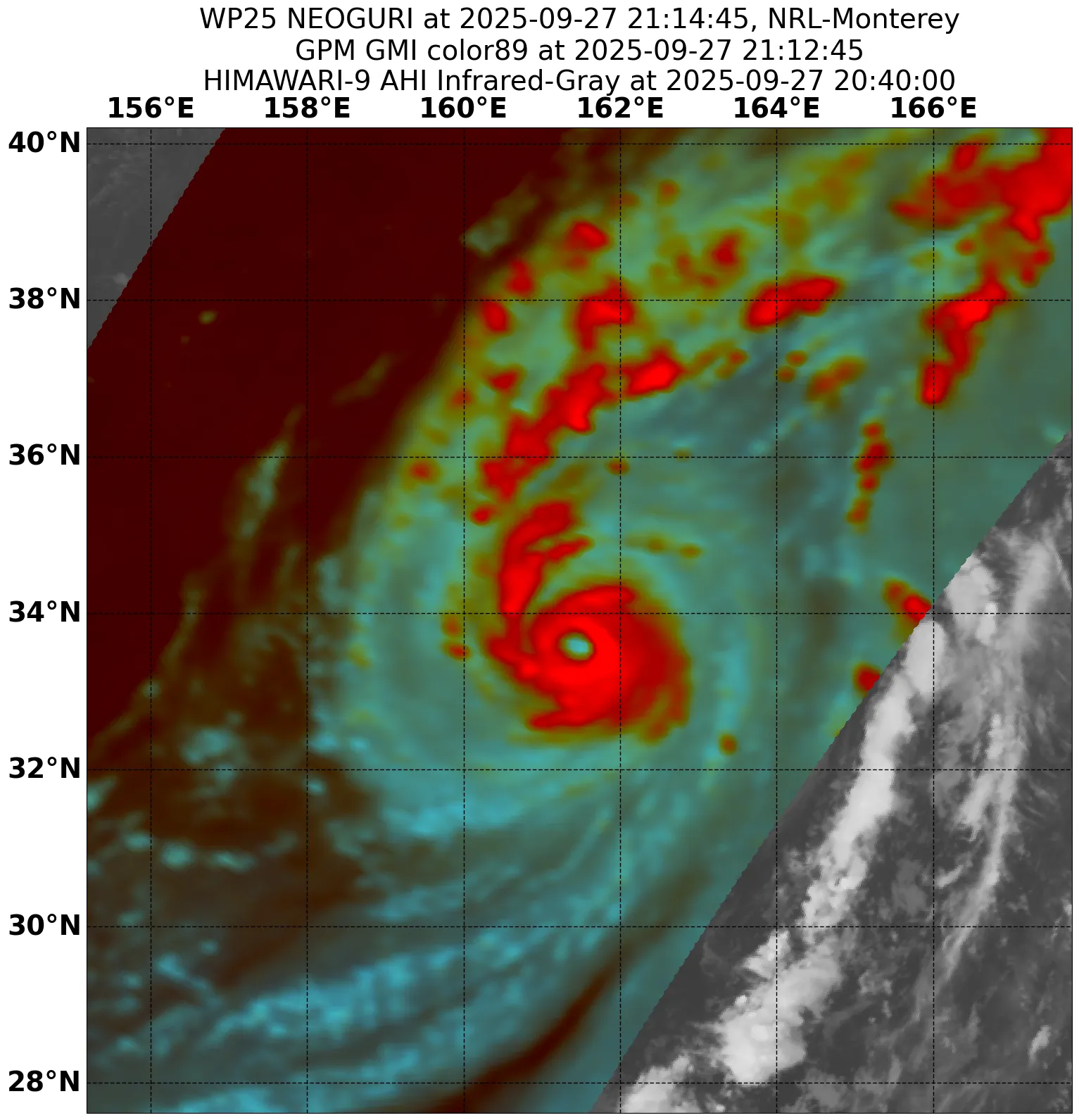
25W NEOGURI 250928 0000 34.3N 162.4E WPAC 95 957
WPAC: NEOGURI - Post-Tropical
Moderator: S2k Moderators
-
cycloneye

- Admin

- Posts: 149504
- Age: 69
- Joined: Thu Oct 10, 2002 10:54 am
- Location: San Juan, Puerto Rico
Re: WPAC: NEOGURI - Typhoon
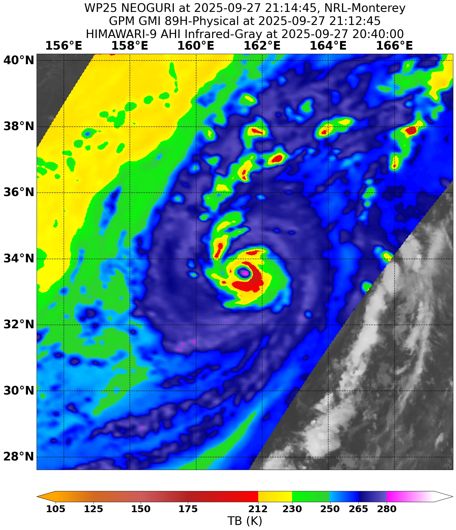
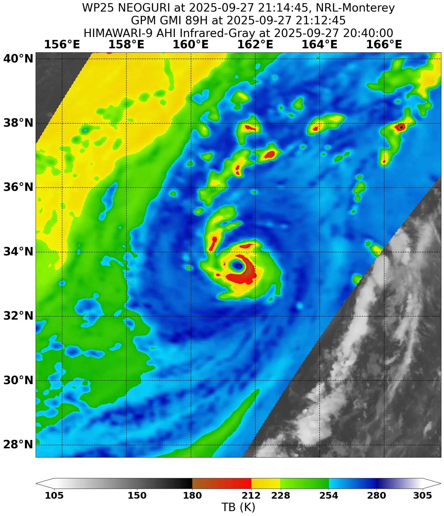
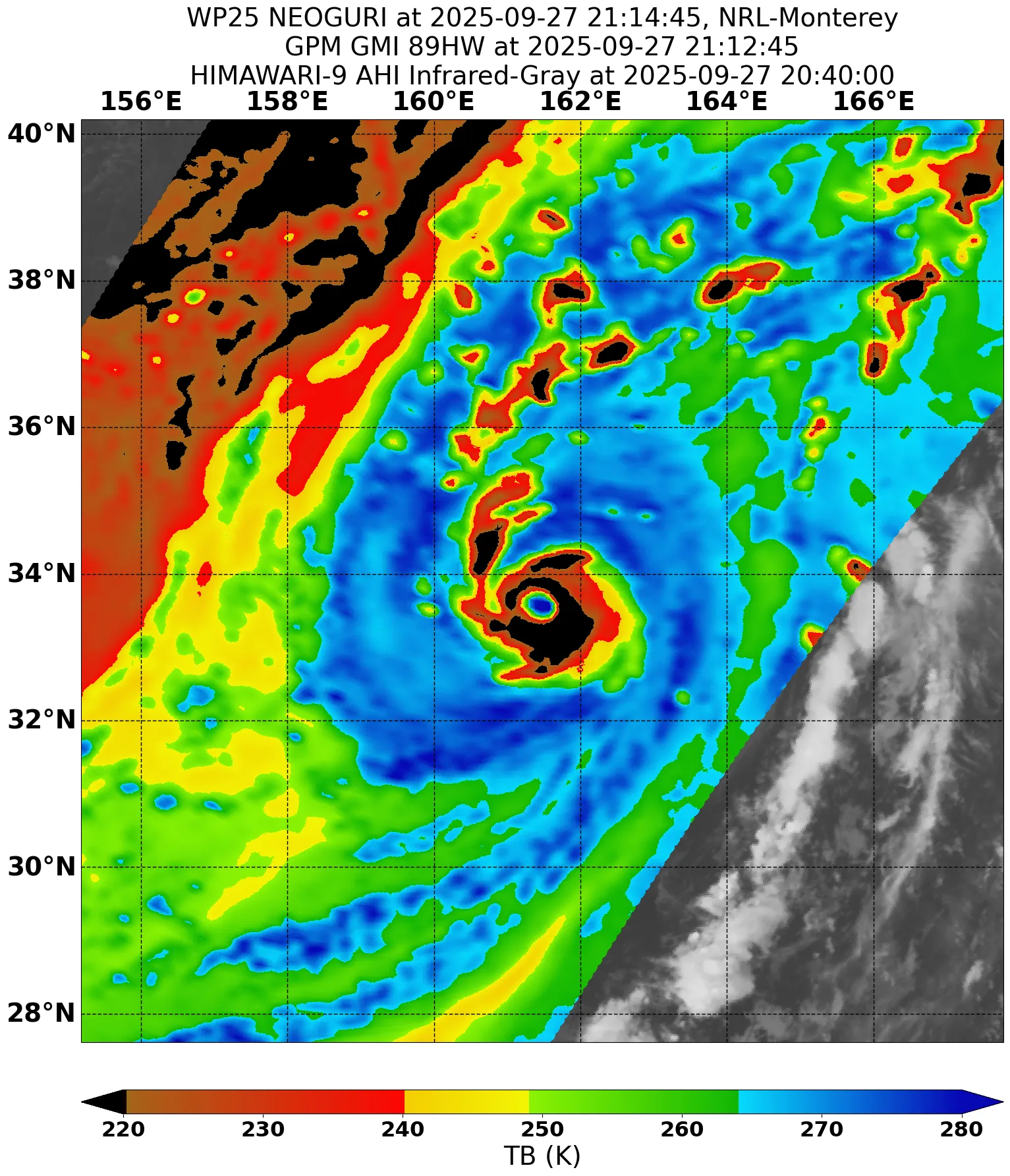
00z Best Track almost cat 3. If what Humberto has done is impressive, what Neoguri is doing is also in that category.
5 likes
Visit the Caribbean-Central America Weather Thread where you can find at first post web cams,radars
and observations from Caribbean basin members Click Here
and observations from Caribbean basin members Click Here

Re: WPAC: NEOGURI - Typhoon
Wow, that was unexpected. Reminds me of when Leslie last year suddenly became a Cat 2.

0 likes
TC naming lists: retirements and intensity
Most aggressive Advisory #1's in North Atlantic (cr. kevin for starting the list)
Most aggressive Advisory #1's in North Atlantic (cr. kevin for starting the list)
-
cycloneye
- Admin
- Posts: 149504
- Age: 69
- Joined: Thu Oct 10, 2002 10:54 am
- Location: San Juan, Puerto Rico
Re: WPAC: NEOGURI - Typhoon
Teban54 wrote:Wow, that was unexpected. Reminds me of when Leslie last year suddenly became a Cat 2.
https://i.postimg.cc/5ydSFzrz/himawari9-ir-25-W-202509272030.gif
And more impressive is where it is in latitude.
1 likes
Visit the Caribbean-Central America Weather Thread where you can find at first post web cams,radars
and observations from Caribbean basin members Click Here
and observations from Caribbean basin members Click Here

Re: WPAC: NEOGURI - Typhoon
This one is really performing especially at that latitude, unlike Bualoi can't even open an eye.
1 likes
ヤンデレ女が寝取られるているのを見たい!!!
ECMWF ensemble NWPAC plots: https://ecmwfensnwpac.imgbb.com/
Multimodel NWPAC plots: https://multimodelnwpac.imgbb.com/
GFS Ensemble NWPAC plots (16 & 35 day forecast): https://gefsnwpac.imgbb.com/
Plots updated automatically
ECMWF ensemble NWPAC plots: https://ecmwfensnwpac.imgbb.com/
Multimodel NWPAC plots: https://multimodelnwpac.imgbb.com/
GFS Ensemble NWPAC plots (16 & 35 day forecast): https://gefsnwpac.imgbb.com/
Plots updated automatically
-
cycloneye
- Admin
- Posts: 149504
- Age: 69
- Joined: Thu Oct 10, 2002 10:54 am
- Location: San Juan, Puerto Rico
Re: WPAC: NEOGURI - Typhoon
Now forecast by JTWC to be once again a major cane but this time wont last long as cat 3 as the final demise will come when it turns extratropical in 2 days.

0 likes
Visit the Caribbean-Central America Weather Thread where you can find at first post web cams,radars
and observations from Caribbean basin members Click Here
and observations from Caribbean basin members Click Here
-
StormWeather

- Category 1

- Posts: 476
- Joined: Wed Jun 05, 2024 2:34 pm
Re: WPAC: NEOGURI - Typhoon
cycloneye wrote:Now forecast by JTWC to be once again a major cane but this time wont last long as cat 3 as the final demise will come when it turns extratropical in 2 days.
https://i.imgur.com/GSZIj1Z.gif
A major tropical cyclone that close to the Alaskan Islands, an area that is extratropical cyclone breeding grounds seems wrong. The waters there are so cold. Tropical cyclones usually don’t make it this far north in the WPAC, as they usually are post-tropical by then.
1 likes
Just an average cyclone tracker
The posts in this forum are NOT official forecasts and should not be used as such. They are just the opinion of the poster and may or may not be backed by sound meteorological data. They are NOT endorsed by any professional institution or storm2k.org. For official information, please refer to the NHC and NWS products
The posts in this forum are NOT official forecasts and should not be used as such. They are just the opinion of the poster and may or may not be backed by sound meteorological data. They are NOT endorsed by any professional institution or storm2k.org. For official information, please refer to the NHC and NWS products
-
mrbagyo

- Category 5

- Posts: 3963
- Age: 33
- Joined: Thu Apr 12, 2012 9:18 am
- Location: 14.13N 120.98E
- Contact:
Re: WPAC: NEOGURI - Typhoon
behold
4 likes
The posts in this forum are NOT official forecast and should not be used as such. They are just the opinion of the poster and may or may not be backed by sound meteorological data. They are NOT endorsed by any professional institution or storm2k.org. For official information, please refer to RSMC, NHC and NWS products.

Re: WPAC: NEOGURI - Typhoon
StormWeather wrote:A major tropical cyclone that close to the Alaskan Islands, an area that is extratropical cyclone breeding grounds seems wrong. The waters there are so cold. Tropical cyclones usually don’t make it this far north in the WPAC, as they usually are post-tropical by then.
That general region has had very high SST anomalies for several months now. Neoguri seems to be enjoying quite a last meal!
0 likes
-
mrbagyo
- Category 5
- Posts: 3963
- Age: 33
- Joined: Thu Apr 12, 2012 9:18 am
- Location: 14.13N 120.98E
- Contact:
Re: WPAC: NEOGURI - Typhoon
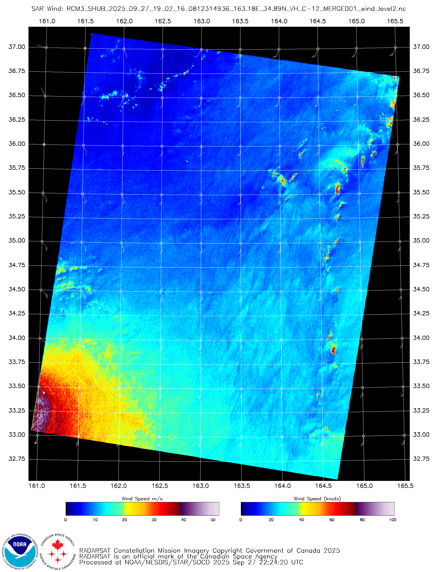
25W NEOGURI 250928 0600 35.8N 164.8E WPAC 110 947
0 likes
The posts in this forum are NOT official forecast and should not be used as such. They are just the opinion of the poster and may or may not be backed by sound meteorological data. They are NOT endorsed by any professional institution or storm2k.org. For official information, please refer to RSMC, NHC and NWS products.
-
cycloneye
- Admin
- Posts: 149504
- Age: 69
- Joined: Thu Oct 10, 2002 10:54 am
- Location: San Juan, Puerto Rico
Re: WPAC: NEOGURI - Typhoon
Keeps impressing while is in it's last act.

0 likes
Visit the Caribbean-Central America Weather Thread where you can find at first post web cams,radars
and observations from Caribbean basin members Click Here
and observations from Caribbean basin members Click Here
-
StormWeather
- Category 1
- Posts: 476
- Joined: Wed Jun 05, 2024 2:34 pm
Re: WPAC: NEOGURI - Typhoon
Neoguri saying its final goodbye after outlasting Ragasa and possibly soon if it hangs on a little longer, Bualoi.
0 likes
Just an average cyclone tracker
The posts in this forum are NOT official forecasts and should not be used as such. They are just the opinion of the poster and may or may not be backed by sound meteorological data. They are NOT endorsed by any professional institution or storm2k.org. For official information, please refer to the NHC and NWS products
The posts in this forum are NOT official forecasts and should not be used as such. They are just the opinion of the poster and may or may not be backed by sound meteorological data. They are NOT endorsed by any professional institution or storm2k.org. For official information, please refer to the NHC and NWS products
-
Hurricane2022

- Category 5
- Posts: 2039
- Joined: Tue Aug 23, 2022 11:38 pm
- Location: Araçatuba, Brazil
Re: WPAC: NEOGURI - Typhoon
!!!

4 likes
Sorry for the bad English sometimes...!
For reliable and detailed information for any meteorological phenomenon, please consult the National Hurricane Center, Joint Typhoon Warning Center , or your local Meteo Center.
--------
ECCE OMNIA NOVA FACIAM (Ap 21,5).
For reliable and detailed information for any meteorological phenomenon, please consult the National Hurricane Center, Joint Typhoon Warning Center , or your local Meteo Center.
--------
ECCE OMNIA NOVA FACIAM (Ap 21,5).
-
cycloneye
- Admin
- Posts: 149504
- Age: 69
- Joined: Thu Oct 10, 2002 10:54 am
- Location: San Juan, Puerto Rico
Re: WPAC: NEOGURI - Typhoon
Going to reach the Aletunian Islands. 

3 likes
Visit the Caribbean-Central America Weather Thread where you can find at first post web cams,radars
and observations from Caribbean basin members Click Here
and observations from Caribbean basin members Click Here
-
Hurricane2022
- Category 5
- Posts: 2039
- Joined: Tue Aug 23, 2022 11:38 pm
- Location: Araçatuba, Brazil
Re: WPAC: NEOGURI - Typhoon
1 likes
Sorry for the bad English sometimes...!
For reliable and detailed information for any meteorological phenomenon, please consult the National Hurricane Center, Joint Typhoon Warning Center , or your local Meteo Center.
--------
ECCE OMNIA NOVA FACIAM (Ap 21,5).
For reliable and detailed information for any meteorological phenomenon, please consult the National Hurricane Center, Joint Typhoon Warning Center , or your local Meteo Center.
--------
ECCE OMNIA NOVA FACIAM (Ap 21,5).
-
cycloneye
- Admin
- Posts: 149504
- Age: 69
- Joined: Thu Oct 10, 2002 10:54 am
- Location: San Juan, Puerto Rico
Re: WPAC: NEOGURI - Typhoon
Looks like finnally has turned extratropical but anyway have a question. Does anyone has the data about how many Tropical Cyclones have crossed from WPAC to CPAC?

1 likes
Visit the Caribbean-Central America Weather Thread where you can find at first post web cams,radars
and observations from Caribbean basin members Click Here
and observations from Caribbean basin members Click Here
-
Hurricanehink

- S2K Supporter

- Posts: 2045
- Joined: Sun Nov 16, 2003 2:05 pm
- Location: New Jersey
Re: WPAC: NEOGURI - Typhoon
cycloneye wrote:Looks like finnally has turned extratropical but anyway have a question. Does anyone has the data about how many Tropical Cyclones have crossed from WPAC to CPAC?
https://i.imgur.com/wy7VdO5.gif
A few come to mind. Omeka crossed the dateline a few times in December 2010. Wene 00 formed in the WPAC as a TD and strengthened in the CPAC. John 94 moved from the CPAC to WPAC back to CPAC. Patsy 59 also straddled the dateline.
1 likes
-
cycloneye
- Admin
- Posts: 149504
- Age: 69
- Joined: Thu Oct 10, 2002 10:54 am
- Location: San Juan, Puerto Rico
Re: WPAC: NEOGURI - Post-Tropical
Final warning from JTWC. They say it put on an amazing show and that is true 100%.
REMARKS:
290300Z POSITION NEAR 42.9N 173.9E.
29SEP25. TYPHOON 25W (NEOGURI), LOCATED APPROXIMATELY 1417 NM
NORTH OF WAKE ISLAND, HAS TRACKED NORTHEASTWARD AT 28 KNOTS OVER
THE PAST SIX HOURS. TYPHOON 25W HAS PUT ON AN AMAZING SHOW OVER THE
LAST COUPLE OF DAYS, BUT IT IS TIME TO TURN OFF THE LIGHTS, THE PARTY
IS OVER. JUST IN THE LAST SIX TO EIGHT HOURS, THE SYSTEM HAS CHANGED
REMARKABLY, GOING FROM A FULLY COUPLED VORTEX WITH A 20NM WIDE EYE,
TO A RAPIDLY DECOUPLING VORTEX AND CLEAR FRONTOGENESIS. A 282257Z
ASCAT-C PASS REVEALED AN ELONGATED LOW LEVEL CIRCULATION CENTER
(LLCC), WITH A VERY SHARP WARM FRONTAL REGION EXTENDING TO THE
NORTHEAST AND A MORE DIFFUSE COLD FRONT EXTENDING TO THE SOUTH OF THE
LLCC. MAXIMUM WINDS IN THE SCATTEROMETER WERE PEGGED AT 65 KNOTS,
PARTICULARLY IN THE NORTHWESTERN QUADRANT, LIKELY REFLECTING THE
PRESENCE OF A STING JET IN THAT REGION. THE INITIAL POSITION WAS
ASSESSED WITH HIGH CONFIDENCE BASED ON THE ASCAT DATA. THE INITIAL
INTENSITY WAS ASSESSED WITH MEDIUM CONFIDENCE BASED ON DVORAK CURRENT
INTENSITY ESTIMATES OF T5.0 FROM MULTIPLE AGENCIES, AS WELL AS
OBJECTIVE ESTIMATES BETWEEN 77-88 KTS. THE SYSTEM IS UNDERGOING RAPID
EXTRATROPICAL TRANSITION (ETT) AND WILL FULLY TRANSITION TO A STORM
FORCE EXTRATROPICAL LOW WITHIN THE NEXT 12 HOURS AS IT PASSES SOUTH
OF THE ALEUTIAN ISLANDS. THIS IS THE FINAL WARNING ON THIS SYSTEM BY
THE JOINT TYPHOON WRNCEN PEARL HARBOR HI.
1 likes
Visit the Caribbean-Central America Weather Thread where you can find at first post web cams,radars
and observations from Caribbean basin members Click Here
and observations from Caribbean basin members Click Here
Who is online
Users browsing this forum: No registered users and 49 guests