ATL: BERYL - Post-Tropical
Moderator: S2k Moderators
-
ozonepete
- Professional-Met

- Posts: 4743
- Joined: Mon Sep 07, 2009 3:23 pm
- Location: From Ozone Park, NYC / Now in Brooklyn, NY
Re: ATL:INVEST 94L
0 likes
-
cycloneye

- Admin

- Posts: 149276
- Age: 69
- Joined: Thu Oct 10, 2002 10:54 am
- Location: San Juan, Puerto Rico
Re: ATL: INVEST 94L
Look how big the area of interest has grown in size on the past few hours.

0 likes
Visit the Caribbean-Central America Weather Thread where you can find at first post web cams,radars
and observations from Caribbean basin members Click Here
and observations from Caribbean basin members Click Here
-
Comanche

- Category 1

- Posts: 381
- Age: 54
- Joined: Wed Jul 06, 2005 9:33 am
- Location: Clear Lake City Texas
Re: ATL: INVEST 94L
Hopefully our friends in GA can get some needed drought relief out of this...
0 likes


Re: ATL: INVEST 94L
local NWS has a special advisement out.
http://www.srh.noaa.gov/media/jax/vBrie ... /index.htm
Looks like a washout for Daytona/Jax over sunday/monday.
http://www.srh.noaa.gov/media/jax/vBrie ... /index.htm
Looks like a washout for Daytona/Jax over sunday/monday.
0 likes

Re: ATL: INVEST 94L
Huge moisture envelope for sure. The shear needs to let up and let this thing consolidate / stack. still displaced. Once that happens, I can see JBs thought of a 50kts coming to fruition. Got to give props to EURO on this guy. Sniffed it out pretty well a few days ago...
0 likes
-
cycloneye
- Admin
- Posts: 149276
- Age: 69
- Joined: Thu Oct 10, 2002 10:54 am
- Location: San Juan, Puerto Rico
Re: ATL: INVEST 94L
ASCAT pass just before 11:00 PM EDT.

0 likes
Visit the Caribbean-Central America Weather Thread where you can find at first post web cams,radars
and observations from Caribbean basin members Click Here
and observations from Caribbean basin members Click Here
Re: ATL: INVEST 94L
I am pretty sure this is going to get named with all the vacationers on the EC beaches. I dont think the NHC will go to a TD but rather straight to a TS given how close it will be to land. I can see that happening late tommorow if it stacks some....JMO.
0 likes
-
bamajammer4eva
- Category 4

- Posts: 907
- Joined: Sun Apr 18, 2010 3:21 am
- Location: Ozark, AL
Re: ATL: INVEST 94L
SPECIAL TROPICAL WEATHER OUTLOOK
NWS NATIONAL HURRICANE CENTER MIAMI FL
425 AM EDT FRI MAY 25 2012
FOR THE NORTH ATLANTIC...CARIBBEAN SEA AND THE GULF OF MEXICO...
1. A BROAD AREA OF LOW PRESSURE LOCATED NEAR THE NORTHWESTERN BAHAMAS
IS PRODUCING AN EXTENSIVE AREA OF SHOWERS AND THUNDERSTORMS OVER
THE BAHAMAS AND CUBA. WHILE THE ORGANIZATION OF THIS SYSTEM HAS NOT
IMPROVED OVER THE PAST FEW HOURS...ENVIRONMENTAL CONDITIONS ARE
EXPECTED TO BECOME MORE CONDUCIVE FOR THE FORMATION OF A
SUBTROPICAL OR TROPICAL CYCLONE BY SATURDAY OR SUNDAY. THE LOW
SHOULD MOVE TOWARD THE NORTHEAST AT ABOUT 15 MPH DURING THE NEXT
DAY OR SO...FOLLOWED BY A GRADUAL TURN BACK TOWARD THE WEST ON
SATURDAY. THIS SYSTEM HAS A HIGH CHANCE...70 PERCENT...OF BECOMING
A TROPICAL OR SUBTROPICAL CYCLONE DURING THE NEXT 48 HOURS.
LOCALLY HEAVY RAINFALL...FLOODING...AND GUSTY WINDS ARE POSSIBLE
TODAY OVER PORTIONS OF THE NORTHWESTERN AND CENTRAL BAHAMAS...AS
WELL AS CENTRAL CUBA. INTERESTS ALONG THE SOUTHEASTERN UNITED
STATES COAST SHOULD CLOSELY MONITOR THE PROGRESS OF THIS SYSTEM
OVER THE MEMORIAL DAY WEEKEND. ANOTHER SPECIAL TROPICAL WEATHER
OUTLOOK FOR THIS SYSTEM WILL BE ISSUED LATER TODAY. FOR ADDITIONAL
INFORMATION ON THIS SYSTEM...PLEASE SEE HIGH SEAS FORECASTS ISSUED
BY THE NATIONAL WEATHER SERVICE...AND PRODUCTS FROM YOUR LOCAL
WEATHER OFFICE.
0 likes
-
northjaxpro

- S2K Supporter

- Posts: 8900
- Joined: Mon Sep 27, 2010 11:21 am
- Location: Jacksonville, FL
Re: ATL: INVEST 94L
ROCK wrote:I am pretty sure this is going to get named with all the vacationers on the EC beaches. I dont think the NHC will go to a TD but rather straight to a TS given how close it will be to land. I can see that happening late tommorow if it stacks some....JMO.
Shear will finally begin to slack off some late Friday night and into Saturday as the High Pressure ridge builds in from the west and the upper level Low cuts off just off the coast of the Carolinas just west of the developing 94L. This should allow for marginally better conditions for 94L to try to consolidate on Saturday and into Sunday and possibly develop initially into a subtropical system and making the transition to tropical as the system traverses the Gulf Stream.
0 likes
NEVER, EVER SAY NEVER in the tropics and weather in general, and most importantly, with life itself!!
________________________________________________________________________________________
Fay 2008 Beryl 2012 Debby 2012 Colin 2016 Hermine 2016 Julia 2016 Matthew 2016 Irma 2017 Dorian 2019
________________________________________________________________________________________
Fay 2008 Beryl 2012 Debby 2012 Colin 2016 Hermine 2016 Julia 2016 Matthew 2016 Irma 2017 Dorian 2019

Re: ATL: INVEST 94L
Moisture advection looks good with high TPW being pulled in from the tropics.
A few hours ago, saw 5000 CAPE air being pulled in from the south.
Core temp at 1C and a little higher in altitude than 24 hrs ago.
No convective cap in place now.
Killer is the upper atmosphere with very high vorticity at 200mb.
UL winds all blowing SW to NE up to 50 knots.
Need some really strong convection to fire up to start to turn it around.
Maybe with the cap gone, high CAPE in-feed, and moderate shear; MCS's could begin to fire up.
0 likes

Re: ATL: INVEST 94L
You said 5000 CAPE? Wow, that's pretty damn unstable air. Already we've had Alberto this season and we're about to have Beryl form.....and it's only May. It feels like something like what would be happening in mid or late-July in a "good season". By "good season" I mean a season with a lot of developed storms.
0 likes
"People might not get all they work for in this world, but they must certainly work for all they get."- Frederick Douglass
Re: ATL: INVEST 94L
AHS2011 wrote:You said 5000 CAPE? Wow, that's pretty damn unstable air. Already we've had Alberto this season and we're about to have Beryl form.....and it's only May. It feels like something like what would be happening in mid or late-July in a "good season". By "good season" I mean a season with a lot of developed storms.
IMHO, in general, the weather is more like July than May.
If trend continues, could see a lot of TC activity.
0 likes
-
cycloneye
- Admin
- Posts: 149276
- Age: 69
- Joined: Thu Oct 10, 2002 10:54 am
- Location: San Juan, Puerto Rico
Re: ATL: INVEST 94L
Here is this morning's discussion of 94L by Rob of Crown Weather Services.
The following post is NOT an official forecast and should not be used as such. It is just the opinion of the poster and may or may not be backed by sound meteorological data. It is NOT endorsed by any professional institution including storm2k.org. For Official Information please refer to the NHC and NWS products.
http://www.crownweather.com/?page_id=4557
Tropical Storm Beryl Likely To Develop On Saturday & Come Ashore In Northeast Florida Near Palm Coast & Saint Augustine On Sunday Night
Friday, May 25, 2012 6:14 am
by Rob Lightbown
Invest 94-L, which is a broad area of low pressure currently located just north of Great Abaco and Grand Bahama Island in the northwestern Bahamas is currently tracking north-northeastward this morning. Currently, environmental conditions are not very favorable for additional development with very strong shear over this system. This was expected as I still do not expect this system to really get going until Saturday. I fully believe that Invest 94-L will transform into a tropical storm during the day Saturday and be named Beryl during Saturday.
So, on Saturday a ridge of high pressure is expected to expand eastward into the southwestern Atlantic and put this system into an environment that is more favorable for development as it tracks to a position about 275 to 300 miles east of Jacksonville, Florida. This eastward building high pressure system will cause this storm to turn to the west and west-southwest by Saturday night and Sunday while it intensifies into a 60 to perhaps 65 mph tropical storm. I still think it is likely that Beryl to be will come ashore in northeastern Florida very near Palm Coast and Saint Augustine on Sunday night as a 50 to 60 mph tropical storm.
Once onshore in northeast Florida I think we will see Beryl first track westward into northern Florida during Monday and into Monday evening before pulling out to the northeast near the Georgia, South Carolina and North Carolina coast on Tuesday and Wednesday where it may redevelop and strengthen. By Thursday, I think we will see Beryl track to the south and east of southern New England and into the open Atlantic by next Friday.
My thinking is fully supported by most of the model guidance, including the European model which I am following quite closely.
As for actual weather associated with Beryl to be: Heavy rainfall with flooding and gusty winds to 40 to 50 mph in gusts are likely today across the northwestern Bahamas.
On Saturday, heavy rainfall with winds to tropical storm force are likely along the entire South Carolina coastline as well as across southeastern and eastern North Carolina.
On Saturday night and Sunday, heavy rainfall with tropical storm force winds with gusts to 50 to 60 mph are possible along the entire Georgia coastline as well as across northeastern Florida, including Jacksonville, Saint Augustine and Palm Coast. Heavy rainfall and tropical storm force winds will continue into Sunday night across northeast Florida as Beryl comes ashore. Heavy rain with gusty winds are likely on Monday across all of northern Florida as Beryl comes further inland across northern Florida.
Beach-goers and vacationers along the coast from northeastern Florida northward to the Georgia, South Carolina and southeastern & eastern North Carolina coastline should be advised that squalls of heavy rain along with tropical storm force winds up to 60 mph and very rough surf are likely throughout the Memorial Day weekend.
0 likes
Visit the Caribbean-Central America Weather Thread where you can find at first post web cams,radars
and observations from Caribbean basin members Click Here
and observations from Caribbean basin members Click Here
-
northjaxpro
- S2K Supporter
- Posts: 8900
- Joined: Mon Sep 27, 2010 11:21 am
- Location: Jacksonville, FL
I generally agree with Rob Lightbown from Crown Weather. I also like the Euro as the model of choice. Things are really going to get interesting around my neck of the woods over the Memorial Day holiday weekend. If the Euro and even the GFS are correct, we will be feeling the effects of Beryl Sunday into early Wednesday.
Hopefully the system won't be more than a 50 mph tropical cyclone, but there is a possibility it may be stronger upon its approach to the coast. This is beginning to resemble to me a Fay-like scenario we had around here in July 2008, where I measured just over 14 inches total with that slow moving storm. Since Beryl seems at this time to impact directly where I am in the Jacksonville and Northeast Florida region, I will be updating as frequently as possible the conditions as they are happening during this event. I am simply hoping that this system will go a long way to wipe out this extreme drought across my area, which is currently running 8-10 inches below the average for this time of year. Should this upcoming storm moves through and meanders slowly across North Florida as it is forecast to do early next week, we should see some very significant rainfall amounts after it is all said and done.
Hopefully the system won't be more than a 50 mph tropical cyclone, but there is a possibility it may be stronger upon its approach to the coast. This is beginning to resemble to me a Fay-like scenario we had around here in July 2008, where I measured just over 14 inches total with that slow moving storm. Since Beryl seems at this time to impact directly where I am in the Jacksonville and Northeast Florida region, I will be updating as frequently as possible the conditions as they are happening during this event. I am simply hoping that this system will go a long way to wipe out this extreme drought across my area, which is currently running 8-10 inches below the average for this time of year. Should this upcoming storm moves through and meanders slowly across North Florida as it is forecast to do early next week, we should see some very significant rainfall amounts after it is all said and done.
Last edited by northjaxpro on Fri May 25, 2012 6:29 am, edited 1 time in total.
0 likes
NEVER, EVER SAY NEVER in the tropics and weather in general, and most importantly, with life itself!!
________________________________________________________________________________________
Fay 2008 Beryl 2012 Debby 2012 Colin 2016 Hermine 2016 Julia 2016 Matthew 2016 Irma 2017 Dorian 2019
________________________________________________________________________________________
Fay 2008 Beryl 2012 Debby 2012 Colin 2016 Hermine 2016 Julia 2016 Matthew 2016 Irma 2017 Dorian 2019
-
Aric Dunn
- Category 5

- Posts: 21238
- Age: 43
- Joined: Sun Sep 19, 2004 9:58 pm
- Location: Ready for the Chase.
- Contact:
Re: ATL: INVEST 94L
Still under high shear but much less then yesterday. The only low I can tell is circled. however anywhere in that mass the final circ can take shape. where and when is very key. If this southern one hold then transitions vs another developing farther north. then we may see a southerly shift to the track. being more inline with the early model runs that were a little more SW motion.

0 likes
Note: If I make a post that is brief. Please refer back to previous posts for the analysis or reasoning. I do not re-write/qoute what my initial post said each time.
If there is nothing before... then just ask
Space & Atmospheric Physicist, Embry-Riddle Aeronautical University,
I believe the sky is falling...
If there is nothing before... then just ask
Space & Atmospheric Physicist, Embry-Riddle Aeronautical University,
I believe the sky is falling...

Re: ATL: INVEST 94L
Aric, the European model has been pretty consistent on track the last several runs bringing it in near St Augustine or even Daytona Bch. It's also been consistently the strongest of the global models in intensity - I believe down to 1003 mb on Sunday night off the NE FL coast from the latest 00z run. While I don't "hug" any one model, it's gernerally been the best in the 72-96 hr time frame. I suspect this one maybe subtropical rather than purely tropical - at least at the start.
0 likes
-
Aric Dunn
- Category 5
- Posts: 21238
- Age: 43
- Joined: Sun Sep 19, 2004 9:58 pm
- Location: Ready for the Chase.
- Contact:
Re: ATL: INVEST 94L
ronjon wrote:Aric, the European model has been pretty consistent on track the last several runs bringing it in near St Augustine or even Daytona Bch. It's also been consistently the strongest of the global models in intensity - I believe down to 1003 mb on Sunday night off the NE FL coast from the latest 00z run. While I don't "hug" any one model, it's gernerally been the best in the 72-96 hr time frame. I suspect this one maybe subtropical rather than purely tropical - at least at the start.
Yeah well its not tropical atm so it will start out sub tropical. As for the Euro even it yesterday and wed had shifted slightly north more to GA and SC and now is farther south back the ST aug daytona area. along with the UKMET 00z is back south. small shifts yes but makes a difference in terms of population.
0 likes
Note: If I make a post that is brief. Please refer back to previous posts for the analysis or reasoning. I do not re-write/qoute what my initial post said each time.
If there is nothing before... then just ask
Space & Atmospheric Physicist, Embry-Riddle Aeronautical University,
I believe the sky is falling...
If there is nothing before... then just ask
Space & Atmospheric Physicist, Embry-Riddle Aeronautical University,
I believe the sky is falling...
-
northjaxpro
- S2K Supporter
- Posts: 8900
- Joined: Mon Sep 27, 2010 11:21 am
- Location: Jacksonville, FL
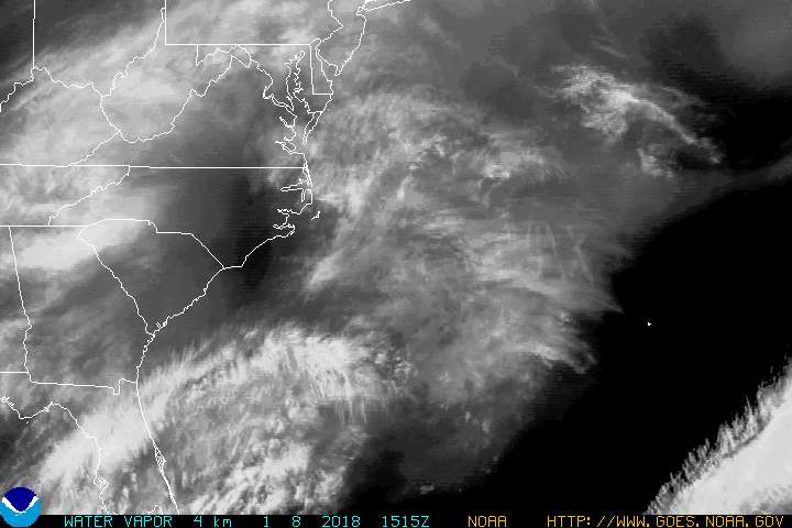
Water Vapor Imagery
0 likes
NEVER, EVER SAY NEVER in the tropics and weather in general, and most importantly, with life itself!!
________________________________________________________________________________________
Fay 2008 Beryl 2012 Debby 2012 Colin 2016 Hermine 2016 Julia 2016 Matthew 2016 Irma 2017 Dorian 2019
________________________________________________________________________________________
Fay 2008 Beryl 2012 Debby 2012 Colin 2016 Hermine 2016 Julia 2016 Matthew 2016 Irma 2017 Dorian 2019

Re: ATL: INVEST 94L
northjaxpro wrote:ROCK wrote:I am pretty sure this is going to get named with all the vacationers on the EC beaches. I dont think the NHC will go to a TD but rather straight to a TS given how close it will be to land. I can see that happening late tommorow if it stacks some....JMO.
Shear will finally begin to slack off some late Friday night and into Saturday as the High Pressure ridge builds in from the west and the upper level Low cuts off just off the coast of the Carolinas just west of the developing 94L. This should allow for marginally better conditions for 94L to try to consolidate on Saturday and into Sunday and possibly develop initially into a subtropical system and making the transition to tropical as the system traverses the Gulf Stream.
Quit copying my lines
I totally agree with you, I still don't expect much out of 94L today, as you said tonight into tomorrow is when we should see a better defined surface low as the UL trough digs in just on top of it and an ULL cuts off. I still say that it will initially have that hybrid look.
I have it at 70% chance that it will be named as a subtropical storm versus tropical storm.
0 likes
-
TropicalAnalystwx13

- Category 5
- Posts: 2109
- Age: 28
- Joined: Tue Jul 19, 2011 8:20 pm
- Location: Wilmington, NC
- Contact:

Who is online
Users browsing this forum: No registered users and 76 guests