ATL: SANDY - Remnants - Discussion

Moderator: S2k Moderators

Message
Author
User avatar
weatherwindow
Category 4
Category 4
Posts: 904
Joined: Mon Sep 20, 2004 9:48 am
Location: key west/ft lauderdale

Re: Re:

#2741 Postby weatherwindow » Mon Oct 29, 2012 10:44 am

weatherwindow wrote:
KWT wrote:Pressure down to 941mbs now, looks like Sandy is indeed strengthening, and looking at it, its still tropical strengthening as well as convection is deepening again.


Recalling those earlier Euro forecast landfall pressures ...932mb, no way, now perhaps way :eek:


According to recon via EJ.....939mb....Definitely WAY :eek:

Oops..make that ....937.5
Last edited by weatherwindow on Mon Oct 29, 2012 10:54 am, edited 1 time in total.
0 likes   

User avatar
Stephanie
S2K Supporter
S2K Supporter
Posts: 23843
Age: 63
Joined: Thu Feb 06, 2003 9:53 am
Location: Glassboro, NJ

Re: ATL: SANDY - Hurricane - Discussion

#2742 Postby Stephanie » Mon Oct 29, 2012 10:44 am

The European Model and all of the others REALLY did a great job nailing this storm early enough to get people to wake up and be aware.
0 likes   

Sanibel
Category 5
Category 5
Posts: 10375
Joined: Mon Aug 30, 2004 11:06 pm
Location: Offshore SW Florida

Re: ATL: SANDY - Hurricane - Discussion

#2743 Postby Sanibel » Mon Oct 29, 2012 10:46 am

And I don't think the worst of it is even there yet. The 90mph core will give that flood water you see in that picture another shove and pile it even higher.
0 likes   

User avatar
N2FSU
S2K Supporter
S2K Supporter
Posts: 1062
Joined: Thu Sep 04, 2003 2:04 pm
Location: Tallahassee, FL

Re: ATL: SANDY - Hurricane - Discussion

#2744 Postby N2FSU » Mon Oct 29, 2012 10:47 am

Joe Bastardi tweet: "Based on the latest data, storm surge values for New York City have been increased to the 12-14ft range."
0 likes   

CrazyC83
Professional-Met
Professional-Met
Posts: 34002
Joined: Tue Mar 07, 2006 11:57 pm
Location: Deep South, for the first time!

#2745 Postby CrazyC83 » Mon Oct 29, 2012 10:47 am

These wind models are nerve-wracking. It sets up a rather odd gradient - rather modest to the 700 layer, then near Cat 2 force at 850 and a solid 75 kt at 925...a shallow wind layer is more likely to get to the surface?
0 likes   

KBBOCA
S2K Supporter
S2K Supporter
Posts: 1559
Joined: Fri Sep 05, 2003 5:27 am
Location: Formerly Boca Raton, often West Africa. Currently Charlotte NC

Re: ATL: SANDY - Hurricane - Discussion

#2746 Postby KBBOCA » Mon Oct 29, 2012 10:48 am

Stephanie wrote:The European Model and all of the others REALLY did a great job nailing this storm early enough to get people to wake up and be aware.


Definitely, Stephanie. I'm in awe of the models & forecasters skill. (And the fact that the forecasters had the confidence to TRUST and BROADCAST such "extreme" forecasts from the models.)

As this board and others will attest, some of us DID wake up early. (I've been posting here and elsewhere since Friday...) But unfortunately not all have been aware until now, and many did not trust what they were hearing. The facts were there, but perhaps not always communicated as clearly as needed.

Of course complacency after storms predicted to be worse, but which then weakened for some areas (Irene in NYC proper...) have made the communications task MUCH harder.
0 likes   

Sanibel
Category 5
Category 5
Posts: 10375
Joined: Mon Aug 30, 2004 11:06 pm
Location: Offshore SW Florida

Re: ATL: SANDY - Hurricane - Discussion

#2747 Postby Sanibel » Mon Oct 29, 2012 10:49 am

N2FSU wrote:Joe Bastardi tweet: "Based on the latest data, storm surge values for New York City have been increased to the 12-14ft range."


Oh boy... :( (one line answer probably appropriate at this point) This will be expensive.
0 likes   

Frank2
Category 5
Category 5
Posts: 4061
Joined: Mon Jul 25, 2005 12:47 pm

Re: ATL: SANDY - Hurricane - Discussion

#2748 Postby Frank2 » Mon Oct 29, 2012 10:50 am

Not sure if anyone posted this radar link - history in the making:

http://radar.weather.gov/radar.php?rid= ... 1&loop=yes
0 likes   

User avatar
artist
Category 5
Category 5
Posts: 9792
Joined: Mon Jun 06, 2005 3:26 pm
Location: West Palm

Re: ATL: SANDY - Hurricane - Discussion

#2749 Postby artist » Mon Oct 29, 2012 10:53 am

stephen23 wrote:
artist wrote:
stephen23 wrote:Could someone please catch me up to speed on whats going on. I have been driving towards ssndy since early this am and no radio stations in la are broadcasting coverage. Im a catastrophe adjuster headed that way to work flood claims

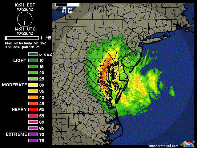
COntinues to drop pressure. Lot's of flooding going on as expected. Many in awe it is actually happening.


Thank you artist. Are they still expecting 13' surge or have they raised it.

I do know it is being stated water levels are much above Irene already and continue to rise.
I don't know if this helps you or not, but this is from the NHC page on tide levels -
Water Level and Meteorological plots available below are updated automatically. Water level predictions relative to Mean Lower Low Water are:

Duck, NC: Next predicted high tides are 4.0 ft (1.23 m) at 10/29/2012 07:41 EDT and 3.3 ft (1.01 m) at 10/29/2012 19:56 EDT.

Chesapeake Bay Bridge Tunnel, VA: Next predicted high tides are 3.2 ft (0.98 m) at 10/29/2012 08:37 EDT and 2.6 ft (0.81 m) at 10/29/2012 20:52 EDT.

Wachapreague, VA: Next predicted high tides are 5.0 ft (1.52 m) at 10/29/2012 08:43 EDT and 4.3 ft (1.32 m) at 10/29/2012 20:58 EDT.

Lewisetta, VA: Next predicted high tides are 1.6 ft (0.49 m) at 10/29/2012 14:02 EDT and 1.4 ft (0.43 m) at 10/30/2012 02:20 EDT.

Ocean City Inlet, MD: Next predicted high tides are 2.6 ft (0.78 m) at 10/29/2012 08:19 EDT and 2.1 ft (0.66 m) at 10/29/2012 20:25 EDT.

Lewes, DE: Next predicted high tides are 4.9 ft (1.48 m) at 10/29/2012 08:55 EDT and 4.1 ft (1.25 m) at 10/29/2012 21:15 EDT.

Cape May, NJ: Next predicted high tides are 5.7 ft (1.72 m) at 10/29/2012 08:49 EDT and 4.9 ft (1.51 m) at 10/29/2012 21:09 EDT.

Atlantic City, NJ: Next predicted high tides are 4.8 ft (1.47 m) at 10/29/2012 07:41 EDT and 4.1 ft (1.27 m) at 10/29/2012 20:00 EDT.

Sandy Hook, NJ: Next predicted high tides are 5.5 ft (1.69 m) at 10/29/2012 08:01 EDT and 4.9 ft (1.50 m) at 10/29/2012 20:22 EDT.

Kings Point, NY: Next predicted high tides are 8.3 ft (2.54 m) at 10/29/2012 12:00 EDT and 7.6 ft (2.34 m) at 10/30/2012 00:27 EDT.

Bridgeport, CT: Next predicted high tides are 7.6 ft (2.31 m) at 10/29/2012 11:29 EDT and 6.9 ft (2.12 m) at 10/29/2012 23:57 EDT.

USCG Station Hatteras, NC: Next predicted high tides are 0.9 ft (0.28 m) at 10/29/2012 08:59 EDT and 0.7 ft (0.22 m) at 10/29/2012 21:30 EDT.
0 likes   

tolakram
Admin
Admin
Posts: 20011
Age: 62
Joined: Sun Aug 27, 2006 8:23 pm
Location: Florence, KY (name is Mark)

Re: ATL: SANDY - Hurricane - Discussion

#2750 Postby tolakram » Mon Oct 29, 2012 10:53 am

Saved Radar Loop

Image
0 likes   
M a r k
- - - - -
Join us in chat: Storm2K Chatroom Invite. Android and IOS apps also available.

The posts in this forum are NOT official forecasts and should not be used as such. Posts are NOT endorsed by any professional institution or STORM2K.org. For official information and forecasts, please refer to NHC and NWS products.

Meow

#2751 Postby Meow » Mon Oct 29, 2012 10:54 am

It seems that Sandy is not extremely large.

Image
Left: Severe Tropical Storm Talas
Right: Hurricane Sandy
0 likes   

IntheEye
Tropical Low
Tropical Low
Posts: 12
Joined: Sun Oct 28, 2012 12:05 pm

Re: ATL: SANDY - Hurricane - Discussion

#2752 Postby IntheEye » Mon Oct 29, 2012 10:54 am

Frank2 wrote:Not sure if anyone posted this radar link - history in the making:

http://radar.weather.gov/radar.php?rid= ... 1&loop=yes


Following the movement of the eye it looks like Sandy will make landfall north of the NHC forecast point (which is closer to Cape May but Sandy may hit Atlantic City instead)
0 likes   

RVAHudson
Tropical Low
Tropical Low
Posts: 11
Joined: Thu Aug 30, 2012 11:25 am

Re: ATL: SANDY - Hurricane - Discussion

#2753 Postby RVAHudson » Mon Oct 29, 2012 10:55 am

0 likes   

chrisjslucia
S2K Supporter
S2K Supporter
Posts: 236
Joined: Thu Oct 09, 2008 8:27 pm
Location: St Lucia

#2754 Postby chrisjslucia » Mon Oct 29, 2012 10:56 am

This image is of every hurricane since 1850 superimposed on a globe of the world. Look at the info at the lower right hand side and it shows the increase in recording of storms - something that is helping improve forecasting, including the potential damage of Sandy. If you want to see the original image it is here:
http://image.guardian.co.uk/sys-images/ ... 85-009.jpg

Image
0 likes   

User avatar
Stephanie
S2K Supporter
S2K Supporter
Posts: 23843
Age: 63
Joined: Thu Feb 06, 2003 9:53 am
Location: Glassboro, NJ

Re: ATL: SANDY - Hurricane - Discussion

#2755 Postby Stephanie » Mon Oct 29, 2012 10:59 am

N2FSU wrote:Joe Bastardi tweet: "Based on the latest data, storm surge values for New York City have been increased to the 12-14ft range."


Thank you for that update.
0 likes   

KBBOCA
S2K Supporter
S2K Supporter
Posts: 1559
Joined: Fri Sep 05, 2003 5:27 am
Location: Formerly Boca Raton, often West Africa. Currently Charlotte NC

Re: ATL: SANDY - Hurricane - Discussion

#2756 Postby KBBOCA » Mon Oct 29, 2012 10:59 am

artist wrote:I don't know if this helps you or not, but this is from the NHC page on tide levels -
Water Level and Meteorological plots available below are updated automatically. Water level predictions relative to Mean Lower Low Water are:

Bridgeport, CT: Next predicted high tides are 7.6 ft (2.31 m) at 10/29/2012 11:29 EDT and 6.9 ft (2.12 m) at 10/29/2012 23:57 EDT.


I'm confused now. I saw a graphic at NOAA earlier today (and posted it here) showing an expected high of 13 feet in Bridgeport.

Do the values you posted take storm surge over and above expected high tide into account?
0 likes   

User avatar
x-y-no
Category 5
Category 5
Posts: 8359
Age: 65
Joined: Wed Aug 11, 2004 12:14 pm
Location: Fort Lauderdale, FL

#2757 Postby x-y-no » Mon Oct 29, 2012 11:00 am

Tide gauge at The Battery:

Image

Level going down due to ebbing tide, but surge currently at 4 1/2 feet.

Next high tide at ~9pm.

Hopefully this continues to be available - the server is obviously having a tough time due to load - database errors and script errors.
0 likes   

Frank2
Category 5
Category 5
Posts: 4061
Joined: Mon Jul 25, 2005 12:47 pm

Re: ATL: SANDY - Hurricane - Discussion

#2758 Postby Frank2 » Mon Oct 29, 2012 11:01 am

Not sure if anyone posted this radar link - history in the making:

http://radar.weather.gov/radar.php?rid= ... 1&loop=yes
0 likes   

User avatar
artist
Category 5
Category 5
Posts: 9792
Joined: Mon Jun 06, 2005 3:26 pm
Location: West Palm

Re: ATL: SANDY - Hurricane - Discussion

#2759 Postby artist » Mon Oct 29, 2012 11:05 am

KBBOCA wrote:
artist wrote:I don't know if this helps you or not, but this is from the NHC page on tide levels -
Water Level and Meteorological plots available below are updated automatically. Water level predictions relative to Mean Lower Low Water are:

Bridgeport, CT: Next predicted high tides are 7.6 ft (2.31 m) at 10/29/2012 11:29 EDT and 6.9 ft (2.12 m) at 10/29/2012 23:57 EDT.


I'm confused now. I saw a graphic at NOAA earlier today (and posted it here) showing an expected high of 13 feet in Bridgeport.

Do the values you posted take storm surge over and above expected high tide into account?

I would assume they don't, now that you mention it, since it states just the tide levels predicted.
0 likes   

superdeluxe
Tropical Low
Tropical Low
Posts: 36
Joined: Wed Aug 02, 2006 11:29 am

Re: ATL: SANDY - Hurricane - Discussion

#2760 Postby superdeluxe » Mon Oct 29, 2012 11:06 am

What is historic about this? Sorry I haven't kept up
0 likes   


Return to “2012”

Who is online

Users browsing this forum: No registered users and 6 guests