ATL: DEBBY - Post-Tropical
Moderator: S2k Moderators
-
Jevo

- S2K Supporter

- Posts: 1729
- Age: 47
- Joined: Tue Aug 03, 2004 8:45 pm
- Location: The Flemish Cap
- Contact:
Re: ATL: DEBBY - Tropical Storm - Discussion
The king has returned..... Gfs called this a week ago. Looks like the off season upgrade helped.
0 likes
Disclaimer: 50% of the time I have no clue of what I am talking about. Chances are I am taking a less than educated guess that sounds good because 10 years ago I stole Mike Watkins book 'The Hurricane and its Impact'. For official information please direct yourself to the NHC and their cadre of weather geniuses.
-
WeatherLovingDoc

- S2K Supporter
- Posts: 453
- Joined: Fri Sep 05, 2008 10:08 pm
- Location: Washington D.C.
Re: ATL: DEBBY - Tropical Storm - Discussion
Just a Mid-Atlantic doc weighing in to wish all under this storm's impact safety and community during this storm.
0 likes
-
ozonepete
- Professional-Met

- Posts: 4743
- Joined: Mon Sep 07, 2009 3:23 pm
- Location: From Ozone Park, NYC / Now in Brooklyn, NY
Re: ATL: DEBBY - Tropical Storm - Discussion
Jevo wrote:The king has returned..... Gfs called this a week ago. Looks like the off season upgrade helped.
Yeah, not only since last week, as you said, but dead on. Let's see what happens next, since for over a week it has also forecast Debby to move out northeastward of northern Florida and intensify again.
0 likes
-
northjaxpro

- S2K Supporter
- Posts: 8900
- Joined: Mon Sep 27, 2010 11:21 am
- Location: Jacksonville, FL
Re: ATL: DEBBY - Tropical Storm - Discussion
WeatherLovingDoc wrote:Just a Mid-Atlantic doc weighing in to wish all under this storm's impact safety and community during this storm.
Thanks for those kind words! We all need encoragement from what is going on arond here curerently for sure.
0 likes
NEVER, EVER SAY NEVER in the tropics and weather in general, and most importantly, with life itself!!
________________________________________________________________________________________
Fay 2008 Beryl 2012 Debby 2012 Colin 2016 Hermine 2016 Julia 2016 Matthew 2016 Irma 2017 Dorian 2019
________________________________________________________________________________________
Fay 2008 Beryl 2012 Debby 2012 Colin 2016 Hermine 2016 Julia 2016 Matthew 2016 Irma 2017 Dorian 2019
-
northjaxpro
- S2K Supporter
- Posts: 8900
- Joined: Mon Sep 27, 2010 11:21 am
- Location: Jacksonville, FL
Re: ATL: DEBBY - Tropical Storm - Discussion
ozonepete wrote:Jevo wrote:The king has returned..... Gfs called this a week ago. Looks like the off season upgrade helped.
Yeah, not only since last week, as you said, but dead on. Let's see what happens next, since for over a week it has also forecast Debby to move out northeastward of northern Florida and intensify again.
Yeah, what can I say about the GFS. This model deserves major kudos and praise for nailing Debby really actually 10 days out in time.The model never whatsoever wavered in developing this storm and moving it into NE GUlf and across North Florida and exiting off the coast near Jacksonville. This is exactly what has occured almost precisely as the model forecasted well in advance.
Maybe the upgrade the GFS model received back on May 22 helps explain this. It is always good to know that a major model like the GFS has been improved to help us all in the future to poinpoint better in predicting forecast paths. EURO usually is old reliable, but it got totally whipped just this once by the GFS.
0 likes
NEVER, EVER SAY NEVER in the tropics and weather in general, and most importantly, with life itself!!
________________________________________________________________________________________
Fay 2008 Beryl 2012 Debby 2012 Colin 2016 Hermine 2016 Julia 2016 Matthew 2016 Irma 2017 Dorian 2019
________________________________________________________________________________________
Fay 2008 Beryl 2012 Debby 2012 Colin 2016 Hermine 2016 Julia 2016 Matthew 2016 Irma 2017 Dorian 2019
For the professionals: strongest winds to the SE, how about heaviest rain? It is my understanding that heaviest rain is usually in the NE quadrant*, any thoughts/knowledge to share? Most, if not all, court hearings in my county cancelled today around 4:20, very unusual. Winds here were picking up, now dropped down to a breeze.
*If one can say this mass has quadrants that is.
*If one can say this mass has quadrants that is.
0 likes

Re: ATL: DEBBY - Tropical Storm - Discussion
I agree the gfs did a great job and hardly waivered......but I really think it could have gone either way. GFS originally had her pulled across Florida because it came up with phantom Ernesto off the Atlantic sea board. Had Debby not keep displacing her LLC to convection to the NE she would have probably gone west.
***Not a met. just my amateur opinion.
***Not a met. just my amateur opinion.
0 likes
The following post is NOT an official forecast and should not be used as such. It is just the opinion of the poster and may or may not be backed by sound meteorological data. It is NOT endorsed by storm2k.org.
-
northjaxpro
- S2K Supporter
- Posts: 8900
- Joined: Mon Sep 27, 2010 11:21 am
- Location: Jacksonville, FL
Convergence band sitting right over metro Jax. Torrential flooding rains occuring currently. Just heard on local news of people having to get rescued from cars that are getting stalled in flood waters here in town.
0 likes
NEVER, EVER SAY NEVER in the tropics and weather in general, and most importantly, with life itself!!
________________________________________________________________________________________
Fay 2008 Beryl 2012 Debby 2012 Colin 2016 Hermine 2016 Julia 2016 Matthew 2016 Irma 2017 Dorian 2019
________________________________________________________________________________________
Fay 2008 Beryl 2012 Debby 2012 Colin 2016 Hermine 2016 Julia 2016 Matthew 2016 Irma 2017 Dorian 2019


Re: ATL: DEBBY - Tropical Storm - Discussion
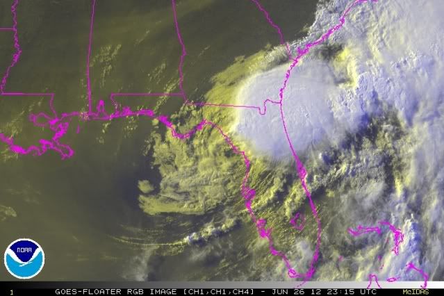
Too funny - Debby is actually sliding SE along the FL west coast. Wants to make a stop in Cedar Key.
http://www.ssd.noaa.gov/goes/east/wfo/tbw/flash-vis.html
http://www.ssd.noaa.gov/goes/east/wfo/tbw/flash-vis.html
0 likes
Re: ATL: DEBBY - Tropical Storm - Discussion
I posted "south" direction this morning - as steering currents weak. Only direction not mention in earlier NHC discussion. This is getting stranger -fast
0 likes
-
northjaxpro
- S2K Supporter
- Posts: 8900
- Joined: Mon Sep 27, 2010 11:21 am
- Location: Jacksonville, FL
Latest radar imagery of the convergence band dumping torrential rainfall estimates of 2 -3 inches per hour currently over Jax metro area.

0 likes
NEVER, EVER SAY NEVER in the tropics and weather in general, and most importantly, with life itself!!
________________________________________________________________________________________
Fay 2008 Beryl 2012 Debby 2012 Colin 2016 Hermine 2016 Julia 2016 Matthew 2016 Irma 2017 Dorian 2019
________________________________________________________________________________________
Fay 2008 Beryl 2012 Debby 2012 Colin 2016 Hermine 2016 Julia 2016 Matthew 2016 Irma 2017 Dorian 2019

Re: ATL: DEBBY - Tropical Storm - Discussion
Certainly seems to be sliding SSE along the coast.
0 likes
-
northjaxpro
- S2K Supporter
- Posts: 8900
- Joined: Mon Sep 27, 2010 11:21 am
- Location: Jacksonville, FL
psyclone, I ran out right quick to look at the rain gauge during a brief slackening of the rain and I have picked up jsut over 5 inches of rain in just over 2 hours at my location. Just an incredible amount of rain in just a brief period and it is now raining heavily again. Looking at radar , could pick up at least 2-4 inches more before this rain eases up sometime hopefully later tonight. Bad flooding occuring over metro Jax.
0 likes
NEVER, EVER SAY NEVER in the tropics and weather in general, and most importantly, with life itself!!
________________________________________________________________________________________
Fay 2008 Beryl 2012 Debby 2012 Colin 2016 Hermine 2016 Julia 2016 Matthew 2016 Irma 2017 Dorian 2019
________________________________________________________________________________________
Fay 2008 Beryl 2012 Debby 2012 Colin 2016 Hermine 2016 Julia 2016 Matthew 2016 Irma 2017 Dorian 2019
Re:
northjaxpro wrote:psyclone, I ran out right quick to look at the rain gauge during a brief slackening of the rain and I have picked up jsut over 5 inches of rain in just over 2 hours at my location. Just an incredible amount of rain in just a brief period and it is now raining heavily again. Looking at radar , could pick up at least 2-4 inches more before this rain eases up sometime hopefully later tonight. bad flooding occuring over metro Jax.
that is just astounding. tropical rainfall is remarkably efficient...the radar reflectivities frequently make the intensity appear less extreme than it is. Good luck to you and everyone in northeast florida...flash flooding is even more dangerous with darkness approaching so i hope folks stay home.
0 likes
-
AmeliaIslandr
- Tropical Low

- Posts: 28
- Joined: Sat Aug 28, 2004 3:04 pm
- Location: Amelia Island, FL
-
thetraveler
- Tropical Depression

- Posts: 65
- Joined: Fri Sep 10, 2004 2:54 pm
- Location: Deep East Texas
Re: ATL: DEBBY - Tropical Storm - Discussion
1979
Amelia did drop a ton of rain over the Texas Hill Country, but TS Claudette in 1979 holds the record for the most rain fall in 24 hours. She dropped 45 inches in Alvin.
http://www.nhc.noaa.gov/outreach/history/#claudette
Ptarmigan wrote:MGC wrote:What is the record for the most rain in a tropcial cyclone in the USA? Is it still Alvin Texas?....MGC
Actually, the record goes to Tropical Storm Amelia over Texas in 1978. A total of 48 inches of rain fell and likely more.
http://www.hpc.ncep.noaa.gov/tropical/r ... a1978.html
http://en.wikipedia.org/wiki/Tropical_S ... elia_(1978)
Amelia did drop a ton of rain over the Texas Hill Country, but TS Claudette in 1979 holds the record for the most rain fall in 24 hours. She dropped 45 inches in Alvin.
http://www.nhc.noaa.gov/outreach/history/#claudette
0 likes
-
cycloneye

- Admin

- Posts: 149275
- Age: 69
- Joined: Thu Oct 10, 2002 10:54 am
- Location: San Juan, Puerto Rico
Re: ATL: DEBBY - Advisories
8 PM EDT Advisory/Downgraded to Tropical Depression
WTNT34 KNHC 262357
TCPAT4
BULLETIN
TROPICAL DEPRESSION DEBBY INTERMEDIATE ADVISORY NUMBER 14A
NWS NATIONAL HURRICANE CENTER MIAMI FL AL042012
800 PM EDT TUE JUN 26 2012
...DEBBY WEAKENS TO A TROPICAL DEPRESSION...COASTAL AND INLAND
FLOODING THREATS REMAIN...
SUMMARY OF 800 PM EDT...0000 UTC...INFORMATION
----------------------------------------------
LOCATION...29.5N 83.1W
ABOUT 25 MI...40 KM N OF CEDAR KEY FLORIDA
MAXIMUM SUSTAINED WINDS...35 MPH...55 KM/H
PRESENT MOVEMENT...ENE OR 70 DEGREES AT 6 MPH...9 KM/H
MINIMUM CENTRAL PRESSURE...997 MB...29.44 INCHES
WATCHES AND WARNINGS
--------------------
CHANGES WITH THIS ADVISORY...
THE TROPICAL STORM WARNING FOR THE GULF COAST OF FLORIDA HAS BEEN
DISCONTINUED.
SUMMARY OF WATCHES AND WARNINGS IN EFFECT...
THERE ARE NO COASTAL WATCHES OR WARNINGS IN EFFECT.
FOR STORM INFORMATION SPECIFIC TO YOUR AREA...INCLUDING POSSIBLE
INLAND WATCHES AND WARNINGS...PLEASE MONITOR PRODUCTS ISSUED BY
YOUR LOCAL NATIONAL WEATHER SERVICE FORECAST OFFICE.
DISCUSSION AND 48-HOUR OUTLOOK
------------------------------
AT 800 PM EDT...0000 UTC...THE CENTER OF TROPICAL STORM DEBBY WAS
LOCATED NEAR LATITUDE 29.5 NORTH...LONGITUDE 83.1 WEST. DEBBY IS
MOVING TOWARD THE EAST-NORTHEAST NEAR 6 MPH...9 KM/H. AN EASTWARD
OR EAST-NORTHEASTWARD MOTION WITH SOME FURTHER INCREASE IN FORWARD
SPEED IS EXPECTED DURING THE NEXT COUPLE OF DAYS. ON THE FORECAST
TRACK...THE CENTER OF DEBBY SHOULD CROSS THE NORTHERN FLORIDA
PENINSULA DURING THE NEXT 24 HOURS.
MAXIMUM SUSTAINED WINDS HAVE DECREASED TO NEAR 35 MPH...55 KM/H...
WITH HIGHER GUSTS. LITTLE CHANGE IN STRENGTH IS EXPECTED WHILE THE
CENTER CROSSES THE FLORIDA PENINSULA.
THE ESTIMATED MINIMUM CENTRAL PRESSURE BASED ON SURFACE OBSERVATIONS
IS 997 MB...29.44 INCHES.
HAZARDS AFFECTING LAND
----------------------
WIND...GUSTS TO TROPICAL-STORM FORCE ARE POSSIBLE OVER PORTIONS OF
THE FLORIDA GULF COAST THROUGH THIS EVENING.
STORM SURGE...EVEN THOUGH DEBBY CONTINUES TO SLOWLY WEAKEN...COASTAL
FLOODING WILL CONTINUE DURING THE NEXT DAY OR TWO DUE TO PERSISTENT
ONSHORE WINDS. THE COMBINATION OF A STORM SURGE AND THE TIDE WILL
CAUSE AREAS NEAR THE COAST TO BE FLOODED BY RISING WATERS DURING THE
NEXT HIGH TIDE THIS EVENING...WITH LEVELS SIMILAR TO THOSE THAT
OCCURRED ON MONDAY. THE WATER COULD REACH THE FOLLOWING DEPTHS
ABOVE GROUND...
APALACHEE BAY AND THE NATURE COAST...2 TO 4 FT
SOUTH OF THE NATURE COAST INCLUDING TAMPA BAY...1 TO 3 FT
THE DEEPEST WATER WILL OCCUR ALONG THE IMMEDIATE COAST IN AREAS OF
ONSHORE FLOW. SURGE-RELATED FLOODING DEPENDS ON THE RELATIVE
TIMING OF THE SURGE AND THE TIDAL CYCLE...AND CAN VARY GREATLY OVER
SHORT DISTANCES. FOR INFORMATION SPECIFIC TO YOUR AREA...PLEASE
SEE PRODUCTS ISSUED BY YOUR LOCAL NATIONAL WEATHER SERVICE OFFICE.
RAINFALL...DEBBY IS EXPECTED TO PRODUCE ADDITIONAL RAIN
ACCUMULATIONS OF 4 TO 8 INCHES OVER NORTHERN FLORIDA AND EXTREME
SOUTHEASTERN GEORGIA THROUGH WEDNESDAY EVENING...WITH ISOLATED
RAINFALL TOTALS AS HIGH AS 10 INCHES. ISOLATED STORM TOTAL AMOUNTS
OF 25 INCHES ARE POSSIBLE IN NORTHERN FLORIDA.
TORNADOES...ISOLATED TORNADOES ARE POSSIBLE ACROSS THE FLORIDA
PENINSULA TONIGHT.
NEXT ADVISORY
-------------
NEXT COMPLETE ADVISORY...1100 PM EDT.
$$
FORECASTER BEVEN
0 likes
Visit the Caribbean-Central America Weather Thread where you can find at first post web cams,radars
and observations from Caribbean basin members Click Here
and observations from Caribbean basin members Click Here
Who is online
Users browsing this forum: Google Adsense [Bot] and 30 guests