Some convection bursting near the center.
http://www.ssd.noaa.gov/PS/TROP/floater ... -long.html
ATL: LESLIE - Post-Tropical - Discussion
Moderator: S2k Moderators
-
Hurricane Alexis

- Category 2

- Posts: 683
- Age: 29
- Joined: Thu Jun 14, 2012 7:59 pm
- Location: Miami,Florida
Re: ATL: LESLIE - Tropical Storm - Discussion
0 likes
Personal Forecast Disclaimer:
The posts in this forum are NOT official forecast and should not be used as such. They are just the opinion of the poster and may or may not be backed by sound meteorological data. They are NOT endorsed by any professional institution or storm2k.org. For official information, please refer to the NHC and NWS products.
The posts in this forum are NOT official forecast and should not be used as such. They are just the opinion of the poster and may or may not be backed by sound meteorological data. They are NOT endorsed by any professional institution or storm2k.org. For official information, please refer to the NHC and NWS products.

Re: ATL: LESLIE - Tropical Storm - Discussion
now that I look at this, looks like the WNW jog was just a wobble...need a few more frames...convection has caught up to the LLC as well but still displaced.....current steering
http://tropic.ssec.wisc.edu/real-time/d ... oom=&time=
still some ridging to the north maybe the reason it has slowed down a lot....
http://tropic.ssec.wisc.edu/real-time/d ... oom=&time=
still some ridging to the north maybe the reason it has slowed down a lot....
0 likes
-
Riptide

- Category 2
- Posts: 753
- Age: 34
- Joined: Fri Jul 23, 2010 3:33 pm
- Location: Cape May, New Jersey
- Contact:
Re: ATL: LESLIE - Tropical Storm - Discussion
ROCK wrote:now that I look at this, looks like the WNW jog was just a wobble...need a few more frames...convection has caught up to the LLC as well but still displaced.....current steering
http://tropic.ssec.wisc.edu/real-time/d ... oom=&time=
still some ridging to the north maybe the reason it has slowed down a lot....
Classic stairstepping motion, I still think it's too far west for current forecast projections to verify.
0 likes
Re: ATL: LESLIE - Tropical Storm - Discussion
Riptide wrote:ROCK wrote:now that I look at this, looks like the WNW jog was just a wobble...need a few more frames...convection has caught up to the LLC as well but still displaced.....current steering
http://tropic.ssec.wisc.edu/real-time/d ... oom=&time=
still some ridging to the north maybe the reason it has slowed down a lot....
Classic stairstepping motion, I still think it's too far west for current forecast projections to verify.
maybe so....models are playing catch up...
0 likes
Re: ATL: LESLIE - Tropical Storm - Discussion
This all seems vaguely similar, per the NHC article on Hurricane Andrew (with the exception of high surface pressures to the north):
"...Between the 17th and 20th of August, the tropical storm passed south of the center of the high pressure area over the eastern Atlantic. Steering currents carried Andrew closer to a strong upper-level low pressure system centered about 500 n mi to the east-southeast of Bermuda and to a trough that extended southward from the low for a few hundred miles. These currents gradually changed and Andrew decelerated on a course which became northwesterly. This change in heading spared the Lesser Antilles from an encounter with Andrew. The change in track also brought the tropical storm into an environment of strong southwesterly vertical wind shear and quite high surface pressures to its north. Although the estimated maximum wind speed of Andrew varied little then, a rather remarkable evolution occurred.
Satellite images suggest that Andrew produced deep convection only sporadically for several days, mainly in several bursts of about 12 hours duration. Also, the deep convection did not persist. Instead, it was stripped away from the low-level circulation by the strong southwesterly flow at upper levels. Air Force Reserve unit reconnaissance aircraft investigated Andrew and, on the 20th, found that the cyclone had degenerated to the extent that only a diffuse low-level circulation center remained. Andrew's central pressure rose considerably (Fig. 2 [87K GIF]). Nevertheless, the flight-level data indicated that Andrew retained a vigorous circulation aloft. Wind speeds near 70 kt were measured at an altitude of 1500 ft near a convective band lying to the northeast of the low-level center. Hence, Andrew is estimated on 20 August to have been a tropical storm with 40 kt surface winds and an astonishingly high central pressure of 1015 mb (Figs. 2 and 3 [87K GIF]).
Significant changes in the large-scale environment near and downstream from Andrew began by 21 August. Satellite imagery in the water vapor channel indicated that the low aloft to the east-southeast of Bermuda weakened and split. The bulk of the low opened into a trough which retreated northward. That evolution decreased the vertical wind shear over Andrew. The remainder of the low dropped southward to a position just southwest of Andrew where its circulation enhanced the upper-level outflow over the tropical storm. At the same time, a strong and deep high pressure cell formed near the U.S. southeast coast. A ridge built eastward from the high into the southwestern Atlantic with its axis lying just north of Andrew. The associated steering flow over the tropical storm became easterly. Andrew turned toward the west, accelerated to near 16 kt, and quickly intensified...."
0 likes
-
Riptide
- Category 2
- Posts: 753
- Age: 34
- Joined: Fri Jul 23, 2010 3:33 pm
- Location: Cape May, New Jersey
- Contact:
Re: ATL: LESLIE - Tropical Storm - Discussion
Hurricane Andrew also did not pass through the Hebert Box; yet still managed to strike South Florida directly.
0 likes
-
Hurricane Alexis
- Category 2
- Posts: 683
- Age: 29
- Joined: Thu Jun 14, 2012 7:59 pm
- Location: Miami,Florida
Re: ATL: LESLIE - Tropical Storm - Discussion
Frank2 wrote:This all seems vaguely similar, per the NHC article on Hurricane Andrew (with the exception of high surface pressures to the north):
"...Between the 17th and 20th of August, the tropical storm passed south of the center of the high pressure area over the eastern Atlantic. Steering currents carried Andrew closer to a strong upper-level low pressure system centered about 500 n mi to the east-southeast of Bermuda and to a trough that extended southward from the low for a few hundred miles. These currents gradually changed and Andrew decelerated on a course which became northwesterly. This change in heading spared the Lesser Antilles from an encounter with Andrew. The change in track also brought the tropical storm into an environment of strong southwesterly vertical wind shear and quite high surface pressures to its north. Although the estimated maximum wind speed of Andrew varied little then, a rather remarkable evolution occurred.
Satellite images suggest that Andrew produced deep convection only sporadically for several days, mainly in several bursts of about 12 hours duration. Also, the deep convection did not persist. Instead, it was stripped away from the low-level circulation by the strong southwesterly flow at upper levels. Air Force Reserve unit reconnaissance aircraft investigated Andrew and, on the 20th, found that the cyclone had degenerated to the extent that only a diffuse low-level circulation center remained. Andrew's central pressure rose considerably (Fig. 2 [87K GIF]). Nevertheless, the flight-level data indicated that Andrew retained a vigorous circulation aloft. Wind speeds near 70 kt were measured at an altitude of 1500 ft near a convective band lying to the northeast of the low-level center. Hence, Andrew is estimated on 20 August to have been a tropical storm with 40 kt surface winds and an astonishingly high central pressure of 1015 mb (Figs. 2 and 3 [87K GIF]).
Significant changes in the large-scale environment near and downstream from Andrew began by 21 August. Satellite imagery in the water vapor channel indicated that the low aloft to the east-southeast of Bermuda weakened and split. The bulk of the low opened into a trough which retreated northward. That evolution decreased the vertical wind shear over Andrew. The remainder of the low dropped southward to a position just southwest of Andrew where its circulation enhanced the upper-level outflow over the tropical storm. At the same time, a strong and deep high pressure cell formed near the U.S. southeast coast. A ridge built eastward from the high into the southwestern Atlantic with its axis lying just north of Andrew. The associated steering flow over the tropical storm became easterly. Andrew turned toward the west, accelerated to near 16 kt, and quickly intensified...."
Even if Leslie somehow pulls an Andrew it doesn't look like it will be anything near a cat 5.
0 likes
Personal Forecast Disclaimer:
The posts in this forum are NOT official forecast and should not be used as such. They are just the opinion of the poster and may or may not be backed by sound meteorological data. They are NOT endorsed by any professional institution or storm2k.org. For official information, please refer to the NHC and NWS products.
The posts in this forum are NOT official forecast and should not be used as such. They are just the opinion of the poster and may or may not be backed by sound meteorological data. They are NOT endorsed by any professional institution or storm2k.org. For official information, please refer to the NHC and NWS products.
-
Riptide
- Category 2
- Posts: 753
- Age: 34
- Joined: Fri Jul 23, 2010 3:33 pm
- Location: Cape May, New Jersey
- Contact:
Re: ATL: LESLIE - Tropical Storm - Discussion
Hurricane Alexis wrote:Frank2 wrote:This all seems vaguely similar, per the NHC article on Hurricane Andrew (with the exception of high surface pressures to the north):
"...Between the 17th and 20th of August, the tropical storm passed south of the center of the high pressure area over the eastern Atlantic. Steering currents carried Andrew closer to a strong upper-level low pressure system centered about 500 n mi to the east-southeast of Bermuda and to a trough that extended southward from the low for a few hundred miles. These currents gradually changed and Andrew decelerated on a course which became northwesterly. This change in heading spared the Lesser Antilles from an encounter with Andrew. The change in track also brought the tropical storm into an environment of strong southwesterly vertical wind shear and quite high surface pressures to its north. Although the estimated maximum wind speed of Andrew varied little then, a rather remarkable evolution occurred.
Satellite images suggest that Andrew produced deep convection only sporadically for several days, mainly in several bursts of about 12 hours duration. Also, the deep convection did not persist. Instead, it was stripped away from the low-level circulation by the strong southwesterly flow at upper levels. Air Force Reserve unit reconnaissance aircraft investigated Andrew and, on the 20th, found that the cyclone had degenerated to the extent that only a diffuse low-level circulation center remained. Andrew's central pressure rose considerably (Fig. 2 [87K GIF]). Nevertheless, the flight-level data indicated that Andrew retained a vigorous circulation aloft. Wind speeds near 70 kt were measured at an altitude of 1500 ft near a convective band lying to the northeast of the low-level center. Hence, Andrew is estimated on 20 August to have been a tropical storm with 40 kt surface winds and an astonishingly high central pressure of 1015 mb (Figs. 2 and 3 [87K GIF]).
Significant changes in the large-scale environment near and downstream from Andrew began by 21 August. Satellite imagery in the water vapor channel indicated that the low aloft to the east-southeast of Bermuda weakened and split. The bulk of the low opened into a trough which retreated northward. That evolution decreased the vertical wind shear over Andrew. The remainder of the low dropped southward to a position just southwest of Andrew where its circulation enhanced the upper-level outflow over the tropical storm. At the same time, a strong and deep high pressure cell formed near the U.S. southeast coast. A ridge built eastward from the high into the southwestern Atlantic with its axis lying just north of Andrew. The associated steering flow over the tropical storm became easterly. Andrew turned toward the west, accelerated to near 16 kt, and quickly intensified...."
Even if Leslie somehow pulls an Andrew it doesn't look like it will be anything near a cat 5.
0 likes
-
cheezyWXguy

- Category 5

- Posts: 6281
- Joined: Mon Feb 13, 2006 12:29 am
- Location: Dallas, TX
Re: ATL: LESLIE - Tropical Storm - Discussion
Hurricane Alexis wrote:Frank2 wrote:This all seems vaguely similar, per the NHC article on Hurricane Andrew (with the exception of high surface pressures to the north):
"...Between the 17th and 20th of August, the tropical storm passed south of the center of the high pressure area over the eastern Atlantic. Steering currents carried Andrew closer to a strong upper-level low pressure system centered about 500 n mi to the east-southeast of Bermuda and to a trough that extended southward from the low for a few hundred miles. These currents gradually changed and Andrew decelerated on a course which became northwesterly. This change in heading spared the Lesser Antilles from an encounter with Andrew. The change in track also brought the tropical storm into an environment of strong southwesterly vertical wind shear and quite high surface pressures to its north. Although the estimated maximum wind speed of Andrew varied little then, a rather remarkable evolution occurred.
Satellite images suggest that Andrew produced deep convection only sporadically for several days, mainly in several bursts of about 12 hours duration. Also, the deep convection did not persist. Instead, it was stripped away from the low-level circulation by the strong southwesterly flow at upper levels. Air Force Reserve unit reconnaissance aircraft investigated Andrew and, on the 20th, found that the cyclone had degenerated to the extent that only a diffuse low-level circulation center remained. Andrew's central pressure rose considerably (Fig. 2 [87K GIF]). Nevertheless, the flight-level data indicated that Andrew retained a vigorous circulation aloft. Wind speeds near 70 kt were measured at an altitude of 1500 ft near a convective band lying to the northeast of the low-level center. Hence, Andrew is estimated on 20 August to have been a tropical storm with 40 kt surface winds and an astonishingly high central pressure of 1015 mb (Figs. 2 and 3 [87K GIF]).
Significant changes in the large-scale environment near and downstream from Andrew began by 21 August. Satellite imagery in the water vapor channel indicated that the low aloft to the east-southeast of Bermuda weakened and split. The bulk of the low opened into a trough which retreated northward. That evolution decreased the vertical wind shear over Andrew. The remainder of the low dropped southward to a position just southwest of Andrew where its circulation enhanced the upper-level outflow over the tropical storm. At the same time, a strong and deep high pressure cell formed near the U.S. southeast coast. A ridge built eastward from the high into the southwestern Atlantic with its axis lying just north of Andrew. The associated steering flow over the tropical storm became easterly. Andrew turned toward the west, accelerated to near 16 kt, and quickly intensified...."
Even if Leslie somehow pulls an Andrew it doesn't look like it will be anything near a cat 5.
heh, neither did Andrew...
on the other hand though, I wouldn't bet on lightning striking the same spot twice.
0 likes
-
Riptide
- Category 2
- Posts: 753
- Age: 34
- Joined: Fri Jul 23, 2010 3:33 pm
- Location: Cape May, New Jersey
- Contact:
Re:
HurricaneAndrew92 wrote:I live in Southern New England, is there any chance it hits me?
Yes, the probability is somewhere around 2%. The uncertain factor that might raise the chances to a greater degree is that there are no viable analogs for Leslie's forecast projections. All systems that formed in the area either recurved sharply out to sea or moved along the western edge of the Bermuda high.

0 likes
I live in Southern New England, is there any chance it hits me?
Not sure - my Aunt lives in coastal Maine, and I'm sure they'll be keeping and eye out...
Per my Andrew post, of course each system is unique but it seems we better not turn our back on Leslie - per TWC this morning it might become a large wave maker during the week, with a 300-mile radius of 39-73 knot winds...
Frank
0 likes
-
brunota2003

- S2K Supporter

- Posts: 9476
- Age: 35
- Joined: Sat Jul 30, 2005 9:56 pm
- Location: Stanton, KY...formerly Havelock, NC
- Contact:
Certainly an interesting evolution on visible imagery this morning. Looked like the convection grabbed the LLCs reins and jerked on them really hard. I swear I saw the LLC heading SW briefly (maybe a small loop), and the convection jumped up towards the center.
0 likes
Just a small town southern boy helping other humans.
Re: ATL: LESLIE - Tropical Storm - Discussion
Dr. Jeff Masters' take on Leslie today - if nothing else, Leslie will build ACE since we could still be talking about her...only stronger...by next weekend near Bermuda as long as she can hang on until shear drops big time mid-week.
Tropical Storm Leslie is struggling today under a high 20 knots of wind shear, due to strong upper-level winds out of the northwest. The high shear is keeping heavy thunderstorms confined to the southeast quadrant of the storm, as seen on satellite loops. According to the latest SHIPS model forecast, the shear is expected to stay high through Wednesday, then drop to the low category, 5 - 10 knots, on Thursday and Friday.
At that time, Leslie will be over warm ocean waters of 29°C, and may intensify to a hurricane by Friday, as predicted by most of the intensity forecast models. Steering currents for Leslie are expected to collapse by mid-week, as Leslie gets stuck between two upper level lows. The storm will slowly meander over the open ocean for many days, and the latest guidance from the GFS and ECMWF models shows Leslie making a very close pass by Bermuda on Saturday, and that island can expect a 3-day period of rough weather Friday through Sunday. Leslie will stay stuck in a weak steering current environment until a strong trough of low pressure approaches the U.S. East Coast on Saturday. This trough should be strong enough to pull Leslie to the north by Sunday, September 9.
At that time, Leslie may be close enough to the coast that the storm will make landfall in Canada or New England by Monday, September 10. However, making forecasts of what a tropical cyclone might do a week in advance is a sketchy proposition. Leslie could miss land entirely; this all depends upon the timing and strength of the September 8 trough of low pressure. If Leslie survives its encounter with high wind shear early this week and becomes a hurricane late in the week, the storm will bring an extended period of high waves to the U.S. coast late this week. These waves will be capable of creating dangerous rip currents and beach erosion.
0 likes
-
HurricaneAndrew92
Re: ATL: LESLIE - Tropical Storm - Discussion
At that time, Leslie may be close enough to the coast that the storm will make landfall in Canada or New England by Monday, September 10. However, making forecasts of what a tropical cyclone might do a week in advance is a sketchy proposition. Leslie could miss land entirely; this all depends upon the timing and strength of the September 8 trough of low pressure. If Leslie survives its encounter with high wind shear early this week and becomes a hurricane late in the week, the storm will bring an extended period of high waves to the U.S. coast late this week. These waves will be capable of creating dangerous rip currents and beach erosion.
Will watch that just in case. Here is the worst case scenario in the red(in general and for me), and the green is the likely path.

Will watch that just in case. Here is the worst case scenario in the red(in general and for me), and the green is the likely path.

0 likes
Re: ATL: LESLIE - Tropical Storm - Discussion
Frank2 wrote:This all seems vaguely similar, per the NHC article on Hurricane Andrew (with the exception of high surface pressures to the north):
"...At the same time, a strong and deep high pressure cell formed near the U.S. southeast coast. A ridge built eastward from the high into the southwestern Atlantic with its axis lying just north of Andrew. The associated steering flow over the tropical storm became easterly. Andrew turned toward the west, accelerated to near 16 kt, and quickly intensified...."
Regardless of what Andrew did and barring some kind of miracle, Leslie isn't coming to FL. There is no deep troughing predicted for the W U.S. to occur soon enough (which did occur right before Andrew hit FL) to allow for a big ridge near the east coast (also not predicted) to impart enough westerly steering to bring it westward enough to get into FL, GA, or lower SC for that matter. On the contrary, I'd say the SE US is protected more than average for early Sep. based on my many years of following the tropics. I actually feel quite relaxed right now. We'll just have to wait for the next legit. threat.
0 likes
Personal Forecast Disclaimer:
The posts in this forum are NOT official forecasts and should not be used as such. They are just the opinion of the poster and may or may not be backed by sound meteorological data. They are NOT endorsed by any professional institution or storm2k.org. For official information, please refer to the NHC and NWS products.
The posts in this forum are NOT official forecasts and should not be used as such. They are just the opinion of the poster and may or may not be backed by sound meteorological data. They are NOT endorsed by any professional institution or storm2k.org. For official information, please refer to the NHC and NWS products.
Re: ATL: LESLIE - Tropical Storm - Discussion
Be really interesting if it is off N. Car coast near end of week?
May show that the Weather Gods have no political affiliation? (off Topic - but LOL -back to weather)
May show that the Weather Gods have no political affiliation? (off Topic - but LOL -back to weather)
0 likes
-
hurricanes1234
- Category 5
- Posts: 2908
- Joined: Sat Jul 28, 2012 6:19 pm
- Location: Trinidad and Tobago
Re: ATL: LESLIE - Tropical Storm - Discussion
Seems to be reattaching a bit - deep convection has wrapped partially around the center.
0 likes
PLEASE NOTE: With the exception of information from weather agencies that I may copy and paste here, my posts will NEVER be official, since I am NOT a meteorologist. They are solely my amateur opinion, and may or may not be accurate. Therefore, please DO NOT use them as official details, particularly when making important decisions. Thank you.
Re: ATL: LESLIE - Tropical Storm - Discussion
Current 5-day track reminds me of the advisory map we saw for Jeanne when it was initially thought she was going to go north and then out to sea (Jeanne was 600 miles west of Leslie....so i don't think there is any scenario that a Jeanne track to Florida is likely for Leslie)...but Bermuda and maybe Canada may need to keep an eye out
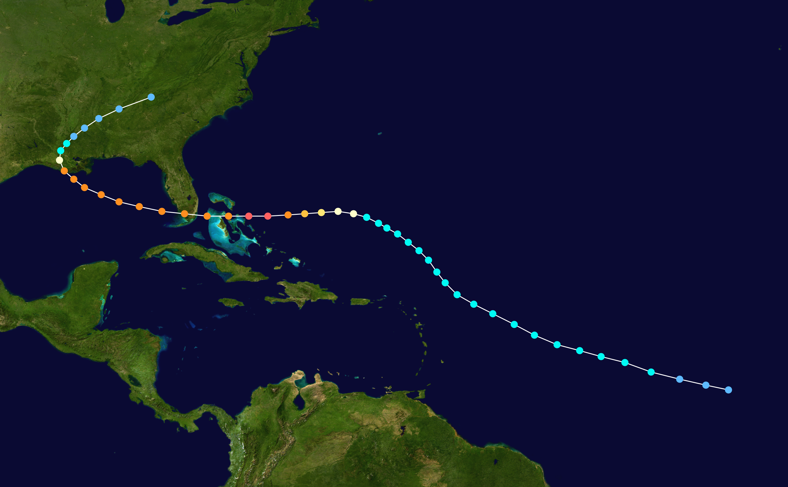
Leslie in 2012:

Jeanne in 2004:

Leslie in 2012:
Jeanne in 2004:
0 likes
Who is online
Users browsing this forum: No registered users and 89 guests