ATL: INVEST 92L - Discussion
Moderator: S2k Moderators
-
floridasun78
- Category 5

- Posts: 3755
- Joined: Sun May 17, 2009 10:16 pm
- Location: miami fl
-
USTropics
- Professional-Met

- Posts: 2738
- Joined: Sun Aug 12, 2007 3:45 am
- Location: Florida State University
Re: ATL: INVEST 92L - Discussion
Hurricaneman wrote:USTropics wrote:It appears to me to have multiple vorticies rotating around the center. The last few visible images show one taking form just north of Eleuthera Island. CIMSS vorticity overlay also indicating this is the strongest area for vorticity. I placed a red arrow indicating what I'm referring to:
http://i.imgur.com/4Ls9TTH.jpg
thats an eddy moving around the main low I believe
It will die off quickly, it's more of an indication that the low level circulation is not quite there yet.
Also, as far as I know, there is actually no essential difference between eddies and vortices. Vortex is used when you look at the individual case and eddy is used primarily in plural.
Last edited by USTropics on Wed Sep 10, 2014 4:44 pm, edited 1 time in total.
0 likes

-
gatorcane

- S2K Supporter

- Posts: 23708
- Age: 48
- Joined: Sun Mar 13, 2005 3:54 pm
- Location: Boca Raton, FL
Re:
floridasun78 wrote:wfor weatherman say wont chace become td because got short time before coming over fl longer take get better less time become td or ts
I certainly would not be making such statements. If we see a dramatic increase in convection soon or later tonight, could get going looking at the conditions it has to work with. The key will be will we see this convection take off or not?
0 likes

Re: Re:
gatorcane wrote:floridasun78 wrote:wfor weatherman say wont chace become td because got short time before coming over fl longer take get better less time become td or ts
I certainly would not be making such statements. If we see a dramatic increase in convection soon or later tonight, could get going looking at the conditions it has to work with. The key will be will we see this convection take off or not?
Yea no doubt the convection is key. It is still very weak IMO. Need the nice burst to tighten the broad low up. What it has going for it is the environment and a better low level structure than last night so we will see what happens.
0 likes
The following post is NOT an official forecast and should not be used as such. It is just the opinion of the poster and may or may not be backed by sound meteorological data. It is NOT endorsed by any professional institution including storm2k.org For Official Information please refer to the NHC and NWS products.
-
tropicwatch

- Category 5
- Posts: 3426
- Age: 62
- Joined: Sat Jun 02, 2007 10:01 am
- Location: The Villages, Florida
- Contact:
Several weather stations on Great Abaco are reporting westerly winds now, as earlier they were from the north. This is a good indication that there is a surface circulation present.
0 likes
Tropicwatch
Agnes 72', Eloise 75, Elena 85', Kate 85', Charley 86', Florence 88', Beryl 94', Dean 95', Erin 95', Opal 95', Earl 98', Georges 98', Ivan 2004', Arlene 2005', Dennis 2005', Ida 2009' Debby 2012' Irma 2017' Michael 2018'
Agnes 72', Eloise 75, Elena 85', Kate 85', Charley 86', Florence 88', Beryl 94', Dean 95', Erin 95', Opal 95', Earl 98', Georges 98', Ivan 2004', Arlene 2005', Dennis 2005', Ida 2009' Debby 2012' Irma 2017' Michael 2018'
-
weatherfanatic
- Tropical Depression

- Posts: 58
- Age: 44
- Joined: Sun Jun 29, 2014 7:52 am
- Location: Yonkers, NY
I agree, I think this storm has a good shot. The spin is going under the convection nicely, bigger blowup than expected today, lets see how it does with the nighttime if it keeps up the convection and forms LLC we may have a weak TS before gets to FL. BUT as I said in models section, IMO the GOM is going to be key in how strong it gets on that turnback and then if CMC is at all right the east coast all the way up needs to pay attention next week.
0 likes
This post is NOT AN OFFICIAL FORECAST and should not be used as such. It is just the opinion of the poster and may or may not be backed by sound meteorological data. It is NOT endorsed by any professional institution including storm2k.org. For Official Information please refer to the NHC and NWS products.


Re:
USTropics wrote:It appears to me to have multiple vorticies rotating around the center. The last few visible images show one taking form just north of Eleuthera Island. CIMSS vorticity overlay also indicating this is the strongest area for vorticity. I placed a red arrow indicating what I'm referring to:
http://i.imgur.com/4Ls9TTH.jpg
In my experience those overlays are not always centered, I see nothing in that area.
0 likes
The following post is NOT an official forecast and should not be used as such. It is just the opinion of the poster and may or may not be backed by sound meteorological data. It is NOT endorsed by any professional institution including storm2k.org For Official Information please refer to the NHC and NWS products.
-
Hurricaneman

- Category 5
- Posts: 7404
- Age: 45
- Joined: Tue Aug 31, 2004 3:24 pm
- Location: central florida
Re:
Senobia wrote:That backloop looks crazy. What's in the steering pattern that would make it do that?
IMO it would probably be a strong trough that would do such a thing
The posts in this forum are NOT official forecast and should not be used as such. They are just the opinion of the poster and may or may not be backed by sound meteorological data. They are NOT endorsed by any professional institution or storm2k.org. For official information, please refer to the NHC and NWS products
0 likes
-
wxman57

- Moderator-Pro Met

- Posts: 23175
- Age: 68
- Joined: Sat Jun 21, 2003 8:06 pm
- Location: Houston, TX (southwest)
Re: Re:
tailgater wrote:USTropics wrote:It appears to me to have multiple vorticies rotating around the center. The last few visible images show one taking form just north of Eleuthera Island. CIMSS vorticity overlay also indicating this is the strongest area for vorticity. I placed a red arrow indicating what I'm referring to:
http://i.imgur.com/4Ls9TTH.jpg
In my experience those overlays are not always centered, I see nothing in that area.
Careful. Plots of vorticity won't be centered over convection. The convection will be found in the area of positive vorticity advection.
0 likes
Re: Re:
Hurricaneman wrote:Senobia wrote:That backloop looks crazy. What's in the steering pattern that would make it do that?
IMO it would probably be a strong trough that would do such a thing
The posts in this forum are NOT official forecast and should not be used as such. They are just the opinion of the poster and may or may not be backed by sound meteorological data. They are NOT endorsed by any professional institution or storm2k.org. For official information, please refer to the NHC and NWS products
Like the cold front that's going to push off the Texas coast this weekend?
0 likes
-
SFLcane

- S2K Supporter
- Posts: 10281
- Age: 48
- Joined: Sat Jun 05, 2010 1:44 pm
- Location: Lake Worth Florida
Re: ATL: INVEST 92L - Discussion
Recon ready to go...
000
NOUS42 KNHC 102130
REPRPD
WEATHER RECONNAISSANCE FLIGHTS
CARCAH, NATIONAL HURRICANE CENTER, MIAMI, FL.
0530 PM EDT WED 10 SEPTEMBER 2014
SUBJECT: TROPICAL CYCLONE PLAN OF THE DAY (TCPOD)
VALID 11/1100Z TO 12/1100Z SEPTEMBER 2014
TCPOD NUMBER.....14-102 AMENDMENT
I. ATLANTIC REQUIREMENTS...ADDED
1. SUSPECT AREA (NEAR BAHAMAS)
FLIGHT ONE -- TEAL 71
A. 11/1730Z
B. AFXXX 01HHA INVEST
C. 11/1445Z
D. 27.0N 77.5W
E. 11/1700Z TO 11/2200Z
F. SFC TO 10,000FT
FLIGHT TWO - TEAL 72
A. 12/0530Z, 1130Z
B. AFXXX 0206A CYCLONE
C. 12/0215Z
D. 27.0N 78.5W
E. 12/0500Z TO 12/1130Z
F. SFC TO 10,000FT
0 likes
-
Evil Jeremy

- S2K Supporter
- Posts: 5463
- Age: 32
- Joined: Mon Apr 10, 2006 2:10 pm
- Location: Los Angeles, CA
Re: ATL: INVEST 92L - Discussion
0 likes
Frances 04 / Jeanne 04 / Katrina 05 / Wilma 05 / Fay 08 / Debby 12 / Andrea 13 / Colin 16 / Hermine 16 / Matthew 16 / Irma 17
-
USTropics
- Professional-Met
- Posts: 2738
- Joined: Sun Aug 12, 2007 3:45 am
- Location: Florida State University
Re: Re:
wxman57 wrote:tailgater wrote:USTropics wrote:It appears to me to have multiple vorticies rotating around the center. The last few visible images show one taking form just north of Eleuthera Island. CIMSS vorticity overlay also indicating this is the strongest area for vorticity. I placed a red arrow indicating what I'm referring to:
http://i.imgur.com/4Ls9TTH.jpg
In my experience those overlays are not always centered, I see nothing in that area.
Careful. Plots of vorticity won't be centered over convection. The convection will be found in the area of positive vorticity advection.
I completely understand, I was not trying to say that a center is forming in this area, rather that multiple vortices are rotating around a broad center, and that one spun up and would likely quickly die in this area. Coupled with that outflow boundary heading west and it's not a sign of a quickly organizing system.
Last edited by USTropics on Wed Sep 10, 2014 5:10 pm, edited 1 time in total.
0 likes
-
wxman57
- Moderator-Pro Met
- Posts: 23175
- Age: 68
- Joined: Sat Jun 21, 2003 8:06 pm
- Location: Houston, TX (southwest)
Re: ATL: INVEST 92L - Discussion
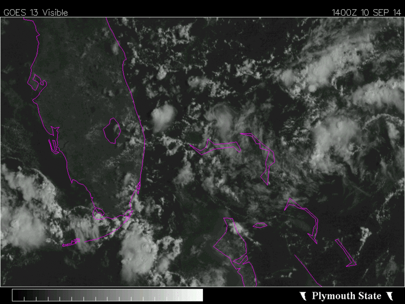
Was working on a study since 7am today, so just looked at this disturbance around 3:45pm. In my opinion, there is evidence that a low-level circulation center has developed. It's not strong, but I think it's present. Convection remains weak and disorganized, located generally NW of the weak LLC. I see a large outflow boundary moving outward in the western half of the disturbance, a sign of collapsing squalls.
Both the EC and GFS carry the vorticity south of west across Florida and the Gulf, reaching NE Mexico to south Texas next Monday afternoon (GFS) or Tuesday (EC). Neither indicates any significant development (just a wave after passing Florida). A 20-30% chance of development looks good for now, but I am concerned that it already does appear to have a LLC. It should move over Florida on Friday morning, so we'll see if that LLC can persist. Conditions in the Gulf don't look TOO hostile toward development, but there's the issue with the cold front reaching the NW Gulf on Saturday.
Both the GFS and Euro indicate that the front will stall along the TX coast on Saturday. Will it? If it doesn't stall, then the disturbance may not continue its westward trek. What about dry air moving out over the Gulf being ingested by the disturbance by late Sunday? That could certainly be an inhibiting factor.
Something to keep a close eye on for the next 4-5 days. It doesn't look like a hurricane threat - for now.
0 likes
Re: ATL: INVEST 92L - Discussion
0 likes
The following post is NOT an official forecast and should not be used as such. It is just the opinion of the poster and may or may not be backed by sound meteorological data. It is NOT endorsed by any professional institution including storm2k.org For Official Information please refer to the NHC and NWS products.
-
SFLcane
- S2K Supporter
- Posts: 10281
- Age: 48
- Joined: Sat Jun 05, 2010 1:44 pm
- Location: Lake Worth Florida
Re: ATL: INVEST 92L - Discussion
2. OUTLOOK FOR SUCCEEDING DAY.....CONTINUE 6-HRLY
FIXES IF SYSTEM DEVELOPS AND REMAINS OFFSHORE.
3. REMARKS: NASA 872 RESEARCH FLIGHT AT 12/2200Z
FIXES IF SYSTEM DEVELOPS AND REMAINS OFFSHORE.
3. REMARKS: NASA 872 RESEARCH FLIGHT AT 12/2200Z
0 likes
Who is online
Users browsing this forum: No registered users and 47 guests