
Frank2 wrote:In this loop 96L is seen moving rapidly and appears more like a wave (IMO):
http://www.ssd.noaa.gov/PS/TROP/floater ... imated.gif
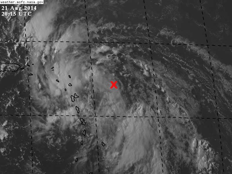
It is moving very fast:
AN ELONGATED 1009 MB ATLANTIC OCEAN LOW PRESSURE CENTER IS
LOCATED 310 NM SE OF GUADELOUPE NEAR 15N56W MOVING NW AT 20-25
KT. A TROPICAL WAVE PRESENTLY EXTENDS N FROM THE LOW CENTER.
CLUSTERS OF SCATTERED MODERATE TO ISOLATED STRONG CONVECTION IS
FROM 15N-20N BETWEEN 57W-63W. WIDELY SCATTERED MODERATE
CONVECTION IS FROM 8N-15N BETWEEN 54W-60W. GRADUAL DEVELOPMENT
OF THIS FEATURE IS POSSIBLE DURING THE NEXT FEW DAYS ACROSS THE
LEEWARD ISLANDS...PUERTO RICO...AND THE BAHAMAS. INTERESTS
DOWNSTREAM OF THE LOW SHOULD MONITOR CLOSELY THE PROGRESS OF
THIS SYSTEM. THE CHANCE FOR DEVELOPMENT INTO A TROPICAL CYCLONE
DURING THE NEXT 48 HOURS IS MEDIUM.


