WPAC: HAIYAN - Post-Tropical
Moderator: S2k Moderators
-
ManilaTC

- WesternPacificWeather.com

- Posts: 593
- Age: 47
- Joined: Mon Oct 26, 2009 5:13 am
- Location: Mandaluyong City, Philippines
- Contact:
Re: WPAC: HAIYAN - Typhoon
Looks like it has resumed WNW/280 deg movement...
0 likes
The above post is NOT official and should not be used as such. It is my opinion and may or may not be backed by sound meteorological data. It is not endorsed by any professional institution or storm2k.org. Please refer to your official national weather agency.
WEB http://goo.gl/JDiKXB | FB https://goo.gl/N5sIle | @ManilaTC
WEB http://goo.gl/JDiKXB | FB https://goo.gl/N5sIle | @ManilaTC

Re: WPAC: HAIYAN - Typhoon
What a beast!
0 likes
Georges '98, Irene '99, Frances '04, Jeanne '04, Katrina '05, Wilma '05, Gustav '08, Isaac '12, Matthew '16, Florence '18, Michael '18, Ian '22
-
Extratropical94

- Professional-Met

- Posts: 3545
- Age: 31
- Joined: Wed Oct 20, 2010 6:36 am
- Location: Hamburg, Germany
- Contact:
Best track up to 135 knots, very close to category 5 now!
31W HAIYAN 131106 0600 7.6N 138.0E WPAC 135 922
31W HAIYAN 131106 0600 7.6N 138.0E WPAC 135 922
0 likes
54° 11' 59'' N, 9° 9' 20'' E
Boomer Sooner!
Go Broncos! Go Cards!
Clinching counties, one at a time: https://mob-rule.com/user-gifs/USA/xtrp94.gif
- Daniel
Boomer Sooner!
Go Broncos! Go Cards!
Clinching counties, one at a time: https://mob-rule.com/user-gifs/USA/xtrp94.gif
- Daniel
-
Meow
90kt per JMA, expecting a violent typhoon overland.

TY 1330 (HAIYAN)
Issued at 06:50 UTC, 6 November 2013
<Analyses at 06/06 UTC>
Scale -
Intensity Very Strong
Center position N7°35'(7.6°)
E138°00'(138.0°)
Direction and speed of movement W 30km/h(16kt)
Central pressure 940hPa
Maximum wind speed near the center 45m/s(90kt)
Maximum wind gust speed 65m/s(130kt)
Area of 50kt winds or more ALL110km(60NM)
Area of 30kt winds or more ALL280km(150NM)
<Forecast for 06/18 UTC>
Intensity Very Strong
Center position of probability circle N8°35'(8.6°)
E134°55'(134.9°)
Direction and speed of movement WNW 30km/h(16kt)
Central pressure 930hPa
Maximum wind speed near the center 50m/s(95kt)
Maximum wind gust speed 70m/s(135kt)
Radius of probability circle 90km(50NM)
Storm warning area ALL280km(150NM)
<Forecast for 07/06 UTC>
Intensity Very Strong
Center position of probability circle N9°40'(9.7°)
E131°30'(131.5°)
Direction and speed of movement WNW 35km/h(18kt)
Central pressure 925hPa
Maximum wind speed near the center 50m/s(100kt)
Maximum wind gust speed 70m/s(140kt)
Radius of probability circle 140km(75NM)
Storm warning area ALL330km(180NM)
<Forecast for 08/06 UTC>
Intensity Violent
Center position of probability circle N11°40'(11.7°)
E124°25'(124.4°)
Direction and speed of movement WNW 35km/h(18kt)
Central pressure 920hPa
Maximum wind speed near the center 55m/s(105kt)
Maximum wind gust speed 75m/s(150kt)
Radius of probability circle 260km(140NM)
Storm warning area ALL460km(250NM)
<Forecast for 09/06 UTC>
Intensity Very Strong
Center position of probability circle N13°20'(13.3°)
E116°20'(116.3°)
Direction and speed of movement W 35km/h(20kt)
Central pressure 930hPa
Maximum wind speed near the center 50m/s(95kt)
Maximum wind gust speed 70m/s(135kt)
Radius of probability circle 390km(210NM)
Storm warning area ALL560km(300NM)
0 likes

Thats old news JMA has been about 12 hours behind all the other agencies.
Personal Forecast Disclaimer:
The posts in this forum are NOT official forecast and should not be used as such. They are just the opinion of the poster and may or may not be backed by sound meteorological data. They are NOT endorsed by any professional institution or storm2k.org. For official information, please refer to the NHC and NWS products.
0 likes

-
xtyphooncyclonex

- Category 5

- Posts: 3898
- Age: 24
- Joined: Sat Dec 08, 2012 9:07 am
- Location: Cebu City
- Contact:
Re: WPAC: HAIYAN - Typhoon
GFS has this making landfall over Southern Leyte. 

0 likes
REMINDER: My opinions that I, or any other NON Pro-Met in this forum, are unofficial. Please do not take my opinions as an official forecast and warning. I am NOT a meteorologist. Following my forecasts blindly may lead to false alarm, danger and risk if official forecasts from agencies are ignored.
-
xtyphooncyclonex
- Category 5
- Posts: 3898
- Age: 24
- Joined: Sat Dec 08, 2012 9:07 am
- Location: Cebu City
- Contact:
Bopha Part II?
0 likes
REMINDER: My opinions that I, or any other NON Pro-Met in this forum, are unofficial. Please do not take my opinions as an official forecast and warning. I am NOT a meteorologist. Following my forecasts blindly may lead to false alarm, danger and risk if official forecasts from agencies are ignored.
-
dexterlabio
- Category 5
- Posts: 3517
- Joined: Sat Oct 24, 2009 11:50 pm
Re: WPAC: HAIYAN - Typhoon
Bopha was too far south. I'm thinking a lot stronger version of 2006 Typhoon Utor. The bulk of the models are now pointing towards a hit near Boracay Islands. I wonder if James is considering a trip going to Boracay or go straight to Guian Samar.
0 likes
Personal Forecast Disclaimer:
The posts in this forum are NOT official forecast and should not be used as such. They are just the opinion of the poster and may or may not be backed by sound meteorological data. They are NOT endorsed by any professional institution or storm2k.org. For official information, please refer to the NHC and NWS products.
The posts in this forum are NOT official forecast and should not be used as such. They are just the opinion of the poster and may or may not be backed by sound meteorological data. They are NOT endorsed by any professional institution or storm2k.org. For official information, please refer to the NHC and NWS products.
-
dexterlabio
- Category 5
- Posts: 3517
- Joined: Sat Oct 24, 2009 11:50 pm
I'm seeing a dry spot surrounding the pinhole eye. I have a feeling if that clears out and a larger round eye appears, DT numbers will skyrocket.
0 likes
Personal Forecast Disclaimer:
The posts in this forum are NOT official forecast and should not be used as such. They are just the opinion of the poster and may or may not be backed by sound meteorological data. They are NOT endorsed by any professional institution or storm2k.org. For official information, please refer to the NHC and NWS products.
The posts in this forum are NOT official forecast and should not be used as such. They are just the opinion of the poster and may or may not be backed by sound meteorological data. They are NOT endorsed by any professional institution or storm2k.org. For official information, please refer to the NHC and NWS products.
Re:
dexterlabio wrote:I'm seeing a dry spot surrounding the pinhole eye. I have a feeling if that clears out and a larger round eye appears, DT numbers will skyrocket.
Spot on .
Personal Forecast Disclaimer:
The posts in this forum are NOT official forecast and should not be used as such. They are just the opinion of the poster and may or may not be backed by sound meteorological data. They are NOT endorsed by any professional institution or storm2k.org. For official information, please refer to the NHC and NWS products.
0 likes
Re: WPAC: HAIYAN - Typhoon
dexterlabio wrote:Bopha was too far south. I'm thinking a lot stronger version of 2006 Typhoon Utor. The bulk of the models are now pointing towards a hit near Boracay Islands. I wonder if James is considering a trip going to Boracay or go straight to Guian Samar.
Mary
0 likes
-
xtyphooncyclonex
- Category 5
- Posts: 3898
- Age: 24
- Joined: Sat Dec 08, 2012 9:07 am
- Location: Cebu City
- Contact:
Re:
stormkite wrote:I was thinking lower peninsula of Samar few days ago your track is a little south.
BTW xtyphooncyclonex what facilities are in place for the safety of the people
Also, it was not my track, it was of the GFS.
Last edited by xtyphooncyclonex on Wed Nov 06, 2013 6:08 am, edited 1 time in total.
0 likes
REMINDER: My opinions that I, or any other NON Pro-Met in this forum, are unofficial. Please do not take my opinions as an official forecast and warning. I am NOT a meteorologist. Following my forecasts blindly may lead to false alarm, danger and risk if official forecasts from agencies are ignored.
-
hurricanes1234
- Category 5
- Posts: 2908
- Joined: Sat Jul 28, 2012 6:19 pm
- Location: Trinidad and Tobago
Re: WPAC: HAIYAN - Typhoon
I've never seen a perfect ring of cloudtops this cold surrounding the eye. Amazing.

0 likes
PLEASE NOTE: With the exception of information from weather agencies that I may copy and paste here, my posts will NEVER be official, since I am NOT a meteorologist. They are solely my amateur opinion, and may or may not be accurate. Therefore, please DO NOT use them as official details, particularly when making important decisions. Thank you.
-
dexterlabio
- Category 5
- Posts: 3517
- Joined: Sat Oct 24, 2009 11:50 pm
Re: WPAC: HAIYAN - Typhoon
LOL I was wrong in saying DT's will skyrocket because they already did. Now up to 7.0 from JTWC.
0 likes
Personal Forecast Disclaimer:
The posts in this forum are NOT official forecast and should not be used as such. They are just the opinion of the poster and may or may not be backed by sound meteorological data. They are NOT endorsed by any professional institution or storm2k.org. For official information, please refer to the NHC and NWS products.
The posts in this forum are NOT official forecast and should not be used as such. They are just the opinion of the poster and may or may not be backed by sound meteorological data. They are NOT endorsed by any professional institution or storm2k.org. For official information, please refer to the NHC and NWS products.
-
Meow
-
cycloneye

- Admin

- Posts: 149696
- Age: 69
- Joined: Thu Oct 10, 2002 10:54 am
- Location: San Juan, Puerto Rico
Re: WPAC: HAIYAN - Typhoon
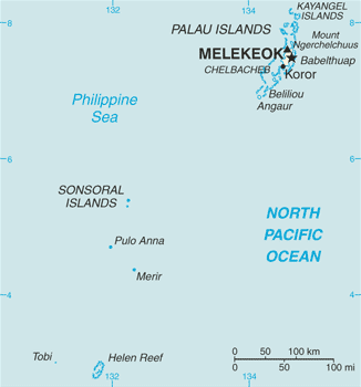
It looks like the eye will pass just north of Palau.
0 likes
Visit the Caribbean-Central America Weather Thread where you can find at first post web cams,radars
and observations from Caribbean basin members Click Here
and observations from Caribbean basin members Click Here
-
RobWESTPACWX
- WestPACMet

- Posts: 1616
- Joined: Fri Sep 17, 2010 2:26 am
- Location: Tokyo, Japan
- Contact:
Re: WPAC: HAIYAN - Typhoon
Some storm footage out of Yap, max winds recorded here up to 106kph.
[youtube]https://www.youtube.com/watch?v=gze2LBl8uQ0[/youtube]
[youtube]https://www.youtube.com/watch?v=gze2LBl8uQ0[/youtube]
0 likes
Satellites, Charts and Forecasting tools for East Asia at WESTERNPACIFICWEATHER.COM
-
xtyphooncyclonex
- Category 5
- Posts: 3898
- Age: 24
- Joined: Sat Dec 08, 2012 9:07 am
- Location: Cebu City
- Contact:
Really worried about this! Strongest storm ever to hit Visayas!
0 likes
REMINDER: My opinions that I, or any other NON Pro-Met in this forum, are unofficial. Please do not take my opinions as an official forecast and warning. I am NOT a meteorologist. Following my forecasts blindly may lead to false alarm, danger and risk if official forecasts from agencies are ignored.
Who is online
Users browsing this forum: No registered users and 64 guests