ATL: INVEST 98L - Discussion
Moderator: S2k Moderators
-
cycloneye

- Admin

- Posts: 149720
- Age: 69
- Joined: Thu Oct 10, 2002 10:54 am
- Location: San Juan, Puerto Rico
Re: ATL: INVEST 98L - Discussion
CV season has been very poor in activity despite Chantal,Dorian and Erin as all three were wimpys.
0 likes
Visit the Caribbean-Central America Weather Thread where you can find at first post web cams,radars
and observations from Caribbean basin members Click Here
and observations from Caribbean basin members Click Here
-
Gustywind

- Category 5

- Posts: 12334
- Joined: Mon Sep 03, 2007 7:29 am
- Location: Baie-Mahault, GUADELOUPE
TROPICAL WEATHER DISCUSSION
NWS NATIONAL HURRICANE CENTER MIAMI FL
805 PM EDT TUE SEP 03 2013
AN ATLANTIC OCEAN TROPICAL WAVE IS OFF THE COAST OF WEST AFRICA
FROM 19N19W TO AN EMBEDDED 1009 MB LOW NEAR THE CAPE VERDE
ISLANDS AT 15N23W TO 8N23W MOVING W AT 10 KT. SCATTERED MODERATE
CONVECTION IS ALONG THE COAST OF MAURITANIA FROM 15N-19N BETWEEN
16W-18W... AND S OF THE LOW FROM 9N-14N BETWEEN 21W-26W.
0 likes
-
Hurricaneman

- Category 5
- Posts: 7404
- Age: 45
- Joined: Tue Aug 31, 2004 3:24 pm
- Location: central florida
Re: ATL: INVEST 98L - Discussion
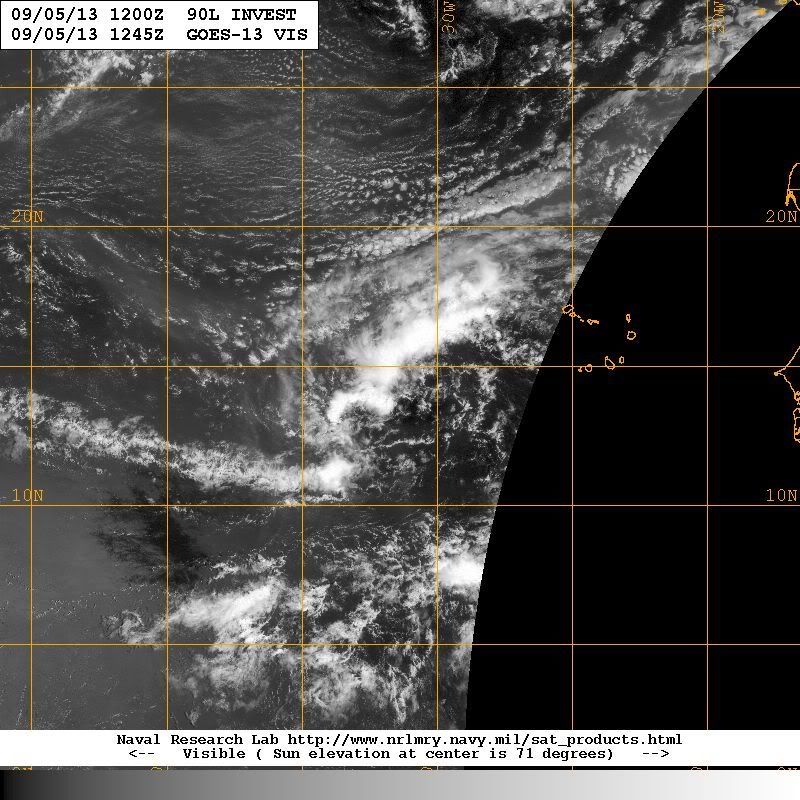
This has a pretty vigorous circulation, and if it stays weak like this until farther west this may need to be watched
0 likes
-
Gustywind
- Category 5
- Posts: 12334
- Joined: Mon Sep 03, 2007 7:29 am
- Location: Baie-Mahault, GUADELOUPE
TROPICAL WEATHER DISCUSSION
NWS NATIONAL HURRICANE CENTER MIAMI FL
205 AM EDT WED SEP 04 2013
A TROPICAL WAVE ASSOCIATED WITH A 1012 MB LOW PRESSURE CENTER
CAME OFF THE AFRICAN COAST EARLIER TODAY AND CURRENTLY IS MOVING
ACROSS THE CAPE VERDE ISLANDS. ITS AXIS EXTENDS FROM 19N23W TO
THE LOW NEAR 13N24W TO 08N23W AND IS MOVING NEAR 10 KT. TOTAL
PRECIPITABLE WATER IMAGERY SHOW HIGH MOISTURE E OF THE LOW
CENTER...A MODERATE MOIST ENVIRONMENT S OF IT BUT A MUCH DRIER
ENVIRONMENT NW OF THE LOW SINCE THE WAVE IS BEING ENGULFED BY
SAHARAN DRY AIR AND DUST. THEREFORE...DEEP CONVECTION IS BEING
HINDERED. WIDELY SCATTERED MODERATE CONVECTION IS SW OF THE LOW
FROM 08N-13N BETWEEN 24W-30W AS WELL AS E-NE OF THE LOW FROM 13N-
16N.
0 likes
-
tolakram
- Admin
- Posts: 20186
- Age: 62
- Joined: Sun Aug 27, 2006 8:23 pm
- Location: Florence, KY (name is Mark)
Re:
ninel conde wrote:the mighty 98L has struck out.
Another wave that DID emerge from Africa and DID get destroyed by 2013.
This is why I doubt the talk about no African waves. We've had plenty, it's not the reason for the season.
0 likes
M a r k
- - - - -
Join us in chat: Storm2K Chatroom Invite. Android and IOS apps also available.
The posts in this forum are NOT official forecasts and should not be used as such. Posts are NOT endorsed by any professional institution or STORM2K.org. For official information and forecasts, please refer to NHC and NWS products.

-
ninel conde
http://moe.met.fsu.edu/cgi-bin/cmctc2.cgi?time=2013090412&field=Sea+Level+Pressure&hour=168hr
canadian shows the lead one as 98L. DONT SEE IT ON THE gfs.
canadian shows the lead one as 98L. DONT SEE IT ON THE gfs.
0 likes
-
tolakram
- Admin
- Posts: 20186
- Age: 62
- Joined: Sun Aug 27, 2006 8:23 pm
- Location: Florence, KY (name is Mark)
Re: ATL: INVEST 98L - Discussion
Please use the URL tags when posting links. 
0 likes
M a r k
- - - - -
Join us in chat: Storm2K Chatroom Invite. Android and IOS apps also available.
The posts in this forum are NOT official forecasts and should not be used as such. Posts are NOT endorsed by any professional institution or STORM2K.org. For official information and forecasts, please refer to NHC and NWS products.
- - - - -
Join us in chat: Storm2K Chatroom Invite. Android and IOS apps also available.
The posts in this forum are NOT official forecasts and should not be used as such. Posts are NOT endorsed by any professional institution or STORM2K.org. For official information and forecasts, please refer to NHC and NWS products.
-
tolakram
- Admin
- Posts: 20186
- Age: 62
- Joined: Sun Aug 27, 2006 8:23 pm
- Location: Florence, KY (name is Mark)
Re:
ninel conde wrote:i just did, looks the same
I edited the post. The URL tags force the browser to open a new window. Just trying to remind people, it's not just you.
0 likes
M a r k
- - - - -
Join us in chat: Storm2K Chatroom Invite. Android and IOS apps also available.
The posts in this forum are NOT official forecasts and should not be used as such. Posts are NOT endorsed by any professional institution or STORM2K.org. For official information and forecasts, please refer to NHC and NWS products.
- - - - -
Join us in chat: Storm2K Chatroom Invite. Android and IOS apps also available.
The posts in this forum are NOT official forecasts and should not be used as such. Posts are NOT endorsed by any professional institution or STORM2K.org. For official information and forecasts, please refer to NHC and NWS products.
-
HurricaneDREW92
- Category 1

- Posts: 320
- Age: 27
- Joined: Sun Jul 28, 2013 11:56 am
- Location: Boston, MA
Re: ATL: INVEST 98L - Discussion
This wave looks dead to me.
0 likes
This post is NOT AN OFFICIAL FORECAST and should not be used as such. It is just the opinion of the poster and may or may not be backed by sound meteorological data. It is NOT endorsed by any professional institution including storm2k.org. For Official Information please refer to the NHC and NWS products.
-THE ABOVE IS THE OPINION OF DREW ONLY
-THE ABOVE IS THE OPINION OF DREW ONLY

-
Gustywind
- Category 5
- Posts: 12334
- Joined: Mon Sep 03, 2007 7:29 am
- Location: Baie-Mahault, GUADELOUPE
8 AM Tropical Weather Outlook.
SHOWERS AND THUNDERSTORMS ASSOCIATED WITH A TROPICAL WAVE LOCATED
ABOUT 450 MILES WEST-SOUTHWEST OF THE CAPE VERDE ISLANDS ARE
SHOWING SOME SIGNS OF ORGANIZATION. HOWEVER...FURTHER
DEVELOPMENT...IF ANY...IS EXPECTED TO BE LIMITED DUE TO DRY
AIR...AND ENVIRONMENTAL CONDITIONS ARE FORECAST TO BECOME VERY
UNFAVORABLE IN A COUPLE OF DAYS. THIS SYSTEM HAS A LOW CHANCE...
10 PERCENT...OF BECOMING A TROPICAL CYCLONE DURING THE NEXT
48 HOURS...AND A LOW CHANCE...10 PERCENT...OF BECOMING A TROPICAL
CYCLONE DURING THE NEXT 5 DAYS WHILE IT MOVES TO THE WEST-NORTHWEST
AT ABOUT 10 MPH.
0 likes
-
Gustywind
- Category 5
- Posts: 12334
- Joined: Mon Sep 03, 2007 7:29 am
- Location: Baie-Mahault, GUADELOUPE
8 AM Tropical Weather Discussion.
TROPICAL WAVE W OF THE CAPE VERDE ISLANDS EXTENDS FROM 18N29W
THROUGH A 1012 MB LOW NEAR 14N31W TO 9N31W. WAVE HAS BEEN MOVING
W NEAR 10-15 KT FOR THE PAST 24 HOURS. WAVE IS EMBEDDED WITHIN A
BROAD SURGE OF DEEP MOISTURE AS DEPICTED ON TOTAL PRECIPITABLE
WATER IMAGERY. WAVE IS WELL DEFINED IN THE SATELLITE WINDS WITH
CLUSTERS OF SCATTERED MODERATE/ISOLATED STRONG CONVECTION WITHIN
75 NM OF LINE FROM 17N27W 15N32W TO 10N34W.
0 likes
Who is online
Users browsing this forum: No registered users and 41 guests