ATL: INGRID - Remnants - Discussion

Moderator: S2k Moderators

Message
Author
ozonepete
Professional-Met
Professional-Met
Posts: 4743
Joined: Mon Sep 07, 2009 3:23 pm
Location: From Ozone Park, NYC / Now in Brooklyn, NY

Re: ATL: INGRID - Hurricane - Discussion

#921 Postby ozonepete » Sat Sep 14, 2013 11:02 pm

cycloneye wrote:Interesting exerpt from TS Manuel discussion that mentions Ingrid.

INITIAL INTENSITY HAS BEEN INCREASED TO 60 KT...WHICH COULD BE
CONSERVATIVE GIVEN THAT MANUEL LOOKS STRIKINGLY SIMILAR IN
STRUCTURE TO HURRICANE INGRID LOCATED IN THE BAY OF CAMPECHE
.


Fascinating stuff, Luis. You could be right that we get two landfalling hurricanes in Mexico on each coast within less than 48 hours or so. And I don't know when or if this has ever happened.
0 likes   

ozonepete
Professional-Met
Professional-Met
Posts: 4743
Joined: Mon Sep 07, 2009 3:23 pm
Location: From Ozone Park, NYC / Now in Brooklyn, NY

Re: Re:

#922 Postby ozonepete » Sat Sep 14, 2013 11:05 pm

CrazyC83 wrote:
Time_Zone wrote:
CrazyC83 wrote:Once Manuel makes landfall and shreds itself over the mountains, shear should decrease due to less outflow?


Yes.


If Ingrid can hold its own up to that time and maintain a strong inner core, I can see it RI'ing afterward...


If the shear drops and Manuel stops interfering with the ouflow on the southern side of Ingrid, yeah it could ramp up even more.
0 likes   

ozonepete
Professional-Met
Professional-Met
Posts: 4743
Joined: Mon Sep 07, 2009 3:23 pm
Location: From Ozone Park, NYC / Now in Brooklyn, NY

Re: ATL: INGRID - Hurricane - Discussion

#923 Postby ozonepete » Sat Sep 14, 2013 11:08 pm

Boy, if it weren't for those huge mountains in between them, those two would be doing a serious Fujiwhara.

Image
0 likes   

User avatar
TheStormExpert
Category 5
Category 5
Posts: 8487
Age: 30
Joined: Wed Feb 16, 2011 5:38 pm
Location: Palm Beach Gardens, FL

#924 Postby TheStormExpert » Sat Sep 14, 2013 11:28 pm

Definitely some very cold cloud-tops currently associated with Hurricane Ingrid looking at it from the overall U.S. satellite.

Image
0 likes   
The following post is NOT an official forecast and should not be used as such. It is just the opinion of the poster and may or may not be backed by sound meteorological data. It is NOT endorsed by storm2k.org.

User avatar
Hammy
Category 5
Category 5
Posts: 5595
Age: 40
Joined: Fri May 25, 2012 5:25 pm
Contact:

#925 Postby Hammy » Sat Sep 14, 2013 11:38 pm

I'm noticing a faint white ring near the middle, is that the overshooting tops of the formative eyewall clouds?

http://www.ssd.noaa.gov/PS/TROP/floaters/10L/flash-rbtop-long.html
0 likes   
The above post is not official and should not be used as such. It is the opinion of the poster and may or may not be backed by sound meteorological data. It is not endorsed by any professional institution or storm2k.org. For official information, please refer to the NHC and NWS products.

User avatar
ROCK
Category 5
Category 5
Posts: 9254
Age: 53
Joined: Tue Aug 17, 2004 7:30 am
Location: Kemah, Texas

Re:

#926 Postby ROCK » Sat Sep 14, 2013 11:45 pm

Hammy wrote:I'm noticing a faint white ring near the middle, is that the overshooting tops of the formative eyewall clouds?

http://www.ssd.noaa.gov/PS/TROP/floaters/10L/flash-rbtop-long.html


yep thats it....looks to have taken a wobble left some...
0 likes   

Alyono
Professional-Met
Professional-Met
Posts: 6961
Joined: Fri Apr 26, 2013 3:52 pm
Location: Texas Coast

#927 Postby Alyono » Sun Sep 15, 2013 12:44 am

0 likes   

User avatar
South Texas Storms
Professional-Met
Professional-Met
Posts: 4040
Joined: Thu Jun 24, 2010 12:28 am
Location: Houston, TX

Re: ATL: INGRID - Hurricane - Discussion

#928 Postby South Texas Storms » Sun Sep 15, 2013 12:51 am

:uarrow:
Yeah it really doesn't look very good for a hurricane right now.
0 likes   

Time_Zone
Category 1
Category 1
Posts: 251
Joined: Sat May 08, 2010 4:15 am

#929 Postby Time_Zone » Sun Sep 15, 2013 12:56 am

Wow sure does look like an absolute mess right now.
0 likes   

JonathanBelles
Professional-Met
Professional-Met
Posts: 11430
Age: 33
Joined: Sat Dec 24, 2005 9:00 pm
Location: School: Florida State University (Tallahassee, FL) Home: St. Petersburg, Florida
Contact:

#930 Postby JonathanBelles » Sun Sep 15, 2013 1:10 am

There's a more recent microwave image, and what you circled does not seem to be any part of an eyewall.
0 likes   

ozonepete
Professional-Met
Professional-Met
Posts: 4743
Joined: Mon Sep 07, 2009 3:23 pm
Location: From Ozone Park, NYC / Now in Brooklyn, NY

Re:

#931 Postby ozonepete » Sun Sep 15, 2013 1:11 am

Alyono wrote:http://www.nrlmry.navy.mil/htdocs_dyn_pregen_sat/PUBLIC/tc_pages/pages/tc13/ATL/10L.INGRID/tc_ssmis/91h/2degreeticks/full/20130915.0133.f18.x.91h.10LINGRID.70kts-983mb-217N-947W.56pc.html

structure is AWFUL


I removed my earlier response because I just realized your image is from 6 hours ago and I circled incorrectly. But a lot has happened since then.
Last edited by ozonepete on Sun Sep 15, 2013 1:13 am, edited 1 time in total.
0 likes   

ozonepete
Professional-Met
Professional-Met
Posts: 4743
Joined: Mon Sep 07, 2009 3:23 pm
Location: From Ozone Park, NYC / Now in Brooklyn, NY

Re:

#932 Postby ozonepete » Sun Sep 15, 2013 1:12 am

JonathanBelles wrote:There's a more recent microwave image, and what you circled does not seem to be any part of an eyewall.


Yeah I know - I took it out and issued another statement. My bad. But that mv is really old now. Can you post the newer image. I get tired of doing all of the image posting, lol.
0 likes   

JonathanBelles
Professional-Met
Professional-Met
Posts: 11430
Age: 33
Joined: Sat Dec 24, 2005 9:00 pm
Location: School: Florida State University (Tallahassee, FL) Home: St. Petersburg, Florida
Contact:

#933 Postby JonathanBelles » Sun Sep 15, 2013 1:15 am

Image
0 likes   

Time_Zone
Category 1
Category 1
Posts: 251
Joined: Sat May 08, 2010 4:15 am

#934 Postby Time_Zone » Sun Sep 15, 2013 1:16 am

Looks terrible.
0 likes   

User avatar
Hurricaneman
Category 5
Category 5
Posts: 7285
Age: 43
Joined: Tue Aug 31, 2004 3:24 pm
Location: central florida

#935 Postby Hurricaneman » Sun Sep 15, 2013 1:20 am

I could be wrong but it looks like there's a MLC to the SE of the surface low, could that be causing shear

The posts in this forum are NOT official forecast and should not be used as such. They are just the opinion of the poster and may or may not be backed by sound meteorological data. They are NOT endorsed by any professional institution or storm2k.org. For official information, please refer to the NHC and NWS products
0 likes   

ozonepete
Professional-Met
Professional-Met
Posts: 4743
Joined: Mon Sep 07, 2009 3:23 pm
Location: From Ozone Park, NYC / Now in Brooklyn, NY

Re:

#936 Postby ozonepete » Sun Sep 15, 2013 1:28 am

JonathanBelles wrote:Image


Thanks, Jon! I appreciate it. Too much tequila tonight out with the crowd, lol. I'm going with Alyono and the rest that structure is not good, but it's not "terrible" lol. The eye is clearly discernible on that mv sat and looks like convection is wrapping around it. It will all about the shear from here on...
0 likes   

supercane4867
Category 5
Category 5
Posts: 4966
Joined: Wed Nov 14, 2012 10:43 am

Re: ATL: INGRID - Hurricane - Discussion

#937 Postby supercane4867 » Sun Sep 15, 2013 1:33 am

Surprisingly T-number from SAB just went back to 4.0
It was down to 3.5 earlier

DATE TIME LAT LON CLASSIFICATION ID NAME
20130915 0545 22.4 95.1 T4.0/4.0 10L INGRID
20130914 2345 21.7 94.6 T3.5/4.0 10L INGRID
0 likes   

JonathanBelles
Professional-Met
Professional-Met
Posts: 11430
Age: 33
Joined: Sat Dec 24, 2005 9:00 pm
Location: School: Florida State University (Tallahassee, FL) Home: St. Petersburg, Florida
Contact:

#938 Postby JonathanBelles » Sun Sep 15, 2013 1:39 am

Yea, it does not look terrible, but it does look like it weakened a bit over the last 6 hours. Nothing that will kill Ingrid though.
0 likes   

supercane4867
Category 5
Category 5
Posts: 4966
Joined: Wed Nov 14, 2012 10:43 am

Re: ATL: INGRID - Hurricane - Discussion

#939 Postby supercane4867 » Sun Sep 15, 2013 1:41 am

LOL

That must be the the worst T5.0 storm I've seen

AL, 10, 201309150545, 10, DVTS, CI, , 2220N, 9520W, , 3, 90, 2, 970, 2, DVRK, , , , , , , , , , , , , , L, TAFB, EC, I, 5, 5050 /////, , , GOES13, CSC, T,
0 likes   

WeatherGuesser
Category 5
Category 5
Posts: 2672
Joined: Tue Jun 29, 2010 6:46 am

Re: ATL: INGRID - Hurricane - Discussion

#940 Postby WeatherGuesser » Sun Sep 15, 2013 1:54 am

ozonepete wrote:
cycloneye wrote:Interesting exerpt from TS Manuel discussion that mentions Ingrid.

INITIAL INTENSITY HAS BEEN INCREASED TO 60 KT...WHICH COULD BE
CONSERVATIVE GIVEN THAT MANUEL LOOKS STRIKINGLY SIMILAR IN
STRUCTURE TO HURRICANE INGRID LOCATED IN THE BAY OF CAMPECHE
.


Fascinating stuff, Luis. You could be right that we get two landfalling hurricanes in Mexico on each coast within less than 48 hours or so. And I don't know when or if this has ever happened.

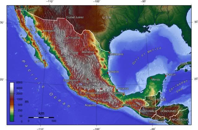
MAXIMUM SUSTAINED WINDS ARE NEAR 70 MPH...110 KM/H...WITH HIGHER
GUSTS. SOME ADDITIONAL STRENGTHENING IS POSSIBLE...AND MANUEL
COULD BE A HURRICANE WHEN IT MAKES LANDFALL ON SUNDAY.


100 AM CDT SUN SEP 15 2013

...INGRID EXPECTED TO MAKE LANDFALL ON MONDAY...


Or maybe within 24 hours.
0 likes   


Return to “2013”

Who is online

Users browsing this forum: No registered users and 5 guests