Global model runs discussion
Moderator: S2k Moderators

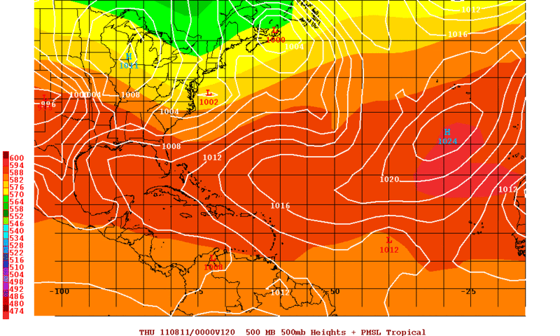
A very interesting run from the 06z, we are certainly getting to the time of year where the CV region should start to be producing systems that could develop in the MDR zone, so its certainly possible something like that could happen.
0 likes
Personal Forecast Disclaimer:
The posts in this forum are NOT official forecast and should not be used as such. They are just the opinion of the poster and may or may not be backed by sound meteorological data. They are NOT endorsed by any professional institution or storm2k.org. For official information, please refer to the NHC and NWS products
The posts in this forum are NOT official forecast and should not be used as such. They are just the opinion of the poster and may or may not be backed by sound meteorological data. They are NOT endorsed by any professional institution or storm2k.org. For official information, please refer to the NHC and NWS products
-
gatorcane

- S2K Supporter

- Posts: 23708
- Age: 48
- Joined: Sun Mar 13, 2005 3:54 pm
- Location: Boca Raton, FL
Re:
KWT wrote:Current pattern means its going to be very very difficult to get a US landfall, probably the best way is a weak system makes it to neasr the Bahamas and explodes just at the same time as some brief ridging comes in, but the pattern is TROUGHY in a big way, just loike last yeaer, in fact almost a clone of last year.
Right certainly looks that way. But the heart of the CV season is still about 3-4 weeks away, and the long-wave pattern can change by then.
And even if it does not, all it takes is one of those CV storms slipping through at the right time.....it just takes one.
0 likes


Re: Global Model Runs Discussion
The long range GFS shows a robust subtropical ridge, as shown by the fantasy storms taking Carib and GOM tracks. Obviously the aggregate of many runs is what to look for.
0 likes
-
ConvergenceZone
.gif)
- Category 5

- Posts: 5241
- Joined: Fri Jul 29, 2005 1:40 am
- Location: Northern California
Re:
KWT wrote:Current pattern means its going to be very very difficult to get a US landfall, probably the best way is a weak system makes it to neasr the Bahamas and explodes just at the same time as some brief ridging comes in, but the pattern is TROUGHY in a big way, just loike last yeaer, in fact almost a clone of last year.
Yea, i was wondering the same thing yesterday morning KWT. August may be a pretty quiet month for the USA. I still roll my eyes at the prediction before the season started that we should have more landfalling hurricanes this year
So far the supporting evidence for that statement is not to be found.
But September and early October might still be active for the USA if the patterns change.
0 likes
-
HurricaneFan
- Tropical Storm

- Posts: 192
- Age: 42
- Joined: Tue Jan 18, 2011 6:16 pm
- Location: Anguilla,Leeward Islands 18.3N 63.0W
Re:
KWT wrote:Current pattern means its going to be very very difficult to get a US landfall, probably the best way is a weak system makes it to neasr the Bahamas and explodes just at the same time as some brief ridging comes in, but the pattern is TROUGHY in a big way, just loike last yeaer, in fact almost a clone of last year.
But how will that pattern affect the Lesser Antilles?
0 likes
-
cycloneye

- Admin

- Posts: 149514
- Age: 69
- Joined: Thu Oct 10, 2002 10:54 am
- Location: San Juan, Puerto Rico
Re: Global Model Runs Discussion
12z GFS develops the wave behind the one that is just off the African coast despicting it as a real long tracker that develops down the road in the long range.
8/6/11 loop of 12z GFS
8/6/11 loop of 12z GFS
0 likes
Visit the Caribbean-Central America Weather Thread where you can find at first post web cams,radars
and observations from Caribbean basin members Click Here
and observations from Caribbean basin members Click Here
-
cycloneye
- Admin
- Posts: 149514
- Age: 69
- Joined: Thu Oct 10, 2002 10:54 am
- Location: San Juan, Puerto Rico
Re: Global Model Runs Discussion
cycloneye wrote:12z GFS develops the wave behind the one that is just off the African coast despicting it as a real long tracker that develops down the road in the long range.
8/6/11 loop of 12z GFS
Look at where this run ends with this developing system.

Uploaded by imageshack.us
0 likes
Visit the Caribbean-Central America Weather Thread where you can find at first post web cams,radars
and observations from Caribbean basin members Click Here
and observations from Caribbean basin members Click Here
-
OuterBanker
- S2K Supporter
- Posts: 1761
- Joined: Wed Feb 26, 2003 10:53 am
- Location: Nags Head, NC
- Contact:
Re: Global Model Runs Discussion
Troughs are always here this time of year. First the Bermuda high is progged to retrograde west in the next two weeks. Models are also now showing a major trough split in a couple weeks which would allow a passage to the east coast. Of course as always it's a matter of timing. Will there be anything out there when all this happens.
0 likes
-
OuterBanker
- S2K Supporter
- Posts: 1761
- Joined: Wed Feb 26, 2003 10:53 am
- Location: Nags Head, NC
- Contact:
-
ConvergenceZone
- Category 5
- Posts: 5241
- Joined: Fri Jul 29, 2005 1:40 am
- Location: Northern California
-
cycloneye
- Admin
- Posts: 149514
- Age: 69
- Joined: Thu Oct 10, 2002 10:54 am
- Location: San Juan, Puerto Rico
Re:
ConvergenceZone wrote:cycloneye, this question is only for entertainment/speculative reasons, but approx what Cat level is that storm that
the GFS is showing with that type of pressure?
Again, I know it's days and days away and there will be tons of changes, but I'm just curious
Well,if you see 981 mbs in a model run, double it and you have a cat 3. I remember when GFS had Dean as a 1007 mb low.
0 likes
Visit the Caribbean-Central America Weather Thread where you can find at first post web cams,radars
and observations from Caribbean basin members Click Here
and observations from Caribbean basin members Click Here
-
cycloneye
- Admin
- Posts: 149514
- Age: 69
- Joined: Thu Oct 10, 2002 10:54 am
- Location: San Juan, Puerto Rico
Re: Global Model Runs Discussion
The wave now at WestCentral Africa behind the one that is just off the African Coast is the one GFS has ending just off SC/NC coast.

0 likes
Visit the Caribbean-Central America Weather Thread where you can find at first post web cams,radars
and observations from Caribbean basin members Click Here
and observations from Caribbean basin members Click Here
-
Rgv20

- S2K Supporter
- Posts: 2466
- Age: 39
- Joined: Wed Jan 05, 2011 5:42 pm
- Location: Edinburg/McAllen Tx
0zUKMET hinting at a low pressure area by mid week around 30W. In my opinion something may try to get going but not until it reaches 50W to 55W by next weekend.
0zUKMET forecast valid for Wednesday 7pm CDT.
0zUKMET forecast valid for Wednesday 7pm CDT.
0 likes
The following post is NOT an official forecast and should not be used as such. It is just the opinion of the poster and may or may not be backed by sound meteorological data. It is NOT endorsed by any professional institution including storm2k.org For Official Information please refer to the NHC and NWS products.
-
Hybridstorm_November2001

- S2K Supporter
- Posts: 2817
- Joined: Sat Aug 21, 2004 2:50 pm
- Location: SW New Brunswick, Canada
- Contact:
Re: Global Model Runs Discussion
cycloneye wrote:cycloneye wrote:12z GFS develops the wave behind the one that is just off the African coast despicting it as a real long tracker that develops down the road in the long range.
8/6/11 loop of 12z GFS
Look at where this run ends with this developing system.
Uploaded by imageshack.us
Holy moly, still in fantasy land however, now that has my interest.
0 likes
-
dwsqos2
-
cycloneye
- Admin
- Posts: 149514
- Age: 69
- Joined: Thu Oct 10, 2002 10:54 am
- Location: San Juan, Puerto Rico
Re: Global Model Runs Discussion
Discussion from the San Juan NWS this afternoon where they are paying close attention to the models.
EXTENDED OPERATIONAL AND ENSEMBLE GUIDANCE SHOW RELATIVELY LOW
PRES (LESS THAN 1008MB) ACROSS THE ENTIRE TROPICS FROM THE 13TH OF
AUGUST ONWARD AND LATEST MJO PROGNOSIS INDICATE SIGNAL AMPLIFLYING
ACROSS THE INDIAN OCEAN WHICH TYPICALLY RESULTS IN ACTIVE TROPICAL
CYCLONE PERIOD ACROSS THE ATLC BASIN. ALL OF THESE SUGGEST WE ARE
ABOUT TO ENTER A HEIGHTENED PERIOD OF TC ACTIVIY ACROSS THE WRN
HEMISPHERE AFTER THE 10TH OF AUGUST.
0 likes
Visit the Caribbean-Central America Weather Thread where you can find at first post web cams,radars
and observations from Caribbean basin members Click Here
and observations from Caribbean basin members Click Here
-
ConvergenceZone
- Category 5
- Posts: 5241
- Joined: Fri Jul 29, 2005 1:40 am
- Location: Northern California
Re: Global Model Runs Discussion
cycloneye wrote:Discussion from the San Juan NWS this afternoon where they are paying close attention to the models.
EXTENDED OPERATIONAL AND ENSEMBLE GUIDANCE SHOW RELATIVELY LOW
PRES (LESS THAN 1008MB) ACROSS THE ENTIRE TROPICS FROM THE 13TH OF
AUGUST ONWARD AND LATEST MJO PROGNOSIS INDICATE SIGNAL AMPLIFLYING
ACROSS THE INDIAN OCEAN WHICH TYPICALLY RESULTS IN ACTIVE TROPICAL
CYCLONE PERIOD ACROSS THE ATLC BASIN. ALL OF THESE SUGGEST WE ARE
ABOUT TO ENTER A HEIGHTENED PERIOD OF TC ACTIVIY ACROSS THE WRN
HEMISPHERE AFTER THE 10TH OF AUGUST.
After the 10th of August huh? Well, rest while ya can then.....
0 likes
-
hurricaneCW
- Category 5
- Posts: 1799
- Joined: Wed Mar 03, 2010 6:20 am
- Location: Toms River, NJ
Re: Global Model Runs Discussion
Probably like last season, were going to enter a very active 4 week period of tropical activity, but we'll see any impacts is the real question or will it be exactly like last season where we had a few close calls but no impacts.
0 likes

Re: Global Model Runs Discussion
0 likes
-
cycloneye
- Admin
- Posts: 149514
- Age: 69
- Joined: Thu Oct 10, 2002 10:54 am
- Location: San Juan, Puerto Rico
Re: Global Model Runs Discussion
The trio by 18z GFS at medium range.

0 likes
Visit the Caribbean-Central America Weather Thread where you can find at first post web cams,radars
and observations from Caribbean basin members Click Here
and observations from Caribbean basin members Click Here
Who is online
Users browsing this forum: No registered users and 33 guests