
ATL: DANNY - Remnants - Discussion
Moderator: S2k Moderators
-
tolakram
- Admin

- Posts: 20179
- Age: 62
- Joined: Sun Aug 27, 2006 8:23 pm
- Location: Florence, KY (name is Mark)
Re: ATL: FOUR - Tropical Depression
Saved visible loop from the floater.
0 likes
M a r k
- - - - -
Join us in chat: Storm2K Chatroom Invite. Android and IOS apps also available.
The posts in this forum are NOT official forecasts and should not be used as such. Posts are NOT endorsed by any professional institution or STORM2K.org. For official information and forecasts, please refer to NHC and NWS products.
-
galaxy401

- Category 5

- Posts: 2446
- Age: 30
- Joined: Sat Aug 25, 2012 9:04 pm
- Location: Casa Grande, Arizona
Re:
Weatherboy1 wrote:Well, at least we can safely say this is the most interesting system to watch yet! LOL. The important thing to me is that unlike many other disappointing waves, this one is not hauling across the Atlantic at 20-25 mph+. That happened to many waves in the last two years, causing them to die out. Four is moving at a much more normal speed, so could easily avoid that same fate.
Agreed, those storms the last couple years were too fast for their own good. This one is even supposed to slow down and might not even get to the Virgin islands by the weekend.
0 likes
Got my eyes on moving right into Hurricane Alley: Florida.
-
Gustywind

- Category 5
- Posts: 12334
- Joined: Mon Sep 03, 2007 7:29 am
- Location: Baie-Mahault, GUADELOUPE
TROPICAL WEATHER DISCUSSION
NWS NATIONAL HURRICANE CENTER MIAMI FL
205 PM EDT TUE AUG 18 2015
...SPECIAL FEATURES...
AS OF 1500 UTC...TROPICAL DEPRESSION FOUR HAS
DEVELOPED...CURRENTLY CENTERED NEAR 10.6N AND 36.5W. THE
DEPRESSION IS MOVING W AT ABOUT 12 KT AND HAS MAXIMUM SUSTAINED
WINDS NEAR 30 KT. THE ESTIMATED MINIMUM CENTRAL PRESSURE IS 1009
MB. NUMEROUS SHOWERS AND THUNDERSTORMS PREVAILS FROM 06N-13N
BETWEEN 32W-42W. GRADUAL STRENGTHENING IS FORECAST OVER THE NEXT
48 HOURS. PLEASE SEE LATEST PUBLIC ADVISORY UNDER THE AWIPS/WMO
HEADERS MIATCPAT4/WTNT34 KNHC FOR MORE DETAILS.
0 likes
-
Gustywind
- Category 5
- Posts: 12334
- Joined: Mon Sep 03, 2007 7:29 am
- Location: Baie-Mahault, GUADELOUPE
Stays at 2.0/2.0
DATE/TIME LAT LON CLASSIFICATION STORM
18/1745 UTC 11.1N 37.0W T2.0/2.0 04L
18/1145 UTC 10.2N 35.9W T2.0/2.0 96L
18/0545 UTC 9.5N 34.4W T1.5/1.5 96L
18/0000 UTC 9.3N 33.2W T1.0/1.0 96L
17/1745 UTC 9.8N 32.8W T1.0/1.0 96L
17/1145 UTC 9.6N 31.0W T1.0/1.0 96L
17/0545 UTC 9.8N 29.9W T1.0/1.0 96L
DATE/TIME LAT LON CLASSIFICATION STORM
18/1745 UTC 11.1N 37.0W T2.0/2.0 04L
18/1145 UTC 10.2N 35.9W T2.0/2.0 96L
18/0545 UTC 9.5N 34.4W T1.5/1.5 96L
18/0000 UTC 9.3N 33.2W T1.0/1.0 96L
17/1745 UTC 9.8N 32.8W T1.0/1.0 96L
17/1145 UTC 9.6N 31.0W T1.0/1.0 96L
17/0545 UTC 9.8N 29.9W T1.0/1.0 96L
0 likes
-
NCSTORMMAN
Re:
Gustywind wrote:Stays at 2.0/2.0
DATE/TIME LAT LON CLASSIFICATION STORM
18/1745 UTC 11.1N 37.0W T2.0/2.0 04L
18/1145 UTC 10.2N 35.9W T2.0/2.0 96L
18/0545 UTC 9.5N 34.4W T1.5/1.5 96L
18/0000 UTC 9.3N 33.2W T1.0/1.0 96L
17/1745 UTC 9.8N 32.8W T1.0/1.0 96L
17/1145 UTC 9.6N 31.0W T1.0/1.0 96L
17/0545 UTC 9.8N 29.9W T1.0/1.0 96L
I personally disagree. This thing already looks better than some of the tropical storms from the past that I googled. Actually it already looks better than Bill from earlier this season ever did.
Last edited by NCSTORMMAN on Tue Aug 18, 2015 1:27 pm, edited 1 time in total.
0 likes
-
Yellow Evan

- Professional-Met

- Posts: 16231
- Age: 27
- Joined: Fri Jul 15, 2011 12:48 pm
- Location: Henderson, Nevada/Honolulu, HI
- Contact:
-
Weatherboy1

- Category 5
- Posts: 1190
- Age: 50
- Joined: Mon Jul 05, 2004 1:50 pm
- Location: Jupiter/Sarasota, FL
-
cycloneye

- Admin
- Posts: 149276
- Age: 69
- Joined: Thu Oct 10, 2002 10:54 am
- Location: San Juan, Puerto Rico
Re: ATL: FOUR - Tropical Depression
18z Best Track to TS DANNY!
AL, 04, 2015081818, , BEST, 0, 108N, 370W, 35, 1008, TS
AL, 04, 2015081818, , BEST, 0, 108N, 370W, 35, 1008, TS
0 likes
Visit the Caribbean-Central America Weather Thread where you can find at first post web cams,radars
and observations from Caribbean basin members Click Here
and observations from Caribbean basin members Click Here
-
PTrackerLA

- Category 5
- Posts: 5281
- Age: 42
- Joined: Thu Oct 10, 2002 8:40 pm
- Location: Lafayette, LA
-
Gustywind
- Category 5
- Posts: 12334
- Joined: Mon Sep 03, 2007 7:29 am
- Location: Baie-Mahault, GUADELOUPE
Depression Four Forms East of the Islands. Could become Hurricane Danny by Friday
18 Aug 2015
|
 http://www.soualiganewsday.com/local/so ... riday.html
SINT MAARTEN – As of 11.00AM Tropical Depression (TD) #4 has formed 1665 miles to the East of the Windward Islands. TD#4 is moving west at 13 miles per hour with highest winds at 35 miles per hour. The system at this time does not pose a threat to Sint Maarten.
According to Crown Weather, “The area of low pressure that was Invest 96-L continues to organize and strengthen and is now considered a tropical depression. Satellite imagery indicates that TD 4 has a well-defined circulation and wind estimates from satellite data indicates there are 35 mph winds occurring with this system.
All indications are, “…that the depression will continue to track on a general west to west-northwest track over the next several days. While this system tracks westward, it is expected to strengthen as the overall environmental conditions are favourable for slow and steady strengthening throughout this week right into this weekend.
“The only inhibiting factor will be dry air that will try to pulled into the circulation of this system. With that said, given the otherwise favourable environment, it is extremely likely that TD 4 will strengthen into Tropical Storm Danny as soon as tonightand there is the possibility that it could become a hurricane by about Friday.
“From there, there is the possibility that TD 4/Danny will encounter increasingly unfavorable conditions as it gets near the Lesser Antilles by Monday of next week. With that said, everyone across the central Lesser Antilles, especially the islands of Antigua, Guadeloupe, Dominica and Martinique, should be aware that this system could be at least a moderate to strong tropical storm and very possibly a hurricane when it moves through on Monday intoTuesday of next week.
“Once this system enters the eastern Caribbean, the environment is still expected to become increasingly more unfavorable with this tropical cyclone likely weakening as it passes to the south of Puerto Rico and Hispaniola.”
SOUALIGA NEWSDAY REPORT
18 Aug 2015
|
SINT MAARTEN – As of 11.00AM Tropical Depression (TD) #4 has formed 1665 miles to the East of the Windward Islands. TD#4 is moving west at 13 miles per hour with highest winds at 35 miles per hour. The system at this time does not pose a threat to Sint Maarten.
According to Crown Weather, “The area of low pressure that was Invest 96-L continues to organize and strengthen and is now considered a tropical depression. Satellite imagery indicates that TD 4 has a well-defined circulation and wind estimates from satellite data indicates there are 35 mph winds occurring with this system.
All indications are, “…that the depression will continue to track on a general west to west-northwest track over the next several days. While this system tracks westward, it is expected to strengthen as the overall environmental conditions are favourable for slow and steady strengthening throughout this week right into this weekend.
“The only inhibiting factor will be dry air that will try to pulled into the circulation of this system. With that said, given the otherwise favourable environment, it is extremely likely that TD 4 will strengthen into Tropical Storm Danny as soon as tonightand there is the possibility that it could become a hurricane by about Friday.
“From there, there is the possibility that TD 4/Danny will encounter increasingly unfavorable conditions as it gets near the Lesser Antilles by Monday of next week. With that said, everyone across the central Lesser Antilles, especially the islands of Antigua, Guadeloupe, Dominica and Martinique, should be aware that this system could be at least a moderate to strong tropical storm and very possibly a hurricane when it moves through on Monday intoTuesday of next week.
“Once this system enters the eastern Caribbean, the environment is still expected to become increasingly more unfavorable with this tropical cyclone likely weakening as it passes to the south of Puerto Rico and Hispaniola.”
SOUALIGA NEWSDAY REPORT
0 likes
-
Yellow Evan
- Professional-Met
- Posts: 16231
- Age: 27
- Joined: Fri Jul 15, 2011 12:48 pm
- Location: Henderson, Nevada/Honolulu, HI
- Contact:
-
northjaxpro

- S2K Supporter

- Posts: 8900
- Joined: Mon Sep 27, 2010 11:21 am
- Location: Jacksonville, FL
Danny has been born based on the latest Best Track.
0 likes
NEVER, EVER SAY NEVER in the tropics and weather in general, and most importantly, with life itself!!
________________________________________________________________________________________
Fay 2008 Beryl 2012 Debby 2012 Colin 2016 Hermine 2016 Julia 2016 Matthew 2016 Irma 2017 Dorian 2019
________________________________________________________________________________________
Fay 2008 Beryl 2012 Debby 2012 Colin 2016 Hermine 2016 Julia 2016 Matthew 2016 Irma 2017 Dorian 2019
-
Gustywind
- Category 5
- Posts: 12334
- Joined: Mon Sep 03, 2007 7:29 am
- Location: Baie-Mahault, GUADELOUPE
Atlantic Gives Birth to Tropical Depression Four
Alex Sosnowski
By Alex Sosnowski, AccuWeather.com Senior Meteorologist
August 18, 2015; 2:41 PM ET
http://www.accuweather.com/en/weather-n ... y/51857239
An area of disturbed weather in the south-central Atlantic has become Tropical Depression Four and could strengthen into the first hurricane of the 2015 season during the next couple of days.
The system moved westward across Africa during the first part of August and continues to move westward this week at 10-15 mph (15-25 kph).
According to AccuWeather Meteorologist Jordan Root, "Showers and thunderstorms continue to spiral around an area of circulation and organization seems to be increasing as this feature moves through favorable conditions during the middle days of this week."
When a closed circulation near the sea surface has been confirmed, a tropical depression is born. When sustained winds around the circulation reach 39 mph (63 kph), a tropical depression is upgraded to a tropical storm. For a system to become a hurricane, sustained winds must reach 74 mph (119 kph).
The system is currently almost halfway between the Cape Verde Islands and the Windward Islands just north of the equator and is in a zone where winds aloft are light.
Strong winds aloft (wind shear) can prevent a tropical system from developing or cause an organized tropical system to weaken.
According to AccuWeather Meteorologist Evan Duffey, wind shear has been strong over the Caribbean during much of hurricane season thus far.
"The most likely time for the system to strengthen is through Thursday, since beyond this point wind shear is likely to increase as the system approaches and later moves into the Caribbean," Duffey said.
Should the system advance beyond the tropical depression stage it would gather the name Danny, following Ana, Bill and Claudette from earlier this season. None of the first three storms reached hurricane status.
Much of the islands in the Caribbean Sea are in drought and would trade the inconvenience and hazards that a tropical storm would bring for rainfall. Even a poorly organized tropical depression or storm could bring an uptick in drenching showers and thunderstorms, if the system tracks close by.
The exact track of the system beyond several days is questionable at this point. A track across the Windward or Leeward islands late Monday, then into the Caribbean later next week is most likely, provided the system remains relatively weak. However, a curve to the northwest and dissipation are also possibilities.
Should the system ramp up quickly to a hurricane, then a jog to the northwest would be more likely. AccuWeather meteorologists expect the system to reach tropical storm strength and perhaps minimal hurricane status.
If the system becomes a hurricane, it would be the first of the 2015 Atlantic season.
Another significant area of disturbed weather is forecast to soon emerge off Africa later this week.
"Steering winds favor a more northwest track with this second system when compared to the existing tropical depression and potential impacts to land will likely be reduced, should it develop this weekend into next week," Duffey said.
During El Nino, the number of named tropical systems in the Atlantic basin tends to be lower than average.
AccuWeather is forecasting eight tropical storms, four hurricanes and one major hurricane for the 2015 season with two to three landfalls in the United States. Ana and Bill made landfall in the U.S. during May and June respectively.
Alex Sosnowski
By Alex Sosnowski, AccuWeather.com Senior Meteorologist
August 18, 2015; 2:41 PM ET
An area of disturbed weather in the south-central Atlantic has become Tropical Depression Four and could strengthen into the first hurricane of the 2015 season during the next couple of days.
The system moved westward across Africa during the first part of August and continues to move westward this week at 10-15 mph (15-25 kph).
According to AccuWeather Meteorologist Jordan Root, "Showers and thunderstorms continue to spiral around an area of circulation and organization seems to be increasing as this feature moves through favorable conditions during the middle days of this week."
When a closed circulation near the sea surface has been confirmed, a tropical depression is born. When sustained winds around the circulation reach 39 mph (63 kph), a tropical depression is upgraded to a tropical storm. For a system to become a hurricane, sustained winds must reach 74 mph (119 kph).
The system is currently almost halfway between the Cape Verde Islands and the Windward Islands just north of the equator and is in a zone where winds aloft are light.
Strong winds aloft (wind shear) can prevent a tropical system from developing or cause an organized tropical system to weaken.
According to AccuWeather Meteorologist Evan Duffey, wind shear has been strong over the Caribbean during much of hurricane season thus far.
"The most likely time for the system to strengthen is through Thursday, since beyond this point wind shear is likely to increase as the system approaches and later moves into the Caribbean," Duffey said.
Should the system advance beyond the tropical depression stage it would gather the name Danny, following Ana, Bill and Claudette from earlier this season. None of the first three storms reached hurricane status.
Much of the islands in the Caribbean Sea are in drought and would trade the inconvenience and hazards that a tropical storm would bring for rainfall. Even a poorly organized tropical depression or storm could bring an uptick in drenching showers and thunderstorms, if the system tracks close by.
The exact track of the system beyond several days is questionable at this point. A track across the Windward or Leeward islands late Monday, then into the Caribbean later next week is most likely, provided the system remains relatively weak. However, a curve to the northwest and dissipation are also possibilities.
Should the system ramp up quickly to a hurricane, then a jog to the northwest would be more likely. AccuWeather meteorologists expect the system to reach tropical storm strength and perhaps minimal hurricane status.
If the system becomes a hurricane, it would be the first of the 2015 Atlantic season.
Another significant area of disturbed weather is forecast to soon emerge off Africa later this week.
"Steering winds favor a more northwest track with this second system when compared to the existing tropical depression and potential impacts to land will likely be reduced, should it develop this weekend into next week," Duffey said.
During El Nino, the number of named tropical systems in the Atlantic basin tends to be lower than average.
AccuWeather is forecasting eight tropical storms, four hurricanes and one major hurricane for the 2015 season with two to three landfalls in the United States. Ana and Bill made landfall in the U.S. during May and June respectively.
0 likes
-
Gustywind
- Category 5
- Posts: 12334
- Joined: Mon Sep 03, 2007 7:29 am
- Location: Baie-Mahault, GUADELOUPE
Interresting discussion from Dr. Jeff Masters
http://www.wunderground.com/blog/JeffMa ... rynum=3075
Tropical Depression Forms in the North Atlantic
The fourth tropical depression of 2015 has developed in the central tropical Atlantic, and it could become the year’s first Atlantic hurricane by later this week. Advisories on TD 4 were initiated by the National Hurricane Center (NHC) at 11:00 am EDT Tuesday. The depression was located near 10.6°N, 36.5°W, moving west at about 13 mph. Top sustained winds were estimated at 35 mph, just below tropical-storm strength (40 mph). TD 4 is expected to become Tropical Storm Danny, the season’s fourth named system, by later tonight, according to the NHC. Interestingly, this is the first named system of the 2015 Atlantic season to begin its official life as a tropical depression. Ana began as a subtropical storm, while Bill and Claudette were tracked as tropical storms by NHC from the outset.
The outlook for TD 4
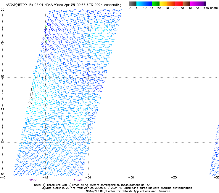
As the first Cape Verde depression of the year, TD 4 formed well east of the Caribbean, where El Niño has been producing record amounts of vertical wind shear this summer. Even though the Atlantic tropics have been largely suppressed, as expected with this year’s strong El Niño event, TD 4 appears to be finding a window in time and space where some development is possible. Wind shear near the system is quite low, only around 5 knots (see Figure 3), and the region of stronger upper-level westerlies to the north of TD 4 could end up helping to support development by serving as an outflow channel. A massive area of Saharan dust and dry air lies just north of TD 4, but as mentioned in Tuesday’s morning’s NHC discussion, it appears that the depression is surrounded by enough moisture that it may be able to intensify even if it ingests some of this dry, dusty air.
The 11 am EDT outlook from NHC brings TD 4 to hurricane strength by Friday morning and to Category 2 strength (sustained winds of 100 mph) by Saturday. This long-range forecast is consistent with the statistical models that show more skill than dynamical models at intensity prediction beyond 3 days. Of the two dynamical models most trusted for intensity forecasting, the HWRF has consistently called for TD 4 to develop into at least a strong Category 1 hurricane, while the GFDL has failed to develop TD 4, so the recently upgraded HWRF may end up closer to the mark in this case. Intensity prediction is still very challenging, so it is quite possible that TD 4 could be substantially weaker or stronger by this weekend than the current NHC forecast indicates. Over the last two years, the average 5-day error in NHC intensity projections was around 15 mph, or a bit more than half a category on the Saffir-Simpson Hurricane Wind Scale. This is substantially better than prior years: between 2000 and 2010, intensity errors at 5 days averaged more than 25 mph.
Looking ahead
TD 4 is many days away from any threat to the Leeward Islands. Most of the dynamical track models keep TD 4 moving west to west-northwest at a modest pace. The model consensus keeps TD 4 east of 50°W longitude until this weekend, when a building ridge to the north of TD 4 should help push it at a faster rate toward the islands. By that point, the system would draw on oceanic heat content that gradually increases along its path. It is far too early to predict with any confidence how much of a threat TD 4 might pose to the United States next week. Only a small change in trajectory this far out can have big implications for the track many days from now, and it remains to be seen whether dry air and dust will keep TD 4 from maximizing its potential for development.
Tropical Depression Forms in the North Atlantic
The fourth tropical depression of 2015 has developed in the central tropical Atlantic, and it could become the year’s first Atlantic hurricane by later this week. Advisories on TD 4 were initiated by the National Hurricane Center (NHC) at 11:00 am EDT Tuesday. The depression was located near 10.6°N, 36.5°W, moving west at about 13 mph. Top sustained winds were estimated at 35 mph, just below tropical-storm strength (40 mph). TD 4 is expected to become Tropical Storm Danny, the season’s fourth named system, by later tonight, according to the NHC. Interestingly, this is the first named system of the 2015 Atlantic season to begin its official life as a tropical depression. Ana began as a subtropical storm, while Bill and Claudette were tracked as tropical storms by NHC from the outset.
The outlook for TD 4
As the first Cape Verde depression of the year, TD 4 formed well east of the Caribbean, where El Niño has been producing record amounts of vertical wind shear this summer. Even though the Atlantic tropics have been largely suppressed, as expected with this year’s strong El Niño event, TD 4 appears to be finding a window in time and space where some development is possible. Wind shear near the system is quite low, only around 5 knots (see Figure 3), and the region of stronger upper-level westerlies to the north of TD 4 could end up helping to support development by serving as an outflow channel. A massive area of Saharan dust and dry air lies just north of TD 4, but as mentioned in Tuesday’s morning’s NHC discussion, it appears that the depression is surrounded by enough moisture that it may be able to intensify even if it ingests some of this dry, dusty air.
The 11 am EDT outlook from NHC brings TD 4 to hurricane strength by Friday morning and to Category 2 strength (sustained winds of 100 mph) by Saturday. This long-range forecast is consistent with the statistical models that show more skill than dynamical models at intensity prediction beyond 3 days. Of the two dynamical models most trusted for intensity forecasting, the HWRF has consistently called for TD 4 to develop into at least a strong Category 1 hurricane, while the GFDL has failed to develop TD 4, so the recently upgraded HWRF may end up closer to the mark in this case. Intensity prediction is still very challenging, so it is quite possible that TD 4 could be substantially weaker or stronger by this weekend than the current NHC forecast indicates. Over the last two years, the average 5-day error in NHC intensity projections was around 15 mph, or a bit more than half a category on the Saffir-Simpson Hurricane Wind Scale. This is substantially better than prior years: between 2000 and 2010, intensity errors at 5 days averaged more than 25 mph.
Looking ahead
TD 4 is many days away from any threat to the Leeward Islands. Most of the dynamical track models keep TD 4 moving west to west-northwest at a modest pace. The model consensus keeps TD 4 east of 50°W longitude until this weekend, when a building ridge to the north of TD 4 should help push it at a faster rate toward the islands. By that point, the system would draw on oceanic heat content that gradually increases along its path. It is far too early to predict with any confidence how much of a threat TD 4 might pose to the United States next week. Only a small change in trajectory this far out can have big implications for the track many days from now, and it remains to be seen whether dry air and dust will keep TD 4 from maximizing its potential for development.
0 likes
-
SouthDadeFish

- Professional-Met
- Posts: 2835
- Joined: Thu Sep 23, 2010 2:54 pm
- Location: Miami, FL
- Contact:

Re: Re:
adam0983 wrote:Does anyone think that shear will destory Tropical Depression 4 based on the conditions of the Atlantic all season and EL Nino. I say this doesn't survive the shear. Just an opinion not a forecast
what shear? Shear is forecast to be less than 10 kts through the next 5 days
0 likes


Re: Re:
adam0983 wrote:Does anyone think that shear will destory Tropical Depression 4 based on the conditions of the Atlantic all season and EL Nino. I say this doesn't surivie the shear. Just an opinion not a forecast
El Nino doesn't destroy TD4, it is a background influence meaning over time conditions are tilted away from being favorable. This doesn't mean a system like this can't find an open window when things relax. If it can continue to build thunderstorms it will fight off dry air and create it's environment and even fight off some shear. It's greatest odds will be curve to the north of the Antilles as the CCKW helping it moves away. Here shear is lower and if well formed by then it can become more. Into the Caribbean and it's a tougher path.
0 likes
The above post and any post by Ntxw is NOT an official forecast and should not be used as such. It is just the opinion of the poster and may or may not be backed by sound meteorological data. It is NOT endorsed by any professional institution including Storm2k. For official information, please refer to NWS products.
Help support Storm2K!

Who is online
Users browsing this forum: No registered users and 52 guests