
WPAC: MAYSAK - Post-Tropical
Moderator: S2k Moderators
-
xtyphooncyclonex

- Category 5

- Posts: 3891
- Age: 24
- Joined: Sat Dec 08, 2012 9:07 am
- Location: Cebu City
- Contact:
Starting to bend to the west...
0 likes
REMINDER: My opinions that I, or any other NON Pro-Met in this forum, are unofficial. Please do not take my opinions as an official forecast and warning. I am NOT a meteorologist. Following my forecasts blindly may lead to false alarm, danger and risk if official forecasts from agencies are ignored.
-
HurricaneBill
- Category 5
- Posts: 3419
- Joined: Sun Apr 11, 2004 5:51 pm
- Location: East Longmeadow, MA, USA
-
1900hurricane

- Category 5
- Posts: 6063
- Age: 34
- Joined: Fri Feb 06, 2015 12:04 pm
- Location: Houston, TX
- Contact:
Alyono wrote:already north of Yap. Looks to have cleared them. Probably just wind and rain for them. Not sure this dives to the WSW again
Yeah, kinda thinking the same thing here. At the moment, I think I'm favoring the start of a recurve a bit east of Luzon (maybe around 130*E?) followed by decoupling from the much more hostile conditions above 15*N or so. After that, the low level circulation could get shoved west into Luzon. We'll see though, that's still many days out yet, and after all, I don't have my degree just quite yet!
0 likes
Contract Meteorologist. TAMU & MSST. Fiercely authentic, one of a kind. We are all given free will, so choose a life meant to be lived. We are the Masters of our own Stories.
Opinions expressed are mine alone.
Follow me on Twitter at @1900hurricane : Read blogs at https://1900hurricane.wordpress.com/
Opinions expressed are mine alone.
Follow me on Twitter at @1900hurricane : Read blogs at https://1900hurricane.wordpress.com/
-
Yellow Evan

- Professional-Met

- Posts: 16231
- Age: 27
- Joined: Fri Jul 15, 2011 12:48 pm
- Location: Henderson, Nevada/Honolulu, HI
- Contact:
-
cycloneye

- Admin

- Posts: 149276
- Age: 69
- Joined: Thu Oct 10, 2002 10:54 am
- Location: San Juan, Puerto Rico
Re: WPAC: MAYSAK - Typhoon

WDPN31 PGTW 310300
MSGID/GENADMIN/JOINT TYPHOON WRNCEN PEARL HARBOR HI//
SUBJ/PROGNOSTIC REASONING FOR TYPHOON 04W (MAYSAK) WARNING NR 17//
RMKS//
1. FOR METEOROLOGISTS.
2. 6 HOUR SUMMARY AND ANALYSIS.
TYPHOON (TY) 04W (MAYSAK), LOCATED APPROXIMATELY 260 NM EAST OF
YAP, HAS TRACKED WESTWARD AT 12 KNOTS OVER THE PAST SIX HOURS.
ANIMATED MULTISPECTRAL SATELLITE IMAGERY SHOWS THE SYSTEM HAS
MAINTAINED AN OVERALL DEEP AND INTENSE CONVECTIVE SIGNATURE WITH
TIGHTLY-WRAPPED BANDING INTO A SHARPLY OUTLINED 15-NM EYE, WHICH
PROVIDES HIGH CONFIDENCE IN THE INITIAL POSITION. THE EYE FEATURE IS
ALSO READILY APPARENT ON A 302351Z 37V GPM COLOR COMPOSITE MICROWAVE
PASS. THE INITIAL INTENSITY IS BASED ON AN OVERALL ASSESSMENT OF
CLOSELY-SPACED DVORAK ESTIMATES FROM ALL REPORTING AGENCIES. ANIMATED
WATER VAPOR IMAGERY CONTINUES TO SHOW EXCELLENT RADIAL OUTFLOW WITH
ENHANCED POLEWARD OUTFLOW ASSOCIATED WITH THE MID-LATITUDE
WESTERLIES. TY MAYSAK IS TRACKING ALONG THE SOUTHERN PERIPHERY OF THE
DEEP-LAYERED SUBTROPICAL RIDGE (STR) TO THE NORTH.
3. FORECAST REASONING.
A. THERE IS NO CHANGE TO THE FORECAST PHILOSOPHY SINCE THE
PREVIOUS PROGNOSTIC REASONING MESSAGE.
B. TY 04W WILL CONTINUE TRACKING WEST-NORTHWESTWARD UNDER THE
INFLUENCE OF THE STEERING STR THROUGH THE ENTIRE FORECAST PERIOD. THE
CYCLONE WILL CONTINUE TO INTENSIFY DUE TO FAVORABLE UPPER-LEVEL
CONDITIONS AND WARM SST (29 CELSIUS) AND IS FORECAST TO REACH A PEAK
INTENSITY OF 140 KNOTS AROUND TAU 24. AFTER TAU 36, TY 04W SHOULD
TRACK TOWARD A BREAK IN THE STR ASSOCIATED WITH A PASSING SHORTWAVE
TROUGH TO THE NORTH. AS THE TYPHOON GAINS LATITUDE IT WILL GRADUALLY
WEAKEN AS IT ENCOUNTERS INCREASED VWS (15-20 KNOT).
C. IN THE EXTENDED PERIOD, TY 04W WILL WEAKEN AS IT TRANSITIONS TO
THE STEERING INFLUENCE OF THE WESTERN STR AND ENCOUNTERS UPPER-LEVEL
CONVERGENCE AND INCREASING VWS. DYNAMIC MODEL GUIDANCE REMAINS IN
OVERALL GOOD AGREEMENT, LENDING HIGH CONFIDENCE IN THE JTWC TRACK
FORECAST.//
NNNN
0 likes
Visit the Caribbean-Central America Weather Thread where you can find at first post web cams,radars
and observations from Caribbean basin members Click Here
and observations from Caribbean basin members Click Here
-
xtyphooncyclonex
- Category 5
- Posts: 3891
- Age: 24
- Joined: Sat Dec 08, 2012 9:07 am
- Location: Cebu City
- Contact:
Re:
1900hurricane wrote:Alyono wrote:already north of Yap. Looks to have cleared them. Probably just wind and rain for them. Not sure this dives to the WSW again
Yeah, kinda thinking the same thing here. At the moment, I think I'm favoring the start of a recurve a bit east of Luzon (maybe around 130*E?) followed by decoupling from the much more hostile conditions above 15*N or so. After that, the low level circulation could get shoved west into Luzon. We'll see though, that's still many days out yet, and after all, I don't have my degree just quite yet!If I lived in the Phillipines, I'd still be figuring out preparations.
But do you realize that the STR moved back to the west and strengthened more? That's why its current track is no longer very WNW but just North of West, maybe west later today. The trough that JT and other agencies mentioned or showed in their forecast is unlikely to affect the storm. Therefore, a more west movement, a lower latitude, a less hostile environment.
0 likes
REMINDER: My opinions that I, or any other NON Pro-Met in this forum, are unofficial. Please do not take my opinions as an official forecast and warning. I am NOT a meteorologist. Following my forecasts blindly may lead to false alarm, danger and risk if official forecasts from agencies are ignored.
-
xtyphooncyclonex
- Category 5
- Posts: 3891
- Age: 24
- Joined: Sat Dec 08, 2012 9:07 am
- Location: Cebu City
- Contact:
Re: WPAC: MAYSAK - Typhoon
Chuuk hit hard by Typhoon Maysak
Read more at: http://www.mvariety.com/cnmi/cnmi-news/local/75337-chuuk-hit-hard-by-typhoon-maysak
HAGÅTÑA — Relief efforts are underway to help residents of Chuuk as they recover from a devastating typhoon that hit the islands Sunday evening. Meanhwhile, the neighboring state of Yap braces for the same as Typhoon Maysak is expected to intensify into a supertyphoon and pass through Yap by Wednesday.
Though communication with Chuuk was difficult, Carlotta Leon Guerrero, executive director of the Ayuda Foundation, was in communication by email with Kembo Mida Jr., of the Law Firm Ramp and Mida of Chuuk, and an owner of the Level 5 (L5) Hotel on Weno, Chuuk’s main island. Gov. Johnson Elimo was at the hotel as damage assessment reports came in.
A breadfruit tree falls onto a residence and power lines. Photo posted on Facebook by Joey Iwo
A BREADFRUIT TREE FALLS ONTO A RESIDENCE AND POWER LINES. PHOTO POSTED ON FACEBOOK BY JOEY IWO
Mida stated in an early morning email, “We’re in Chuuk and dealt with the typhoon,” said Mida. “I don’t believe it was a category I. Yap must prepare. Chuuk was devastated. L5 also suffered damage from wind and flooding throughout the building. Houses were blown away and trees snapped in half. It was very dangerous and scary.”
Several hours later, Mida provided an update. “We spent all day dealing with flooding and our 5th (floor) was hit hard. But our neighbor’s homes were gone. A ship sank too.”
Yesterday, citizens of the Federated States of Micronesia residing on Guam worried as they anticipated news regarding damage from the storm. “I’ve been trying to call my family and kids all morning,” said Richard Gideon, a security guard from Chuuk. The father of 10 worried about the state of his home and children who live on the big island of Tol.
FSM citizen Ray Rokop, a Guam resident for some 20 years, said he too was worried after learning of the storm. The grocery store manager told Variety, “I tried to make contact all day with my family. I heard from friends that it’s really bad. I think three people have died because of the storm.”
0 likes
REMINDER: My opinions that I, or any other NON Pro-Met in this forum, are unofficial. Please do not take my opinions as an official forecast and warning. I am NOT a meteorologist. Following my forecasts blindly may lead to false alarm, danger and risk if official forecasts from agencies are ignored.
-
1900hurricane
- Category 5
- Posts: 6063
- Age: 34
- Joined: Fri Feb 06, 2015 12:04 pm
- Location: Houston, TX
- Contact:
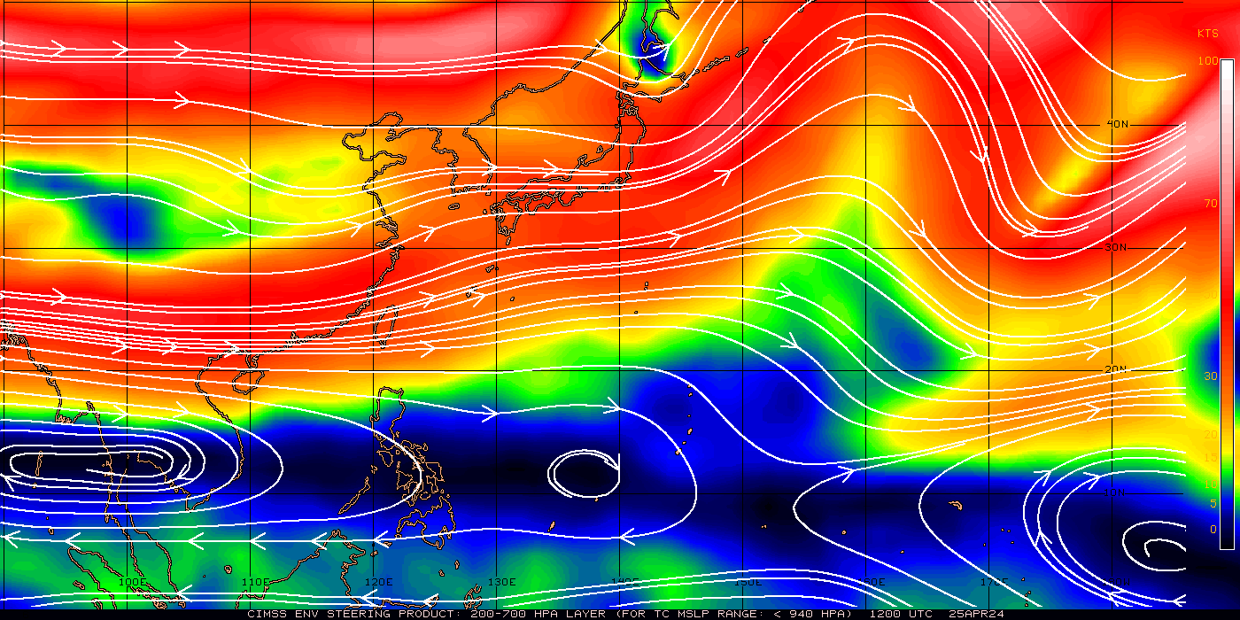
Check out the water vapor loop and look at the shortwave over the southern China/northern Vietnam area. As that moves east, it will likely begin to shear out, but my thinking is that it will allow enough of a weakness in the subtropical ridging that Maysak will be able to exploit it. It won't be much, but I don't think it will take as much as some think for Maysak to have a large poleward component to its motion.

0 likes
Contract Meteorologist. TAMU & MSST. Fiercely authentic, one of a kind. We are all given free will, so choose a life meant to be lived. We are the Masters of our own Stories.
Opinions expressed are mine alone.
Follow me on Twitter at @1900hurricane : Read blogs at https://1900hurricane.wordpress.com/
Opinions expressed are mine alone.
Follow me on Twitter at @1900hurricane : Read blogs at https://1900hurricane.wordpress.com/
-
xtyphooncyclonex
- Category 5
- Posts: 3891
- Age: 24
- Joined: Sat Dec 08, 2012 9:07 am
- Location: Cebu City
- Contact:
This is simply the most impressive April/March typhoon, even more than Isa, Mitag and the rest!
It somewhat reminds me of Halong and Cristina in structure

It somewhat reminds me of Halong and Cristina in structure
0 likes
REMINDER: My opinions that I, or any other NON Pro-Met in this forum, are unofficial. Please do not take my opinions as an official forecast and warning. I am NOT a meteorologist. Following my forecasts blindly may lead to false alarm, danger and risk if official forecasts from agencies are ignored.
-
HurricaneTracker2031
- Tropical Storm

- Posts: 248
- Age: 26
- Joined: Fri Jul 19, 2013 7:20 pm
- Location: Pembroke Pines, FL, USA
- Contact:
Re: WPAC: MAYSAK - Typhoon
Maysak has come a long way over the past 12 hours or so. It is now approaching Super Typhoon status as it nears Yap. People residing in the storm's path should pay close attention. Also, I think a Philippines landfall is more likely now.

Analysis for Typhoon Maysak: http://goo.gl/nDnUkP
Personal Forecast Disclaimer:
The posts in this forum are NOT official forecast and should not be used as such. They are just the opinion of the poster and may or may not be backed by sound meteorological data. They are NOT endorsed by any professional institution or storm2k.org. For official information, please refer to the NHC and NWS products.
0 likes
SHORT VERSION OF DISCLAIMER: THIS SITE LINK BELOW IS NOT AN OFFICIAL FORECASTING OFFICE AND SHOULD NOT BE USED TO MAKE ANY EMERGENCY DECISIONS....
http://www.macstropicalweather.weebly.com
http://www.macstropicalweather.weebly.com
-
dexterlabio
- Category 5
- Posts: 3503
- Joined: Sat Oct 24, 2009 11:50 pm
Re: WPAC: MAYSAK - Typhoon
TPPN10 PGTW 310313
A. TYPHOON 04W (MAYSAK)
B. 31/0232Z
C. 9.75N
D. 141.90E
E. ONE/MTSAT
F. T7.0/7.0/D2.0/24HRS STT: D1.0/03HRS
G. IR/EIR/VIS/MSI
H. REMARKS: 07A/PBO IRREG EYE/ANMTN. WMG EYE SURROUNDED BY W
(+1.0 ADJUSTMENT FOR WHITE) YIELDS A DT OF 7.0. MET AND PT WERE
6.5. DBO DT.
I. ADDITIONAL POSITIONS:
30/2122Z 9.42N 143.05E SSMS
30/2226Z 9.52N 142.88E SSMS
30/2351Z 9.58N 142.48E GPMI
31/0039Z 9.67N 142.35E MMHS
LONG
Maysak will be a rare March super typhoon just in time...
0 likes
Personal Forecast Disclaimer:
The posts in this forum are NOT official forecast and should not be used as such. They are just the opinion of the poster and may or may not be backed by sound meteorological data. They are NOT endorsed by any professional institution or storm2k.org. For official information, please refer to the NHC and NWS products.
The posts in this forum are NOT official forecast and should not be used as such. They are just the opinion of the poster and may or may not be backed by sound meteorological data. They are NOT endorsed by any professional institution or storm2k.org. For official information, please refer to the NHC and NWS products.
-
dexterlabio
- Category 5
- Posts: 3503
- Joined: Sat Oct 24, 2009 11:50 pm
Re:
1900hurricane wrote:Check out the water vapor loop and look at the shortwave over the southern China/northern Vietnam area. As that moves east, it will likely begin to shear out, but my thinking is that it will allow enough of a weakness in the subtropical ridging that Maysak will be able to exploit it. It won't be much, but I don't think it will take as much as some think for Maysak to have a large poleward component to its motion.
Agreed to this....though it will be crucial when the trough clears and Maysak reaches the 130E line, whether the high pressure ridge over China will take over the steering... IMO it will nudge westward from that point, as it succumbs to dry air, higher pressure, increased VWS...
0 likes
Personal Forecast Disclaimer:
The posts in this forum are NOT official forecast and should not be used as such. They are just the opinion of the poster and may or may not be backed by sound meteorological data. They are NOT endorsed by any professional institution or storm2k.org. For official information, please refer to the NHC and NWS products.
The posts in this forum are NOT official forecast and should not be used as such. They are just the opinion of the poster and may or may not be backed by sound meteorological data. They are NOT endorsed by any professional institution or storm2k.org. For official information, please refer to the NHC and NWS products.
-
xtyphooncyclonex
- Category 5
- Posts: 3891
- Age: 24
- Joined: Sat Dec 08, 2012 9:07 am
- Location: Cebu City
- Contact:
No longer gaining MUCH latitude, however.. That's why I'm favoring consistently my forecast. No trough to the north. If there is however, it would not be close enough to break the STR, and not strong enough (like Hagupit)
0 likes
REMINDER: My opinions that I, or any other NON Pro-Met in this forum, are unofficial. Please do not take my opinions as an official forecast and warning. I am NOT a meteorologist. Following my forecasts blindly may lead to false alarm, danger and risk if official forecasts from agencies are ignored.
-
1900hurricane
- Category 5
- Posts: 6063
- Age: 34
- Joined: Fri Feb 06, 2015 12:04 pm
- Location: Houston, TX
- Contact:
T7.0 from PGTW likely means 135 kt in the trackfile at 06Z. Maysak is really looking good right now. Looking at the BD curve IR, the ring of white and colder has become much more symmetric around a warm medium grey eye of 15*C+. It'll be interesting to see if the cold medium greys expand in coverage after the sun goes down.
Last edited by 1900hurricane on Mon Mar 30, 2015 10:45 pm, edited 1 time in total.
0 likes
Contract Meteorologist. TAMU & MSST. Fiercely authentic, one of a kind. We are all given free will, so choose a life meant to be lived. We are the Masters of our own Stories.
Opinions expressed are mine alone.
Follow me on Twitter at @1900hurricane : Read blogs at https://1900hurricane.wordpress.com/
Opinions expressed are mine alone.
Follow me on Twitter at @1900hurricane : Read blogs at https://1900hurricane.wordpress.com/
-
xtyphooncyclonex
- Category 5
- Posts: 3891
- Age: 24
- Joined: Sat Dec 08, 2012 9:07 am
- Location: Cebu City
- Contact:
Re:
Alyono wrote:still moving WNW. Yap should not receive more than low end TS winds at this rate
WNW or north of west?
Maybe you are referring to its previous movement. Last night, (our time) in every warning Maysak gained .3-.4 degrees in latitude. Now, just a fraction of it is gained.

0 likes
REMINDER: My opinions that I, or any other NON Pro-Met in this forum, are unofficial. Please do not take my opinions as an official forecast and warning. I am NOT a meteorologist. Following my forecasts blindly may lead to false alarm, danger and risk if official forecasts from agencies are ignored.
-
1900hurricane
- Category 5
- Posts: 6063
- Age: 34
- Joined: Fri Feb 06, 2015 12:04 pm
- Location: Houston, TX
- Contact:
Re: WPAC: MAYSAK - Typhoon
spiral wrote:Don't think that trough will have any affect cant see it reaching anywhere near 20 N to do any damage.
It already is at 20*N. It's not a bruiser, but you can sample some of the height falls associated with the shortwave by comparing the 00Z sounding data between Laoag and Haikou.


0 likes
Contract Meteorologist. TAMU & MSST. Fiercely authentic, one of a kind. We are all given free will, so choose a life meant to be lived. We are the Masters of our own Stories.
Opinions expressed are mine alone.
Follow me on Twitter at @1900hurricane : Read blogs at https://1900hurricane.wordpress.com/
Opinions expressed are mine alone.
Follow me on Twitter at @1900hurricane : Read blogs at https://1900hurricane.wordpress.com/
-
xtyphooncyclonex
- Category 5
- Posts: 3891
- Age: 24
- Joined: Sat Dec 08, 2012 9:07 am
- Location: Cebu City
- Contact:
Re: WPAC: MAYSAK - Typhoon
1900hurricane wrote:spiral wrote:Don't think that trough will have any affect cant see it reaching anywhere near 20 N to do any damage.
It already is at 20*N. It's not a bruiser, but you can sample some of the height falls associated with the shortwave by comparing the 00Z sounding data between Laoag and Haikou.
So you're saying the trough will break RIGHT through the STR? How about how strong the STR is? Height falls would not necessarily change the direction of movement, probably just make Maysak temporarily decelerate. It is merely a slight break, and does not really mean a weakness. Also important to note that the STR actually is located over Central Luzon, not over the northern part.
0 likes
REMINDER: My opinions that I, or any other NON Pro-Met in this forum, are unofficial. Please do not take my opinions as an official forecast and warning. I am NOT a meteorologist. Following my forecasts blindly may lead to false alarm, danger and risk if official forecasts from agencies are ignored.
-
xtyphooncyclonex
- Category 5
- Posts: 3891
- Age: 24
- Joined: Sat Dec 08, 2012 9:07 am
- Location: Cebu City
- Contact:
From WesternPacificWeather:
And JMA forecast goes down to 925 hPa.
Interesting fact, if Maysak drops below 930hpa in pressure today it will be the strongest typhoon in history prior to April. Now at 935hpa. (Weather 101, lower the pressure in a typhoon the stronger the storm)
And JMA forecast goes down to 925 hPa.
0 likes
REMINDER: My opinions that I, or any other NON Pro-Met in this forum, are unofficial. Please do not take my opinions as an official forecast and warning. I am NOT a meteorologist. Following my forecasts blindly may lead to false alarm, danger and risk if official forecasts from agencies are ignored.
Who is online
Users browsing this forum: No registered users and 90 guests