Saved animated GIF from that loop

I'm using a tool called ScreenToGif, open source, for the PC: https://screentogif.codeplex.com/
Moderator: S2k Moderators

ronjon wrote:NDG wrote:It appears to me that the circulation just east of Key West is just yet another eddy rotating WSW around the larger circulation, mid level circulation is much closer now.
Agreed NDG. Thinking low pressure will have to eventually form underneath that mid level center. But it needs more convection to do that.

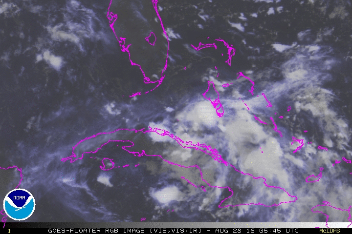


GCANE wrote:Obviously getting a feed of dry air in from the north.
http://www.ssd.noaa.gov/PS/TROP/floater ... -long.html
Looks like skys are clear over much of S FL.
Expecting to see pop up convection this afternoon over FL feed into 99L and moisten the mid levels.
Could help develop it Sunday night.


jlauderdal wrote:GCANE wrote:Obviously getting a feed of dry air in from the north.
http://www.ssd.noaa.gov/PS/TROP/floater ... -long.html
Looks like skys are clear over much of S FL.
Expecting to see pop up convection this afternoon over FL feed into 99L and moisten the mid levels.
Could help develop it Sunday night.
its cleared out over sofla...breezy and partly cloudy, no sign of heavy rains


panamatropicwatch wrote:I believe the main circulation to be in the vicinity of the circled area.
the clear out ended...raining ne fllnand lowering cloud deck to the eastGCANE wrote:jlauderdal wrote:GCANE wrote:Obviously getting a feed of dry air in from the north.
http://www.ssd.noaa.gov/PS/TROP/floater ... -long.html
Looks like skys are clear over much of S FL.
Expecting to see pop up convection this afternoon over FL feed into 99L and moisten the mid levels.
Could help develop it Sunday night.
its cleared out over sofla...breezy and partly cloudy, no sign of heavy rains
CAPE over the glades went from 1500 to 2500 the last 15 min.
Sun could continue to destabilize the air.
Users browsing this forum: No registered users and 49 guests


