Alyono wrote:TropicalSailor wrote:Alyono wrote:Ignore what TWC is saying. They are saying this is intensifying
Recon found a slightly higher pressure.
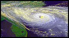
A simple look at a visible satellite image shows this is actually LESS organized. The convective burst has died leaving only cirrus
The longer this thing stays disorganized and weak while almost stalling out does that increase any chance we see a more westward track as in LA/Panhandle or do you still expect a NE turn?
not going to Louisiana. Slower track has implications for the Mid Atlantic and New England
ATL: HERMINE - Post-Tropical - Discussion
Moderator: S2k Moderators
-
Stormcenter
- S2K Supporter

- Posts: 6689
- Joined: Wed Sep 03, 2003 11:27 am
- Location: Houston, TX
Re: ATL: NINE - Tropical Depression - Discussion
Atlantic and New England? It needs to survive the GOM shear first.
1 likes
-
ConvergenceZone
.gif)
- Category 5

- Posts: 5241
- Joined: Fri Jul 29, 2005 1:40 am
- Location: Northern California
Re: ATL: NINE - Tropical Depression - Discussion
Alyono wrote:Ignore what TWC is saying. They are saying this is intensifying
Recon found a slightly higher pressure.
A simple look at a visible satellite image shows this is actually LESS organized. The convective burst has died leaving only cirrus
Per your comments above, do you think this will be downgraded to a wave? I guess we'll have to wait until recon gets in there again later to see if they are still finding a closed circulation
1 likes
-
CrazyC83
- Professional-Met

- Posts: 34315
- Joined: Tue Mar 07, 2006 11:57 pm
- Location: Deep South, for the first time!
Re: ATL: NINE - Recon
000
URNT15 KWBC 301809
NOAA3 0909A CYCLONE HDOB 14 20160830
180000 2330N 08609W 9256 00756 0085 +228 +205 220028 029 027 000 00
180030 2329N 08607W 9251 00760 0085 +224 +207 223027 028 026 000 00
180100 2327N 08606W 9251 00760 0085 +226 +196 222028 029 025 000 00
180130 2326N 08604W 9250 00762 0086 +225 +193 222028 029 027 000 00
180200 2325N 08603W 9249 00764 0087 +225 +192 220028 028 028 001 00
180230 2323N 08601W 9249 00764 0089 +218 +200 223031 032 027 000 00
180300 2322N 08600W 9249 00765 0090 +220 +197 222033 033 028 000 00
180330 2321N 08559W 9249 00765 0090 +221 +202 223031 033 026 000 00
180400 2320N 08557W 9250 00766 0091 +220 +203 222031 032 027 000 00
180430 2318N 08556W 9250 00767 0092 +223 +193 219031 032 026 000 00
180500 2317N 08554W 9252 00766 0092 +225 +198 222029 030 027 000 00
180530 2315N 08553W 9249 00769 0094 +222 +193 219029 029 026 000 00
180600 2314N 08552W 9250 00768 0093 +227 +184 219029 030 026 000 00
180630 2313N 08550W 9252 00766 0093 +231 +180 220028 029 027 000 00
180700 2312N 08549W 9249 00770 0092 +234 +174 218028 028 026 000 00
180730 2310N 08547W 9252 00768 0094 +230 +171 217029 029 027 000 00
180800 2309N 08546W 9251 00770 0096 +231 +170 216031 032 026 000 00
180830 2309N 08544W 9255 00769 0099 +229 +174 216032 032 026 000 03
180900 2311N 08544W 9250 00773 0097 +230 +169 215032 032 029 000 00
180930 2313N 08544W 9251 00771 0096 +232 +170 212032 032 028 000 00
I can only post for the next 30-40 minutes or so.
0 likes
-
Florida1118
Re: ATL: NINE - Tropical Depression - Discussion
ConvergenceZone wrote:Alyono wrote:Ignore what TWC is saying. They are saying this is intensifying
Recon found a slightly higher pressure.
A simple look at a visible satellite image shows this is actually LESS organized. The convective burst has died leaving only cirrus
Per your comments above, do you think this will be downgraded to a wave? I guess we'll have to wait until recon gets in there again later to see if they are still finding a closed circulation
They just sent a VDM. It didn't open up into a wave.
1 likes
-
Stormcenter
- S2K Supporter
- Posts: 6689
- Joined: Wed Sep 03, 2003 11:27 am
- Location: Houston, TX
Re: ATL: NINE - Tropical Depression - Discussion
Looks like area north of Yucatan has a better spin to it than the NHC's center. IMO
http://www.ssd.noaa.gov/goes/east/gmex/flash-vis.html
http://www.ssd.noaa.gov/goes/east/gmex/flash-vis.html
1 likes
-
StormHunter72
- Tropical Storm

- Posts: 166
- Joined: Wed May 25, 2016 6:36 am
- Location: Nature Coast
Re: ATL: NINE - Tropical Depression - Discussion
listen to experts. Trying to get info. Fluff posts are useless for those in the path.Stormcenter wrote:Looks like area north of Yucatan has a better spin to it than the NHC's center. IMO
http://www.ssd.noaa.gov/goes/east/gmex/flash-vis.html
1 likes
The following post is NOT an official forecast and should not be used as such. It is just the opinion of the poster and may or may not be backed by sound meteorological data. It is NOT endorsed by any professional institution including storm2k.org For Official Information please refer to the NHC and NWS products.
-
Frank P
- S2K Supporter
- Posts: 2779
- Joined: Fri Aug 29, 2003 10:52 am
- Location: Biloxi Beach, Ms
- Contact:
Re: ATL: NINE - Tropical Depression - Discussion
Stormcenter wrote:Looks like area north of Yucatan has a better spin to it than the NHC's center. IMO
http://www.ssd.noaa.gov/goes/east/gmex/flash-vis.html
Does looks better down there, but overall what a big mess.... gotta be a big stacking issue...
Last edited by Frank P on Tue Aug 30, 2016 1:18 pm, edited 1 time in total.
1 likes
-
ConvergenceZone
- Category 5
- Posts: 5241
- Joined: Fri Jul 29, 2005 1:40 am
- Location: Northern California
Re: ATL: NINE - Tropical Depression - Discussion
Florida1118 wrote:ConvergenceZone wrote:Alyono wrote:Ignore what TWC is saying. They are saying this is intensifying
Recon found a slightly higher pressure.
A simple look at a visible satellite image shows this is actually LESS organized. The convective burst has died leaving only cirrus
Per your comments above, do you think this will be downgraded to a wave? I guess we'll have to wait until recon gets in there again later to see if they are still finding a closed circulation
They just sent a VDM. It didn't open up into a wave.
I meant when they check later, since it's health appears to be declining
1 likes
-
Florida1118
Re: ATL: NINE - Tropical Depression - Discussion
ConvergenceZone wrote:Florida1118 wrote:ConvergenceZone wrote:
Per your comments above, do you think this will be downgraded to a wave? I guess we'll have to wait until recon gets in there again later to see if they are still finding a closed circulation
They just sent a VDM. It didn't open up into a wave.
I meant when they check later, since it's health appears to be declining
I wouldn't think so. It's not something the NHC or the NWS has mentioned, and the models (for what it's worth) have not been dropping it. I don't think that is a solution, at least as of now.
1 likes
-
CrazyC83
- Professional-Met
- Posts: 34315
- Joined: Tue Mar 07, 2006 11:57 pm
- Location: Deep South, for the first time!
Re: ATL: NINE - Recon
000
URNT15 KWBC 301819
NOAA3 0909A CYCLONE HDOB 15 20160830
181000 2315N 08544W 9250 00772 0097 +231 +170 215031 032 028 000 00
181030 2317N 08544W 9253 00770 0096 +234 +169 216030 030 028 000 00
181100 2320N 08544W 9251 00770 0096 +233 +170 215030 030 028 000 00
181130 2322N 08544W 9252 00769 0095 +233 +176 214028 029 030 000 00
181200 2324N 08544W 9253 00768 0094 +232 +178 214029 029 029 000 00
181230 2326N 08544W 9253 00767 0093 +230 +189 212029 030 027 000 00
181300 2328N 08544W 9252 00767 0093 +226 +191 210030 030 026 000 00
181330 2330N 08544W 9250 00768 0093 +224 +195 209029 030 024 000 00
181400 2332N 08544W 9255 00765 0094 +224 +195 211030 030 026 000 00
181430 2334N 08544W 9253 00765 0094 +222 +195 211030 031 027 000 00
181500 2336N 08544W 9255 00764 0094 +222 +199 213030 031 028 000 00
181530 2338N 08544W 9253 00764 0092 +223 +198 211029 030 027 000 00
181600 2341N 08544W 9254 00764 0092 +225 +194 211030 030 027 000 00
181630 2343N 08544W 9252 00764 0092 +225 +196 209030 030 028 000 00
181700 2345N 08544W 9254 00764 0092 +223 +199 208029 029 027 000 00
181730 2347N 08544W 9253 00764 0092 +222 +202 209029 029 028 000 00
181800 2349N 08544W 9254 00763 0091 +222 +205 208027 027 026 001 00
181830 2351N 08544W 9256 00762 0092 +222 +203 212027 028 028 000 00
181900 2353N 08544W 9253 00763 0091 +222 +206 212026 027 027 000 00
181930 2355N 08544W 9255 00762 0091 +223 +208 210025 026 026 000 00
0 likes


Re: ATL: NINE - Tropical Depression - Discussion
ConvergenceZone wrote:Florida1118 wrote:ConvergenceZone wrote:
Per your comments above, do you think this will be downgraded to a wave? I guess we'll have to wait until recon gets in there again later to see if they are still finding a closed circulation
They just sent a VDM. It didn't open up into a wave.
I meant when they check later, since it's health appears to be declining
It's still popping convection but yes, it has some ways to go. However, Euro 12z run just came out and showed a strong Cat 2 hurricane heading for the big bend. So..just keep watching.
1 likes
The posts or stuff said are NOT an official forecast. Please look to the NHC and NWS for official forecasts and products.
Floyd-1999, Frances-2004, Jeanne-2004, Fay-2008, Beryl-2012, Debby-2012, Colin-2016, Hermine-2016, Julia-2016, Matthew-2016, Irma-2017, Elsa-2021, Idalia-2023, Debby-2024, Helene-2024.
Go Gators! Go Jags!
Floyd-1999, Frances-2004, Jeanne-2004, Fay-2008, Beryl-2012, Debby-2012, Colin-2016, Hermine-2016, Julia-2016, Matthew-2016, Irma-2017, Elsa-2021, Idalia-2023, Debby-2024, Helene-2024.
Go Gators! Go Jags!
-
wxmann_91

- Category 5
- Posts: 8007
- Age: 34
- Joined: Fri Jul 15, 2005 2:49 pm
- Location: Southern California
- Contact:
Re: ATL: NINE - Tropical Depression - Discussion
JaxGator wrote:ConvergenceZone wrote:Florida1118 wrote:They just sent a VDM. It didn't open up into a wave.
I meant when they check later, since it's health appears to be declining
It's still popping convection but yes, it has some ways to go. However, Euro 12z run just came out and showed a strong Cat 2 hurricane heading for the big bend. So..just keep watching.
Euro is useless for this system.
2 likes

Re: ATL: NINE - Tropical Depression - Discussion
IMO I don't think one run that they have showed can be correct. we don't even know where the center is, and are they rolling the dice on it getting pulled ne?
1 likes
Re: ATL: NINE - Tropical Depression - Discussion
Something to ponder....I know the local METS have been showing larger rainfall totals on the Florida West Coast. They are seeming to ignore one thing we see all the time....the June Tropical Storm effect. If this entity never fully stacks, battles shear and then gets whipped NE...most of the convection could possible be in the Atlantic before the center makes landfall...and convection moving at a very good clip as well. If it stays weaker, also wont have as strong a helicity for tornadic development. It is always wise to never turn your back on a storm in the fishbowl...but if it continues on its current course at this present state or slightly stronger...we may be very fortunate to not see much of anything but some blustery showers...fingers crossed.
0 likes
Re: ATL: NINE - Tropical Depression - Discussion
wxmann_91 wrote:JaxGator wrote:ConvergenceZone wrote:
I meant when they check later, since it's health appears to be declining
It's still popping convection but yes, it has some ways to go. However, Euro 12z run just came out and showed a strong Cat 2 hurricane heading for the big bend. So..just keep watching.
Euro is useless for this system.
It wasn't a forecast. It was an observation.
1 likes
The posts or stuff said are NOT an official forecast. Please look to the NHC and NWS for official forecasts and products.
Floyd-1999, Frances-2004, Jeanne-2004, Fay-2008, Beryl-2012, Debby-2012, Colin-2016, Hermine-2016, Julia-2016, Matthew-2016, Irma-2017, Elsa-2021, Idalia-2023, Debby-2024, Helene-2024.
Go Gators! Go Jags!
Floyd-1999, Frances-2004, Jeanne-2004, Fay-2008, Beryl-2012, Debby-2012, Colin-2016, Hermine-2016, Julia-2016, Matthew-2016, Irma-2017, Elsa-2021, Idalia-2023, Debby-2024, Helene-2024.
Go Gators! Go Jags!
-
Wx_Warrior
- Category 5
- Posts: 2718
- Joined: Thu Aug 03, 2006 3:58 pm
- Location: Beaumont, TX
Re: ATL: NINE - Tropical Depression - Discussion
Euro much stronger at landfall in 12z run south of Tallahassee, fyi

1 likes
-
Soonercane
Re: ATL: NINE - Tropical Depression - Discussion
whatacane wrote:IMO I don't think one run that they have showed can be correct. we don't even know where the center is, and are they rolling the dice on it getting pulled ne?
No the turn to the NE is very likely given guidance (and the mid-level trough which will pull it to the northeast is a synoptic scale feature which global models generally handle fairly well in the medium range).
1 likes
-
Florida1118
Re: ATL: NINE - Tropical Depression - Discussion
whatacane wrote:IMO I don't think one run that they have showed can be correct. we don't even know where the center is, and are they rolling the dice on it getting pulled ne?
Literally every model, from the least reliable, to the most, all show it going Northeast. It's final destination is unknown, but there is very good agreement on it going towards the Northeast; it certainly is not a roll of the dice. Intensity is a bit of a gamble, but track is not.
1 likes
Re: ATL: NINE - Tropical Depression - Discussion
Florida1118 wrote:whatacane wrote:IMO I don't think one run that they have showed can be correct. we don't even know where the center is, and are they rolling the dice on it getting pulled ne?
Literally every model, from the least reliable, to the most, all show it going Northeast. It's final destination is unknown, but there is very good agreement on it going towards the Northeast; it certainly is not a roll of the dice. Intensity is a bit of a gamble, but track is not.
The reason I doubt it is because this thing is still moving w from what I think I see? well I guess we will know soon enough!
1 likes
-
CrazyC83
- Professional-Met
- Posts: 34315
- Joined: Tue Mar 07, 2006 11:57 pm
- Location: Deep South, for the first time!
Re: ATL: NINE - Recon
000
URNT15 KWBC 301829
NOAA3 0909A CYCLONE HDOB 16 20160830
182000 2357N 08544W 9255 00762 0091 +223 +207 209024 025 026 000 00
182030 2359N 08544W 9253 00763 0089 +225 +202 209023 024 027 000 00
182100 2401N 08544W 9253 00763 0090 +226 +205 205022 023 026 000 00
182130 2403N 08544W 9253 00762 0088 +227 +206 208022 023 027 000 00
182200 2406N 08544W 9256 00760 0089 +226 +212 203023 024 025 000 00
182230 2408N 08544W 9255 00760 0088 +226 +214 200024 024 025 000 00
182300 2410N 08544W 9257 00758 0088 +227 +210 203024 025 025 000 00
182330 2412N 08544W 9251 00763 0088 +225 +213 200025 026 023 000 00
182400 2414N 08544W 9255 00761 0088 +226 +212 199025 026 023 000 00
182430 2416N 08544W 9255 00761 0088 +227 +209 200024 024 022 000 00
182500 2418N 08544W 9256 00760 0088 +228 +204 196024 024 021 001 00
182530 2420N 08544W 9252 00762 0086 +228 +209 190023 024 024 001 00
182600 2422N 08544W 9255 00760 0088 +227 +215 192023 024 025 000 00
182630 2424N 08544W 9255 00760 0087 +226 +216 190024 025 024 000 00
182700 2426N 08544W 9252 00762 0087 +227 +217 187023 024 025 000 00
182730 2428N 08543W 9256 00760 0088 +228 +219 182024 025 024 000 00
182800 2430N 08544W 9257 00759 0087 +229 +215 186023 024 025 000 00
182830 2432N 08544W 9254 00762 0088 +232 +207 185022 022 026 000 00
182900 2434N 08545W 9255 00766 0094 +230 +209 185023 023 025 000 00
182930 2436N 08545W 9256 00763 0091 +230 +209 182024 024 025 000 00
0 likes
Who is online
Users browsing this forum: No registered users and 54 guests