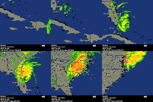
ATL: COLIN - Post-Tropical - Discussion

Moderator: S2k Moderators

Message
Author
User avatar
AJC3
Admin
Admin
Posts: 3998
Age: 61
Joined: Tue Aug 31, 2004 7:04 pm
Location: West Melbourne, Florida
Contact:

Re: ATL: COLIN - Tropical Storm - Discussion

#601 Postby AJC3 » Sun Jun 05, 2016 5:55 pm

northjaxpro wrote:Also, with the models suddenly indicating a stronger Colin making landfall on the peninsula by tomorrow evening, I would have to believe the Storm Prediction Center out in Oklahoma City will probably increase the threat level for tornadoes from slight to marginal for the next 36 hours. I am really growing concerned about the tornado threat all across the peninsula the next 36 hours or so.


You probably meant to say from "Slight" to "Enhanced". "Marginal" is the category below "Slight"
0 likes   

User avatar
gatorcane
S2K Supporter
S2K Supporter
Posts: 23689
Age: 47
Joined: Sun Mar 13, 2005 3:54 pm
Location: Boca Raton, FL

Re: ATL: COLIN - Tropical Storm - Discussion

#602 Postby gatorcane » Sun Jun 05, 2016 5:56 pm

Very intense blowup of convection underway along northern coast of Yucatan and south of the center
0 likes   

User avatar
cycloneye
Admin
Admin
Posts: 143879
Age: 68
Joined: Thu Oct 10, 2002 10:54 am
Location: San Juan, Puerto Rico

Re: ATL: COLIN - Recon

#603 Postby cycloneye » Sun Jun 05, 2016 5:57 pm

Mission is over.
0 likes   
Visit the Caribbean-Central America Weather Thread where you can find at first post web cams,radars
and observations from Caribbean basin members Click Here

tolakram
Admin
Admin
Posts: 19990
Age: 61
Joined: Sun Aug 27, 2006 8:23 pm
Location: Florence, KY (name is Mark)

Re: ATL: COLIN - Models

#604 Postby tolakram » Sun Jun 05, 2016 5:59 pm

HWRF running, pretty far south for landfall.

Image
0 likes   
M a r k
- - - - -
Join us in chat: Storm2K Chatroom Invite. Android and IOS apps also available.

The posts in this forum are NOT official forecasts and should not be used as such. Posts are NOT endorsed by any professional institution or STORM2K.org. For official information and forecasts, please refer to NHC and NWS products.

User avatar
northjaxpro
S2K Supporter
S2K Supporter
Posts: 8900
Joined: Mon Sep 27, 2010 11:21 am
Location: Jacksonville, FL

Re: ATL: COLIN - Tropical Storm - Discussion

#605 Postby northjaxpro » Sun Jun 05, 2016 5:59 pm

AJC3 wrote:
northjaxpro wrote:Also, with the models suddenly indicating a stronger Colin making landfall on the peninsula by tomorrow evening, I would have to believe the Storm Prediction Center out in Oklahoma City will probably increase the threat level for tornadoes from slight to marginal for the next 36 hours. I am really growing concerned about the tornado threat all across the peninsula the next 36 hours or so.


You probably meant to say from "Slight" to "Enhanced". "Marginal" is the category below "Slight"


LOL.. You are right AJC3. I did not even realized that I had misstated like that. I have been monitoring everything here today. But, thanks. Yeah, I meant to say from slight to Enhanced. I am worried about the tornado risk tomorrow here and all over the state, especially with Colin organizing unexpectedly well.
Last edited by northjaxpro on Sun Jun 05, 2016 6:00 pm, edited 1 time in total.
0 likes   
NEVER, EVER SAY NEVER in the tropics and weather in general, and most importantly, with life itself!!

________________________________________________________________________________________

Fay 2008 Beryl 2012 Debby 2012 Colin 2016 Hermine 2016 Julia 2016 Matthew 2016 Irma 2017 Dorian 2019

emeraldislenc
Category 2
Category 2
Posts: 558
Joined: Fri Aug 24, 2012 4:49 pm
Location: Emerald Isle NC

Re: ATL: COLIN - Tropical Storm - Discussion

#606 Postby emeraldislenc » Sun Jun 05, 2016 5:59 pm

You are right very intense blow up.
0 likes   

User avatar
MetroMike
Category 4
Category 4
Posts: 943
Joined: Sun Aug 29, 2004 8:13 pm
Location: Tampa Bay
Contact:

Re: ATL: COLIN - Tropical Storm - Discussion

#607 Postby MetroMike » Sun Jun 05, 2016 6:02 pm

AJC3 wrote:
northjaxpro wrote:Also, with the models suddenly indicating a stronger Colin making landfall on the peninsula by tomorrow evening, I would have to believe the Storm Prediction Center out in Oklahoma City will probably increase the threat level for tornadoes from slight to marginal for the next 36 hours. I am really growing concerned about the tornado threat all across the peninsula the next 36 hours or so.


You probably meant to say from "Slight" to "Enhanced". "Marginal" is the category below "Slight"

That is very much a possibility but for now it's only slight risk
0 likes   

User avatar
chaser1
S2K Supporter
S2K Supporter
Posts: 5407
Age: 64
Joined: Sat Oct 15, 2005 5:59 pm
Location: Longwood, Fl

Re: ATL: COLIN - Tropical Storm - Discussion

#608 Postby chaser1 » Sun Jun 05, 2016 6:03 pm

johngaltfla wrote:
NDG wrote:Recon finds windshift much further east and south than earlier estimated by the NHC on its latest advisory.
Just as I thought :)


That was a good call. Now I wonder as the LLC and MLC migrate together as it appears to be at an angle, if we end up with a big change in trajectory later.


I'm still here shaking my head at the Depression upgrade, and now its a T.S. lol? Well, i'm guessing there's gonna be some serious organization changes tonight as we begin to see a much better consolitation and an eastward shift to the COC. That was a good find, NDG. I'd guess this farther east and south wind shift is indicative of falling pressures under what many of us were looking at closer to the MLC. I do think this will likely bring the center of Colin (and certainly the associated heavy weather) at a closer parellel to Florida. I also think coastal areas near Ft. Myers, Tampa and points north, will likely see a bigger flooding risk than what we might have thought 12-24 hours ago.

By the way, I don't think anyone has touched on this but not only does this track comfortably fall within climotology, but also in agreement with many of our own assumptions regarding where this season's storm tracks might pose a bit more of a threat. I've learned many years ago that an early track such as this, is often a harbinger something stronger yet to come.
0 likes   
Andy D

(For official information, please refer to the NHC and NWS products.)

caneman
Category 5
Category 5
Posts: 1446
Joined: Fri Sep 05, 2014 5:44 am
Location: Clearwater Beach, Fl

Re: ATL: COLIN - Tropical Storm - Discussion

#609 Postby caneman » Sun Jun 05, 2016 6:09 pm

Chaser1, not to be confrontational by why are you shaking your head at the upgrade? It seems warranted to me. There have been enough numerous reportings of upward to 40 - 50 mph winds, wind shift etc?? Heck, we're getting pelted by a serious feeder band right now with heavy wind and rain. One of the models now takes it up to high end tropical storm. If you're expecting a beautiful storm in June it just doesn't happen and this isn't the time to for the nhc to play games.
Last edited by caneman on Sun Jun 05, 2016 6:17 pm, edited 2 times in total.
0 likes   

User avatar
tropicwatch
Category 5
Category 5
Posts: 3364
Age: 61
Joined: Sat Jun 02, 2007 10:01 am
Location: Panama City Florida
Contact:

Re: ATL: COLIN - Tropical Storm - Discussion

#610 Postby tropicwatch » Sun Jun 05, 2016 6:11 pm

Vortex message and is west not east of previous HH spot.
roduct: Air Force Vortex Message (URNT12 KNHC)
Transmitted: 5th day of the month at 23:00Z
Agency: United States Air Force
Aircraft: Lockheed WC-130J Hercules with reg. number AF98-5307
Tropical Depression: Three (flight in the North Atlantic basin)
Mission Number: 1
Observation Number: 15
A. Time of Center Fix: 5th day of the month at 22:14:20Z
B. Center Fix Coordinates: 22°57'N 87°47'W (22.95N 87.7833W)
C. Minimum Height at Standard Level: Not Available
D. Estimated (by SFMR or visually) Maximum Surface Wind: 31kts (~ 35.7mph)
E. Location of the Estimated Maximum Surface Wind: 145 nautical miles (167 statute miles) to the NE/ENE (56°) of center fix
F. Maximum Flight Level Wind Inbound: From 122° at 34kts (From the ESE at ~ 39.1mph)
G. Location of Maximum Flight Level Wind Inbound: 148 nautical miles (170 statute miles) to the ENE (57°) of center fix
H. Minimum Sea Level Pressure: 1005mb (29.68 inHg) - Extrapolated
I. Maximum Flight Level Temp & Pressure Altitude Outside Eye: 23°C (73°F) at a pressure alt. of 399m (1,309ft)
J. Maximum Flight Level Temp & Pressure Altitude Inside Eye: 24°C (75°F) at a pressure alt. of 396m (1,299ft)
K. Dewpoint Temp & Sea Surface Temp (collected at same location as temp inside eye): Not Available
L. Eye Character: Not Available
M. Eye Shape: Not Available
N. Fix Determined By: Penetration, Wind and Pressure
N. Fix Level: 1,500 feet
O. Navigational Fix Accuracy: 0.02 nautical miles
O. Meteorological Accuracy: 20 nautical miles

Remarks Section:
Maximum Flight Level Wind: 43kts (~ 49.5mph) which was observed 152 nautical miles (175 statute miles) to the ENE (61°) from the flight level center at 21:23:00Z
Sea Level Pressure Extrapolation From: Below 1,500 feet
Maximum Flight Level Temp: 24°C (75°F) which was observed 11 nautical miles (13 statute miles) to the ENE (59°) from the flight level center
General Notes About Vortex Messages:
- Reported winds are usually averaged over a 10 second period. (NHC advisory wind speeds are the highest expected winds averaged over a 1 minute period.)
- The maximum flight level temperature outside the eye (item I.) "is taken just outside the central region of a cyclone (i.e., just outside the eyewall or just beyond the maximum wind band). This temperature may not be the highest recorded on the inbound leg but is representative of the environmental temperature just outside the central region of the storm."
- The maximum flight level temperature inside the eye (item J.) is the "maximum temperature observed within 5 nm of the center fix coordinates. If a higher temperature is observed at a location more than 5 nm away from the flight level center (item BRAVO), it is reported in Remarks, including bearing and distance from the flight level center."
(Quotes from National Hurricane Operations Plan - NHOP)
Last edited by tropicwatch on Sun Jun 05, 2016 6:14 pm, edited 1 time in total.
0 likes   
Tropicwatch


Agnes 72', Eloise 75, Elena 85', Kate 85', Charley 86', Florence 88', Beryl 94', Dean 95', Erin 95', Opal 95', Earl 98', Georges 98', Ivan 2004', Arlene 2005', Dennis 2005', Ida 2009' Debby 2012' Irma 2017' Michael 2018'

User avatar
ronjon
Category 5
Category 5
Posts: 4811
Joined: Fri Aug 19, 2005 5:17 pm
Location: Hernando Beach, FL

Re: ATL: COLIN - Tropical Storm - Discussion

#611 Postby ronjon » Sun Jun 05, 2016 6:12 pm

Thought the 5pm NHC Advisory was still a TD. Did I miss something?
0 likes   

User avatar
Extratropical94
Professional-Met
Professional-Met
Posts: 3538
Age: 30
Joined: Wed Oct 20, 2010 6:36 am
Location: Hamburg, Germany
Contact:

Re: ATL: COLIN - Tropical Storm - Discussion

#612 Postby Extratropical94 » Sun Jun 05, 2016 6:14 pm

ronjon wrote:Thought the 5pm NHC Advisory was still a TD. Did I miss something?


There was a Special Update at 5.30 pm due to new recon data.
0 likes   
54° 11' 59'' N, 9° 9' 20'' E
Boomer Sooner!
Go Broncos! Go Cards! Go Niners!
- Daniel

User avatar
northjaxpro
S2K Supporter
S2K Supporter
Posts: 8900
Joined: Mon Sep 27, 2010 11:21 am
Location: Jacksonville, FL

Re: ATL: COLIN - Tropical Storm - Discussion

#613 Postby northjaxpro » Sun Jun 05, 2016 6:15 pm

ronjon wrote:Thought the 5pm NHC Advisory was still a TD. Did I miss something?


NHC upgraded to Colin with a special statement after Recon found tropical storm winds just shortly after they had issued the main advisory.
0 likes   
NEVER, EVER SAY NEVER in the tropics and weather in general, and most importantly, with life itself!!

________________________________________________________________________________________

Fay 2008 Beryl 2012 Debby 2012 Colin 2016 Hermine 2016 Julia 2016 Matthew 2016 Irma 2017 Dorian 2019

Stormcenter
S2K Supporter
S2K Supporter
Posts: 6677
Joined: Wed Sep 03, 2003 11:27 am
Location: Houston, TX

Re: ATL: COLIN - Models

#614 Postby Stormcenter » Sun Jun 05, 2016 6:17 pm

Not a good time to go visit Mickey and friends. :(
0 likes   

User avatar
MGC
S2K Supporter
S2K Supporter
Posts: 5885
Joined: Sun Mar 23, 2003 9:05 pm
Location: Pass Christian MS, or what is left.

Re: ATL: COLIN - Tropical Storm - Discussion

#615 Postby MGC » Sun Jun 05, 2016 6:19 pm

Max surface winds are displaced 145NM from the center....seems more subtropical to me. I too questioned the upgrade to TD this morning...but I'm not writing the official advisories. You folks in Florida stay dry......MGC
0 likes   

User avatar
thundercam96
Tropical Storm
Tropical Storm
Posts: 129
Joined: Thu Aug 18, 2011 3:01 pm
Location: Boston, MA

Re: ATL: COLIN - Models

#616 Postby thundercam96 » Sun Jun 05, 2016 6:19 pm

Stormcenter wrote:Not a good time to go visit Mickey and friends. :(


I'm afraid there will be many vacations that are altered by this storm.....especially considering the fact the public didn't really know about this storm until a few hours ago.
0 likes   
Fay '08 / Mathew 16'

Personal Forecast Disclaimer: I am not a certified meteorologist, therefore, what is posted on this forum under my header should not be treated as an official forecast. Please refer to the NWS/NHC products for forecast information.

AutoPenalti
Category 5
Category 5
Posts: 4029
Age: 28
Joined: Mon Aug 17, 2015 4:16 pm
Location: Ft. Lauderdale, Florida

Re: ATL: COLIN - Tropical Storm - Discussion

#617 Postby AutoPenalti » Sun Jun 05, 2016 6:19 pm

Anyone know if this is still a Miami threat, especially now with the upgrade?
0 likes   
The posts in this forum are NOT official forecasts and should not be used as such. They are just the opinion of the poster and may or may not be backed by sound meteorological data. They are NOT endorsed by any professional institution or STORM2K. For official information, please refer to products from the NHC and NWS.


Model Runs Cheat Sheet:
GFS (5:30 AM/PM, 11:30 AM/PM)
HWRF, GFDL, UKMET, NAVGEM (6:30-8:00 AM/PM, 12:30-2:00 AM/PM)
ECMWF (1:45 AM/PM)

TCVN
is a weighted averaged

User avatar
Hammy
Category 5
Category 5
Posts: 5849
Age: 41
Joined: Fri May 25, 2012 5:25 pm
Contact:

Re: ATL: COLIN - Tropical Storm - Discussion

#618 Postby Hammy » Sun Jun 05, 2016 6:23 pm

MGC wrote:Max surface winds are displaced 145NM from the center....seems more subtropical to me. I too questioned the upgrade to TD this morning...but I'm not writing the official advisories. You folks in Florida stay dry......MGC


I believe the upgrade was made in order to issue warnings and on the assumption it would eventually organize further.
0 likes   
The above post is not official and should not be used as such. It is the opinion of the poster and may or may not be backed by sound meteorological data. It is not endorsed by any professional institution or storm2k.org. For official information, please refer to the NHC and NWS products.

User avatar
robbielyn
Category 5
Category 5
Posts: 1298
Joined: Wed May 07, 2003 9:45 am
Location: brooksville, fl

Re: ATL: COLIN - Tropical Storm - Discussion

#619 Postby robbielyn » Sun Jun 05, 2016 6:24 pm

MGC wrote:Max surface winds are displaced 145NM from the center....seems more subtropical to me. I too questioned the upgrade to TD this morning...but I'm not writing the official advisories. You folks in Florida stay dry......MGC

Kinda hard with a TS coming. :roll: j/k.
0 likes   
Robbielyn McCrary
I know just about enough to sound like I know what I'm talking about sometimes. But for your safety please follow the nhc for truly professional forecasting. :D

caneman
Category 5
Category 5
Posts: 1446
Joined: Fri Sep 05, 2014 5:44 am
Location: Clearwater Beach, Fl

Re: ATL: COLIN - Tropical Storm - Discussion

#620 Postby caneman » Sun Jun 05, 2016 6:25 pm

In addition, winds of 40 - 50 mph have been found and now the gfs takes it to high end t.s. the nhc doesn't have time or the luxury of playing semantics.
0 likes   


Return to “2016”

Who is online

Users browsing this forum: No registered users and 54 guests