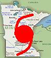
Alyono wrote:One potential major concern. If this does come inland near Palm Beach, tidal surge over Lake Okeechobee could be very bad
That could be a repeat of the 1928 okeechobee hurricane ☹️️
Moderator: S2k Moderators
Alyono wrote:One potential major concern. If this does come inland near Palm Beach, tidal surge over Lake Okeechobee could be very bad
Hypercane_Kyle wrote:Matthew still isn't strengthening per latest past. Pressures around 960mb.


SouthDadeFish wrote:Low-level structure of Hurricane Matthew looks to be improving. Almost a closed cyan ring (classic cyan ring would be thicker on SW side to my understanding). For those unfamiliar with microwave imagery, a cyan ring around the eye is a harbinger of rapid intensification.
https://twitter.com/MikeFischerWx/status/783838482233958400
Hammy wrote:Somebody mentioned the ERC and it got me wondering, this was in the middle of one when it made landfall--that may have caused a greater reduction in organization than may have otherwise occurred.
johngaltfla wrote:Michele B wrote:johngaltfla wrote:
BAD advice. There is no guarantee YET that the storm will not take a more westerly path. Heading to the panhandle region would be the safest area for now. Besides, every room within 60 miles of Sarasota is pretty much booked now per our local news at 6 pm.
Agreed, panhandle is safest if you can get there, and not get caught up in lots and lots of traffic.
We are in a little town west of Lake Okeechobee, but not all the way to Sarasota. Went out earlier and so much traffic coming home - ALL going west, obviously running from the storm.
Okeechobee is under a Hurricane Warning and West of there a Tropical Storm Warning. I would not move anywhere near points from Sarasota south just in case this storm turns hard left (aka, Katrina) at the last minute. Based on the models and forecasts, you're in for a rough ride and those folks who bugged out to Arcadia could have a long night tomorrow also.

I also live Clay County what do you think winds will be like here?jdray wrote:delta lady wrote:. I was in Orlando 2004 for Charlie, Frances and Jeanne all in a 31 day time span. Horrendous power outages, even though we had underground utilities. Now that I'm in Jax what scares the bejesus out of me is the fact that you don't have underground utilities. Everything is above ground. A direct hit on this city would be catastrophic for the downed power lines alone. Let's not even talk about the trees.northjaxpro wrote:
I am here in Jacksonville and all this is going to depend just how close the eyewall will come and then pass within the Northeast Florida coast. The forecast is for the eyewall to come within 30-40 miles of Jacksonville Beach. Should that manifest, hurrucane conditions willbe experienced from about the I-95 corridor east to the coast with regards to Matthew's closest approach here. I think 40-60. mph sustajned winds will be likely just inland and points to the the St.Johns River .
I live out in Clay County, while my neighborhood has underground utilities, there are still some above ground lines between me and the substation. I lost power with Frances for 3 days.
ThetaE wrote:Hammy wrote:Somebody mentioned the ERC and it got me wondering, this was in the middle of one when it made landfall--that may have caused a greater reduction in organization than may have otherwise occurred.
I thought Matthew completed his ERC before landfall. The eye was noticably larger.

Hammy wrote:Somebody mentioned the ERC and it got me wondering, this was in the middle of one when it made landfall--that may have caused a greater reduction in organization than may have otherwise occurred.

Hammy wrote:Somebody mentioned the ERC and it got me wondering, this was in the middle of one when it made landfall--that may have caused a greater reduction in organization than may have otherwise occurred.
northjaxpro wrote:SouthDadeFish wrote:Low-level structure of Hurricane Matthew looks to be improving. Almost a closed cyan ring (classic cyan ring would be thicker on SW side to my understanding). For those unfamiliar with microwave imagery, a cyan ring around the eye is a harbinger of rapid intensification.
https://twitter.com/MikeFischerWx/status/783838482233958400
Looking at microwave and IR imagery,it sure looks to me that the eyewall has fully closed. It is just about time for liftoff of rather modest intensification of the cyclone to take place shortly.
Hammy wrote:ThetaE wrote:Hammy wrote:Somebody mentioned the ERC and it got me wondering, this was in the middle of one when it made landfall--that may have caused a greater reduction in organization than may have otherwise occurred.
I thought Matthew completed his ERC before landfall. The eye was noticably larger.
Concentric eye walls were visible on radar at the time.
http://flhurricane.com/images/mirrors/2 ... 161910.gif

stephen23 wrote:Hypercane_Kyle wrote:Matthew still isn't strengthening per latest past. Pressures around 960mb.
960 mb would be a 2mb drop in last pass but I have yet to see a vortex message from this pass. Plotted looks like they missed the center and are making a sharp turn
marye45 wrote:Alyono wrote:One potential major concern. If this does come inland near Palm Beach, tidal surge over Lake Okeechobee could be very bad
That could be a repeat of the 1928 okeechobee hurricane ☹️️
OverlandHurricane wrote:Point of information: In order for this to qualify as a landfall, must the entire eye come onshore, or only the center of circulation?

Alyono wrote:One potential major concern. If this does come inland near Palm Beach, tidal surge over Lake Okeechobee could be very bad
Blown Away wrote:Alyono wrote:One potential major concern. If this does come inland near Palm Beach, tidal surge over Lake Okeechobee could be very bad
How realistic is that? Is there anything in the current situation or modeling that gives you that thought?
Users browsing this forum: No registered users and 19 guests


