ATL: HERMINE - Post-Tropical - Discussion

Moderator: S2k Moderators

Message
Author
User avatar
tropicwatch
Category 5
Category 5
Posts: 3205
Age: 60
Joined: Sat Jun 02, 2007 10:01 am
Location: Panama City Florida
Contact:

Re: ATL: HERMINE - Tropical Storm - Discussion

#7841 Postby tropicwatch » Thu Sep 01, 2016 10:56 am

psyclone wrote:with that wrap up on the west side...folks just west of the landfall point could be in for some very spicy weather. I'd really be watching with intense interest in places like Bay and Gulf counties.


I will report my weather station obs.
1 likes   
Tropicwatch


Agnes 72', Eloise 75, Elena 85', Kate 85', Charley 86', Florence 88', Beryl 94', Dean 95', Erin 95', Opal 95', Earl 98', Georges 98', Ivan 2004', Arlene 2005', Dennis 2005', Ida 2009' Debby 2012' Irma 2017' Michael 2018'

User avatar
GCANE
S2K Supporter
S2K Supporter
Posts: 10787
Joined: Mon Oct 22, 2007 8:03 am

Re: ATL: HERMINE - Tropical Storm - Discussion

#7842 Postby GCANE » Thu Sep 01, 2016 10:56 am

0 likes   

SeGaBob

Re: ATL: HERMINE - Tropical Storm - Discussion

#7843 Postby SeGaBob » Thu Sep 01, 2016 10:58 am

Are they thinking the west side will build up? I don't get the forecast for strong winds and several inches of rain.
0 likes   

MaineWeatherNut
Tropical Storm
Tropical Storm
Posts: 225
Joined: Sun Sep 01, 2013 5:06 pm

Re: ATL: HERMINE - Tropical Storm - Discussion

#7844 Postby MaineWeatherNut » Thu Sep 01, 2016 10:59 am

xcool22 wrote:People act like this cat 5 hurricane clam down god lol


People die in weak tropical storms if they are out being stupid...
3 likes   
The content of this post does NOT constitute official forecast and should not be used as such. They are the opinion of the poster and may or may not be backed by sound meteorological data. They are NOT endorsed by any professional institution or Storm2K. For official information, please refer to the local meteorological centers of respective areas.

BRweather
Category 1
Category 1
Posts: 331
Joined: Wed Aug 31, 2016 8:50 am
Location: Baton Rouge, LA

Re: ATL: HERMINE - Tropical Storm - Discussion

#7845 Postby BRweather » Thu Sep 01, 2016 10:59 am

50 mph surface winds all along 83.5W
1 likes   

Zanthe
Tropical Storm
Tropical Storm
Posts: 149
Age: 29
Joined: Sat May 26, 2012 9:26 pm
Location: New Castle, PA

Re: ATL: HERMINE - Tropical Storm - Discussion

#7846 Postby Zanthe » Thu Sep 01, 2016 11:00 am

xcool22 wrote:People act like this cat 5 hurricane clam down god lol


because no ones ever died from a Tropical Depression, and Tropical Storms have never caused MASSIVE damage to the point of having their name retired, right?

Prepare like this is a Cat 5, because even if the wind isn't there, the rain and storm surge could cut you off for a while, and yes, if you aren't prepared you could find yourself in a life threatening situation.

Don't spread false statements, like this storm isn't dangerous. It is dangerous and needs to be taken seriously or lives will be lost.
8 likes   
I'm no expert, everything I say should be taken with a large amount of salt. I could easily be very, very wrong.
~Zanthe Go Coyotes~

CrazyC83
Professional-Met
Professional-Met
Posts: 33399
Joined: Tue Mar 07, 2006 11:57 pm
Location: Deep South, for the first time!

Re: ATL: HERMINE - Recon

#7847 Postby CrazyC83 » Thu Sep 01, 2016 11:00 am

000
URNT15 KNHC 011555
AF307 1309A HERMINE HDOB 17 20160901
154600 2525N 08342W 8428 01594 0121 +175 +164 198047 048 030 003 00
154630 2527N 08342W 8428 01596 0120 +175 +166 197048 048 031 003 00
154700 2529N 08343W 8433 01589 0119 +171 +168 198048 048 031 002 00
154730 2531N 08343W 8429 01595 0119 +170 +168 198049 049 032 001 01
154800 2533N 08344W 8429 01596 //// +170 //// 198049 049 033 002 01
154830 2535N 08344W 8430 01591 0118 +170 +167 197049 049 033 003 01
154900 2537N 08344W 8432 01588 0118 +170 +168 197049 050 032 004 00
154930 2539N 08345W 8429 01591 //// +168 //// 198050 050 034 003 01
155000 2541N 08345W 8429 01589 0117 +170 +165 198050 050 035 003 00
155030 2543N 08346W 8429 01588 0117 +170 +167 198051 052 035 003 01
155100 2545N 08346W 8429 01585 //// +167 //// 199052 052 037 003 01
155130 2547N 08346W 8430 01586 0115 +167 //// 199053 054 038 003 01
155200 2549N 08347W 8429 01584 0112 +169 +162 196054 054 039 004 00
155230 2551N 08347W 8430 01583 0111 +169 +156 194054 054 039 004 00
155300 2553N 08348W 8430 01581 0110 +170 +153 193054 055 040 003 00
155330 2555N 08348W 8430 01579 0106 +171 +157 192056 057 042 003 00
155400 2557N 08348W 8429 01578 0106 +170 +149 190056 056 043 004 00
155430 2559N 08349W 8430 01577 0099 +180 +141 189057 058 044 003 00
155500 2601N 08349W 8426 01582 0098 +180 +148 188058 058 044 003 00
155530 2603N 08350W 8432 01571 0095 +183 +140 188058 059 044 003 00
$$
;
0 likes   

BRweather
Category 1
Category 1
Posts: 331
Joined: Wed Aug 31, 2016 8:50 am
Location: Baton Rouge, LA

Re: ATL: HERMINE - Tropical Storm - Discussion

#7848 Postby BRweather » Thu Sep 01, 2016 11:01 am

xcool22 wrote:People act like this cat 5 hurricane clam down god lol


There is a reason why some tropical storm names are retired. You can easily offend people with a statement like that.
3 likes   

User avatar
tropicwatch
Category 5
Category 5
Posts: 3205
Age: 60
Joined: Sat Jun 02, 2007 10:01 am
Location: Panama City Florida
Contact:

Re: ATL: HERMINE - Tropical Storm - Discussion

#7849 Postby tropicwatch » Thu Sep 01, 2016 11:01 am

All I can say is wow!

Image
1 likes   
Tropicwatch


Agnes 72', Eloise 75, Elena 85', Kate 85', Charley 86', Florence 88', Beryl 94', Dean 95', Erin 95', Opal 95', Earl 98', Georges 98', Ivan 2004', Arlene 2005', Dennis 2005', Ida 2009' Debby 2012' Irma 2017' Michael 2018'

User avatar
AdamFirst
S2K Supporter
S2K Supporter
Posts: 2488
Age: 35
Joined: Thu Aug 14, 2008 10:54 am
Location: Port Saint Lucie, FL

Re: ATL: HERMINE - Tropical Storm - Discussion

#7850 Postby AdamFirst » Thu Sep 01, 2016 11:02 am

Got that classic comma shape...watch out Tampa Bay-northward.
1 likes   
Dolphins Marlins Canes Golden Panthers HEAT
Andrew 1992 - Irene 1999 - Frances 2004 - Jeanne 2004 - Wilma 2005 - Fay 2008 - Isaac 2012 - Matthew 2016 - Irma 2017 - Dorian 2019 - Ian 2022 - Nicole 2022

BRweather
Category 1
Category 1
Posts: 331
Joined: Wed Aug 31, 2016 8:50 am
Location: Baton Rouge, LA

Re: ATL: HERMINE - Tropical Storm - Discussion

#7851 Postby BRweather » Thu Sep 01, 2016 11:02 am

Last edited by BRweather on Thu Sep 01, 2016 11:04 am, edited 1 time in total.
0 likes   

User avatar
Happy Pelican
S2K Supporter
S2K Supporter
Posts: 119
Joined: Tue Sep 29, 2015 11:12 pm
Location: Pelican Island, Jersey Shore

Re: ATL: HERMINE - Tropical Storm - Discussion

#7852 Postby Happy Pelican » Thu Sep 01, 2016 11:02 am

xcool22 wrote:People act like this cat 5 hurricane clam down god lol


People are so crazy for being concerned about their life and property, right? :roll:
Still rebuilding from Sandy so yeah, this is offensive.
Last edited by Happy Pelican on Thu Sep 01, 2016 11:04 am, edited 1 time in total.
4 likes   

User avatar
gatorcane
S2K Supporter
S2K Supporter
Posts: 23499
Age: 46
Joined: Sun Mar 13, 2005 3:54 pm
Location: Boca Raton, FL

Re: ATL: HERMINE - Tropical Storm - Discussion

#7853 Postby gatorcane » Thu Sep 01, 2016 11:03 am

looks like some intense squalls approaching Pinellas in the Tampa Bay area...these would be the first true feeder bands from Hermine....
Last edited by gatorcane on Thu Sep 01, 2016 11:03 am, edited 1 time in total.
3 likes   

tallywx
Category 2
Category 2
Posts: 786
Joined: Thu Jul 03, 2003 10:19 am
Location: Raleigh/Durham, NC

Re: ATL: HERMINE - Tropical Storm - Discussion

#7854 Postby tallywx » Thu Sep 01, 2016 11:03 am

Steve wrote:
tallywx wrote:
BRweather wrote:Latest HRRR has a:

Landfall -- midnight w/ pressure of 983 mb
10 meter winds -- 73 knots
80 meter winds -- 90 knots
Gusts -- 98 knots
Tallahassee with big impacts and almost sustained hurricane force winds along coast


GFS 12z has landfall at Alligator Point/Shell Point with hurricane force gusts clipping Tallahassee. Given 30+ years of almost untouched (by storm) tree cover (Tallahassee is one of the most jungle-like cities that exists in the lower 48), a lot of stuff is going to come down.


Ain't been that long Tally. My youngest brother was at FSU and lived there after from like 1993-1998. There were numerous 40-50mph swipes at that time. He'd always call me to harass me since we'd be getting nothing here. Having said that, I'm over there all the time. It's got more trees than almost any other city. Gonna take a couple of days to clean the streets for sure.


Was there for Kate in '85, and also for Beryl '94 (64 mph gusts), Allison and Opal '95 (~60 mph gusts), and Earl '98 (~60mph gusts). Those storms basically just kept the Kate pruning in ship shape. But since then, nothing but tree growth,
3 likes   

User avatar
xcool22
Category 1
Category 1
Posts: 311
Age: 42
Joined: Mon Oct 05, 2009 3:06 pm
Location: slidell la
Contact:

Re: ATL: HERMINE - Tropical Storm - Discussion

#7855 Postby xcool22 » Thu Sep 01, 2016 11:03 am

Looking go rain here in slidell
2 likes   
SCOTT

NJWxHurricane
Tropical Storm
Tropical Storm
Posts: 145
Joined: Wed Aug 24, 2016 11:51 am
Location: Seaside Heights, NJ (Jersey Shore)

Re: ATL: HERMINE - Tropical Storm - Discussion

#7856 Postby NJWxHurricane » Thu Sep 01, 2016 11:04 am

Really hope the Jersey Shore/Mid-Atlantic even knows what's going on.. the attention currently is directed at the gulf/florida right now. What happens afterwards still needs to be watched.
2 likes   

psyclone
S2K Supporter
S2K Supporter
Posts: 4510
Joined: Wed Aug 24, 2005 9:04 pm
Location: palm harbor fl

Re: ATL: HERMINE - Tropical Storm - Discussion

#7857 Postby psyclone » Thu Sep 01, 2016 11:05 am

I'm really curious to see what kind of weather we get here in the bay area. very close shave with TS conditions. Perhaps Dennis 05 would be a good analog.
2 likes   

User avatar
gatorcane
S2K Supporter
S2K Supporter
Posts: 23499
Age: 46
Joined: Sun Mar 13, 2005 3:54 pm
Location: Boca Raton, FL

Re: HERMINE: Preps/obs/reports thread - Caribbean, Florida/Gulf coast

#7858 Postby gatorcane » Thu Sep 01, 2016 11:05 am

SPECIAL WEATHER STATEMENT
NATIONAL WEATHER SERVICE TAMPA BAY AREA / RUSKIN FL
1153 AM EDT THU SEP 1 2016

FLZ050-149-155-160-162-255-260-011645-
COASTAL SARASOTA FL-COASTAL MANATEE FL-PINELLAS FL-
COASTAL CHARLOTTE FL-COASTAL PASCO FL-INLAND MANATEE FL-
INLAND SARASOTA FL-
1153 AM EDT THU SEP 1 2016

...SIGNIFICANT WEATHER ADVISORY FOR SARASOTA...NORTHWESTERN
CHARLOTTE...SOUTHWESTERN PASCO...NORTHWESTERN MANATEE AND PINELLAS
COUNTIES UNTIL 1245 PM EDT...

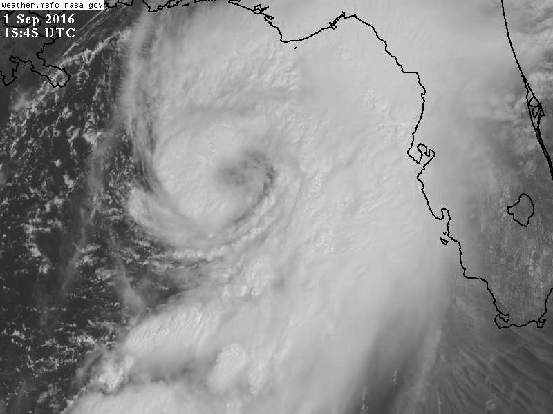
AT 1150 AM EDT...DOPPLER RADAR WAS TRACKING SEVERAL OUTER RAINBANDS
FROM TROPICAL STORM HERMINE. THESE RAINBANDS EXTENDED FROM 10 MILES
NORTHWEST OF HARBOR BLUFFS TO 28 MILES WEST OF PINELAND...AND WERE
MOVING EAST AT 5 TO 10 MILES PER HOUR. WITHIN THESE
RAINBANDS...BRIEF ROTATING THUNDERSTORMS HAVE BEEN NOTED...AND
WATERSPOUTS WILL BE POSSIBLE WITH VIRTUALLY ANY THUNDERSTORM.
WATERSPOUTS MAY BRIEFLY MOVE ASHORE...POSING A RISK TO PEOPLE AND
PROPERTY ALONG THE COAST.

WIND GUSTS IN EXCESS OF 40 MPH WILL ALSO BE POSSIBLE WITH THESE
STORMS...IN ADDITION TO THE THREAT OF WATERSPOUTS.

LOCATIONS IMPACTED INCLUDE...
TAMPA...CLEARWATER...LARGO...NORTH PORT...SARASOTA...BRADENTON...
PINELLAS PARK...SEMINOLE...NEW PORT RICHEY...PALMETTO...
FORT DESOTO PARK...SAINT PETERSBURG...HOLIDAY...
DOWNTOWN SAINT PETERSBURG...ST. PETERSBURG...ST.
PETE BEACH...ANNA MARIA...RIDGE WOOD HEIGHTS...TIERRA VERDE AND
KENSINGTON PARK.

PRECAUTIONARY/PREPAREDNESS ACTIONS...

TORRENTIAL RAINFALL IS ALSO OCCURRING WITH THESE STORMS...AND MAY
LEAD TO LOCALIZED FLOODING. DO NOT DRIVE YOUR VEHICLE THROUGH
FLOODED ROADWAYS.

&&

LAT...LON 2815 8289 2831 8274 2767 8253 2765 8255
2764 8252 2691 8220 2682 8236 2751 8280
2771 8281 2785 8291
TIME...MOT...LOC 1550Z 218DEG 7KT 2798 8297 2681 8258

$$

AUSTIN
http://forecast.weather.gov/showsigwx.php?warnzone=FLZ050&warncounty=FLC103&firewxzone=FLZ050&local_place1=3%20Miles%20ESE%20Tarpon%20Springs%20FL&product1=Special+Weather+Statement&lat=28.1309&lon=-82.7436#.V8hRtk3rupo
0 likes   

Slughitter3
Tropical Depression
Tropical Depression
Posts: 50
Age: 34
Joined: Wed Jul 10, 2013 1:16 pm
Location: Philadelphia, PA

Re: ATL: HERMINE - Tropical Storm - Discussion

#7859 Postby Slughitter3 » Thu Sep 01, 2016 11:06 am

Albert Whitted Airport in St. Pete is reporting Sustained 22-24 mph since 0600 this morning. The airport is right on the bay, not sure of the height of the equipment though.
http://w1.weather.gov/obhistory/KSPG.html
2 likes   
I'm a weather-loving Coastie.
This post is only an opinion not a forecast. Please refer to the NHC and local NWS offices for forecasts.

Shawn

User avatar
Happy Pelican
S2K Supporter
S2K Supporter
Posts: 119
Joined: Tue Sep 29, 2015 11:12 pm
Location: Pelican Island, Jersey Shore

Re: ATL: HERMINE - Tropical Storm - Discussion

#7860 Postby Happy Pelican » Thu Sep 01, 2016 11:06 am

Really being conservative with the watches and warnings. This concerns me as Hermine gets closer to Jersey. It's packed with tourists where I am and I know they don't want to scare the business revenue away but this area is not ready for the smallest storm surge.... :double:
1 likes   


Return to “2016”

Who is online

Users browsing this forum: No registered users and 6 guests