

ATL: TEN - Models
Moderator: S2k Moderators
Re: ATL: INVEST 92L - Models
GFS coming in stronger on this run with the SW vorticity.
0 likes
The following post is NOT an official forecast and should not be used as such. It is just the opinion of the poster and may or may not be backed by sound meteorological data. It is NOT endorsed by any professional institution including storm2k.org For Official Information please refer to the NHC and NWS products.
-
Miami Storm Tracker

- Category 4

- Posts: 916
- Age: 68
- Joined: Sun Jun 13, 2010 10:12 pm
- Location: Key Largo, Fla.
- Contact:
Re: ATL: INVEST 92L - Models
BLP,
That was the southern Vort correct. Movement still WNW should come in between the upper keys and Miami.
That was the southern Vort correct. Movement still WNW should come in between the upper keys and Miami.
0 likes
-
Bocadude85

- Category 5

- Posts: 2991
- Age: 39
- Joined: Mon Apr 18, 2005 2:20 pm
- Location: Honolulu,Hi
Re: ATL: INVEST 92L - Models
Miami Storm Tracker wrote:BLP,
That was the southern Vort correct. Movement still WNW should come in between the upper keys and Miami.
It ends up moving NNW right along the SE Fla coast.
0 likes
-
Miami Storm Tracker
- Category 4
- Posts: 916
- Age: 68
- Joined: Sun Jun 13, 2010 10:12 pm
- Location: Key Largo, Fla.
- Contact:
Re: ATL: INVEST 92L - Models
Anyone else picking up on the GFS runoff you can please post would be much appreciated.
0 likes
-
Miami Storm Tracker
- Category 4
- Posts: 916
- Age: 68
- Joined: Sun Jun 13, 2010 10:12 pm
- Location: Key Largo, Fla.
- Contact:
Re: ATL: INVEST 92L - Models
Miami Storm Tracker wrote:BLP,
That was the southern Vort correct. Movement still WNW should come in between the upper keys and Miami.
Hi Dave, Yes GFS only model showing this right now. Rides right up the Florida coast versus 18z which was in Bahamas.
1 likes
The following post is NOT an official forecast and should not be used as such. It is just the opinion of the poster and may or may not be backed by sound meteorological data. It is NOT endorsed by any professional institution including storm2k.org For Official Information please refer to the NHC and NWS products.


-
Miami Storm Tracker
- Category 4
- Posts: 916
- Age: 68
- Joined: Sun Jun 13, 2010 10:12 pm
- Location: Key Largo, Fla.
- Contact:
Re: ATL: INVEST 92L - Models
Evening,
Thanks for posting the chart, BLP so a bit further west than the last run. Maybe a bit more rain, is the stall still in play or moving up the coast.
Thanks for posting the chart, BLP so a bit further west than the last run. Maybe a bit more rain, is the stall still in play or moving up the coast.
0 likes
Re: ATL: INVEST 92L - Models
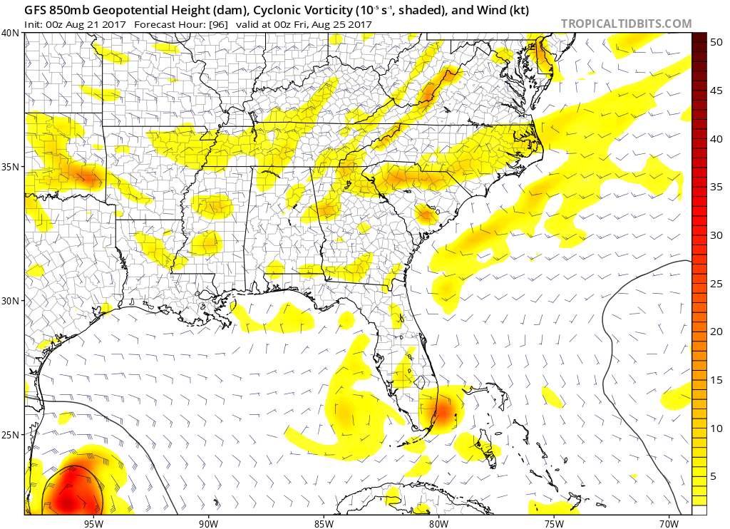
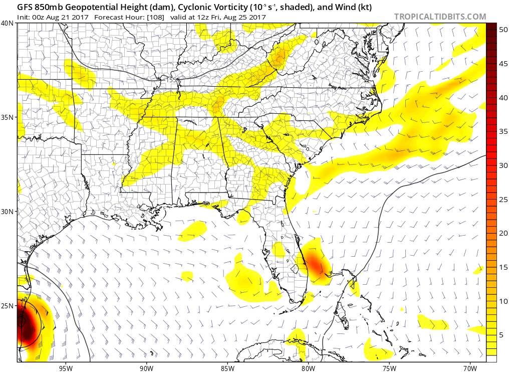
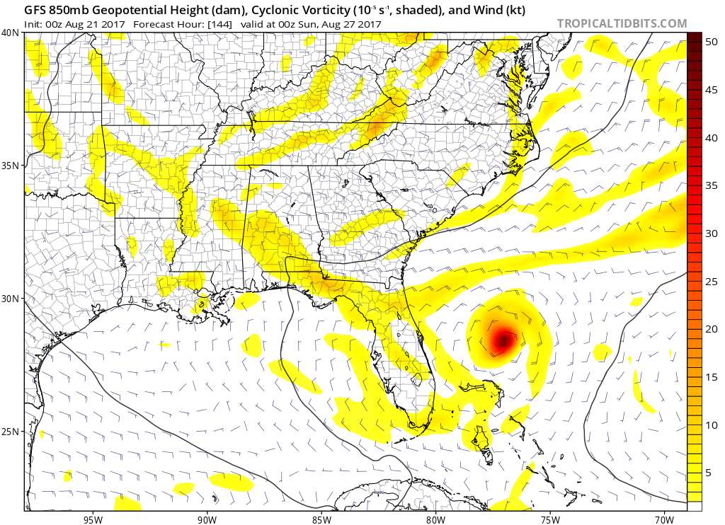
Here you go. GFS loop.
[url]blob:https://www.tropicaltidbits.com/fe1af5b4-eccf-4175-8b9a-e6b108370de3[/url]
[url]blob:https://www.tropicaltidbits.com/fe1af5b4-eccf-4175-8b9a-e6b108370de3[/url]
Last edited by blp on Sun Aug 20, 2017 11:14 pm, edited 1 time in total.
0 likes
The following post is NOT an official forecast and should not be used as such. It is just the opinion of the poster and may or may not be backed by sound meteorological data. It is NOT endorsed by any professional institution including storm2k.org For Official Information please refer to the NHC and NWS products.
-
Bocadude85
- Category 5
- Posts: 2991
- Age: 39
- Joined: Mon Apr 18, 2005 2:20 pm
- Location: Honolulu,Hi
Re: ATL: INVEST 92L - Models
0Z Canadian brings a tropical storm into Miami Dade, then takes a wsw dip and crosses the state and exits near Everglades City...very Katrina esque this run.
Last edited by Bocadude85 on Sun Aug 20, 2017 11:18 pm, edited 2 times in total.
0 likes
-
Miami Storm Tracker
- Category 4
- Posts: 916
- Age: 68
- Joined: Sun Jun 13, 2010 10:12 pm
- Location: Key Largo, Fla.
- Contact:
Re: ATL: INVEST 92L - Models
Bocadude85 wrote:0Z Canadian brings a tropical storm into Miami Dade, then takes a wsw dip and crosses the state and exits near Everglades City...very Katrina esque this run.
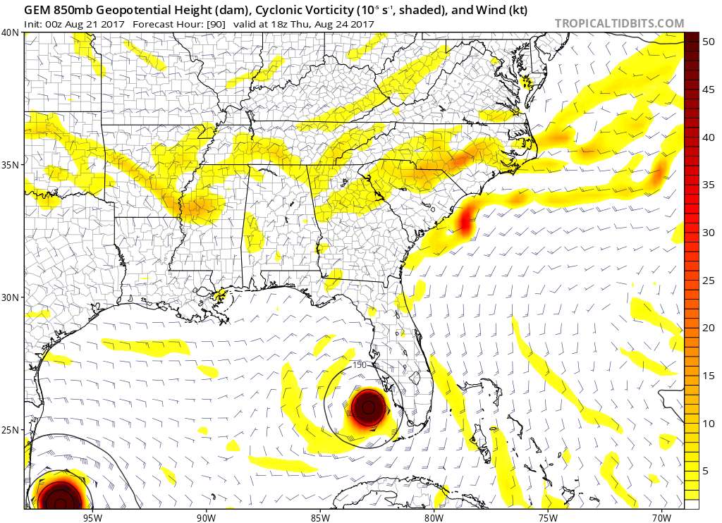
After the WSW dip into the Gulf.
0 likes
Re: ATL: INVEST 92L - Models
I did not realize 18z NAvGEm is also the SE vorticity but much faster than GFS. Interesting.
https://www.tropicaltidbits.com/analysis/models/?model=navgem®ion=seus&pkg=mslp_uv850&runtime=2017082018&fh=30&xpos=0&ypos=0
https://www.tropicaltidbits.com/analysis/models/?model=navgem®ion=seus&pkg=mslp_uv850&runtime=2017082018&fh=30&xpos=0&ypos=0
0 likes
The following post is NOT an official forecast and should not be used as such. It is just the opinion of the poster and may or may not be backed by sound meteorological data. It is NOT endorsed by any professional institution including storm2k.org For Official Information please refer to the NHC and NWS products.
-
Miami Storm Tracker
- Category 4
- Posts: 916
- Age: 68
- Joined: Sun Jun 13, 2010 10:12 pm
- Location: Key Largo, Fla.
- Contact:
Re: ATL: INVEST 92L - Models
so still a possible double shot the CMC has not backed down, with the exception of some minor changes.
0 likes
Re: ATL: INVEST 92L - Models
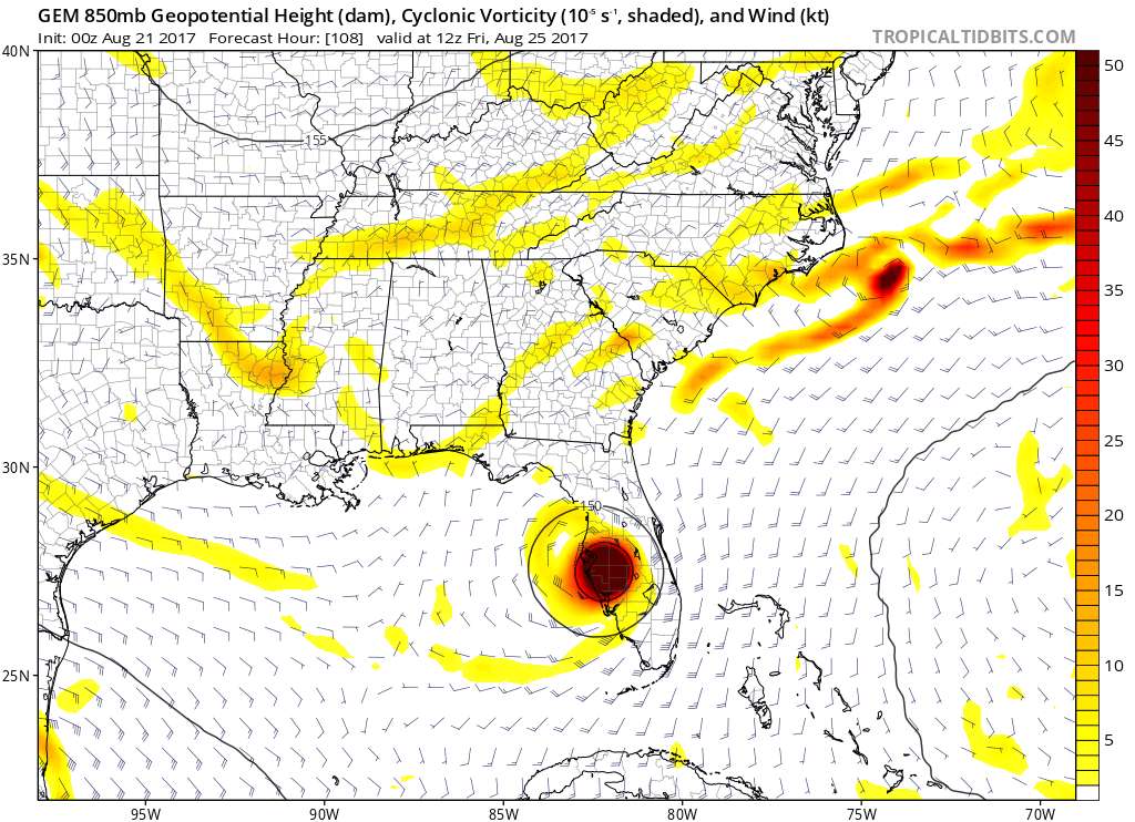
This is at least the 8th run in a row where the GFS has developed a separate system from 92L coming straight up from the cuban coast along the SE Florida coast, which ejects a little to the NE and then stalls in the western atlantic. Note that the trend in the stall has been further south and west, which is concerning only in the fact that the further south it stalls the harder its going to be to get picked up and permanently ejected out.
2 likes
-
Miami Storm Tracker
- Category 4
- Posts: 916
- Age: 68
- Joined: Sun Jun 13, 2010 10:12 pm
- Location: Key Largo, Fla.
- Contact:
Re: ATL: INVEST 92L - Models
BLP,
the run you just posted looks a bit more south than previoius runs, and gets in there southern gulf before coming back east near Tampa.
the run you just posted looks a bit more south than previoius runs, and gets in there southern gulf before coming back east near Tampa.
0 likes
Who is online
Users browsing this forum: No registered users and 49 guests