Thread at Talking Tropics that was the topic for this area.
viewtopic.php?f=31&t=118975&p=2600269#p2600269

Moderator: S2k Moderators


gatorcane wrote:Needs to be watched closely looking at the setup ahead as it could into the area get north of islands and near Bahamas where conditions could be much more favorable.
SFLcane wrote:gatorcane wrote:Needs to be watched closely looking at the setup ahead as it could into the area get north of islands and near Bahamas where conditions could be much more favorable.
For now ECMWF recurves it near Bermuda

gatorcane wrote:SFLcane wrote:gatorcane wrote:Needs to be watched closely looking at the setup ahead as it could into the area get north of islands and near Bahamas where conditions could be much more favorable.
For now ECMWF recurves it near Bermuda
The ECMWF takes this just north of the islands and into the southern Bahamas. The wave behind this one is the one that ECMWF recurves (i.e. disturbance #3 0/20%)
gatorcane wrote:Needs to be watched closely looking at the setup ahead as it could into the area get north of islands and near Bahamas where conditions could be much more favorable.


TheStormExpert wrote:gatorcane wrote:Needs to be watched closely looking at the setup ahead as it could into the area get north of islands and near Bahamas where conditions could be much more favorable.
Yeah like we saw with 99L/Gert, 92L needs to be closely monitored once north of the Eastern Caribbean and near the Bahamas region.

ronjon wrote:92L looking very healthy on VIS SAT - may already be close to depression status.
http://www.ssd.noaa.gov/PS/TROP/floaters/92L/imagery/vis_lalo-animated.gif

gatorcane wrote:Starting to show signs of organization - if it can build enough convection and vorticity it could survive the PV streamer NE of the Lesser Antilles and find more favorable conditions north of the islands and in the vicinity of the Bahamas (what the CMC is showing).
Latest floater here:
http://rammb.cira.colostate.edu/ramsdis ... display=12
GCANE wrote:gatorcane wrote:Starting to show signs of organization - if it can build enough convection and vorticity it could survive the PV streamer NE of the Lesser Antilles and find more favorable conditions north of the islands and in the vicinity of the Bahamas (what the CMC is showing).
Latest floater here:
http://rammb.cira.colostate.edu/ramsdis ... display=12
Latest GFS is showing 92L directly interacting with the PV streamer and sweeping it west.
Looks like it'll open up for the wave behind it (93L) and really get it spinning.
That one could be a headliner.
weathaguyry wrote:ronjon wrote:92L looking very healthy on VIS SAT - may already be close to depression status.
http://www.ssd.noaa.gov/PS/TROP/floaters/92L/imagery/vis_lalo-animated.gif
We shall see, it really does look good, but I'm not sure that the NHC will be too quick with it since there is no immediate threat to land. Maybe a nice increase in the 2PM TWO, maybe 30/40? Just a 100% amateur guess.

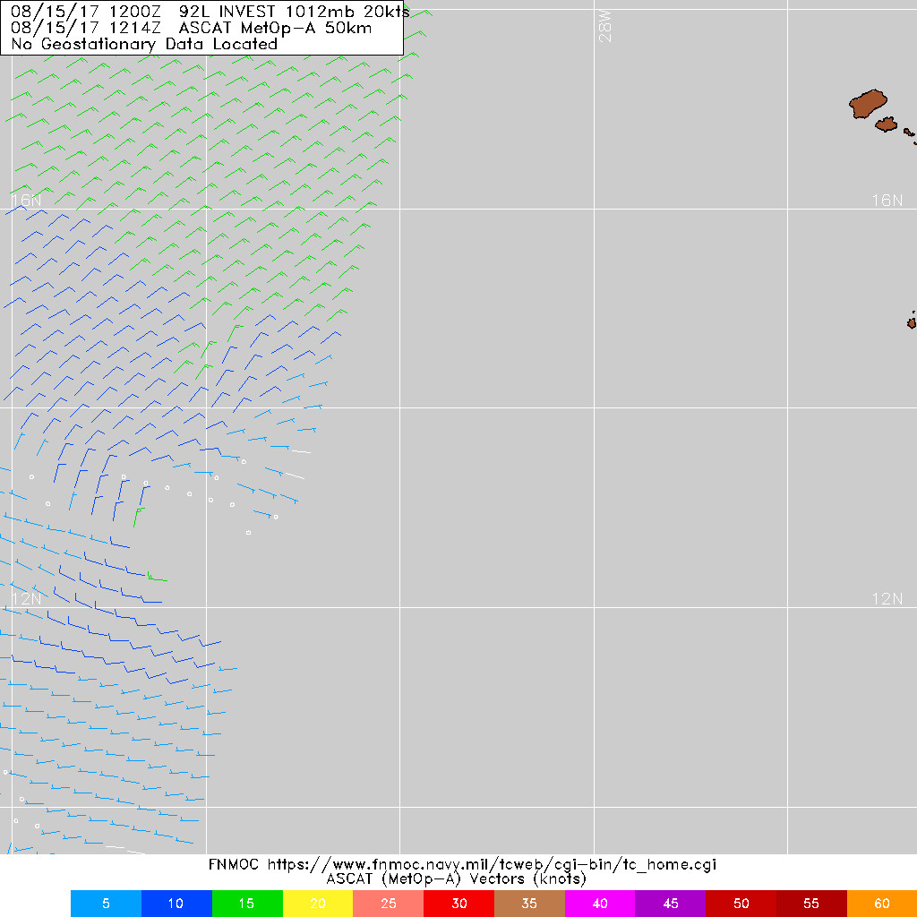
northjaxpro wrote::uarrow: That ASCAT shows that 92L is as close to being closed off as it can be. This may be a TD already.
Users browsing this forum: No registered users and 7 guests

