ATL: FLORENCE - Post-Tropical - Discussion
Moderator: S2k Moderators
-
1900hurricane

- Category 5

- Posts: 6063
- Age: 34
- Joined: Fri Feb 06, 2015 12:04 pm
- Location: Houston, TX
- Contact:
Re: ATL: FLORENCE - Hurricane - Discussion
Florence has been playing very nicely with KZC. Expected pressures have only been off from the expected pressures by two millibars at most ever since recon began to investigate the system.
2 likes
Contract Meteorologist. TAMU & MSST. Fiercely authentic, one of a kind. We are all given free will, so choose a life meant to be lived. We are the Masters of our own Stories.
Opinions expressed are mine alone.
Follow me on Twitter at @1900hurricane : Read blogs at https://1900hurricane.wordpress.com/
Opinions expressed are mine alone.
Follow me on Twitter at @1900hurricane : Read blogs at https://1900hurricane.wordpress.com/
-
PavelGaborik10
- Category 1

- Posts: 472
- Joined: Tue Sep 04, 2018 3:23 pm
Re: ATL: FLORENCE - Hurricane - Discussion
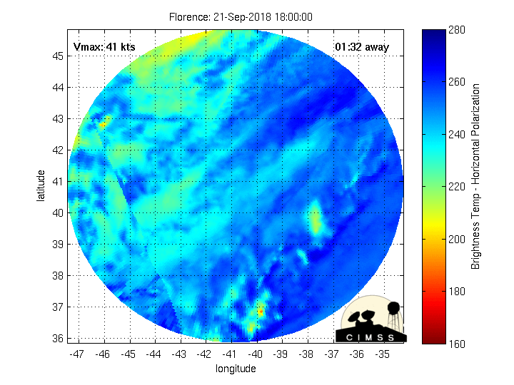
Frank2 wrote:Outflow from 95L might have slowed Florence's intensification or a return of southerly shear the past few hours is affecting the system ATTM:
https://www.star.nesdis.noaa.gov/GOES/G ... &length=24
They're quite separated at the moment, are we sure Dry air isn't the culprit?
1 likes
-
MacTavish
Re: ATL: FLORENCE - Hurricane - Discussion
I believe that Florence may be about to enter less than favorable conditions. The line I put near the storm seems to be some kind of boundary being caused by the storm moving into the westward winds around the ULL to the storms NW. I could be wrong.

0 likes
Re: ATL: FLORENCE - Hurricane - Discussion
In the 5PM discussion NHC said:
So are we expecting more eastward shifts based on this disturbance in subsequent runs? Enough to keep it off shore?
There is a new player in the forecast as well, with the disturbance over the northwestern Caribbean adding some uncertainty in the ridge strength over the southeastern United States. Perhaps it isn't surprising that the model spread has increased on this cycle, with a small eastward shift overall.
So are we expecting more eastward shifts based on this disturbance in subsequent runs? Enough to keep it off shore?
0 likes
Re: ATL: FLORENCE - Hurricane - Discussion
They're quite separated at the moment, are we sure Dry air isn't the culprit?
Yes, a slot of dry air is seen south of the eye, and I agree less than favorable conditions - let's hope...
0 likes

Re: ATL: FLORENCE - Hurricane - Discussion
NDG wrote:Recon finds that Florence is holding steady on strength, has not found any stronger winds, for now.
I'm interested to see what they find when they get to the NE Quad. The research mission earlier had a dropsonde in that quad that measured a 160kt gust about 40-45mb above the surface, with a 500m average of 142kts and a 150m average of 135kts.
I think this plane might find SFMR values between 125-130kts when they sample that quad.
2 likes
Solar Aquarian
Lunar Cancerian
 Sagittarian
Lunar Cancerian

Re: ATL: FLORENCE - Hurricane - Discussion
Blinhart wrote:wxman57 wrote:EnnisTx wrote:
Storm is about 500 miles wide with Hurricane force winds out almost 200 from the center.
What storm are you talking about? Florence is a little below-average in size. Squalls with 25+ mph wind span about 250 miles north-south (not counting cirrus outflow). Hurricane-force winds are 50-60 miles across and predicted to peak about 50-60 miles from the center, which is not far from average.
Thank you wxman57, I was wondering where EnnisTX got that number. That is why I said 200 miles in diameter, but it is growing, I'm expecting it to have a diameter of around 350-400 miles by the time it makes final approach.
Bad information from our wonderful "The Weather Channel "
I haven't been following it due to being out of town. I thought that sounded rather massive but, that's what I heard.
0 likes
-
xtyphooncyclonex

- Category 5
- Posts: 3890
- Age: 24
- Joined: Sat Dec 08, 2012 9:07 am
- Location: Cebu City
- Contact:
Re: ATL: FLORENCE - Hurricane - Discussion
Ken711 wrote:In the 5PM discussion NHC said:There is a new player in the forecast as well, with the disturbance over the northwestern Caribbean adding some uncertainty in the ridge strength over the southeastern United States. Perhaps it isn't surprising that the model spread has increased on this cycle, with a small eastward shift overall.
So are we expecting more eastward shifts based on this disturbance in subsequent runs? Enough to keep it off shore?
The shifts mean the models are closing in on a landfall over the Carolinas. Whether this makes landfall or stays offshore, it is almost certain that several population areas over the SE US and Mid-Atlantic would have impacts to some extent. I wouldn't let my guard down. The NC governor wouldn't issue a state of emergency for a storm curving far away OTS.
Hence, the NHC mentioned the phrase "small eastward shifts" and NOT "significant eastward trends/shifts."
0 likes
REMINDER: My opinions that I, or any other NON Pro-Met in this forum, are unofficial. Please do not take my opinions as an official forecast and warning. I am NOT a meteorologist. Following my forecasts blindly may lead to false alarm, danger and risk if official forecasts from agencies are ignored.
-
tarheelprogrammer

- S2K Supporter

- Posts: 1793
- Joined: Mon Mar 28, 2016 9:25 pm
- Location: Raleigh, NC area (Garner, NC)
Re: ATL: FLORENCE - Hurricane - Discussion
xtyphooncyclonex wrote:Ken711 wrote:In the 5PM discussion NHC said:There is a new player in the forecast as well, with the disturbance over the northwestern Caribbean adding some uncertainty in the ridge strength over the southeastern United States. Perhaps it isn't surprising that the model spread has increased on this cycle, with a small eastward shift overall.
So are we expecting more eastward shifts based on this disturbance in subsequent runs? Enough to keep it off shore?
The shifts mean the models are closing in on a landfall over the Carolinas. Whether this makes landfall or stays offshore, it is almost certain that several population areas over the SE US and Mid-Atlantic would have impacts to some extent. I wouldn't let my guard down. The NC governor wouldn't issue a state of emergency for a storm curving far away OTS.
Hence, the NHC mentioned the phrase "small eastward shifts" and NOT "significant eastward trends/shifts."
It looks a lot better for folks from Wilmington south to MB. OBX and Jacksonville are direct hits though.
0 likes
My posts are not official forecasts. They are just my opinion and may or may not be backed by sound meteorological data. They are NOT endorsed by any professional institution or storm2k.org. For official information, please refer to the NHC and NWS products.

Re: ATL: FLORENCE - Hurricane - Discussion
Syx6sic wrote:Stores here in Norfolk are packed and everything is being sold out quick guess people are starting to take this serious now before here in Norfolk everyone always waited till watch’s and warning were posted
It's like The Hunger Games in some of the stores in Chesapeake too.
0 likes
I never received my Hogwarts letter, so I'm leaving the Shire and becoming a Sith Lord.
Re: ATL: FLORENCE - Hurricane - Discussion
Frank2 wrote:They're quite separated at the moment, are we sure Dry air isn't the culprit?
Yes, a slot of dry air is seen south of the eye, and I agree less than favorable conditions - let's hope...
The south side does look a bit pinched...but we don't get to where we are with less than favorable conditions...ya got a cat 4.
1 likes
-
PavelGaborik10
- Category 1
- Posts: 472
- Joined: Tue Sep 04, 2018 3:23 pm
Re: ATL: FLORENCE - Hurricane - Discussion
MacTavish wrote:I believe that Florence may be about to enter less than favorable conditions. The line I put near the storm seems to be some kind of boundary being caused by the storm moving into the westward winds around the ULL to the storms NW. I could be wrong.
Can you elaborate a tad on this? Not trying to be rude but am genuinely curious. If anything I'm seeing seeing better conditions ahead of Florence.
0 likes
-
xtyphooncyclonex
- Category 5
- Posts: 3890
- Age: 24
- Joined: Sat Dec 08, 2012 9:07 am
- Location: Cebu City
- Contact:
Re: ATL: FLORENCE - Hurricane - Discussion
tarheelprogrammer wrote:
It looks a lot better for folks from Wilmington south to MB. OBX and Jacksonville are direct hits though.
It's still three days out and we shouldn't be already concluding if it's "better" for one place or another. My mistake earlier---small westward shifts: Florida (for example). Larger shifts could happen from time to time, but the consensus points to the Carolinas already. Again, changes could happen; it could just brush the OBX or strike Wilmington, or in between/nearby areas. Let's not forget the likelihood of extreme rainfall events over the Carolinas, extending towards the Virginia-DC area.
1 likes
REMINDER: My opinions that I, or any other NON Pro-Met in this forum, are unofficial. Please do not take my opinions as an official forecast and warning. I am NOT a meteorologist. Following my forecasts blindly may lead to false alarm, danger and risk if official forecasts from agencies are ignored.


Re: ATL: FLORENCE - Hurricane - Discussion
With the ERC's this will vary in intensity but no real unfavorable conditions in her path.
1 likes
Re: ATL: FLORENCE - Hurricane - Discussion
tarheelprogrammer wrote:xtyphooncyclonex wrote:Ken711 wrote:In the 5PM discussion NHC said:
So are we expecting more eastward shifts based on this disturbance in subsequent runs? Enough to keep it off shore?
The shifts mean the models are closing in on a landfall over the Carolinas. Whether this makes landfall or stays offshore, it is almost certain that several population areas over the SE US and Mid-Atlantic would have impacts to some extent. I wouldn't let my guard down. The NC governor wouldn't issue a state of emergency for a storm curving far away OTS.
Hence, the NHC mentioned the phrase "small eastward shifts" and NOT "significant eastward trends/shifts."
It looks a lot better for folks from Wilmington south to MB. OBX and Jacksonville are direct hits though.
I would be feeling a cautious sense of optimism in wilmington right now since the storm is still a ways out and the track has ticked ever so slightly northward. Hugo provided a great illustration that one need not be too far south and west of the center of a northwestward moving hurricane to have a dramatically less impactful event. as there are multiple forecast cycles before landfall if the track starts ticking ever so slightly eastward things could look better for that region if that trend remains intact. Of course that comes at the expense of those up the coast. unfortunately someone is likey to pay rent with this one.
3 likes

Re: ATL: FLORENCE - Hurricane - Discussion
eastcoastFL wrote:EnnisTx wrote:Blinhart wrote:OK, I am now off of where it will be making landfall, because no matter what this is going to be a very serious situation. This storm is what 200 miles in diameter and growing. This will have storm surge effects all the way up to Long Island, up Chesapeake Bay. So you are talking about probably 25% of the US population will be under some types of impact of Flo. So don't just look at the initial landfall spot, this will be having a large impact over a whole lot of the country.
Storm is about 500 miles wide with Hurricane force winds out almost 200 from the center.
Are you counting cloud cover? I doubt effects from the storm can be felt 500 miles from the center.
It would be 250 miles from the center. You're thinking of the radius being 500 miles - he's talking about diameter.
1 likes
Igor 2010, Sandy 2012, Fay 2014, Gonzalo 2014, Joaquin 2015, Nicole 2016, Humberto 2019, Imelda 2025
I am only a tropical weather enthusiast. My predictions are not official and may or may not be backed by sound meteorological data. For official information, please refer to the NHC and NWS products.
I am only a tropical weather enthusiast. My predictions are not official and may or may not be backed by sound meteorological data. For official information, please refer to the NHC and NWS products.


Re: ATL: FLORENCE - Hurricane - Discussion
EnnisTx wrote:Blinhart wrote:wxman57 wrote:
What storm are you talking about? Florence is a little below-average in size. Squalls with 25+ mph wind span about 250 miles north-south (not counting cirrus outflow). Hurricane-force winds are 50-60 miles across and predicted to peak about 50-60 miles from the center, which is not far from average.
Thank you wxman57, I was wondering where EnnisTX got that number. That is why I said 200 miles in diameter, but it is growing, I'm expecting it to have a diameter of around 350-400 miles by the time it makes final approach.
Bad information from our wonderful "The Weather Channel "
I haven't been following it due to being out of town. I thought that sounded rather massive but, that's what I heard.
Yeah, I watched them "measure" it.
Sure enough, they measured CLOUD COVER and came up with that "500 miles wide" figure.
0 likes
Cleo - 1964, Betsy - 1965, David - 1979, Andrew - 1992, Charlie (Francis, Ivan, Jeanne) - 2004, Irma - 2017, Ian - 2022, Milton - 2024
-
PandaCitrus
- Category 1
- Posts: 424
- Joined: Mon Sep 04, 2017 2:44 pm
Re: ATL: FLORENCE - Hurricane - Discussion
Florence looks like it's taken another western wobble.
3 likes
Who is online
Users browsing this forum: No registered users and 5 guests