ATL: ISAAC - Models

Moderator: S2k Moderators

Message
Author
User avatar
NDG
S2K Supporter
S2K Supporter
Posts: 14947
Joined: Sun Jul 09, 2006 10:14 pm
Location: Orlando, FL

Re: ATL: ISAAC - Models

#241 Postby NDG » Sun Sep 09, 2018 1:33 pm

SoupBone wrote:
NDG wrote:
SoupBone wrote:Latest CMC doesn't turn it away before impacting the islands. It has it scraping them, then heading out to sea.

http://i64.tinypic.com/34ig28z.png


The CMC has gone from bad to really really bad as the season has gone, why even bother with it.


I know but I don't want to be accused of model bias. :lol:

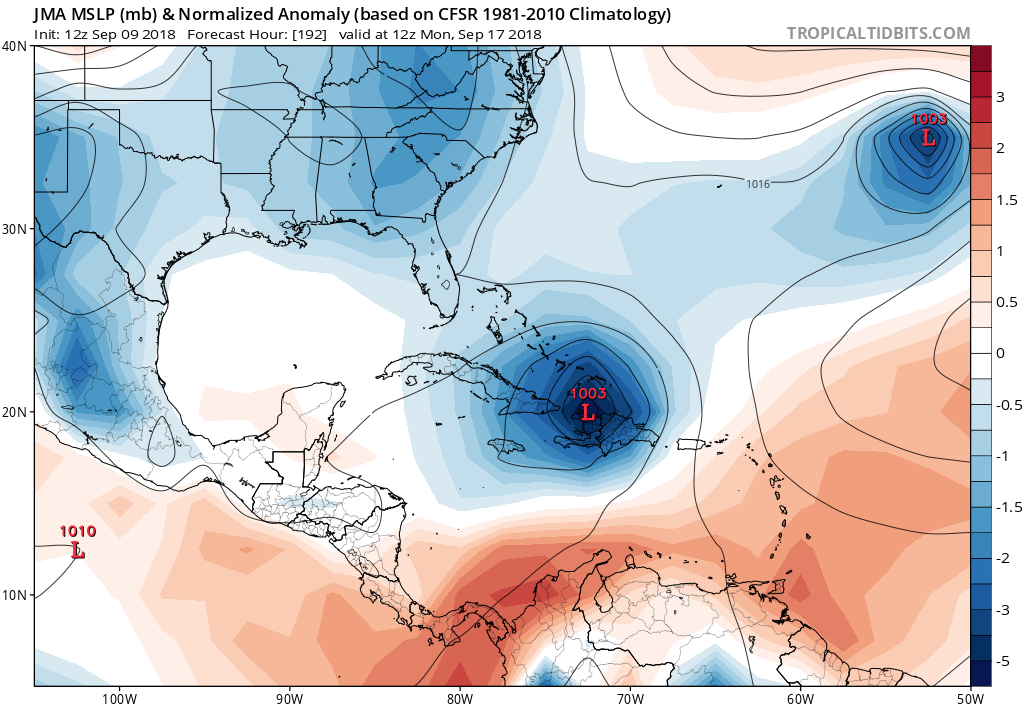
Did you see the NW Caribbean potential system? Just got a message from our service talking about it. They say 20% chance of it getting to a depression.


Yeah, that's the disturbance the GFS and Euro were developing a few days ago but then dropped it.
1 likes   

User avatar
gatorcane
S2K Supporter
S2K Supporter
Posts: 23499
Age: 46
Joined: Sun Mar 13, 2005 3:54 pm
Location: Boca Raton, FL

Re: ATL: ISAAC - Models

#242 Postby gatorcane » Sun Sep 09, 2018 1:35 pm

JMA has this turning north into the Bahamas after weakening some moving over Haiti:

Image
0 likes   

User avatar
Yellow Evan
Professional-Met
Professional-Met
Posts: 15960
Age: 25
Joined: Fri Jul 15, 2011 12:48 pm
Location: Henderson, Nevada/Honolulu, HI
Contact:

Re: ATL: ISAAC - Models

#243 Postby Yellow Evan » Sun Sep 09, 2018 1:37 pm

12z ECMWF and GFS still basically kills this in the Caribbean graveyard.
0 likes   

User avatar
SoupBone
Category 5
Category 5
Posts: 3073
Joined: Tue Sep 20, 2005 5:24 pm

Re: ATL: ISAAC - Models

#244 Postby SoupBone » Sun Sep 09, 2018 1:42 pm

Yellow Evan wrote:12z ECMWF and GFS still basically kills this in the Caribbean graveyard.


Basically, there are a few schools of model thought right now:

Euro, GFS, and FV3-GFS - Minimal hurricane over the islands, then kill it in Honduras/Nicaragua. This has been their solutions for a few days now.

CMC & HWRF - Now have it hitting the islands with a pretty potent system, then turning out to sea

UKMET - Turning out to sea before hitting the islands.


I honestly haven't been watching the other models.
0 likes   
Personal Forecast Disclaimer:
The posts in this forum are NOT official forecast and should not be used as such. They are just the opinion of the poster and may or may not be backed by sound meteorological data. They are NOT endorsed by any professional institution or storm2k.org. For official information, please refer to the NHC and NWS products.

User avatar
1900hurricane
Category 5
Category 5
Posts: 6044
Age: 33
Joined: Fri Feb 06, 2015 12:04 pm
Location: Houston, TX
Contact:

Re: ATL: ISAAC - Models

#245 Postby 1900hurricane » Sun Sep 09, 2018 2:06 pm

I'm not saying guidance is wrong by any means, but a small system below 20ºN can give some of the models (particularly the ECMWF) fits at times. Many of the current solutions show dissipation somewhere in the Caribbean, but I won't feel totally at ease until that time frame moves closer and things become more apparent.
5 likes   
Contract Meteorologist. TAMU & MSST. Fiercely authentic, one of a kind. We are all given free will, so choose a life meant to be lived. We are the Masters of our own Stories.
Opinions expressed are mine alone.

Follow me on Twitter at @1900hurricane : Read blogs at https://1900hurricane.wordpress.com/

User avatar
blp
Category 5
Category 5
Posts: 2807
Age: 45
Joined: Thu Sep 09, 2004 7:51 pm
Location: Miami, FL
Contact:

Re: ATL: ISAAC - Models

#246 Postby blp » Sun Sep 09, 2018 2:16 pm

1900hurricane wrote:I'm not saying guidance is wrong by any means, but a small system below 20ºN can give some of the models (particularly the ECMWF) fits at times. Many of the current solutions show dissipation somewhere in the Caribbean, but I won't feel totally at ease until that time frame moves closer and things become more apparent.


Agreed. I don't think that forecast is settled by no means. I noticed the Euro is stronger at 120hrs than the previous forecast. If it maintains it's core then the intensity forecast is a crapshoot.
1 likes   
The following post is NOT an official forecast and should not be used as such. It is just the opinion of the poster and may or may not be backed by sound meteorological data. It is NOT endorsed by any professional institution including storm2k.org For Official Information please refer to the NHC and NWS products.

User avatar
SoupBone
Category 5
Category 5
Posts: 3073
Joined: Tue Sep 20, 2005 5:24 pm

Re: ATL: ISAAC - Models

#247 Postby SoupBone » Sun Sep 09, 2018 3:41 pm

Image
0 likes   
Personal Forecast Disclaimer:
The posts in this forum are NOT official forecast and should not be used as such. They are just the opinion of the poster and may or may not be backed by sound meteorological data. They are NOT endorsed by any professional institution or storm2k.org. For official information, please refer to the NHC and NWS products.

Nolachick504
Tropical Wave
Tropical Wave
Posts: 4
Joined: Thu Aug 24, 2017 10:52 pm

Re: ATL: ISAAC - Models

#248 Postby Nolachick504 » Sun Sep 09, 2018 4:26 pm

Hi All!
Is there any chance of Isaac getting into the GOM. We New Orleanians stay on pins and needles during hurricane season after Hurricane Katrina!
0 likes   

User avatar
GeneratorPower
S2K Supporter
S2K Supporter
Posts: 1648
Age: 44
Joined: Sun Dec 18, 2005 11:48 pm
Location: Huntsville, AL

Re: ATL: ISAAC - Models

#249 Postby GeneratorPower » Sun Sep 09, 2018 4:27 pm

Nolachick504 wrote:Hi All!
Is there any chance of Isaac getting into the GOM. We New Orleanians stay on pins and needles during hurricane season after Hurricane Katrina!


Sure there is a chance. But it’s nowhere near known yet.
0 likes   

User avatar
AtlanticWind
S2K Supporter
S2K Supporter
Posts: 1809
Age: 65
Joined: Sun Aug 08, 2004 9:57 pm
Location: Plantation,Fla

Re: ATL: ISAAC - Models

#250 Postby AtlanticWind » Sun Sep 09, 2018 4:48 pm

Isaac stronger on this GFS run
0 likes   

User avatar
SoupBone
Category 5
Category 5
Posts: 3073
Joined: Tue Sep 20, 2005 5:24 pm

Re: ATL: ISAAC - Models

#251 Postby SoupBone » Sun Sep 09, 2018 5:01 pm

Last GFS run vs the current one.

ImageImage
1 likes   
Personal Forecast Disclaimer:
The posts in this forum are NOT official forecast and should not be used as such. They are just the opinion of the poster and may or may not be backed by sound meteorological data. They are NOT endorsed by any professional institution or storm2k.org. For official information, please refer to the NHC and NWS products.

HurricaneEric
Tropical Storm
Tropical Storm
Posts: 146
Age: 29
Joined: Mon Sep 07, 2015 11:06 am
Location: Miami, FL

Re: ATL: ISAAC - Models

#252 Postby HurricaneEric » Sun Sep 09, 2018 5:13 pm

Question for the pro-Mets or anyone who knows: Wouldn’t Issac feel the weakness left by Florence and pull North out of the Caribbean in this position? Or is it too far south? In that case, what’s steering it west?

Image


Sent from my iPhone using Tapatalk
1 likes   
Irene '99, Katrina '05, Wilma '05, Irma '17 (storms I remember my area getting hurricane force winds/gusts).

The posts in this forum are NOT official forecast and shouldn't be used as such. They are just the opinion of the poster and may or may not be backed by sound meteorological data. For official information, please refer to the experts.

User avatar
SoupBone
Category 5
Category 5
Posts: 3073
Joined: Tue Sep 20, 2005 5:24 pm

Re: ATL: ISAAC - Models

#253 Postby SoupBone » Sun Sep 09, 2018 5:16 pm

HurricaneEric wrote:Question for the pro-Mets or anyone who knows: Wouldn’t Issac feel the weakness left by Florence and pull North out of the Caribbean in this position? Or is it too far south? In that case, what’s steering it west?


NDG and I were talking about that earlier. From NDG - "The almost due west motion across the Caribbean is also due to the models showing it to weakening and getting caught in the low level easterlies across the Caribbean".

Also, the models are showing a high pressure piece sitting right on top the Cuba, not allowing it to gain latitude.

Some models do show it curving as it scrapes the islands, then heading out to sea (CMC, HWRF, and UKMET).
3 likes   
Personal Forecast Disclaimer:
The posts in this forum are NOT official forecast and should not be used as such. They are just the opinion of the poster and may or may not be backed by sound meteorological data. They are NOT endorsed by any professional institution or storm2k.org. For official information, please refer to the NHC and NWS products.

CrazyC83
Professional-Met
Professional-Met
Posts: 33399
Joined: Tue Mar 07, 2006 11:57 pm
Location: Deep South, for the first time!

Re: ATL: ISAAC - Models

#254 Postby CrazyC83 » Sun Sep 09, 2018 5:29 pm

HurricaneEric wrote:Question for the pro-Mets or anyone who knows: Wouldn’t Issac feel the weakness left by Florence and pull North out of the Caribbean in this position? Or is it too far south? In that case, what’s steering it west?

Image


Sent from my iPhone using Tapatalk


Isaac will likely be much shallower than Florence at that point, so it wouldn't feel an upper-level feature. That said, a much stronger and deeper Isaac could feel it.
3 likes   

User avatar
SoupBone
Category 5
Category 5
Posts: 3073
Joined: Tue Sep 20, 2005 5:24 pm

Re: ATL: ISAAC - Models

#255 Postby SoupBone » Sun Sep 09, 2018 5:34 pm

So a huge change from previous GFS runs is that the open wave (Isaac) gains latitude and heads towards the Yucatan, instead of burying itself in Honduras. If you play the model run, you can see it heading in that direction after clipping Jamaica.
1 likes   
Personal Forecast Disclaimer:
The posts in this forum are NOT official forecast and should not be used as such. They are just the opinion of the poster and may or may not be backed by sound meteorological data. They are NOT endorsed by any professional institution or storm2k.org. For official information, please refer to the NHC and NWS products.

User avatar
Blinhart
Category 5
Category 5
Posts: 1981
Age: 47
Joined: Thu Sep 08, 2011 3:13 pm
Location: Crowley, La.

Re: ATL: ISAAC - Models

#256 Postby Blinhart » Sun Sep 09, 2018 5:43 pm

SoupBone wrote:So a huge change from previous GFS runs is that the open wave (Isaac) gains latitude and heads towards the Yucatan, instead of burying itself in Honduras. If you play the model run, you can see it heading in that direction after clipping Jamaica.


So more like Harvey.
0 likes   
Personal Forecast Disclaimer:
The posts in this forum are NOT official forecast and should not be used as such. They are just the opinion of the poster and may or may not be backed by sound meteorological data. They are NOT endorsed by any professional institution or storm2k.org. For official information, please refer to the NHC and NWS products.

supercane4867
Category 5
Category 5
Posts: 4966
Joined: Wed Nov 14, 2012 10:43 am

Re: ATL: ISAAC - Models

#257 Postby supercane4867 » Sun Sep 09, 2018 6:50 pm

CAT4 on18z HWRF

Image
1 likes   

User avatar
Hypercane_Kyle
Category 5
Category 5
Posts: 2904
Joined: Sat Mar 07, 2015 7:58 pm
Location: Cape Canaveral, FL

Re: ATL: ISAAC - Models

#258 Postby Hypercane_Kyle » Sun Sep 09, 2018 7:01 pm

18z HWRF is just cruel.... really hoping nothing that extreme happens.
0 likes   
My posts are my own personal opinion, defer to the National Hurricane Center (NHC) and other NOAA products for decision making during hurricane season.

CrazyC83
Professional-Met
Professional-Met
Posts: 33399
Joined: Tue Mar 07, 2006 11:57 pm
Location: Deep South, for the first time!

Re: ATL: ISAAC - Models

#259 Postby CrazyC83 » Sun Sep 09, 2018 7:05 pm

Hypercane_Kyle wrote:18z HWRF is just cruel.... really hoping nothing that extreme happens.


IMO it is not unreasonable, and 942 would likely be a strong cat 4 or near cat 5 given the tiny size.
0 likes   

User avatar
cycloneye
Admin
Admin
Posts: 139604
Age: 67
Joined: Thu Oct 10, 2002 10:54 am
Location: San Juan, Puerto Rico

Re: ATL: ISAAC - Models

#260 Postby cycloneye » Sun Sep 09, 2018 7:05 pm

What does HWRF see as very favorable to be that strong?
0 likes   
Visit the Caribbean-Central America Weather Thread where you can find at first post web cams,radars
and observations from Caribbean basin members Click Here


Return to “2018”

Who is online

Users browsing this forum: No registered users and 6 guests