WPAC: JEBI - Post-Tropical
Moderator: S2k Moderators
-
mrbagyo

- Category 5

- Posts: 3963
- Age: 33
- Joined: Thu Apr 12, 2012 9:18 am
- Location: 14.13N 120.98E
- Contact:
Re: WPAC: JEBI - Typhoon
0 likes
The posts in this forum are NOT official forecast and should not be used as such. They are just the opinion of the poster and may or may not be backed by sound meteorological data. They are NOT endorsed by any professional institution or storm2k.org. For official information, please refer to RSMC, NHC and NWS products.
-
mrbagyo
- Category 5
- Posts: 3963
- Age: 33
- Joined: Thu Apr 12, 2012 9:18 am
- Location: 14.13N 120.98E
- Contact:
Re: WPAC: JEBI - Typhoon
Pressure in Muroto is down to 960.3 hpa - 35.7 m/s sustained wind.
BT pressure of 961 hpa is trash. lol
25W JEBI 180904 0000 32.3N 133.6E WPAC 75 961
BT pressure of 961 hpa is trash. lol
25W JEBI 180904 0000 32.3N 133.6E WPAC 75 961
0 likes
The posts in this forum are NOT official forecast and should not be used as such. They are just the opinion of the poster and may or may not be backed by sound meteorological data. They are NOT endorsed by any professional institution or storm2k.org. For official information, please refer to RSMC, NHC and NWS products.
-
1900hurricane

- Category 5
- Posts: 6063
- Age: 34
- Joined: Fri Feb 06, 2015 12:04 pm
- Location: Houston, TX
- Contact:
Re: WPAC: JEBI - Typhoon
mrbagyo wrote:Pressure in Muroto is down to 960.3 hpa - 35.7 m/s sustained wind.
BT pressure of 961 hpa is trash. lol
25W JEBI 180904 0000 32.3N 133.6E WPAC 75 961
The current SATCON estimate is 20 mb lower. I doubt it's that low, but yeah, best track is a bit too high.
0 likes
Contract Meteorologist. TAMU & MSST. Fiercely authentic, one of a kind. We are all given free will, so choose a life meant to be lived. We are the Masters of our own Stories.
Opinions expressed are mine alone.
Follow me on Twitter at @1900hurricane : Read blogs at https://1900hurricane.wordpress.com/
Opinions expressed are mine alone.
Follow me on Twitter at @1900hurricane : Read blogs at https://1900hurricane.wordpress.com/
Re: WPAC: JEBI - Typhoon
JMA’s intensity estimate of 945mb/85KT is very close to reality I would say.
0 likes
Personal Forecast Disclaimer:
The posts in this forum are NOT official forecast and should not be used as such. They are just the opinion of the poster and may or may not be backed by sound meteorological data. They are NOT endorsed by any professional institution or storm2k.org. For official information, please refer to RSMC and NWS products.
The posts in this forum are NOT official forecast and should not be used as such. They are just the opinion of the poster and may or may not be backed by sound meteorological data. They are NOT endorsed by any professional institution or storm2k.org. For official information, please refer to RSMC and NWS products.
-
mrbagyo
- Category 5
- Posts: 3963
- Age: 33
- Joined: Thu Apr 12, 2012 9:18 am
- Location: 14.13N 120.98E
- Contact:
Re: WPAC: JEBI - Typhoon
Muroto recorded 955.3 mb outside the eye -16.4 m/s
0 likes
The posts in this forum are NOT official forecast and should not be used as such. They are just the opinion of the poster and may or may not be backed by sound meteorological data. They are NOT endorsed by any professional institution or storm2k.org. For official information, please refer to RSMC, NHC and NWS products.
-
1900hurricane
- Category 5
- Posts: 6063
- Age: 34
- Joined: Fri Feb 06, 2015 12:04 pm
- Location: Houston, TX
- Contact:
Re: WPAC: JEBI - Typhoon
I might go 950-951 mb based on that.
0 likes
Contract Meteorologist. TAMU & MSST. Fiercely authentic, one of a kind. We are all given free will, so choose a life meant to be lived. We are the Masters of our own Stories.
Opinions expressed are mine alone.
Follow me on Twitter at @1900hurricane : Read blogs at https://1900hurricane.wordpress.com/
Opinions expressed are mine alone.
Follow me on Twitter at @1900hurricane : Read blogs at https://1900hurricane.wordpress.com/
Re: WPAC: JEBI - Typhoon
Lnadfall intensity 950mb/85kt according to JMA. Record-breaking wind speed reported from various weather stations near Osaka and Wakayama.
0 likes
Personal Forecast Disclaimer:
The posts in this forum are NOT official forecast and should not be used as such. They are just the opinion of the poster and may or may not be backed by sound meteorological data. They are NOT endorsed by any professional institution or storm2k.org. For official information, please refer to RSMC and NWS products.
The posts in this forum are NOT official forecast and should not be used as such. They are just the opinion of the poster and may or may not be backed by sound meteorological data. They are NOT endorsed by any professional institution or storm2k.org. For official information, please refer to RSMC and NWS products.
-
mrbagyo
- Category 5
- Posts: 3963
- Age: 33
- Joined: Thu Apr 12, 2012 9:18 am
- Location: 14.13N 120.98E
- Contact:
Re: WPAC: JEBI - Typhoon
Gust above 50 m/s
Kansai Int'l Airport - 58.1m/s (SSW) - 13:38
Wakayama - 57.4 m/s (SSW) - 13:19
Muroto-Misaki - 55.30 m/s (W) - 11:53
Tomogashima - 51.8 m/s (S) - 13:14
Kumatori - 51.2 m/s (S) - 13:40
Hiwasa - 50.3 m/s (E) - 11:05
Pressure below or equal to 960 hpa
Muroto-Misaki - 955.3 hpa
Sumoto - 955.4 hpa
Kobe- 959.4 hpa
Kansai Intl Airport - 959.97 hpa
0 likes
The posts in this forum are NOT official forecast and should not be used as such. They are just the opinion of the poster and may or may not be backed by sound meteorological data. They are NOT endorsed by any professional institution or storm2k.org. For official information, please refer to RSMC, NHC and NWS products.
Re: WPAC: JEBI - Typhoon
Record-breaking storm surge reported from Osaka as well. Possibly the strongest storm affecting this region since Nancy’61.
0 likes
Personal Forecast Disclaimer:
The posts in this forum are NOT official forecast and should not be used as such. They are just the opinion of the poster and may or may not be backed by sound meteorological data. They are NOT endorsed by any professional institution or storm2k.org. For official information, please refer to RSMC and NWS products.
The posts in this forum are NOT official forecast and should not be used as such. They are just the opinion of the poster and may or may not be backed by sound meteorological data. They are NOT endorsed by any professional institution or storm2k.org. For official information, please refer to RSMC and NWS products.
-
mrbagyo
- Category 5
- Posts: 3963
- Age: 33
- Joined: Thu Apr 12, 2012 9:18 am
- Location: 14.13N 120.98E
- Contact:
Re: WPAC: JEBI - Typhoon
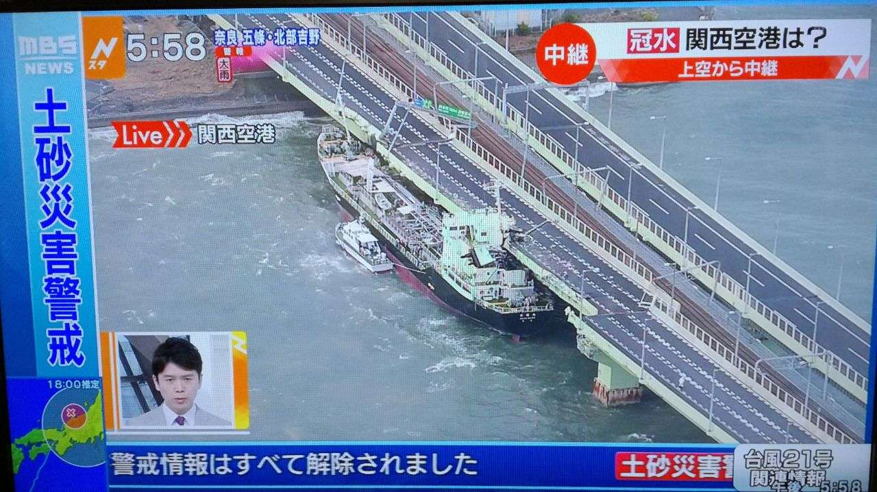
NotoSans wrote:Record-breaking storm surge reported from Osaka as well. Possibly the strongest storm affecting this region since Nancy’61.
Yeah, Kansai Intl airport is underwater
A ship collided to a bridge.
https://twitter.com/zagimu/status/1036852888289431552
Last edited by mrbagyo on Tue Sep 04, 2018 2:50 am, edited 1 time in total.
0 likes
The posts in this forum are NOT official forecast and should not be used as such. They are just the opinion of the poster and may or may not be backed by sound meteorological data. They are NOT endorsed by any professional institution or storm2k.org. For official information, please refer to RSMC, NHC and NWS products.
-
doomhaMwx

- Category 5
- Posts: 2487
- Age: 27
- Joined: Tue Apr 18, 2017 4:01 am
- Location: Baguio/Benguet, Philippines
- Contact:
Re: WPAC: JEBI - Typhoon
The Kansai Int'l Airport inundated by storm surge...
https://twitter.com/nhk_news/status/1036857439814135808
https://twitter.com/nhk_news/status/1036865999440699392
https://twitter.com/nhk_news/status/1036857439814135808
https://twitter.com/nhk_news/status/1036865999440699392
0 likes
Re: WPAC: JEBI - Typhoon
Maximum sustained winds of 90.4 knots (10-minute average) were recorded in Kansai International Airport but such a high wind speed may be attributed to channeling effect. Nevertheless, landfall intensity estimate from JTWC is likely too low.
0 likes
Personal Forecast Disclaimer:
The posts in this forum are NOT official forecast and should not be used as such. They are just the opinion of the poster and may or may not be backed by sound meteorological data. They are NOT endorsed by any professional institution or storm2k.org. For official information, please refer to RSMC and NWS products.
The posts in this forum are NOT official forecast and should not be used as such. They are just the opinion of the poster and may or may not be backed by sound meteorological data. They are NOT endorsed by any professional institution or storm2k.org. For official information, please refer to RSMC and NWS products.
-
1900hurricane
- Category 5
- Posts: 6063
- Age: 34
- Joined: Fri Feb 06, 2015 12:04 pm
- Location: Houston, TX
- Contact:
Re: WPAC: JEBI - Typhoon
Using KZC, I get a 90-95 kt 1 minute wind estimate with the estimated 950 mb pressure and other inputs from JTWC, which seems reasonable to possibly a little low based on surface obs.
0 likes
Contract Meteorologist. TAMU & MSST. Fiercely authentic, one of a kind. We are all given free will, so choose a life meant to be lived. We are the Masters of our own Stories.
Opinions expressed are mine alone.
Follow me on Twitter at @1900hurricane : Read blogs at https://1900hurricane.wordpress.com/
Opinions expressed are mine alone.
Follow me on Twitter at @1900hurricane : Read blogs at https://1900hurricane.wordpress.com/
Re: WPAC: JEBI - Typhoon
mrbagyo wrote:NotoSans wrote:Record-breaking storm surge reported from Osaka as well. Possibly the strongest storm affecting this region since Nancy’61.
Yeah, Kansai Intl airport is underwater
A ship collided to a bridge.
https://twitter.com/zagimu/status/1036852888289431552
The bridge is the only way to get to the airport from Osaka. Looks like some severe disruption to air traffic in the nearby region.
0 likes
Personal Forecast Disclaimer:
The posts in this forum are NOT official forecast and should not be used as such. They are just the opinion of the poster and may or may not be backed by sound meteorological data. They are NOT endorsed by any professional institution or storm2k.org. For official information, please refer to RSMC and NWS products.
The posts in this forum are NOT official forecast and should not be used as such. They are just the opinion of the poster and may or may not be backed by sound meteorological data. They are NOT endorsed by any professional institution or storm2k.org. For official information, please refer to RSMC and NWS products.
-
mrbagyo
- Category 5
- Posts: 3963
- Age: 33
- Joined: Thu Apr 12, 2012 9:18 am
- Location: 14.13N 120.98E
- Contact:
Re: WPAC: JEBI - Typhoon

1 likes
The posts in this forum are NOT official forecast and should not be used as such. They are just the opinion of the poster and may or may not be backed by sound meteorological data. They are NOT endorsed by any professional institution or storm2k.org. For official information, please refer to RSMC, NHC and NWS products.
Re: WPAC: JEBI - Typhoon
According to JMA, Jebi is the first typhoon since Yancy'93 making landfall over the Japanese main islands with sustained winds of 85KT+. Yancy made landfall over Kyushu with sustained winds of 95KT.
0 likes
Personal Forecast Disclaimer:
The posts in this forum are NOT official forecast and should not be used as such. They are just the opinion of the poster and may or may not be backed by sound meteorological data. They are NOT endorsed by any professional institution or storm2k.org. For official information, please refer to RSMC and NWS products.
The posts in this forum are NOT official forecast and should not be used as such. They are just the opinion of the poster and may or may not be backed by sound meteorological data. They are NOT endorsed by any professional institution or storm2k.org. For official information, please refer to RSMC and NWS products.
Re: WPAC: JEBI - Typhoon
Lowest SLP recorded in Japan was 953.0 hPa from Muroto-misaki.
0 likes
Personal Forecast Disclaimer:
The posts in this forum are NOT official forecast and should not be used as such. They are just the opinion of the poster and may or may not be backed by sound meteorological data. They are NOT endorsed by any professional institution or storm2k.org. For official information, please refer to RSMC and NWS products.
The posts in this forum are NOT official forecast and should not be used as such. They are just the opinion of the poster and may or may not be backed by sound meteorological data. They are NOT endorsed by any professional institution or storm2k.org. For official information, please refer to RSMC and NWS products.
-
1900hurricane
- Category 5
- Posts: 6063
- Age: 34
- Joined: Fri Feb 06, 2015 12:04 pm
- Location: Houston, TX
- Contact:
Re: WPAC: JEBI - Typhoon
NotoSans wrote:According to JMA, Jebi is the first typhoon since Yancy'93 making landfall over the Japanese main islands with sustained winds of 85KT+. Yancy made landfall over Kyushu with sustained winds of 95KT.
What landfall intensity does JMA have Goni '15 at? I thought that was an 85 or 90 kt landfall in west Kyushu.
0 likes
Contract Meteorologist. TAMU & MSST. Fiercely authentic, one of a kind. We are all given free will, so choose a life meant to be lived. We are the Masters of our own Stories.
Opinions expressed are mine alone.
Follow me on Twitter at @1900hurricane : Read blogs at https://1900hurricane.wordpress.com/
Opinions expressed are mine alone.
Follow me on Twitter at @1900hurricane : Read blogs at https://1900hurricane.wordpress.com/
-
1900hurricane
- Category 5
- Posts: 6063
- Age: 34
- Joined: Fri Feb 06, 2015 12:04 pm
- Location: Houston, TX
- Contact:
Re: WPAC: JEBI - Typhoon
SATCON seemed to do very well actually with landfall intensity. The 0230Z intensity estimate was 94 kt (one minute)/948 mb, which lines up pretty well with the JMA estimate and appears much better than the one from JTWC. It's interesting to note that SATCON was consistently much higher than the JTWC estimates after peak intensity all the way until landfall.

0 likes
Contract Meteorologist. TAMU & MSST. Fiercely authentic, one of a kind. We are all given free will, so choose a life meant to be lived. We are the Masters of our own Stories.
Opinions expressed are mine alone.
Follow me on Twitter at @1900hurricane : Read blogs at https://1900hurricane.wordpress.com/
Opinions expressed are mine alone.
Follow me on Twitter at @1900hurricane : Read blogs at https://1900hurricane.wordpress.com/
-
mrbagyo
- Category 5
- Posts: 3963
- Age: 33
- Joined: Thu Apr 12, 2012 9:18 am
- Location: 14.13N 120.98E
- Contact:
Re: WPAC: JEBI - Typhoon
1900hurricane wrote:NotoSans wrote:According to JMA, Jebi is the first typhoon since Yancy'93 making landfall over the Japanese main islands with sustained winds of 85KT+. Yancy made landfall over Kyushu with sustained winds of 95KT.
What landfall intensity does JMA have Goni '15 at? I thought that was an 85 or 90 kt landfall in west Kyushu.
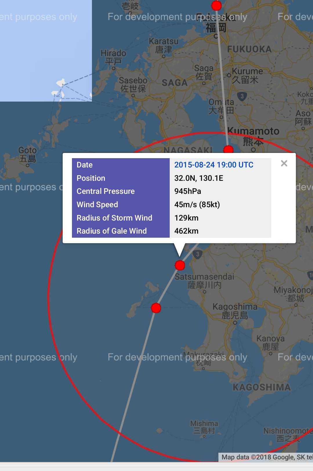
According to JMAs database (Digital Typhoon), Goni was 85 knots / 945hpa before smashing into Kyushu
0 likes
The posts in this forum are NOT official forecast and should not be used as such. They are just the opinion of the poster and may or may not be backed by sound meteorological data. They are NOT endorsed by any professional institution or storm2k.org. For official information, please refer to RSMC, NHC and NWS products.
Who is online
Users browsing this forum: No registered users and 78 guests