

Beginning a more west movement
Moderator: S2k Moderators
artist wrote:Hurricane force winds extend 160 miles, 80 miles from center out, tropical storm force winds extend 390 miles, 195 from center out.
Florence is a large hurricane. Hurricane-force winds extend outward
up to 80 miles (130 km) from the center and tropical-storm-force
winds extend outward up to 195 miles (315 km). NOAA Buoy 41025,
located near Diamond Shoals, North Carolina, recently reported a
sustained wind of 54 mph (87 km/h).
Huge storm and wind field.
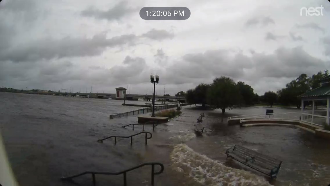
wx98 wrote:ronyan wrote:This guy is on Ocracoke and has been posting some updates: https://twitter.com/JohnMoretti5
He tweeted over an hour ago water has probably risen 2 to 3 feet. Lines up with Jeff Piotrowski's footage of the surge coming in down at Topsail Beach.
Bunkertor wrote:Keraunos
[url]https://abload.de/img/florence_ezgif-4-66f5fdf9w.gif [/url]

artist wrote:Hurricane force winds extend 160 miles, 80 miles from center out, tropical storm force winds extend 390 miles, 195 from center out.
Florence is a large hurricane. Hurricane-force winds extend outward
up to 80 miles (130 km) from the center and tropical-storm-force
winds extend outward up to 195 miles (315 km). NOAA Buoy 41025,
located near Diamond Shoals, North Carolina, recently reported a
sustained wind of 54 mph (87 km/h).
Huge storm and wind field.


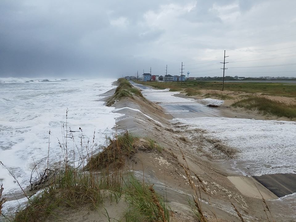
artist wrote:NCDOT NC12
@NCDOT_NC12
Here's a look at overwash on NC12 just north of Hatteras Village. Again, this is NOT the time to be out on the roads on either Ocracoke or Hatteras Islands.
https://s33.postimg.cc/b4dp4awin/image.jpg
Posted over an hour ago

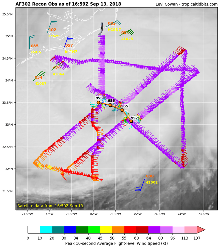
artist wrote:Latest vortex
503
URNT12 KNHC 131707
VORTEX DATA MESSAGE AL062018
A. 13/16:31:10Z
B. 33.50 deg N 075.89 deg W
C. 700 mb 2726 m
D. 955 mb
E. 040 deg 5 kt
F. OPEN E
G. C34
H. 64 kt
I. 181 deg 18 nm 16:25:30Z
J. 259 deg 71 kt
K. 170 deg 45 nm 16:16:00Z
L. 84 kt
M. 358 deg 19 nm 16:37:00Z
N. 091 deg 90 kt
O. 359 deg 30 nm 16:40:30Z
P. 9 C / 3049 m
Q. 18 C / 3044 m
R. 13 C / NA
S. 12345 / 7
T. 0.02 / 1 nm
U. AF302 1406A FLORENCE OB 26
MAX FL WIND 92 KT 059 / 25 NM 14:54:30Z
;
NC George wrote:artist wrote:NCDOT NC12
@NCDOT_NC12
Here's a look at overwash on NC12 just north of Hatteras Village. Again, this is NOT the time to be out on the roads on either Ocracoke or Hatteras Islands.
https://s33.postimg.cc/b4dp4awin/image.jpg
Posted over an hour ago
Compare that to my avatar, which was taken just a little N of where the poster's pic was taken.
lando wrote:What’s Jeff p live stream??


ktulu909 wrote:lando wrote:What’s Jeff p live stream??
https://www.pscp.tv/Jeff_Piotrowski/1rmGPNXPPOQxN
Users browsing this forum: No registered users and 64 guests


![[url]https://abload.de/img/florence_ezgif-4-66f5fdf9w.gif](https://abload.de/image.php?img=florence_ezgif-4-66f5fdf9w.gif)