NWS National Hurricane Center Miami FL
200 AM EDT Sat Aug 24 2019
For the North Atlantic...Caribbean Sea and the Gulf of Mexico:
The National Hurricane Center has issued the last advisory on
Post-Tropical Cyclone Chantal, located several hundred miles west of
the Azores.
1. A broad area of low pressure located inland over South Florida
continues to produce a large area of disorganized showers and
thunderstorms that extend eastward over the northwestern Bahamas
and the adjacent Atlantic waters. Significant development of the
low is unlikely today while it drifts northward over the southern
Florida peninsula. Environmental conditions appear conducive to
support gradual development once the low moves off the east-central
coast of Florida over the western Atlantic by Sunday, and a tropical
or subtropical depression is likely to form early next week while
the system moves northeastward offshore of the southeastern United
States coast.
Regardless of development, locally heavy rains are possible over the
northwestern Bahamas and the southern and central Florida peninsula
through the weekend. Interests in the northwestern Bahamas, the
Florida peninsula, and the southeastern coast of the United States
should monitor the progress of this system. The Air Force Reserve
Hurricane Hunter aircraft scheduled to investigate the system later
today could be postponed if the center of the low remains inland
over Florida. Another aircraft is scheduled to investigate the
system on Sunday.
* Formation chance through 48 hours...high...70 percent.
* Formation chance through 5 days...high...90 percent.
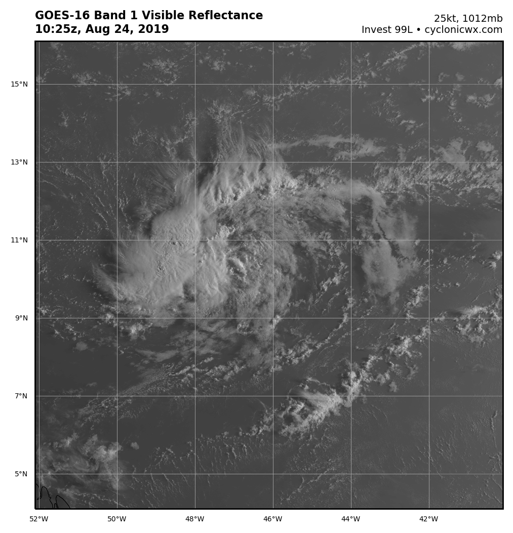
2. Showers and thunderstorms associated with a small area of low
pressure located about 1050 miles east of the Windward Islands are
showing some signs of organization. Environmental conditions appear
conducive for additional development, and a tropical depression is
likely to form over the weekend or early next week while the low
moves westward to west-northwestward at 10 to 15 mph. Conditions
appear less favorable for development when the low reaches the
Lesser Antilles and eastern Caribbean Sea by the middle of next
week.
* Formation chance through 48 hours...medium...60 percent.
* Formation chance through 5 days...high...70 percent.
Forecaster Berg