
ATL: BARRY - Post-Tropical - Discussion
Moderator: S2k Moderators
-
tropicwatch

- Category 5

- Posts: 3426
- Age: 62
- Joined: Sat Jun 02, 2007 10:01 am
- Location: Panama City Florida
- Contact:
Re: ATL: INVEST 92L - Discussion
Starting to see 850mb vorticity increase in the Gulf of Mexico just south of Apalachicola and Port St. Joe.
1 likes
Tropicwatch
Agnes 72', Eloise 75, Elena 85', Kate 85', Charley 86', Florence 88', Beryl 94', Dean 95', Erin 95', Opal 95', Earl 98', Georges 98', Ivan 2004', Arlene 2005', Dennis 2005', Ida 2009' Debby 2012' Irma 2017' Michael 2018'
Agnes 72', Eloise 75, Elena 85', Kate 85', Charley 86', Florence 88', Beryl 94', Dean 95', Erin 95', Opal 95', Earl 98', Georges 98', Ivan 2004', Arlene 2005', Dennis 2005', Ida 2009' Debby 2012' Irma 2017' Michael 2018'
-
Aric Dunn
- Category 5
- Posts: 21238
- Age: 43
- Joined: Sun Sep 19, 2004 9:58 pm
- Location: Ready for the Chase.
- Contact:
Re: ATL: INVEST 92L - Discussion
looks like some feeder bands starting to develop sw of tampa. Deep convection offshore should begin soon and by morning we will likely be looking at a quickly developing TD/TS
2 likes
Note: If I make a post that is brief. Please refer back to previous posts for the analysis or reasoning. I do not re-write/qoute what my initial post said each time.
If there is nothing before... then just ask
Space & Atmospheric Physicist, Embry-Riddle Aeronautical University,
I believe the sky is falling...
If there is nothing before... then just ask
Space & Atmospheric Physicist, Embry-Riddle Aeronautical University,
I believe the sky is falling...

ATL: INVEST 92L - Models
I don't want to see this system form up at all, it isn't in a good spot for anyone. No matter what someone will be getting a ton of rain that has no wheres to go when you are talking about a foot or more of rain. There is really no steering current after it makes it turn North so it could stay anywhere and just dump rain over the same spot for days on end.
Going West to Sabine will cause me to have to worry about the flooding myself, and going to Vermillion Bay would cause New Orleans to be flooded, going to New Orleans would cause all of South Mississippi and Alabama to flood.
Going West to Sabine will cause me to have to worry about the flooding myself, and going to Vermillion Bay would cause New Orleans to be flooded, going to New Orleans would cause all of South Mississippi and Alabama to flood.
2 likes
Personal Forecast Disclaimer:
The posts in this forum are NOT official forecast and should not be used as such. They are just the opinion of the poster and may or may not be backed by sound meteorological data. They are NOT endorsed by any professional institution or storm2k.org. For official information, please refer to the NHC and NWS products.
The posts in this forum are NOT official forecast and should not be used as such. They are just the opinion of the poster and may or may not be backed by sound meteorological data. They are NOT endorsed by any professional institution or storm2k.org. For official information, please refer to the NHC and NWS products.
-
floridasun78
- Category 5
- Posts: 3755
- Joined: Sun May 17, 2009 10:16 pm
- Location: miami fl
Re: ATL: INVEST 92L - Discussion
most storm we saw early have die for night less most now are by new orlean
Last edited by floridasun78 on Tue Jul 09, 2019 11:08 pm, edited 1 time in total.
0 likes
-
northjaxpro

- S2K Supporter

- Posts: 8900
- Joined: Mon Sep 27, 2010 11:21 am
- Location: Jacksonville, FL
Re: ATL: INVEST 92L - Models
Blinhart wrote:I don't want to see this system form up at all, it isn't in a good spot for anyone. No matter what someone will be getting a ton of rain that has no wheres to go when you are talking about a foot or more of rain. There is really no steering current after it makes it turn North so it could stay anywhere and just dump rain over the same spot for days on end.
Going West to Sabine will cause me to have to worry about the flooding myself, and going to Vermillion Bay would cause New Orleans to be flooded, going to New Orleans would cause all of South Mississippi and Alabama to flood.
Yeah, it looks like after landfall, steering currents will be very weak as it apoears the Great Lakes trough will lift out by early next week. This will leave Barry's remnants meandering around the Lower MS River Valley region and Southeast U.S. region for days and days next week. Definitely an ominous situation for potential major flooding down into those areas next week.
0 likes
NEVER, EVER SAY NEVER in the tropics and weather in general, and most importantly, with life itself!!
________________________________________________________________________________________
Fay 2008 Beryl 2012 Debby 2012 Colin 2016 Hermine 2016 Julia 2016 Matthew 2016 Irma 2017 Dorian 2019
________________________________________________________________________________________
Fay 2008 Beryl 2012 Debby 2012 Colin 2016 Hermine 2016 Julia 2016 Matthew 2016 Irma 2017 Dorian 2019
-
MississippiWx

- S2K Supporter
- Posts: 1720
- Joined: Sat Aug 14, 2010 1:44 pm
- Location: Hattiesburg, Mississippi
Re: ATL: INVEST 92L - Discussion
92L looks to be getting its act together early this morning. Satellite is showing a steadily improving structure.
0 likes
This post is not an official forecast and should not be used as such. It is just the opinion of MississippiWx and may or may not be backed by sound meteorological data. It is not endorsed by any professional institution including storm2k.org. For Official Information please refer to the NHC and NWS products.
-
USTropics
- Professional-Met

- Posts: 2737
- Joined: Sun Aug 12, 2007 3:45 am
- Location: Florida State University
Re: ATL: INVEST 92L - Discussion
Looking at the CIMSS vorticity products for all levels of the atmosphere (850, 700, and 500mb), there's still some work to be done but the area in the NE GOM is beginning to dominate:
850mb:

700mb:

500mb:

850mb:
700mb:
500mb:
3 likes

Re: ATL: INVEST 92L - Discussion
Helicity increasing in the last two towers.
One tower just to the south of the CoC.
CAPE should increase during the day today.
IMHO recon should find this closed off and NHC should name this today.

One tower just to the south of the CoC.
CAPE should increase during the day today.
IMHO recon should find this closed off and NHC should name this today.
0 likes
-
Aric Dunn
- Category 5
- Posts: 21238
- Age: 43
- Joined: Sun Sep 19, 2004 9:58 pm
- Location: Ready for the Chase.
- Contact:
Re: ATL: INVEST 92L - Discussion
Surface obs offshore showing a developing circ right in the sweet spot from yesterday as mentioned. It is on its way and well offshore likely farther south than the models.

3 likes
Note: If I make a post that is brief. Please refer back to previous posts for the analysis or reasoning. I do not re-write/qoute what my initial post said each time.
If there is nothing before... then just ask
Space & Atmospheric Physicist, Embry-Riddle Aeronautical University,
I believe the sky is falling...
If there is nothing before... then just ask
Space & Atmospheric Physicist, Embry-Riddle Aeronautical University,
I believe the sky is falling...
Re: ATL: INVEST 92L - Discussion
Track is into a firmly entrenched theta-e ridge.
Given that and a very conducive UL environment, IMHO, chances are high for RI.

Given that and a very conducive UL environment, IMHO, chances are high for RI.
4 likes
Re: ATL: INVEST 92L - Discussion
jconsor wrote:https://twitter.com/yconsor/status/1148867582734282752
I just checked initialization of both models and agree.
CoC is a lot further south than what they show.
1 likes

-
USTropics
- Professional-Met
- Posts: 2737
- Joined: Sun Aug 12, 2007 3:45 am
- Location: Florida State University
Re: ATL: INVEST 92L - Discussion
Aric Dunn wrote:Surface obs offshore showing a developing circ right in the sweet spot from yesterday as mentioned. It is on its way and well offshore likely farther south than the models.
https://i.ibb.co/yP9yrt6/sgdsfnxfhn.png
Yup, can see it clearly with the buoy data right offshore (winds abruptly changed from NW to SSE):

src: https://www.ndbc.noaa.gov/station_page.php?station=sgof1
Data from station in Apalachicola, FL showing E winds at 1:30am and now straight N winds:

src: https://www.ndbc.noaa.gov/station_page.php?station=apcf1

3 likes
-
Aric Dunn
- Category 5
- Posts: 21238
- Age: 43
- Joined: Sun Sep 19, 2004 9:58 pm
- Location: Ready for the Chase.
- Contact:
Re: ATL: INVEST 92L - Discussion
USTropics wrote:Aric Dunn wrote:Surface obs offshore showing a developing circ right in the sweet spot from yesterday as mentioned. It is on its way and well offshore likely farther south than the models.
https://i.ibb.co/yP9yrt6/sgdsfnxfhn.png
Yup, can see it clearly with the buoy data right offshore (winds abruptly changed from NW to SSE):
https://i.imgur.com/sXaPs3W.png
src: https://www.ndbc.noaa.gov/station_page.php?station=sgof1
Data from station in Apalachicola, FL showing E winds at 1:30am and now straight N winds:
https://i.imgur.com/8Md02IK.png
src: https://www.ndbc.noaa.gov/station_page.php?station=apcf1
https://i.imgur.com/lI7d8is.jpg
yeah and on satellite it is the area of greatest curvatures and clearly a good mid level circ on top of it. so 12z models will be adjusted south quite a bit.
2 likes
Note: If I make a post that is brief. Please refer back to previous posts for the analysis or reasoning. I do not re-write/qoute what my initial post said each time.
If there is nothing before... then just ask
Space & Atmospheric Physicist, Embry-Riddle Aeronautical University,
I believe the sky is falling...
If there is nothing before... then just ask
Space & Atmospheric Physicist, Embry-Riddle Aeronautical University,
I believe the sky is falling...
Re: ATL: INVEST 92L - Discussion
42039 Pensacola Bouy also showing a shift in winds and low pressure
https://www.ndbc.noaa.gov/station_page. ... tion=42039


https://www.ndbc.noaa.gov/station_page. ... tion=42039
0 likes
-
Hurricane Andrew

- S2K Supporter
- Posts: 1891
- Age: 27
- Joined: Sun May 23, 2010 2:53 pm
- Location: KS
Re: ATL: INVEST 92L - Discussion
Morning all!
Latest WPC D1-D7 QPF forecast ups expected totals to 10-15" over portions of southern and central Louisiana.
https://www.wpc.ncep.noaa.gov/qpf/p168i.gif?1562717669
Latest WPC D1-D7 QPF forecast ups expected totals to 10-15" over portions of southern and central Louisiana.
https://www.wpc.ncep.noaa.gov/qpf/p168i.gif?1562717669
Last edited by Hurricane Andrew on Wed Jul 10, 2019 4:40 am, edited 1 time in total.
1 likes
The Enthusiast
NREMT-AEMT, WX nerd
Irene '11, Sandy '12, Irma '17 (SAR)
"Hard to think we were born to live this way..." -Wage War
Re: ATL: INVEST 92L - Discussion
Just checked WV and looks like an outflow channel being setup over the Keys / Strait.
A bit of mid-level dry air to the west.
https://www.tropicaltidbits.com/sat/sat ... uct=wv-mid

A bit of mid-level dry air to the west.
https://www.tropicaltidbits.com/sat/sat ... uct=wv-mid
3 likes
-
USTropics
- Professional-Met
- Posts: 2737
- Joined: Sun Aug 12, 2007 3:45 am
- Location: Florida State University
Re: ATL: INVEST 92L - Discussion
GCANE wrote:Just checked WV and looks like an outflow channel being setup over the Keys / Strait.
A bit of mid-level dry air to the west.
https://www.tropicaltidbits.com/sat/sat ... uct=wv-mid
https://imagizer.imageshack.com/img924/1292/N9bWu5.png
Seems to be enhanced by the ULL cruising through the Bahamas currently as well:
https://a.atmos.washington.edu/~ovens/loops/wxloop.cgi?wv_east_enhanced+24
1 likes
-
USTropics
- Professional-Met
- Posts: 2737
- Joined: Sun Aug 12, 2007 3:45 am
- Location: Florida State University
Re: ATL: INVEST 92L - Discussion
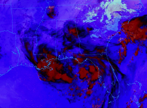
Didn't take long for the organization to ramp up after this splashed down into those warm bath waters, will be an interesting first visible images this morning:

2 likes
Who is online
Users browsing this forum: No registered users and 98 guests