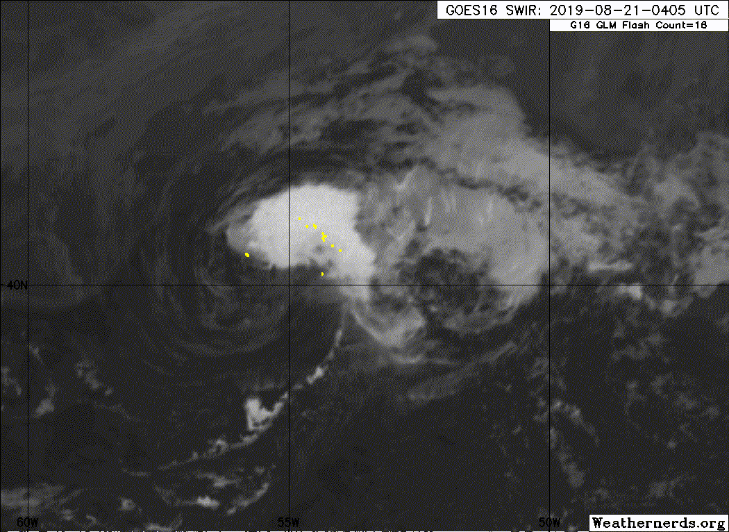
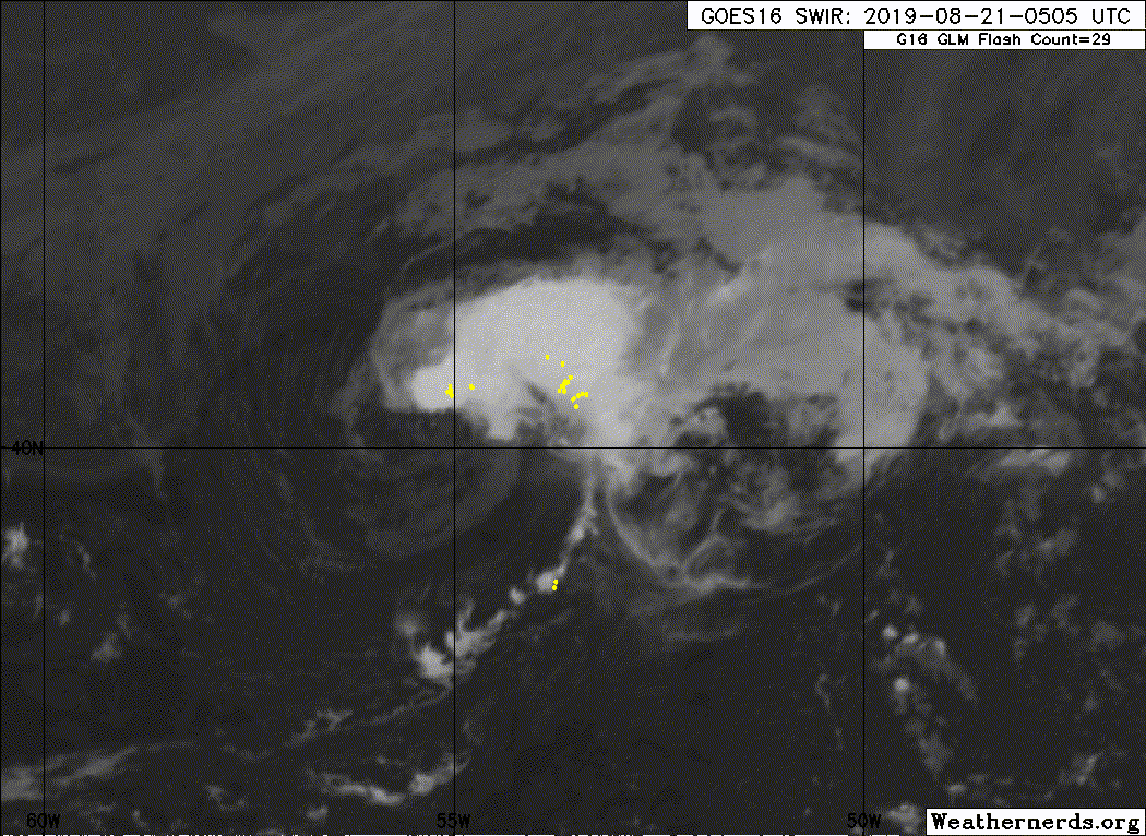
It's getting ripped apart, but the LLC is very evident now.
SLIDER
https://rammb-slider.cira.colostate.edu/?sat=goes-16&z=4&im=12&ts=1&st=0&et=0&speed=130&motion=loop&map=1&lat=0&opacity%5B0%5D=1&opacity%5B1%5D=0.5&hidden%5B0%5D=0&hidden%5B1%5D=0&pause=0&slider=-1&hide_controls=0&mouse_draw=0&follow_feature=0&follow_hide=0&s=rammb-slider&sec=full_disk&p%5B0%5D=band_02&p%5B1%5D=eumetsat_nighttime_microphysics&x=13813&y=2891
https://rammb-slider.cira.colostate.edu/?sat=goes-16&z=4&im=12&ts=1&st=0&et=0&speed=130&motion=loop&map=1&lat=0&opacity%5B0%5D=1&hidden%5B0%5D=0&pause=0&slider=-1&hide_controls=0&mouse_draw=0&follow_feature=0&follow_hide=0&s=rammb-slider&sec=full_disk&p%5B0%5D=band_07&x=13771&y=2955
ATL: CHANTAL - Remnants
Moderator: S2k Moderators
-
tolakram
- Admin

- Posts: 20178
- Age: 62
- Joined: Sun Aug 27, 2006 8:23 pm
- Location: Florence, KY (name is Mark)
Re: ATL: CHANTAL - Tropical Storm - Discussion
0 likes
M a r k
- - - - -
Join us in chat: Storm2K Chatroom Invite. Android and IOS apps also available.
The posts in this forum are NOT official forecasts and should not be used as such. Posts are NOT endorsed by any professional institution or STORM2K.org. For official information and forecasts, please refer to NHC and NWS products.
-
Evil Jeremy

- S2K Supporter

- Posts: 5463
- Age: 32
- Joined: Mon Apr 10, 2006 2:10 pm
- Location: Los Angeles, CA
Re: ATL: CHANTAL - Tropical Storm - Discussion
Fastest 10% to 100% we may ever see from the NHC
8 likes
Frances 04 / Jeanne 04 / Katrina 05 / Wilma 05 / Fay 08 / Debby 12 / Andrea 13 / Colin 16 / Hermine 16 / Matthew 16 / Irma 17
-
Hurricane Jed

- Category 2

- Posts: 546
- Age: 38
- Joined: Mon Jan 24, 2011 3:36 pm
- Location: Cen Tex
Re: ATL: CHANTAL - Tropical Storm - Discussion
It was 40/40 at the 8pm but yeah I get what you mean
0 likes


Re: ATL: CHANTAL - Tropical Storm - Discussion
The formation location and expected track reminds me quite a bit of Chantal's 2007 incarnation
2 likes
Floyd 1999 · Irene 2011 · Sandy 2012
-
floridasun78
- Category 5

- Posts: 3755
- Joined: Sun May 17, 2009 10:16 pm
- Location: miami fl
Re: ATL: CHANTAL - Tropical Storm - Discussion
it have few days too live cold water waiting for it
Last edited by floridasun78 on Tue Aug 20, 2019 9:27 pm, edited 1 time in total.
0 likes
-
CyclonicFury

- Category 5
- Posts: 2032
- Age: 27
- Joined: Sun Jul 02, 2017 12:32 pm
- Location: NC
- Contact:
Re: ATL: CHANTAL - Tropical Storm - Discussion
Perhaps the earlier ASCAT pass was indeed indicating a center reformation, since last night's pass actually looked well-defined but this morning's pass did not.
0 likes
NCSU B.S. in Meteorology Class of 2021. Tropical weather blogger at http://www.cyclonicfury.com. My forecasts and thoughts are NOT official, for official forecasts please consult the National Hurricane Center.
-
galaxy401

- Category 5
- Posts: 2446
- Age: 30
- Joined: Sat Aug 25, 2012 9:04 pm
- Location: Casa Grande, Arizona
Re: ATL: CHANTAL - Tropical Storm - Discussion
So we're not going to go with an unnamed TS after all. Most of the unnamed TS all formed in that exact same area (2006, 2011). Probably been a TS for almost 24 hours already.
That means we won't have a storm-free August even if this will probably only peak at 40 mph.
That means we won't have a storm-free August even if this will probably only peak at 40 mph.
2 likes
Got my eyes on moving right into Hurricane Alley: Florida.
-
cycloneye

- Admin
- Posts: 149275
- Age: 69
- Joined: Thu Oct 10, 2002 10:54 am
- Location: San Juan, Puerto Rico
Re: ATL: CHANTAL - Tropical Storm - Discussion
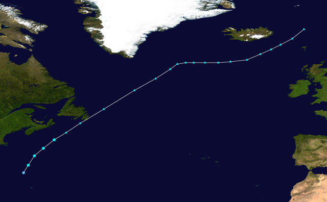
BULLETIN
Tropical Storm Chantal Advisory Number 1
NWS National Hurricane Center Miami FL AL042019
1100 PM AST Tue Aug 20 2019
...TROPICAL STORM CHANTAL FORMS OVER THE FAR NORTH ATLANTIC...
SUMMARY OF 1100 PM AST...0300 UTC...INFORMATION
-----------------------------------------------
LOCATION...40.2N 56.2W
ABOUT 485 MI...780 KM SE OF HALIFAX NOVA SCOTIA
ABOUT 475 MI...765 KM SSW OF CAPE RACE NEWFOUNDLAND
MAXIMUM SUSTAINED WINDS...40 MPH...65 KM/H
PRESENT MOVEMENT...E OR 85 DEGREES AT 22 MPH...35 KM/H
MINIMUM CENTRAL PRESSURE...1010 MB...29.83 INCHES
WATCHES AND WARNINGS
--------------------
There are no coastal watches or warnings in effect.
DISCUSSION AND OUTLOOK
----------------------
At 1100 PM AST (0300 UTC), the center of newly formed Tropical Storm
Chantal was located near latitude 40.2 North, longitude 56.2 West.
Chantal is moving toward the east near 22 mph (35 km/h) and this
general motion with a gradual decrease in forward speed is expected
through Friday.
Maximum sustained winds are near 40 mph (65 km/h) with higher gusts.
Little change in strength is forecast during the next 48 hours.
Tropical-storm-force winds extend outward up to 45 miles (75 km),
mainly south of the center.
The estimated minimum central pressure is 1010 mb (29.83 inches).
HAZARDS AFFECTING LAND
----------------------
None.
NEXT ADVISORY
-------------
Next complete advisory at 500 AM AST.
$$
Forecaster Stewart
Tropical Storm Chantal Discussion Number 1
NWS National Hurricane Center Miami FL AL042019
1100 PM AST Tue Aug 20 2019
Recent scatterometer wind data and passive microwave satellite
images indicate that the small low pressure system that the NHC has
been monitoring for the past few days has developed a well-defined
surface wind circulation and contains tropical-storm-force winds
south of the cyclone's center. Therefore, the low has become
Tropical Storm Chantal.
The initial motion estimate is 085/19 kt. NHC model guidance is in
excellent agreement that Chantal will move eastward around the
northern periphery of the Bermuda-Azores high and gradually slow
down during the next 48 hours. Thereafter, the cyclone is forecast
to drop southward around the eastern portion of the ridge, possibly
stalling over warmer waters. The NHC forecast track lies close to
the consensus models HCCA and TVCN.
Chantal is expected to remain in a moderate southwesterly to
westerly vertical wind shear regime for the next 48 hours or so,
followed by a significant decrease in the shear through 120 h. After
48 hours, the southward motion is also expected to move Chantal over
warmer water with SSTs around 27C. However, mid-level moisture is
expected to be quite sparse with humidity values forecast to be less
than 40 percent based on the GFS and ECMWF SHIPS intensity guidance.
Therefore, little or no significant intensification is expected
throughout the forecast period, and the official intensity forecast
closely follows a blend of the HCCA and IVCN consensus models.
Although the official forecast calls for Chantal to remain a
tropical cyclone through the 120 h, the abundance of dry air that
the cyclone will be moving through could result in erosion of the
deep convection sooner than currently expected.
FORECAST POSITIONS AND MAX WINDS
INIT 21/0300Z 40.2N 56.2W 35 KT 40 MPH
12H 21/1200Z 40.3N 52.6W 35 KT 40 MPH
24H 22/0000Z 40.2N 48.5W 35 KT 40 MPH
36H 22/1200Z 39.0N 44.7W 35 KT 40 MPH
48H 23/0000Z 37.4N 42.3W 35 KT 40 MPH
72H 24/0000Z 34.9N 42.5W 35 KT 40 MPH
96H 25/0000Z 34.6N 44.8W 35 KT 40 MPH
120H 26/0000Z 36.0N 44.8W 35 KT 40 MPH
$$
Forecaster Stewart
1 likes
Visit the Caribbean-Central America Weather Thread where you can find at first post web cams,radars
and observations from Caribbean basin members Click Here
and observations from Caribbean basin members Click Here
-
HurricaneBelle

- S2K Supporter
- Posts: 1209
- Joined: Sun Aug 27, 2006 6:12 pm
- Location: Clearwater, FL
Re: ATL: CHANTAL - Tropical Storm - Discussion
and to think it started as a little hatchling in the Northeast Gulf
2 likes
-
galaxy401
- Category 5
- Posts: 2446
- Age: 30
- Joined: Sat Aug 25, 2012 9:04 pm
- Location: Casa Grande, Arizona
Re: ATL: CHANTAL - Tropical Storm - Discussion
Wow 40 mph for the next 5 days. A lot of uncertainly with this system. Could pull a Leslie? It will probably die sooner rather than later.
2 likes
Got my eyes on moving right into Hurricane Alley: Florida.
-
eastcoastFL

- Category 5
- Posts: 3996
- Age: 44
- Joined: Thu Apr 12, 2007 12:29 pm
- Location: Palm City, FL
Re: ATL: CHANTAL - Tropical Storm - Discussion
Look at that track with the loop around the ridge . Where do the models take it after 5 days?
0 likes
Personal Forecast Disclaimer:
The posts in this forum are NOT official forecast and should not be used as such. They are just the opinion of the poster and may or may not be backed by sound meteorological data. They are NOT endorsed by any professional institution or storm2k.org. For official information, please refer to the NHC and NWS products.
The posts in this forum are NOT official forecast and should not be used as such. They are just the opinion of the poster and may or may not be backed by sound meteorological data. They are NOT endorsed by any professional institution or storm2k.org. For official information, please refer to the NHC and NWS products.
-
AutoPenalti
- Category 5
- Posts: 4091
- Age: 29
- Joined: Mon Aug 17, 2015 4:16 pm
- Location: Ft. Lauderdale, Florida
Re: ATL: CHANTAL - Tropical Storm - Discussion
From 10% to TS Chantal.
That’s escalated quickly.
That’s escalated quickly.
4 likes
The posts in this forum are NOT official forecasts and should not be used as such. They are just the opinion of the poster and may or may not be backed by sound meteorological data. They are NOT endorsed by any professional institution or STORM2K. For official information, please refer to products from the NHC and NWS.
Model Runs Cheat Sheet:
GFS (5:30 AM/PM, 11:30 AM/PM)
HWRF, GFDL, UKMET, NAVGEM (6:30-8:00 AM/PM, 12:30-2:00 AM/PM)
ECMWF (1:45 AM/PM)
TCVN is a weighted averaged
-
1900hurricane

- Category 5
- Posts: 6063
- Age: 34
- Joined: Fri Feb 06, 2015 12:04 pm
- Location: Houston, TX
- Contact:
Re: ATL: CHANTAL - Tropical Storm - Discussion
The NHC analysis and forecast for 35 kt for 120 hours is worth 2.45 units of ACE and 0.8575 units of PDI.
3 likes
Contract Meteorologist. TAMU & MSST. Fiercely authentic, one of a kind. We are all given free will, so choose a life meant to be lived. We are the Masters of our own Stories.
Opinions expressed are mine alone.
Follow me on Twitter at @1900hurricane : Read blogs at https://1900hurricane.wordpress.com/
Opinions expressed are mine alone.
Follow me on Twitter at @1900hurricane : Read blogs at https://1900hurricane.wordpress.com/

Re: ATL: CHANTAL - Tropical Storm - Discussion
The bell does indeed ring on August 20.
Was this the same system that was an X over NW Florida like a week ago?
HurricaneBelle wrote:and to think it started as a little hatchling in the Northeast Gulf
Was this the same system that was an X over NW Florida like a week ago?
8 likes
The above post is not official and should not be used as such. It is the opinion of the poster and may or may not be backed by sound meteorological data. It is not endorsed by any professional institution or storm2k.org. For official information, please refer to the NHC and NWS products.
-
dexterlabio
- Category 5
- Posts: 3503
- Joined: Sat Oct 24, 2009 11:50 pm
Re: ATL: CHANTAL - Tropical Storm - Discussion
Rejoice! The Atlantic is not dead this year. 
7 likes
Personal Forecast Disclaimer:
The posts in this forum are NOT official forecast and should not be used as such. They are just the opinion of the poster and may or may not be backed by sound meteorological data. They are NOT endorsed by any professional institution or storm2k.org. For official information, please refer to the NHC and NWS products.
The posts in this forum are NOT official forecast and should not be used as such. They are just the opinion of the poster and may or may not be backed by sound meteorological data. They are NOT endorsed by any professional institution or storm2k.org. For official information, please refer to the NHC and NWS products.
-
AxaltaRacing24
- Category 5
- Posts: 1774
- Age: 25
- Joined: Wed Jul 27, 2016 11:14 am
- Location: Jupiter, FL
Re: ATL: CHANTAL - Tropical Storm - Discussion
dexterlabio wrote:Rejoice! The Atlantic is not dead this year.
nO sToRmS fOr ThE rEsT oF tHe SeAsOn.
12 likes
-
AnnularCane

- S2K Supporter
- Posts: 2957
- Joined: Thu Jun 08, 2006 9:18 am
- Location: Wytheville, VA
Re: ATL: CHANTAL - Tropical Storm - Discussion
Chantal arrives on "bell-ringing day." How perfect.
7 likes
-
Astromanía
- Category 2
- Posts: 793
- Age: 27
- Joined: Sat Aug 25, 2018 10:34 pm
- Location: Monterrey, N.L, México
Re: ATL: CHANTAL - Tropical Storm - Discussion
Lol what I miss, last time I see 10/10 chances to develop
1 likes
-
eastcoastFL
- Category 5
- Posts: 3996
- Age: 44
- Joined: Thu Apr 12, 2007 12:29 pm
- Location: Palm City, FL
Re: ATL: CHANTAL - Tropical Storm - Discussion
dexterlabio wrote:Rejoice! The Atlantic is not dead this year.
Yup that’s the one
0 likes
Personal Forecast Disclaimer:
The posts in this forum are NOT official forecast and should not be used as such. They are just the opinion of the poster and may or may not be backed by sound meteorological data. They are NOT endorsed by any professional institution or storm2k.org. For official information, please refer to the NHC and NWS products.
The posts in this forum are NOT official forecast and should not be used as such. They are just the opinion of the poster and may or may not be backed by sound meteorological data. They are NOT endorsed by any professional institution or storm2k.org. For official information, please refer to the NHC and NWS products.
-
Sciencerocks
- Category 5
- Posts: 10181
- Age: 40
- Joined: Thu Jul 06, 2017 1:51 am
Re: ATL: CHANTAL - Tropical Storm - Discussion
Starting to move east-southeastward and flaring up some new convection. I wouldn't completely be surprised if this strengthens some as it loops beyond 35 knots.
0 likes
Who is online
Users browsing this forum: No registered users and 231 guests