90E INVEST 191019 0600 17.3N 104.4W EPAC 20 1008
EPAC: PRISCILLA - Remnants
Moderator: S2k Moderators
-
Nancy Smar

- Category 5

- Posts: 1081
- Age: 25
- Joined: Wed Aug 16, 2017 10:03 pm
EPAC: PRISCILLA - Remnants
Last edited by Nancy Smar on Sun Oct 20, 2019 7:02 am, edited 3 times in total.
0 likes
-
Kingarabian

- S2K Supporter

- Posts: 16383
- Joined: Sat Aug 08, 2009 3:06 am
- Location: Honolulu, Hawaii
Re: EPAC: INVEST 90E
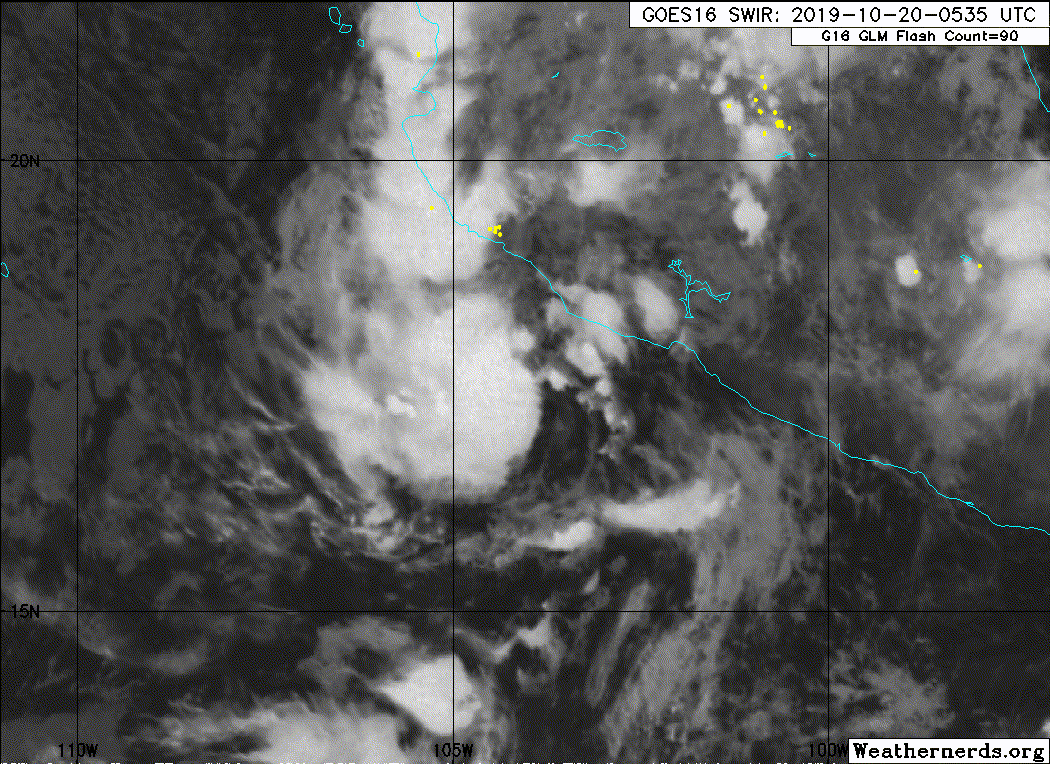
1. Recent satellite wind data and conventional satellite imagery
indicate that the area of low pressure located near the west-central
coast of Mexico has become better organized and is producing winds
to near tropical storm strength. Some additional development is
possible and this system has the potential to become a short-lived
tropical depression or storm this morning or later today before
it moves inland by Sunday night. Regardless of whether or not this
system becomes a tropical cyclone, heavy rainfall associated with
this disturbance could produce flash flooding and mudslides across
portions of Michoacan, Colima, and Jalisco, especially in areas of
mountainous terrain, during the next couple of days.
* Formation chance through 48 hours...high...70 percent.
* Formation chance through 5 days...high...70 percent.
Almost there but may not have time. This fall steering pattern has robbed the season totals of 3 named systems.

0 likes
RIP Kobe Bryant
-
Astromanía
- Category 3

- Posts: 802
- Age: 27
- Joined: Sat Aug 25, 2018 10:34 pm
- Location: Monterrey, N.L, México
Re: EPAC: INVEST 90E
This is so unexpected, it seems every storm in EPAC for the rest of the season will stay to close to land to develop in something strong but short lived depressions and storms will be common afecting with heavy rainfall and strong wind guts, a cat 1 hurricane a la lorena is not out of cuestion, dangerous ecnomic damages and lives lost will still occur
0 likes
-
Nancy Smar
- Category 5
- Posts: 1081
- Age: 25
- Joined: Wed Aug 16, 2017 10:03 pm
Re: EPAC: INVEST 90E
EP, 19, 2019102006, , BEST, 0, 172N, 1040W, 30, 1005, TD, 34, NEQ, 0, 0, 0, 0, 1008, 150, 30, 0, 0, E, 0, , 0, 0, NINETEEN, M, 0, , 0, 0, 0, 0, genesis-num, 042, TRANSITIONED, epD02019 to ep192019,
0 likes
-
cycloneye

- Admin

- Posts: 149840
- Age: 69
- Joined: Thu Oct 10, 2002 10:54 am
- Location: San Juan, Puerto Rico
Re: EPAC: NINETEEN-E - Tropical Depression
BULLETIN
Tropical Depression Nineteen-E Advisory Number 1
NWS National Hurricane Center Miami FL EP192019
400 AM CDT Sun Oct 20 2019
...TROPICAL DEPRESSION FORMS NEAR THE SOUTHWESTERN COAST OF
MEXICO...
...EXPECTED TO BRING HEAVY RAINFALL TO PORTIONS OF SOUTHWESTERN
MEXICO...
SUMMARY OF 400 AM CDT...0900 UTC...INFORMATION
----------------------------------------------
LOCATION...17.5N 104.0W
ABOUT 105 MI...170 KM S OF MANZANILLO MEXICO
MAXIMUM SUSTAINED WINDS...35 MPH...55 KM/H
PRESENT MOVEMENT...N OR 355 DEGREES AT 7 MPH...11 KM/H
MINIMUM CENTRAL PRESSURE...1005 MB...29.68 INCHES
WATCHES AND WARNINGS
--------------------
CHANGES WITH THIS ADVISORY:
The government of Mexico has issued a Tropical Storm Warning from
Punta San Telmo westward to Playa Perula.
SUMMARY OF WATCHES AND WARNINGS IN EFFECT:
A Tropical Storm Warning is in effect for...
* Punta San Telmo to Playa Perula
For storm information specific to your area, please monitor
products issued by your national meteorological service.
DISCUSSION AND OUTLOOK
----------------------
At 400 AM CDT (0900 UTC), the center of Tropical Depression
Nineteen-E was located near latitude 17.5 North, longitude 104.0
West. The depression is moving toward the north near 7 mph (11 km/h)
and this motion is expected to continue through tonight. On this
track, the center of the depression is forecast to approach the
southwestern coast of Mexico within the warning area today, and
move inland by tonight.
Maximum sustained winds are near 35 mph (55 km/h) with higher gusts.
Some slight strengthening is possible, and the depression could
become a tropical storm before it moves inland. Rapid weakening
and dissipation is expected after landfall.
The estimated minimum central pressure is 1005 mb (29.68 inches).
HAZARDS AFFECTING LAND
----------------------
RAINFALL: The tropical depression is expected to produce rainfall
accumulations of 5 to 10 inches, with local amounts to 15 inches,
across portions of Nayarit, Jalisco, Colima, and Michoacan in
southwest Mexico through Tuesday night. This rainfall could produce
flash flooding and mudslides within steep terrain.
WIND: Tropical storm conditions are expected within a portion of
the warning area later today.
NEXT ADVISORY
-------------
Next intermediate advisory at 700 AM CDT.
Next complete advisory at 1000 AM CDT.
$$
Forecaster Brown
Tropical Depression Nineteen-E Discussion Number 1
NWS National Hurricane Center Miami FL EP192019
400 AM CDT Sun Oct 20 2019
Microwave, geostationary satellite, and scatterometer data indicate
that the small area of low pressure located near the southwestern
coast of Mexico quickly became better defined during the evening
hours, and deep convection has persisted and become better
organized overnight. Multiple ASCAT passes revealed winds of at
least 25-30 kt over the southern portion of the circulation, and
based on these data, the system is being classified as a 30-kt
tropical depression.
The depression is moving northward or 355/6 kt. The global models
indicate that the depression will move generally northward around
the western periphery of a mid-level ridge that extends over the
southeastern Gulf of Mexico and eastern Mexico. This motion should
bring the center of the cyclone inland over southwestern Mexico
later today or early tonight. The NHC track forecast follows a
blend of the GFS and ECMWF model fields.
The depression is currently located over warm waters and within an
area of moderate easterly shear. In fact, the center of the
depression is currently located near the eastern edge of the
convective mass. Due to the shear and the very short time the
system is expected to remain over water, only slight strengthening
is predicted. The depression, however, could become a short-lived
tropical storm later today. Once inland, the cyclone should rapidly
weaken and dissipate over the high terrain of southwestern Mexico.
The primary threat with the cyclone will be heavy rainfall
and the potential for flash flooding and mudslides over portions
of southwestern Mexico during the next day or so.
FORECAST POSITIONS AND MAX WINDS
INIT 20/0900Z 17.5N 104.0W 30 KT 35 MPH
12H 20/1800Z 18.3N 104.2W 35 KT 40 MPH
24H 21/0600Z 19.6N 104.4W 30 KT 35 MPH...INLAND
36H 21/1800Z...DISSIPATED
$$
Forecaster Brown
0 likes
Visit the Caribbean-Central America Weather Thread where you can find at first post web cams,radars
and observations from Caribbean basin members Click Here
and observations from Caribbean basin members Click Here
-
Sciencerocks
- Category 5
- Posts: 10194
- Age: 40
- Joined: Thu Jul 06, 2017 1:51 am
-
cycloneye
- Admin
- Posts: 149840
- Age: 69
- Joined: Thu Oct 10, 2002 10:54 am
- Location: San Juan, Puerto Rico
Re: EPAC: PRISCILLA - Tropical Storm
BULLETIN
Tropical Storm Priscilla Intermediate Advisory Number 1A
NWS National Hurricane Center Miami FL EP192019
700 AM CDT Sun Oct 20 2019
...DEPRESSION STRENGTHENS INTO TROPICAL STORM PRISCILLA...
...HEAVY RAINFALL EXPECTED ACROSS PORTIONS OF SOUTHWESTERN MEXICO...
SUMMARY OF 700 AM CDT...1200 UTC...INFORMATION
----------------------------------------------
LOCATION...17.8N 104.0W
ABOUT 100 MI...160 KM SSE OF MANZANILLO MEXICO
MAXIMUM SUSTAINED WINDS...40 MPH...65 KM/H
PRESENT MOVEMENT...N OR 355 DEGREES AT 7 MPH...11 KM/H
MINIMUM CENTRAL PRESSURE...1004 MB...29.65 INCHES
WATCHES AND WARNINGS
--------------------
CHANGES WITH THIS ADVISORY:
None.
SUMMARY OF WATCHES AND WARNINGS IN EFFECT:
A Tropical Storm Warning is in effect for...
* Punta San Telmo to Playa Perula
For storm information specific to your area, please monitor
products issued by your national meteorological service.
DISCUSSION AND OUTLOOK
----------------------
At 700 AM CDT (1200 UTC), the center of Tropical Storm Priscilla was
located near latitude 17.8 North, longitude 104.0 West. Priscilla is
is moving toward the north near 7 mph (11 km/h), and this motion is
expected to continue through tonight. On the forecast track, the
center of Priscilla will approach the southwestern coast of Mexico
within the warning area later today, and move inland by tonight.
Maximum sustained winds have increased to near 40 mph (65 km/h)
with higher gusts. Some additional slight strengthening is possible
before Priscilla moves inland. Rapid weakening and dissipation is
expected after landfall.
The estimated minimum central pressure is 1004 mb (29.65 inches).
HAZARDS AFFECTING LAND
----------------------
RAINFALL: Tropical Storm Priscilla is expected to produce rainfall
accumulations of 5 to 10 inches, with local amounts to 15 inches,
across portions of Nayarit, Jalisco, Colima, and Michoacan in
southwestern Mexico through Tuesday night. This rainfall could
produce flash flooding and mudslides within steep terrain.
WIND: Tropical storm conditions are expected within a portion of
the warning area later today.
NEXT ADVISORY
-------------
Next complete advisory at 1000 AM CDT.
$$
Forecaster Stewart
0 likes
Visit the Caribbean-Central America Weather Thread where you can find at first post web cams,radars
and observations from Caribbean basin members Click Here
and observations from Caribbean basin members Click Here
-
Astromanía
- Category 3
- Posts: 802
- Age: 27
- Joined: Sat Aug 25, 2018 10:34 pm
- Location: Monterrey, N.L, México
Re: EPAC: PRISCILLA - Tropical Storm
Center apears to be coming ashore now, no more intensification
0 likes
-
cycloneye
- Admin
- Posts: 149840
- Age: 69
- Joined: Thu Oct 10, 2002 10:54 am
- Location: San Juan, Puerto Rico
Re: EPAC: PRISCILLA - Tropical Depression
BULLETIN
Tropical Depression Priscilla Advisory Number 3
NWS National Hurricane Center Miami FL EP192019
400 PM CDT Sun Oct 20 2019
...PRISCILLA MAKES LANDFALL EAST OF MANZANILLO MEXICO AND WEAKENS...
...HEAVY RAINFALL EXPECTED ACROSS PORTIONS OF SOUTHWESTERN MEXICO...
SUMMARY OF 400 PM CDT...2100 UTC...INFORMATION
----------------------------------------------
LOCATION...19.1N 104.0W
ABOUT 20 MI...35 KM ENE OF MANZANILLO MEXICO
MAXIMUM SUSTAINED WINDS...35 MPH...55 KM/H
PRESENT MOVEMENT...N OR 360 DEGREES AT 9 MPH...15 KM/H
MINIMUM CENTRAL PRESSURE...1005 MB...29.68 INCHES
Tropical Depression Priscilla Discussion Number 3
NWS National Hurricane Center Miami FL EP192019
400 PM CDT Sun Oct 20 2019
Priscilla moved inland along the coast of southwestern Mexico around
1930 UTC just to the east of Manzanillo. The rugged terrain in that
area is expected to cause the cyclone to rapidly weaken and
dissipate by 12 hours, if not sooner. Satellite intensity estimates
at 1800 UTC were T2.5/35 kt from TAFB and SAB, and T2.7/37 kt and
38 kt from UW-CIMSS ADT and SATCON, respectively, which supported an
intensity of 35 kt at that time. However, the intensity has been
decreased to 30 kt at the advisory time since Priscilla is now
located inland, with most of the deep convection having been
displaced well to the north of the low-level center.
The initial motion estimate is 360/08 kt. Tropical Depression
Priscilla will continue to move northward and farther inland over
southwestern Mexico, resulting in rapid weakening and dissipation
during the next 12 hours. A 12-hour forecast position was provided
mainly for continuity purposes.
The primary threat with Priscilla and its remnants will be heavy
rainfall, along with the potential for flash flooding and mudslides,
over portions of southwestern Mexico during the next day or two.
FORECAST POSITIONS AND MAX WINDS
INIT 20/2100Z 19.1N 104.0W 30 KT 35 MPH...INLAND
12H 21/0600Z 20.0N 104.1W 20 KT 25 MPH...POST-TROP/REMNT LOW
24H 21/1800Z...DISSIPATED INLAND
$$
Forecaster Stewart
0 likes
Visit the Caribbean-Central America Weather Thread where you can find at first post web cams,radars
and observations from Caribbean basin members Click Here
and observations from Caribbean basin members Click Here
-
Sciencerocks
- Category 5
- Posts: 10194
- Age: 40
- Joined: Thu Jul 06, 2017 1:51 am
-
cycloneye
- Admin
- Posts: 149840
- Age: 69
- Joined: Thu Oct 10, 2002 10:54 am
- Location: San Juan, Puerto Rico
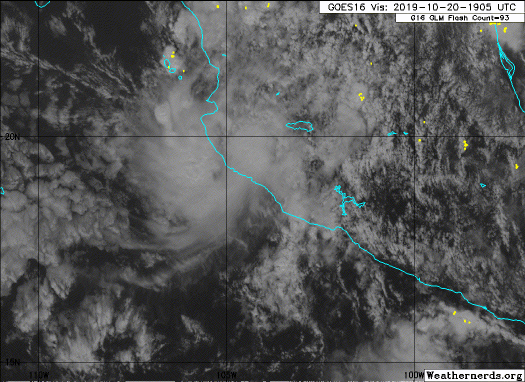
Re: EPAC: PRISCILLA - Remnants
Remnants Of Priscilla Discussion Number 4
NWS National Hurricane Center Miami FL EP192019
1000 PM CDT Sun Oct 20 2019
The rugged terrain of Mexico has taken a toll on Priscilla. Surface
observations indicate that the system no longer has a closed
surface circulation, and therefore this is the last advisory
issued by the National Hurricane Center on this system.
Even though the surface circulation has dissipated, there is
still a fair amount of deep convection associated with the
remnant trough over portions of southwestern and west-central
Mexico. Since the surface trough is expected to linger for another
couple of days over southwestern Mexico, there remains a significant
threat of heavy rains and flash flooding over that region.
FORECAST POSITIONS AND MAX WINDS
INIT 21/0300Z 20.0N 104.7W 25 KT 30 MPH...REMNANTS
12H 21/1200Z...DISSIPATED
$$
Forecaster Cangialosi
0 likes
Visit the Caribbean-Central America Weather Thread where you can find at first post web cams,radars
and observations from Caribbean basin members Click Here
and observations from Caribbean basin members Click Here

Re: EPAC: PRISCILLA - Remnants
This was one of the shortest-lived EP storms I've ever seen.
1 likes
The above post is not official and should not be used as such. It is the opinion of the poster and may or may not be backed by sound meteorological data. It is not endorsed by any professional institution or storm2k.org. For official information, please refer to the NHC and NWS products.
-
Astromanía
- Category 3
- Posts: 802
- Age: 27
- Joined: Sat Aug 25, 2018 10:34 pm
- Location: Monterrey, N.L, México
-
MarioProtVI
- Category 5
- Posts: 1039
- Age: 24
- Joined: Sun Sep 29, 2019 7:33 pm
- Location: New Jersey
Re: EPAC: PRISCILLA - Remnants
Hammy wrote:This was one of the shortest-lived EP storms I've ever seen.
19E from last year would like a word with you on that
0 likes
Who is online
Users browsing this forum: No registered users and 49 guests