#119 Postby TheProfessor » Thu Nov 12, 2020 1:41 pm
Very tricky forecast here in terms of track and it will be dependent multiple things. The first thing that will be important is the strength of the system. If the HMON and HWRF are right the system will feel more of the upper level flow. Unfortunately the forecast for the upper level flow itself is quite complicated. Teleconnections are showing the NAO begin to trend negative and the PNA to trend positives. This favors an east coast trough, especially the closer to winter we get. Here's where things get tricky, where that trough sets up will be critical in deciding where this storm goes, assuming we have a deep storm that is. If the GFS is right and the trough is further off the east coast, then the storm will be under the influences of the western ridge and a deeper storm will dive even farther southwestward. However, if the Canadian is right and the trough is closer to the east coast or even centered over it, then the storm will either be caught in no man's land or will be under the influence of the eastern ridge, which would put Cuba and Florida under threat. However, since the Canadian has a weak storm we don't get to see this played out on the 12z Run. I think the HWRF and HMON are showing something in the middle right now and it's likely that the CMC is as well in terms of the 500 pattern. One would expect the Euro to be even more west with this pattern as it likes to amplify troughs more than the CMC and way more than the GFS, which is know for being to progressive with these patterns.
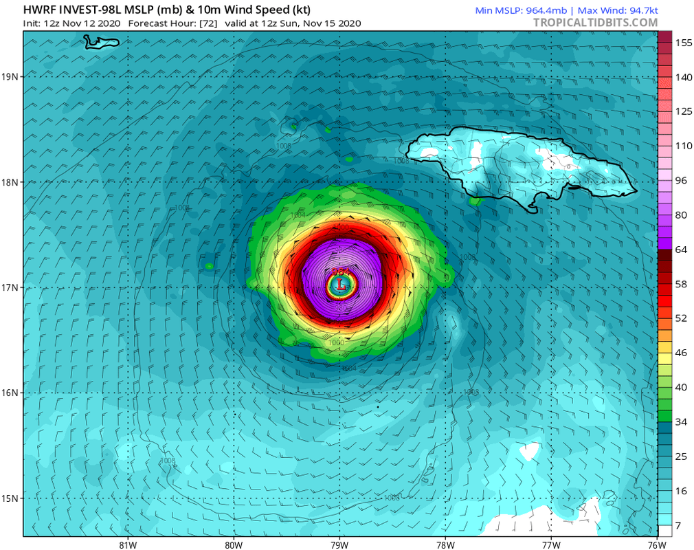
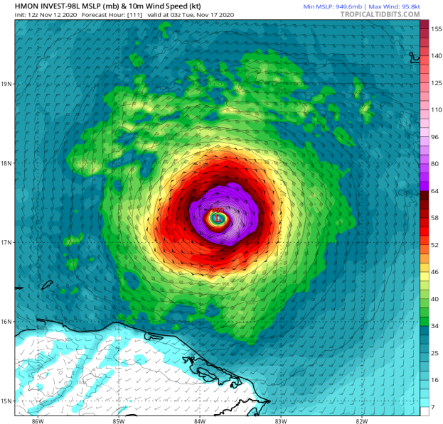
That said, I do think this is a storm that Jamaica and the Yucatan really need to pay attention to as well as Belize, Honduras, and Nicaragua.
6 likes
An alumnus of The Ohio State University.
Your local National Weather Service office is your best source for weather information.


