Aric Dunn wrote:From the looks of it. the sudden NW ( temporary) movement from the HWRF appears to be from 97L being a little stronger to the right. Close enough to affect the track some.
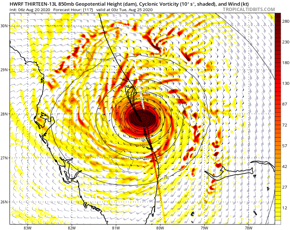
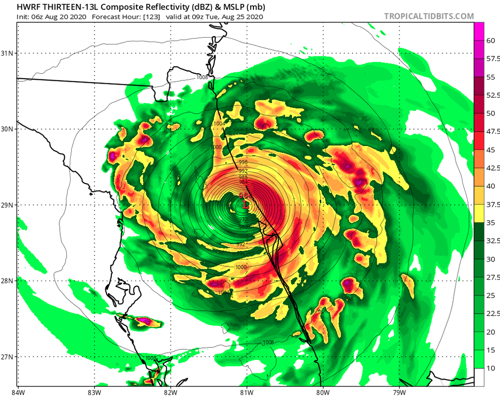
That’s not what I see on the HWRF. The system gradually turns NNW near the longitude of Nassau, so it clearly rounds the periphery of the ridge, with a track paralleling the east coast of FL and making a brief landfall on Cape Canaveral. In other words, the synoptic situation on the HWRF is extremely similar to that of Matthew (2016).
If the threshold of landfall were to be so narrow as shown on the HWRF, then climatology would indicate that such a strong TC would most likely curve just offshore of FL. These kinds of scenarios usually end up with the storm staying offshore. Unless future runs show an even stronger ridge, a high-end Category-4+ TC would likely just miss FL, as Matthew and then Dorian did.