#137 Postby Aric Dunn » Fri Sep 11, 2020 12:06 pm
NDG wrote:Aric Dunn wrote:gfsperpendicular wrote:Only Nassau is at all close to the center, so it's hard to say whether there is a west wind. Like maybe there are some west winds west of Andros. Recon pls

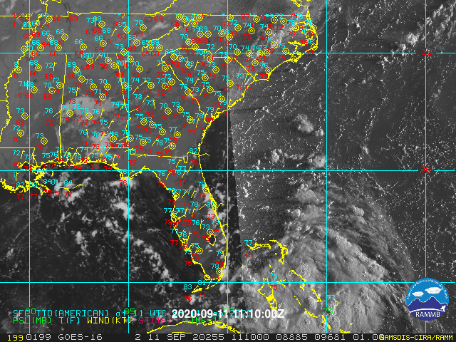
There are easterly moving low level clouds on the south side.. there is very likely a vort/llc somewhere around Nassau. likely in that deep curved band.
the Nassau surface obs is not working properly.. all day yesterday it was showing west to sw winds which of course was not correct. no reason to think it is doing any better today.
so all we have right now are sporadic surface obs to far away, radar, and sat.
Are you sure you are looking at the Nassau airport observation? I only see W & SW winds around midnight which is about the time that the surface trough passed through Nassau.
I only see one time of SW winds earlier in the afternoon.
Radar clearly shows that the surface vorticity is still to the W of Nassau.
https://www.wrh.noaa.gov/mesowest/times ... aw=0&w=325
yeah the airport. I have MADIS on which updates every 5 minutes.
but even if you look at yesterday around noon and go through about midnight. wsw,S, SW, SSW ... and all the flip flopping while all other stations were steady E, ENE..
maybe a tree grew next the anemometer lol
0 likes
Note: If I make a post that is brief. Please refer back to previous posts for the analysis or reasoning. I do not re-write/qoute what my initial post said each time.
If there is nothing before... then just ask

Space & Atmospheric Physicist, Embry-Riddle Aeronautical University,
I believe the sky is falling...


