

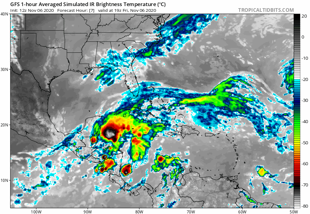
chaser1 wrote:HurricaneFrances04 wrote:Nuno wrote:So much for climatology and history...
A tropical storm hitting Florida from the east...that is currently near/over Belize.
Right, good luck finding THAT in the 'ol history books LOL

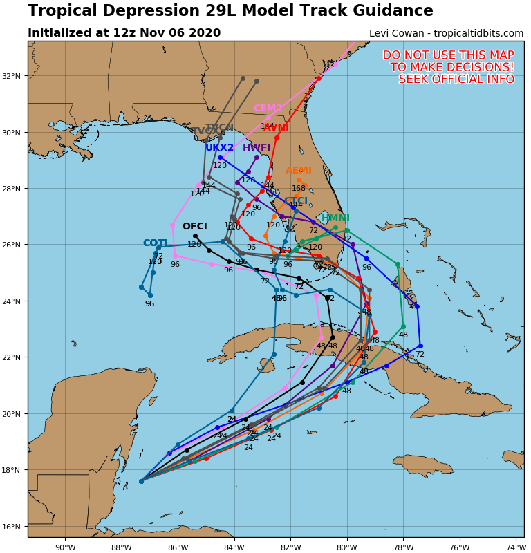
Hurricane King almost perfect analog. Happened late October...


