
Sent from my iPhone using Tapatalk
Moderator: S2k Moderators

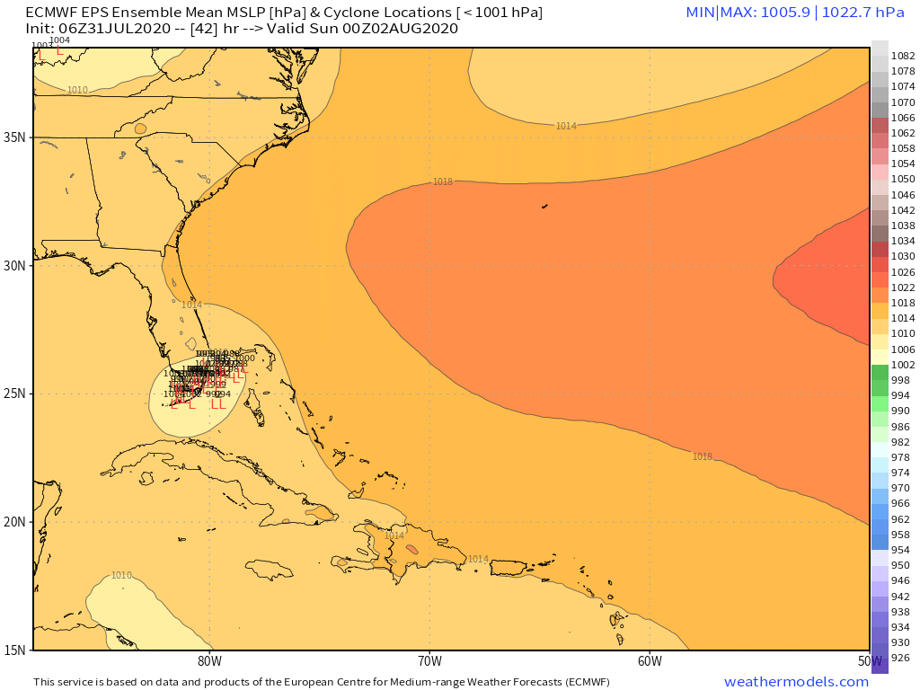
DestinHurricane wrote:Remember folks, the 6Z/18Z Euro are not as reliable as 0Z/12Z. I wouldn't put too much weight in this 6Z run until the 12Z confirms.

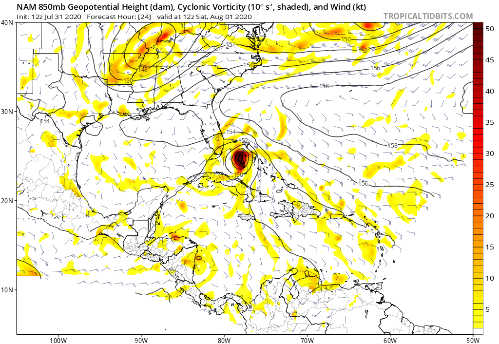
northjaxpro wrote:Powellrm wrote:CMC continues to do a sneaky good job on picking up on trends early on. What does the CMC pick up that the other models don’t quite factor in as much. Super interesting!
The CMC has done rather decent with modeling Isaias, along with the EURO.

SFLcane wrote:HurricaneFrances04 wrote:Euro ensembles with a decent SW shift too. Does the NHC incorporate the 6z/18z Euro into their forecasts? Not sure I've seen them mention those runs before.
Holy..
https://iili.io/d7SPtf.png

DestinHurricane wrote:Remember folks, the 6Z/18Z Euro are not as reliable as 0Z/12Z. I wouldn't put too much weight in this 6Z run until the 12Z confirms.

DestinHurricane wrote:Remember folks, the 6Z/18Z Euro are not as reliable as 0Z/12Z. I wouldn't put too much weight in this 6Z run until the 12Z confirms.


AutoPenalti wrote:DestinHurricane wrote:Remember folks, the 6Z/18Z Euro are not as reliable as 0Z/12Z. I wouldn't put too much weight in this 6Z run until the 12Z confirms.
I can give you the Happy Hour GFS but 06z is the FIRST to get updated forecast for the day, this after ingesting new data from 0z. So no, this is wrong.

gatorcane wrote:northjaxpro wrote:Powellrm wrote:CMC continues to do a sneaky good job on picking up on trends early on. What does the CMC pick up that the other models don’t quite factor in as much. Super interesting!
The CMC has done rather decent with modeling Isaias, along with the EURO.
Northjaxpro kudos for you to sniffing this stronger ridging out. You mentioned this might happen with more of a thumb ridge that drives the storm more west.
ronjon wrote:TVCN model consensus trend above doesn't include new 06z Euro so look for further shifts to the west. What does NHC do at 11 am? I think they nudge it a little closer to the Florida east coast but wait for the 12z model suite to confirm to make any major changes to track or warnings.
ronjon wrote:TVCN model consensus trend above doesn't include new 06z Euro so look for further shifts to the west. What does NHC do at 11 am? I think they nudge it a little closer to the Florida east coast but wait for the 12z model suite to confirm to make any major changes to track or warnings.
ava_ati wrote:Almost every 06z EPS member was over FL or skirting the coast
https://i.imgur.com/Gi7Ip28.gif


ava_ati wrote:Almost every 06z EPS member was over FL or skirting the coast
https://i.imgur.com/Gi7Ip28.gif
HurricaneEnzo wrote:I caught the last part of an update on TWC and I'm pretty sure Cantore said they had planes out there sampling the atmosphere around the storm now so maybe some of it did make it into the models.
Users browsing this forum: No registered users and 43 guests

