ATL: SALLY - Models
Moderator: S2k Moderators

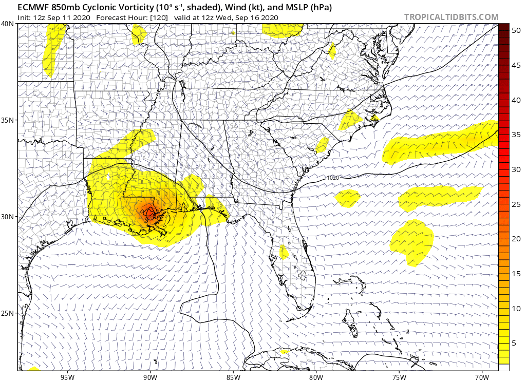
Re: ATL: INVEST 96L - Models
Looks like the Euro wants it to scrape the Panhandle then head west over Alabama and Mississippi coastlines.
0 likes
Personal Forecast Disclaimer:
The posts in this forum are NOT official forecast and should not be used as such. They are just the opinion of the poster and may or may not be backed by sound meteorological data. They are NOT endorsed by any professional institution or storm2k.org. For official information, please refer to the NHC and NWS products.
The posts in this forum are NOT official forecast and should not be used as such. They are just the opinion of the poster and may or may not be backed by sound meteorological data. They are NOT endorsed by any professional institution or storm2k.org. For official information, please refer to the NHC and NWS products.

-
Aric Dunn
- Category 5

- Posts: 21238
- Age: 43
- Joined: Sun Sep 19, 2004 9:58 pm
- Location: Ready for the Chase.
- Contact:
Re: ATL: INVEST 96L - Models
Stronger will turn more northerly.. so given its current trend middle panhandle is possible with a deepening system.
1 likes
Note: If I make a post that is brief. Please refer back to previous posts for the analysis or reasoning. I do not re-write/qoute what my initial post said each time.
If there is nothing before... then just ask
Space & Atmospheric Physicist, Embry-Riddle Aeronautical University,
I believe the sky is falling...
If there is nothing before... then just ask
Space & Atmospheric Physicist, Embry-Riddle Aeronautical University,
I believe the sky is falling...


-
CrazyC83
- Professional-Met

- Posts: 34315
- Joined: Tue Mar 07, 2006 11:57 pm
- Location: Deep South, for the first time!
Re: ATL: INVEST 96L - Models
It seems the models all want to stall this out near the coast. This could be a serious rainmaker.
2 likes

Re: ATL: INVEST 96L - Models
Ivanhater wrote:3 days of a slow scrape of NW Florida to SE Lousiana
With it being so close I wonder if we’ll see tropical storm watches issued for the northern gulf coast soon
0 likes
Re: ATL: INVEST 96L - Models
The 12Z EPS is much more active than any prior EPS with a very slow moving TD/TS+ likely creating big problems due to very heavy rainfall centered on the coasts of MS, AL and the FL Panhandle.
Edit: the 12Z EPS has a whopping 8” of rainfall through hour 174 along parts of the coast of the FL Panhandle!
Edit: the 12Z EPS has a whopping 8” of rainfall through hour 174 along parts of the coast of the FL Panhandle!
0 likes
Personal Forecast Disclaimer:
The posts in this forum are NOT official forecasts and should not be used as such. They are just the opinion of the poster and may or may not be backed by sound meteorological data. They are NOT endorsed by any professional institution or storm2k.org. For official information, please refer to the NHC and NWS products.
The posts in this forum are NOT official forecasts and should not be used as such. They are just the opinion of the poster and may or may not be backed by sound meteorological data. They are NOT endorsed by any professional institution or storm2k.org. For official information, please refer to the NHC and NWS products.
-
LowerAlabamaTider

- Tropical Storm

- Posts: 111
- Age: 66
- Joined: Thu Aug 20, 2020 1:08 pm
Re: ATL: INVEST 96L - Models
We could use some rain now, but we definitely don't need a strong TS or possibly a hurricane.
0 likes
-
fwbbreeze

- S2K Supporter

- Posts: 898
- Joined: Sun Mar 21, 2004 10:09 pm
- Location: Fort Walton Beach, FL
Re: ATL: INVEST 96L - Models
I'm getting some Erin 95 vibes off this one!
PS great to be back posting!

PS great to be back posting!
3 likes


Re: ATL: NINETEEN - Models
Danger, danger Will Robinson! Get the boats ready along the Gulf coast. This, from the 12Z EPS, is one real ugly precip map, especially considering this is from a 51 member ensemble. Hopefully this changes for the better:

1 likes
Personal Forecast Disclaimer:
The posts in this forum are NOT official forecasts and should not be used as such. They are just the opinion of the poster and may or may not be backed by sound meteorological data. They are NOT endorsed by any professional institution or storm2k.org. For official information, please refer to the NHC and NWS products.
The posts in this forum are NOT official forecasts and should not be used as such. They are just the opinion of the poster and may or may not be backed by sound meteorological data. They are NOT endorsed by any professional institution or storm2k.org. For official information, please refer to the NHC and NWS products.
Re: ATL: NINETEEN - Models
LarryWx wrote:Danger, danger Will Robinson! Get the boats ready along the Gulf coast. This, from the 12Z EPS, is one real ugly precip map, especially considering this is from a 51 member ensemble. Hopefully this changes for the better:
https://i.imgur.com/a6lgJQe.png
Edited because reading the word "cumulative" is something my brain refused to read for 11 seconds.
0 likes
-
LowerAlabamaTider
- Tropical Storm
- Posts: 111
- Age: 66
- Joined: Thu Aug 20, 2020 1:08 pm
Re: ATL: NINETEEN - Models
LarryWx wrote:Danger, danger Will Robinson! Get the boats ready along the Gulf coast. This, from the 12Z EPS, is one real ugly precip map, especially considering this is from a 51 member ensemble. Hopefully this changes for the better:
https://i.imgur.com/a6lgJQe.png
I said we needed some rain, but that would be over doing it just a tad!
2 likes
Re: ATL: NINETEEN - Models
This is gonna be a problem if it strengthens to a hurricane. Don’t like the direction
1 likes
-
BigB0882
- S2K Supporter
- Posts: 2291
- Joined: Thu Jul 03, 2003 12:08 am
- Location: Baton Rouge, LA
- Contact:
Re: ATL: NINETEEN - Models
This is a slow mover. Ugh.
What does the NHC see that pushes this on a more westward bend towards the end? Is the ridge building in?
What does the NHC see that pushes this on a more westward bend towards the end? Is the ridge building in?
1 likes
-
Stormcenter
- S2K Supporter
- Posts: 6689
- Joined: Wed Sep 03, 2003 11:27 am
- Location: Houston, TX
Re: ATL: NINETEEN - Models
Building ridge
BigB0882 wrote:This is a slow mover. Ugh.
What does the NHC see that pushes this on a more westward bend towards the end? Is the ridge building in?
0 likes
-
jasons2k

- Storm2k Executive

- Posts: 8290
- Age: 52
- Joined: Wed Jul 06, 2005 12:32 pm
- Location: The Woodlands, TX
ATL: NINETEEN - Models
Please keep the general discussion to the discussion thread and keep this one about models.

1 likes
-
Emmett_Brown

- Category 5
- Posts: 1433
- Joined: Wed Aug 24, 2005 9:10 pm
- Location: Sarasota FL
Re: ATL: NINETEEN - Models
HMON landfalls in SE FL around 9z Sat, moving WNW, exits around Charlotte Harbor. Pressure drops a couple of mb across SFL, so strengthens a little moving over land.
0 likes
-
BigB0882
- S2K Supporter
- Posts: 2291
- Joined: Thu Jul 03, 2003 12:08 am
- Location: Baton Rouge, LA
- Contact:
Re: ATL: NINETEEN - Models
Wow, the GEFS is very tightly clustered on a TX landfall. Incredible. However, it stays quite weak and weakens upon landfall. Are conditions going to be less favorable in the western gulf? Seems conditions are just about perfect right up to the central gulf coast.
0 likes

Re: ATL: NINETEEN - Models
18z HWRF has its 1st landfall (in Florida) at 15 hours as a TS with 50 kts (58 mph, 93 kmh).

0 likes
Who is online
Users browsing this forum: Google Adsense [Bot] and 144 guests