ATL: SALLY - Post-Tropical - Discussion
Moderator: S2k Moderators
-
Ian2401
- Category 1

- Posts: 321
- Joined: Thu Sep 14, 2017 5:55 pm
- Location: Tallahassee, Florida
- Contact:
Re: ATL: INVEST 96L - Discussion
is it PTC or straight TD?
0 likes
B.S. Meteorology from Florida State '24 // Current M.S. Meteorology student at Florida State
Research Interests: Rapid Intensification, TC Climatology, TC Modeling
Consult the NHC for official information
Research Interests: Rapid Intensification, TC Climatology, TC Modeling
Consult the NHC for official information
-
Weatherboy1

- Category 5

- Posts: 1190
- Age: 50
- Joined: Mon Jul 05, 2004 1:50 pm
- Location: Jupiter/Sarasota, FL
Re: ATL: INVEST 96L - Discussion
Hypercane_Kyle wrote:We have Tropical Depression 19!
Absolutely came out of nowhere. Another major forecast fail from the computer models.
NHC hasn't declared it a TD yet. Last time they used this wording was for the PTC that became Nana.
0 likes
-
Hypercane_Kyle

- Category 5
- Posts: 3465
- Joined: Sat Mar 07, 2015 7:58 pm
- Location: Cape Canaveral, FL
Re: ATL: INVEST 96L - Discussion
us89 wrote:Hypercane_Kyle wrote:We have Tropical Depression 19!
Absolutely came out of nowhere. Another major forecast fail from the computer models.
NHC hasn't declared it a TD yet. Last time they used this wording was for the PTC that became Nana.
Yeah, the thought crossed my mind that may be the case after I made that post.
Poor wording from the NHC. Why not just say "we're initiating advisories on PTC 19"?
0 likes
My posts are my own personal opinion, defer to the National Hurricane Center (NHC) and other NOAA products for decision making during hurricane season.
Re: ATL: INVEST 96L - Discussion
Hypercane_Kyle wrote:us89 wrote:Hypercane_Kyle wrote:We have Tropical Depression 19!
Absolutely came out of nowhere. Another major forecast fail from the computer models.
NHC hasn't declared it a TD yet. Last time they used this wording was for the PTC that became Nana.
Yeah, the thought crossed my mind that may be the case after I made that post.
Poor wording from the NHC. Why not just say "we're initiating advisories on PTC 19"?
My bet is because it still gives them a chance to call it a TD in case it organizes further in the next 30 minutes.
12 likes
-
Aric Dunn
- Category 5
- Posts: 21238
- Age: 43
- Joined: Sun Sep 19, 2004 9:58 pm
- Location: Ready for the Chase.
- Contact:
Re: ATL: INVEST 96L - Discussion
us89 wrote:Hypercane_Kyle wrote:us89 wrote:
NHC hasn't declared it a TD yet. Last time they used this wording was for the PTC that became Nana.
Yeah, the thought crossed my mind that may be the case after I made that post.
Poor wording from the NHC. Why not just say "we're initiating advisories on PTC 19"?
My bet is because it still gives them a chance to call it a TD in case it organizes further in the next 30 minutes.
yeppers.. They are watching radar and all other data, closely and see that itis quickly organizing.
5 likes
Note: If I make a post that is brief. Please refer back to previous posts for the analysis or reasoning. I do not re-write/qoute what my initial post said each time.
If there is nothing before... then just ask
Space & Atmospheric Physicist, Embry-Riddle Aeronautical University,
I believe the sky is falling...
If there is nothing before... then just ask
Space & Atmospheric Physicist, Embry-Riddle Aeronautical University,
I believe the sky is falling...
-
cheezyWXguy

- Category 5
- Posts: 6281
- Joined: Mon Feb 13, 2006 12:29 am
- Location: Dallas, TX
Re: ATL: INVEST 96L - Discussion
I can pretty clearly see surface inflow from the west on vis. Regardless of whether it’s a PTC or TD at this advisory I think this one is going to steal the name Sally from 95L by morning
0 likes

Re: ATL: INVEST 96L - Discussion
Aric Dunn wrote:us89 wrote:Hypercane_Kyle wrote:
Yeah, the thought crossed my mind that may be the case after I made that post.
Poor wording from the NHC. Why not just say "we're initiating advisories on PTC 19"?
My bet is because it still gives them a chance to call it a TD in case it organizes further in the next 30 minutes.
yeppers.. They are watching radar and all other data, closely and see that itis quickly organizing.
Yuppp they don’t wanna do what happenned with Nana and have PTC for only .2 seconds
1 likes

Re: ATL: INVEST 96L - Discussion
That wreaking PV streamer more than shear affecting the NW quadrant IMHO. The keys need to watch this one closely
0 likes
The following post is NOT an official forecast and should not be used as such. It is just the opinion of the poster and may or may not be backed by sound meteorological data. It is NOT endorsed by any professional institution including storm2k.org For Official Information please refer to the NHC and NWS products.
-
AnnularCane

- S2K Supporter

- Posts: 2957
- Joined: Thu Jun 08, 2006 9:18 am
- Location: Wytheville, VA
Re: ATL: INVEST 96L - Discussion
Before we accuse this young TD or PTC of theft, let us remember that 95L never technically had ownership of the name Sally.
8 likes

Re: ATL: INVEST 96L - Discussion
There are 2 ships in the vicinity reporting 29.9kts @130° and 160° sustained winds. Disappointed I have to go to work soon and won't be able to watch it form live on radar.
https://www.ndbc.noaa.gov/ship_obs.php
https://www.ndbc.noaa.gov/ship_obs.php
2 likes
-
cheezyWXguy
- Category 5
- Posts: 6281
- Joined: Mon Feb 13, 2006 12:29 am
- Location: Dallas, TX
Re: ATL: INVEST 96L - Discussion
AnnularCane wrote:Before we accuse this young TD or PTC of theft, let us remember that 95L never technically had ownership of the name Sally.
Haha to be fair though, 95L has been modeled for about a week now, and this one popped up, like, today. Not much more than a barely closed low on the models up to this point
1 likes
Re: ATL: INVEST 96L - Discussion
tailgater wrote:That wreaking PV streamer more than shear affecting the NW quadrant IMHO. The keys need to watch this one closely
I am in Key West, very nice day today with light winds. Pressure is dropping though. I will keep the board updated with my weather observations throughout the weekend.
7 likes
Re: ATL: INVEST 96L - Discussion
Heading to Ft Lauderdale beach.. hopefully catch some waves and a few thunderstorms rolling in
1 likes
Re: ATL: INVEST 96L - Discussion
NDG wrote:MIA's pressure down to 1009mb, that's a 6 mb drop from 24 hrs ago, a low closed low pressure east of them is getting deeper this afternoon.
METAR for: KMIA (Miami Intl, FL, US)
Text: KMIA 111953Z 05010G17KT 10SM SCT034 BKN049 BKN085 BKN250 32/23 A2981 RMK AO2 LTG DSNT W SLP095 CB DSNT SW MOV SW T03170233
Temperature: 31.7°C ( 89°F)
Dewpoint: 23.3°C ( 74°F) [RH = 61%]
Pressure (altimeter): 29.81 inches Hg (1009.6 mb) [Sea level pressure: 1009.5 mb]
Winds: from the NE (50 degrees) at 12 MPH (10 knots; 5.1 m/s) gusting to 20 MPH (17 knots; 8.7 m/s)
Visibility: 10 or more sm (16+ km)
Ceiling: 4900 feet AGL
Clouds: scattered clouds at 3400 feet AGL, broken clouds at 4900 feet AGL, broken clouds at 8500 feet AGL, broken clouds at 25000 feet AGL
Can confirm. I'm getting 1010/1009 mb here in coastal Dade.
3 likes
Andrew (1992), Irene (1999), Frances (2004), Katrina (2005), Wilma (2005), Fay (2008), Irma (2017), Eta (2020), Ian (2022)
-
gatorcane

- S2K Supporter
- Posts: 23708
- Age: 48
- Joined: Sun Mar 13, 2005 3:54 pm
- Location: Boca Raton, FL
Re: ATL: INVEST 96L - Discussion
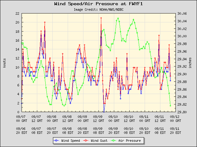
Big pressure drop at Fowey Rocks off Miami, winds increasing:
3 likes
-
Evil Jeremy

- S2K Supporter
- Posts: 5463
- Age: 32
- Joined: Mon Apr 10, 2006 2:10 pm
- Location: Los Angeles, CA
Re: ATL: INVEST 96L - Discussion
Not surprised by advisory. Would be surprised if it’s a TD instead of PTC. Can’t recall the NHC announcing advisories will be issued with half an hour notice without saying what the system would be classified as. Must be an internal debate...
0 likes
Frances 04 / Jeanne 04 / Katrina 05 / Wilma 05 / Fay 08 / Debby 12 / Andrea 13 / Colin 16 / Hermine 16 / Matthew 16 / Irma 17
-
Hypercane_Kyle
- Category 5
- Posts: 3465
- Joined: Sat Mar 07, 2015 7:58 pm
- Location: Cape Canaveral, FL
Re: ATL: INVEST 96L - Discussion
us89 wrote:Hypercane_Kyle wrote:us89 wrote:
NHC hasn't declared it a TD yet. Last time they used this wording was for the PTC that became Nana.
Yeah, the thought crossed my mind that may be the case after I made that post.
Poor wording from the NHC. Why not just say "we're initiating advisories on PTC 19"?
My bet is because it still gives them a chance to call it a TD in case it organizes further in the next 30 minutes.
Makes sense. It is wrapping up quickly.
0 likes
My posts are my own personal opinion, defer to the National Hurricane Center (NHC) and other NOAA products for decision making during hurricane season.
-
Dean4Storms
- S2K Supporter
- Posts: 6358
- Age: 63
- Joined: Sun Aug 31, 2003 1:01 pm
- Location: Miramar Bch. FL
-
WeatherEmperor
- S2K Supporter
- Posts: 4806
- Age: 42
- Joined: Thu Sep 04, 2003 2:54 pm
- Location: South Florida
Re: ATL: INVEST 96L - Discussion
NHC website just listed TD19
Sent from my iPhone using Tapatalk
Sent from my iPhone using Tapatalk
0 likes
Who is online
Users browsing this forum: No registered users and 107 guests