ATL: ETA - Post-Tropical - Discussion

Moderator: S2k Moderators

Message
Author
MJGarrison
Tropical Storm
Tropical Storm
Posts: 146
Joined: Wed Aug 30, 2017 7:26 pm

Re: ATL: ETA - Tropical Storm - Discussion

#3461 Postby MJGarrison » Sun Nov 08, 2020 12:21 pm

ScottNAtlanta wrote:
wxman57 wrote:Currently, Eta is predicted to pass just south of, or possibly over the southern Keys tonight as a hurricane. This track is about 85 miles south of Miami. Hurricane-force winds are predicted to extend only 20-30 miles north of Eta's center, so unless there is quite a large wobble, Miami won't see any sustained hurricane-force wind. Winds may gust 60-75 mph on the beaches of the SE Peninsula tonight. Inland, over the Peninsula, winds will be lower. Long-range track remains quite uncertain. I notice that the NHC's final 120 hr track point hasn't changed since yesterday morning. Still "on hold" waiting for greater forecast confidence. They don't have to issue a 7-day track like I do. Hard to put it "on hold" for 2 more days...


Their cone has increased in size though to show the uncertainty...it almost looks like a big round ball and not a cone.

The cone does not increase in size due to uncertainty, although it may seem that way due to slow movement of the storm.


Sent from my iPhone using Tapatalk
0 likes   

User avatar
gatorcane
S2K Supporter
S2K Supporter
Posts: 23691
Age: 47
Joined: Sun Mar 13, 2005 3:54 pm
Location: Boca Raton, FL

Re: ATL: ETA - Tropical Storm - Discussion

#3462 Postby gatorcane » Sun Nov 08, 2020 12:26 pm

Looks to be making the turn

Image
0 likes   

User avatar
NDG
S2K Supporter
S2K Supporter
Posts: 15446
Joined: Sun Jul 09, 2006 10:14 pm
Location: Orlando, FL

Re: ATL: ETA - Tropical Storm - Discussion

#3463 Postby NDG » Sun Nov 08, 2020 12:28 pm

chaser1 wrote:Eta's magically diminishing core appears to be either reorganizing a tad westward and/or beginning it's more WNW hair-pin turn now (as well shown in attached graphic by Cycloneye above).

Edit: After further review, the play on the field has been reversed lol. Eta still appears to be moving generally Northwest however the center does appear to have expanded and deeper convection appearing shunted to the west atm


Yes, it is overall a NNW to NW heading, it hasn't started yet a WNW heading.
3 likes   

User avatar
SFLcane
S2K Supporter
S2K Supporter
Posts: 10163
Age: 47
Joined: Sat Jun 05, 2010 1:44 pm
Location: Lake Worth Florida

Re: ATL: ETA - Tropical Storm - Discussion

#3464 Postby SFLcane » Sun Nov 08, 2020 12:29 pm

Very unimpressive across the mainland thus far atleast in Broward just a few gusts maybe 25-30 with these weak bands.
0 likes   

User avatar
NC George
Category 2
Category 2
Posts: 633
Age: 55
Joined: Sun Sep 14, 2003 11:44 am
Location: Washington, NC, USA

Re: ATL: ETA - Tropical Storm - Discussion

#3465 Postby NC George » Sun Nov 08, 2020 12:29 pm

chaser1 wrote:Anyone have a Cuban Radar link to verify possible westward jog? If not..... anyone simply have any Cuban cigars lol?


http://www.insmet.cu/asp/genesis.asp?TB ... B1=RADARES
0 likes   
Bertha '96, Fran '96, Bonnie '98, Dennis '99, Floyd '99 :eek: , Isabel '03, Irene '11, Matthew '16, Isaias '20, PTC16????

Avatar is heading into Florence 2018, moving friend's boat, only land between us and Hurricane Florence is Ocracoke Island!

underthwx
Category 5
Category 5
Posts: 2362
Joined: Sat Jul 30, 2011 2:14 pm
Location: Brazoria County Texas

Re: ATL: ETA - Tropical Storm - Discussion

#3466 Postby underthwx » Sun Nov 08, 2020 12:32 pm

NC George wrote:
chaser1 wrote:Anyone have a Cuban Radar link to verify possible westward jog? If not..... anyone simply have any Cuban cigars lol?


http://www.insmet.cu/asp/genesis.asp?TB ... B1=RADARES

Pico SanJuan radar shows a good shot of the center, looks to be jogging WNW?...... I read the Cuban equivalent of the NHC ETA discussion, it's interesting terminology, for example, ETA is described as an organism, I enjoy reading different meteorology discussions from different countries...
Last edited by underthwx on Sun Nov 08, 2020 12:39 pm, edited 1 time in total.
0 likes   

User avatar
SouthDadeFish
Professional-Met
Professional-Met
Posts: 2835
Joined: Thu Sep 23, 2010 2:54 pm
Location: Miami, FL
Contact:

Re: ATL: ETA - Tropical Storm - Discussion

#3467 Postby SouthDadeFish » Sun Nov 08, 2020 12:33 pm

Fairly impressive for having traversed Cuba and considering the shear and dry air:

 https://twitter.com/MikeFischerWx/status/1325490293177790464


2 likes   

User avatar
NDG
S2K Supporter
S2K Supporter
Posts: 15446
Joined: Sun Jul 09, 2006 10:14 pm
Location: Orlando, FL

Re: ATL: ETA - Tropical Storm - Discussion

#3468 Postby NDG » Sun Nov 08, 2020 12:34 pm

Saved radar loop. Now on a NW heading.

Image
0 likes   

User avatar
Canelaw99
S2K Supporter
S2K Supporter
Posts: 2127
Age: 48
Joined: Tue Aug 31, 2004 8:27 am
Location: Homestead, FL

Re: ATL: ETA - Tropical Storm - Discussion

#3469 Postby Canelaw99 » Sun Nov 08, 2020 12:39 pm

It seems like it’s going to pass through FL Keys faster than anticipated before????
0 likes   

Cat5James
Category 1
Category 1
Posts: 417
Joined: Fri Sep 06, 2019 7:54 pm

Re: ATL: ETA - Tropical Storm - Discussion

#3470 Postby Cat5James » Sun Nov 08, 2020 12:41 pm

Dry air has wrapped around and is now eating away at convection from the East
0 likes   

User avatar
Jr0d
S2K Supporter
S2K Supporter
Posts: 1409
Joined: Tue Aug 27, 2019 10:52 am
Location: Cayo Hueso

Re: ATL: ETA - Tropical Storm - Discussion

#3471 Postby Jr0d » Sun Nov 08, 2020 12:42 pm

underthwx wrote:I think that ETA may have a surprise or two in store, as it has demonstrated already, if I lived in Florida, I would stay in touch with the updates, be prepared as best I could, rule of thumb, be prepared for one storm designation higher, then I would carry on as normal, watch a movie with my family or something.... Yall enjoy your Sunday my friends...


Key West is business as usual...kind of wierd considering we are about 12 hours away from potential hurricane conditions.

It will also be D-max when Eta makes it's close approach as well as improving atmospheric conditions. I have been through several marginal tropical storms while in a strengthening phase and its not pretty.

Unless something changes, we have the ingredients for a strengthening hurricane right on top of the lower keys, one that few have prepared for. At least there was not a long line to get sandbags this morning...

I will keep the board updated throughout the night, unless I lose internet/cellphone coverage, on how the conditions are in Key West.
Last edited by Jr0d on Sun Nov 08, 2020 1:34 pm, edited 1 time in total.
2 likes   

underthwx
Category 5
Category 5
Posts: 2362
Joined: Sat Jul 30, 2011 2:14 pm
Location: Brazoria County Texas

Re: ATL: ETA - Tropical Storm - Discussion

#3472 Postby underthwx » Sun Nov 08, 2020 12:43 pm

This discussion is from INSMET-Cuban Weather Office....thought I would share it.... Tropical Cyclone Warning.
Forecast Center, INSMET.
Date: November 8, 2020. Time: 12:05 pm.

TROPICAL CYCLONE NOTICE No. 26.
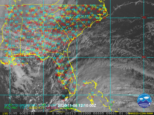
TROPICAL STORM ETA.

... Eta moves through the seas north of the central region ...


Tropical storm Eta hit the sea at around 9:30 am today near Punta Alegre, Ciego de Avila, a coastal town very close to border with the province of Sancti Spíritus.

Eta during the morning has tilted its course to the north, slightly increasing its speed of translation which is now 22 kilometers per hour.

At noon its central region was estimated at 22.9 degrees north latitude and 79.3 degrees west longitude, a position that places it about 100 kilometers northwest of Cayo Coco, Ciego de Avila and about 50 kilometers northeast of Caibarién Villa Clara.

Eta has had fluctuations in its intensity, has maximum sustained winds of 100 kilometers per hour, with higher gusts, and its central pressure remains at 993 hectoPascal.

In the next few hours Eta will maintain a close course between north and north-northwest, tilting its trajectory towards the west from at night when it moves over the Straits of Florida. With this movement over the sea, it can gain more organization and intensity and at the end of the next morning turn into a hurricane, in the vicinity of the Florida Keys.

In the last 24 hours until 8 in the morning, more than 70 points of the network of the Institute of Meteorology and the National Institute of Hydraulic Resources reported rainfall above 100 millimeters, of which 9 were above 200 millimeters.

The highest accumulated were: El Jíbaro Meteorological Station, Sancti Spiritus. 328.0 millimeters South Derivadora del Jibaro, Sancti Spiritus. 304.9 millimeters Pto. Fire Prevention Orlando González, Ciego de Ávila. 290.0 mm Moroccan tele-mail, Ciego de Ávila. 226.3 millimeters Tele-mail Imías, Guantánamo. 226.0 millimeters Tele-mail Guayacanes, Ciego de Ávila. 218.1 mm Embalse La Felicidad, Sancti Spiritus. 205.8 millimeters Las Margaritas reservoir, Ciego de Ávila. 205.5 millimeters Embalse Dignorah, Sancti Spiritus. 203.4 millimeters The heaviest rainfall areas associated with the circulation of Eta are to the north of the central region of the country, however bands of this system can still influence the center and east of the country that have received abundant rainfall in the last hours, saturating the soils. Areas of heavy rains already affect areas of the north western coast, and can spread in the afternoon to inland areas, and can be strong and intense.

During the afternoon of today the winds will decrease, between 35 and 50 kilometers per hour in the northern portion of the central region of Cuba, with higher gusts. These winds will continue to produce strong swells on the south coast, with a rise in sea level between 1 and 1.5 meters and moderate coastal flooding from Júcaro in Ciego de Ávila to Manzanillo in Granma. Due to the combination of the effects of the wind, heavy rains and the sea in the area of ​​the mouth of the Zaza rivers in Sancti Spíritus and Cauto in Granma, floods in these areas are forecast to be strong. On the north coast of the west and center, including the Havana seawall, strong swells will occur with wave heights of between 3 and 4 meters, generating light coastal flooding from this afternoon,

The next tropical cyclone warning for this organism will be issued at three in the afternoon today....
2 likes   

User avatar
Jr0d
S2K Supporter
S2K Supporter
Posts: 1409
Joined: Tue Aug 27, 2019 10:52 am
Location: Cayo Hueso

Re: ATL: ETA - Tropical Storm - Discussion

#3473 Postby Jr0d » Sun Nov 08, 2020 12:51 pm

Cat5James wrote:Dry air has wrapped around and is now eating away at convection from the East


I see that. It was in better shape rightbwhen it emerged off Cuba. It is not a lot of dry air, so I do not think it will be a major inhibitor.

It definately put a cap on intensification this morning and makes it less likely it will be a hurricane before Eta hits the Keys.
Last edited by Jr0d on Sun Nov 08, 2020 12:59 pm, edited 2 times in total.
0 likes   

User avatar
Evil Jeremy
S2K Supporter
S2K Supporter
Posts: 5463
Age: 32
Joined: Mon Apr 10, 2006 2:10 pm
Location: Los Angeles, CA

Re: ATL: ETA - Tropical Storm - Discussion

#3474 Postby Evil Jeremy » Sun Nov 08, 2020 12:55 pm

SFLcane wrote:Very unimpressive across the mainland thus far atleast in Broward just a few gusts maybe 25-30 with these weak bands.


What else would you be expecting from the outer bands of a sheared TS that's still 8-10 hours away from it's closest approach?

In Sunrise, the rain is starting to pile up, and we've got palm leaves and down garbage bins (thankfully empty, just never brought up from yesterday) up and down our street. And a couple houses down, either they brought down their basketball hoop yesterday, or it got knocked down by a gust, and just looking at the angle of collapse I don't think it was intentionally placed that way. So the idea that were going to have another 12-18 hours of this weather, with the apex late this evening, isn't that fun. Sure, this isn't a severe tropical threat by any means, but what we've had so far, since last night, is not unremarkable for a TS that's still just off the coast of Cuba.
3 likes   
Frances 04 / Jeanne 04 / Katrina 05 / Wilma 05 / Fay 08 / Debby 12 / Andrea 13 / Colin 16 / Hermine 16 / Matthew 16 / Irma 17

User avatar
SFLcane
S2K Supporter
S2K Supporter
Posts: 10163
Age: 47
Joined: Sat Jun 05, 2010 1:44 pm
Location: Lake Worth Florida

Re: ATL: ETA - Tropical Storm - Discussion

#3475 Postby SFLcane » Sun Nov 08, 2020 1:03 pm

Evil Jeremy wrote:
SFLcane wrote:Very unimpressive across the mainland thus far atleast in Broward just a few gusts maybe 25-30 with these weak bands.


What else would you be expecting from the outer bands of a sheared TS that's still 8-10 hours away from it's closest approach?

In Sunrise, the rain is starting to pile up, and we've got palm leaves and down garbage bins (thankfully empty, just never brought up from yesterday) up and down our street. And a couple houses down, either they brought down their basketball hoop yesterday, or it got knocked down by a gust, and just looking at the angle of collapse I don't think it was intentionally placed that way. So the idea that were going to have another 12-18 hours of this weather, with the apex late this evening, isn't that fun. Sure, this isn't a severe tropical threat by any means, but what we've had so far, since last night, is not unremarkable for a TS that's still just off the coast of Cuba.


My friend your just down the block! I live in Sunrise my weatherstation peak gusts today has been 26 mph. :roll: we will wait for the circulation to get closer to see if things pick up. Rain also has been not constant so this will help with the flooding.

https://mesowest.utah.edu/cgi-bin/droma ... ?stn=F7105
2 likes   

User avatar
chaser1
S2K Supporter
S2K Supporter
Posts: 5473
Age: 64
Joined: Sat Oct 15, 2005 5:59 pm
Location: Longwood, Fl

Re: ATL: ETA - Tropical Storm - Discussion

#3476 Postby chaser1 » Sun Nov 08, 2020 1:09 pm

NC George wrote:
chaser1 wrote:Anyone have a Cuban Radar link to verify possible westward jog? If not..... anyone simply have any Cuban cigars lol?


http://www.insmet.cu/asp/genesis.asp?TB ... B1=RADARES


Thanks! Unfortunately, it seems that several of the specific radar links are temporarily down atm
0 likes   
Andy D

(For official information, please refer to the NHC and NWS products.)

User avatar
gatorcane
S2K Supporter
S2K Supporter
Posts: 23691
Age: 47
Joined: Sun Mar 13, 2005 3:54 pm
Location: Boca Raton, FL

Re: ATL: ETA - Tropical Storm - Discussion

#3477 Postby gatorcane » Sun Nov 08, 2020 1:15 pm

SFLcane wrote:
Evil Jeremy wrote:
SFLcane wrote:Very unimpressive across the mainland thus far atleast in Broward just a few gusts maybe 25-30 with these weak bands.


What else would you be expecting from the outer bands of a sheared TS that's still 8-10 hours away from it's closest approach?

In Sunrise, the rain is starting to pile up, and we've got palm leaves and down garbage bins (thankfully empty, just never brought up from yesterday) up and down our street. And a couple houses down, either they brought down their basketball hoop yesterday, or it got knocked down by a gust, and just looking at the angle of collapse I don't think it was intentionally placed that way. So the idea that were going to have another 12-18 hours of this weather, with the apex late this evening, isn't that fun. Sure, this isn't a severe tropical threat by any means, but what we've had so far, since last night, is not unremarkable for a TS that's still just off the coast of Cuba.


My friend your just down the block! I live in Sunrise my weatherstation peak gusts today has been 26 mph. :roll: we will wait for the circulation to get closer to see if things pick up. Rain also has been not constant so this will help with the flooding.

https://mesowest.utah.edu/cgi-bin/droma ... ?stn=F7105


May even see the sun later with dry air wrapping around and now into the SE side, check out the clearing over the Bahamas. 8-)

Image
0 likes   

User avatar
NC George
Category 2
Category 2
Posts: 633
Age: 55
Joined: Sun Sep 14, 2003 11:44 am
Location: Washington, NC, USA

Re: ATL: ETA - Tropical Storm - Discussion

#3478 Postby NC George » Sun Nov 08, 2020 1:20 pm

chaser1 wrote:
NC George wrote:
chaser1 wrote:Anyone have a Cuban Radar link to verify possible westward jog? If not..... anyone simply have any Cuban cigars lol?


http://www.insmet.cu/asp/genesis.asp?TB ... B1=RADARES


Thanks! Unfortunately, it seems that several of the specific radar links are temporarily down atm


Just keep refreshing every few minutes, they'll generally pop back up.
0 likes   
Bertha '96, Fran '96, Bonnie '98, Dennis '99, Floyd '99 :eek: , Isabel '03, Irene '11, Matthew '16, Isaias '20, PTC16????

Avatar is heading into Florence 2018, moving friend's boat, only land between us and Hurricane Florence is Ocracoke Island!

User avatar
toad strangler
S2K Supporter
S2K Supporter
Posts: 4543
Joined: Sun Jul 28, 2013 3:09 pm
Location: Earth
Contact:

Re: ATL: ETA - Tropical Storm - Discussion

#3479 Postby toad strangler » Sun Nov 08, 2020 1:21 pm

WOW what a huge area of uncertainty IRT track after 3 days :eek: Eta potentially can badger FL for almost a WEEK.
0 likes   

User avatar
Miami Storm Tracker
Category 4
Category 4
Posts: 910
Age: 67
Joined: Sun Jun 13, 2010 10:12 pm
Location: Key Largo, Fla.
Contact:

Re: ATL: ETA - Tropical Storm - Discussion

#3480 Postby Miami Storm Tracker » Sun Nov 08, 2020 1:27 pm

Afternoon,

Been consistently gusty wind and rain since yesterday her in Key Largo.
0 likes   


Return to “2020”

Who is online

Users browsing this forum: No registered users and 5 guests