ATL: FAY - Post-Tropical - Discussion
Moderator: S2k Moderators

Re: ATL: FAY - Tropical Storm - Discussion
Now that most of Fay’s convection has dissipated, the rain has just about stopped here in SW Connecticut, but winds continue to increase. Looks like maximum sustained winds will peak at ~35 mph between 10pm-1am, and I wouldn’t rule out gusts of up to 50 mph.
0 likes
Irene '11 Sandy '12 Hermine '16 5/15/2018 Derecho Fay '20 Isaias '20 Elsa '21 Henri '21 Ida '21
I am only a meteorology enthusiast who knows a decent amount about tropical cyclones. Look to the professional mets, the NHC, or your local weather office for the best information.
I am only a meteorology enthusiast who knows a decent amount about tropical cyclones. Look to the professional mets, the NHC, or your local weather office for the best information.
-
CrazyC83
- Professional-Met

- Posts: 34315
- Joined: Tue Mar 07, 2006 11:57 pm
- Location: Deep South, for the first time!
Re: ATL: FAY - Post-Tropical - Discussion
The posts in this forum are NOT official forecasts and should not be used as such. They are just the opinion of the poster and may or may not be backed by sound meteorological data. They are NOT endorsed by any professional institution or STORM2K. For official information, please refer to products from the NHC and NWS.
This is not official, but here are my thoughts for the best track and intensity of Fay.
AL062020, FAY, 30,
20200705, 0000, , LO, 28.2N, 89.5W, 20, 1013,
20200705, 0600, , LO, 28.2N, 88.9W, 20, 1013,
20200705, 1200, , LO, 28.3N, 88.4W, 25, 1011,
20200705, 1800, , LO, 28.5N, 87.4W, 30, 1009,
20200706, 0000, , TD, 29.0N, 86.2W, 30, 1008,
20200706, 0600, L, TS, 29.9N, 85.4W, 35, 1007,
20200706, 1200, , TD, 30.8N, 85.1W, 25, 1009,
20200705, 1800, , LO, 31.6N, 84.6W, 20, 1012,
20200707, 0000, , LO, 32.2N, 84.1W, 20, 1012,
20200707, 0600, , LO, 32.8N, 83.7W, 20, 1013,
20200707, 1200, , LO, 33.3N, 83.3W, 20, 1014,
20200707, 1800, , LO, 33.3N, 82.5W, 20, 1014,
20200708, 0000, , LO, 33.3N, 81.5W, 20, 1012,
20200708, 0600, , LO, 33.3N, 80.5W, 25, 1010,
20200708, 1200, , LO, 33.4N, 79.2W, 25, 1009,
20200708, 1800, , LO, 33.7N, 78.0W, 25, 1008,
20200709, 0000, , LO, 33.9N, 77.0W, 30, 1008,
20200709, 0600, , TD, 34.0N, 76.3W, 30, 1007,
20200709, 1200, , TS, 34.5N, 75.4W, 35, 1006,
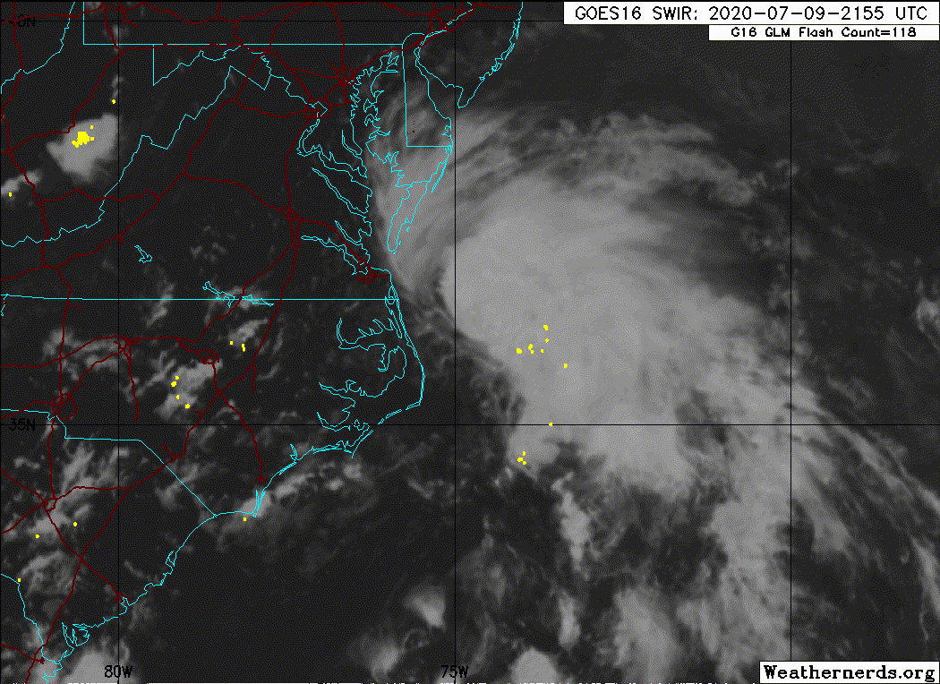
20200709, 1800, , TS, 35.4N, 75.0W, 40, 1005,
20200710, 0000, , TS, 35.9N, 74.8W, 45, 1004,
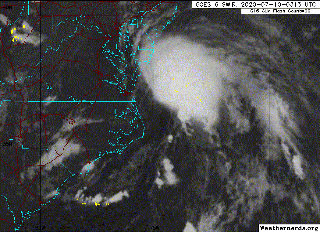
20200710, 0600, , TS, 36.8N, 74.7W, 45, 1002,
20200710, 1200, , TS, 37.6N, 74.6W, 50, 999,
20200710, 1800, , TS, 38.9N, 74.4W, 50, 998,
20200710, 2045, L, TS, 39.6N, 74.2W, 45, 999,
20200711, 0000, , TS, 40.2N, 74.1W, 35, 1000,
20200711, 0230, L, TD, 40.5N, 74.1W, 30, 1001,
20200711, 0600, , LO, 41.6N, 74.0W, 30, 1001,
20200711, 1200, , LO, 43.3N, 74.0W, 25, 1002,
20200711, 1800, , LO, 45.5N, 73.8W, 25, 1002,
Absorbed by front at 0000Z
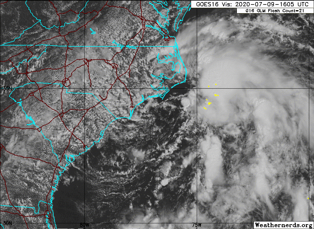
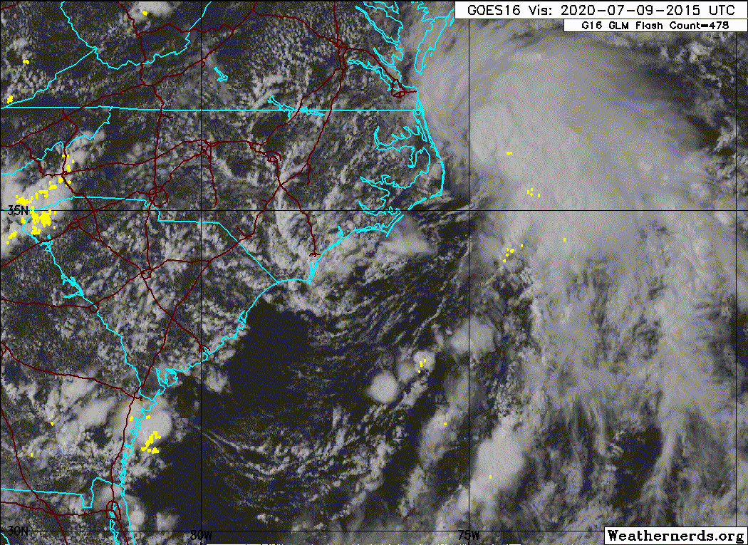
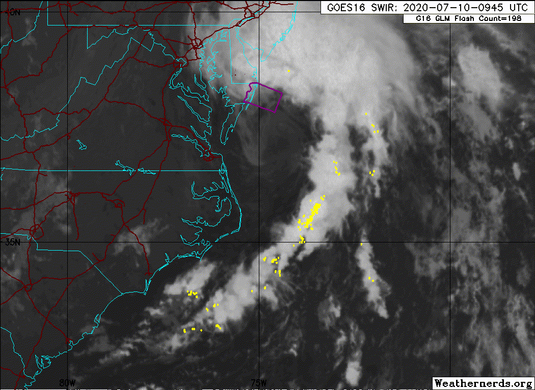
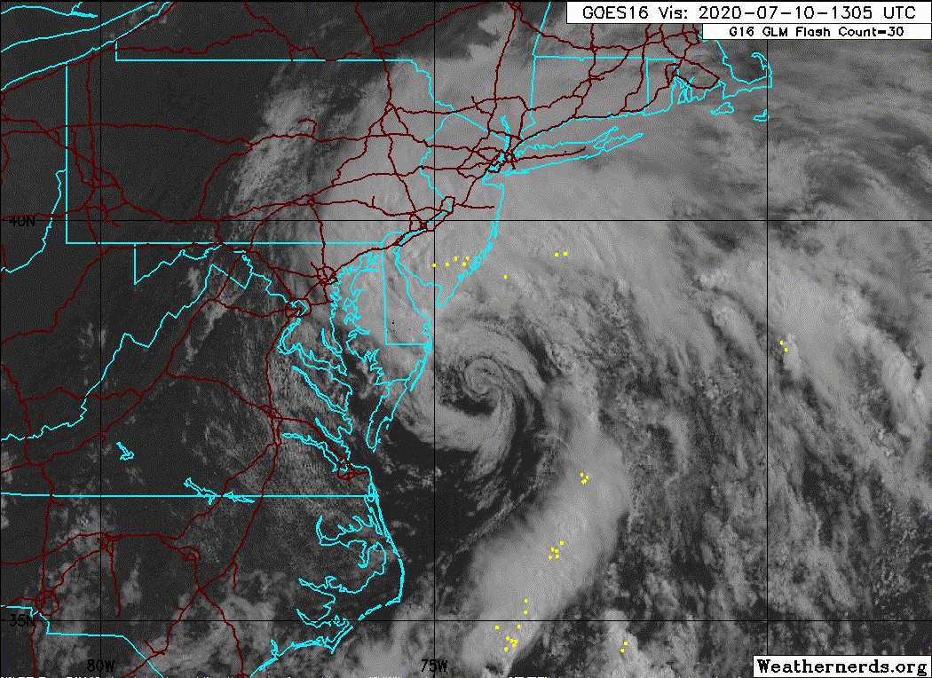
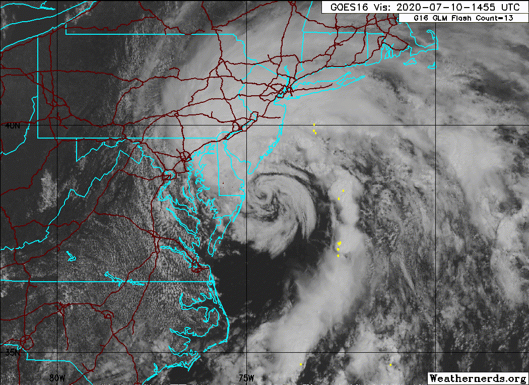
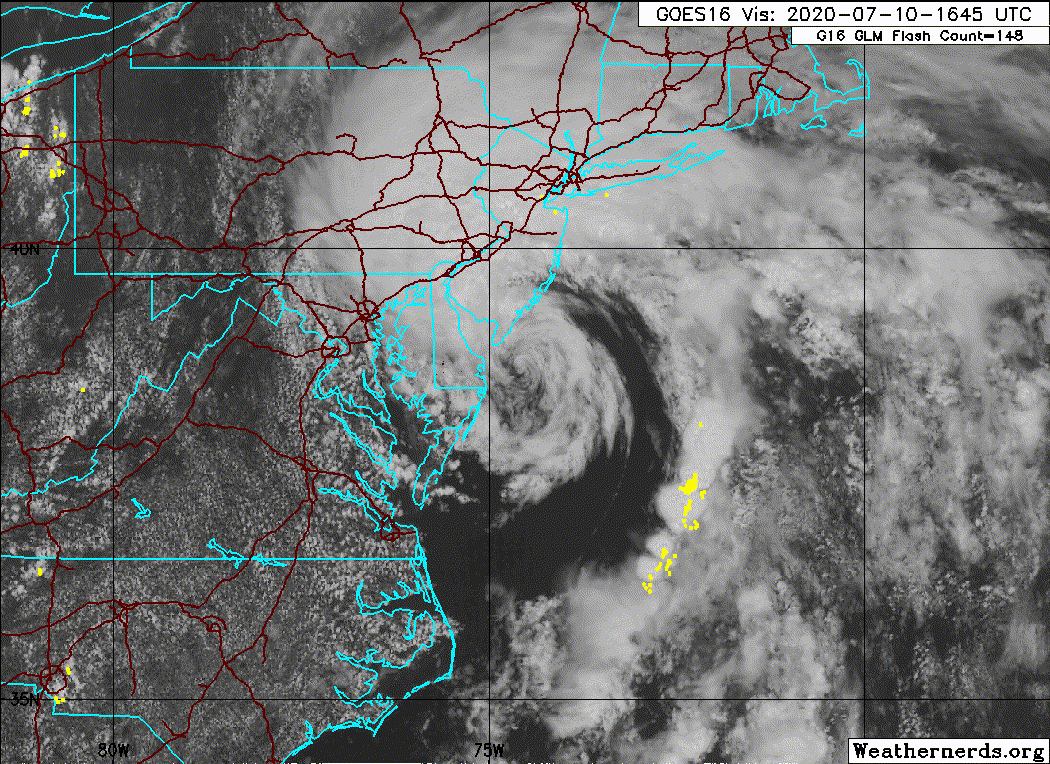
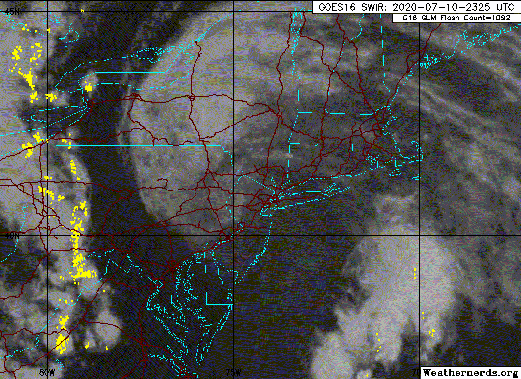
The big change is that I believe Fay was a TC for a relatively short period on July 6 in the Gulf and approaching Florida. Radar had a clear signature and there appeared to be sufficient deep convection for such a classification. The 35 kt landfall intensity (at Mexico Beach, FL at 0600Z) is inferred from a buoy SW of the center that measured 28 kt winds at 4 m at 0600Z with the strongest winds likely not measured being on the back side. By 1800Z, it was likely back to a remnant low as the radar signature had deteriorated dramatically.
The (re-)genesis is also moved up 12 hours as a 30 kt tropical depression. That is based on radar evidence of curved banding as early as 0300Z as well as improving satellite signatures as it was just offshore. An ASCAT pass of 32 kt (low resolution) at 1300Z suggests it was a tropical storm at 1200Z, before aircraft arrived at 1800Z to confirm the 40 kt intensity.
The peak intensity is unchanged, as is the NJ landfall intensity. The track is adjusted a touch to the east based on wind analyses and an additional landfall in New York Harbor is added (as a 30 kt tropical depression as there appeared to be no winds of gale force of any kind by then).
2 likes
-
Sciencerocks
- Category 5

- Posts: 10181
- Age: 40
- Joined: Thu Jul 06, 2017 1:51 am


Re: ATL: FAY - Tropical Storm - Discussion
Hammy wrote:Track and satellite appearance remind me of Danielle in 1992. Not common we see tropical storms ride up the coast here, especially if they're not long trackers that came from further south.
Cool to bring up Danielle. I was living in Bethany Beach at the time Danielle made landfall just to the south of Delaware. I'm not sure how the max winds of Danielle compared to Fay at closest approach to Delaware (both may have been around 50) but standing on the beach during both storms...no comparison. Danielle's sustained wind speeds were quite a bit higher than Fay. Danielle's track just to the west of coastal Delaware put us on the right front part of the storm, and it was quite windy as it passed.
1 likes
Who is online
Users browsing this forum: No registered users and 81 guests