I am seeing some very cold tops within the CDO and for the first time, I am seeing pretty good indications that Hanna is building a solid inner core.
All of you on the Texas coast better buckle up. I am getting a bit nervous for you all out there because Hanna is really beginning to flex her muscle. I think she is well.on.her way to becoming a very formidable tropical cyclone!
ATL: HANNA - Remnants - Discussion
Moderator: S2k Moderators
-
northjaxpro

- S2K Supporter

- Posts: 8900
- Joined: Mon Sep 27, 2010 11:21 am
- Location: Jacksonville, FL
Re: ATL: HANNA - Tropical Storm - Discussion
2 likes
NEVER, EVER SAY NEVER in the tropics and weather in general, and most importantly, with life itself!!
________________________________________________________________________________________
Fay 2008 Beryl 2012 Debby 2012 Colin 2016 Hermine 2016 Julia 2016 Matthew 2016 Irma 2017 Dorian 2019
________________________________________________________________________________________
Fay 2008 Beryl 2012 Debby 2012 Colin 2016 Hermine 2016 Julia 2016 Matthew 2016 Irma 2017 Dorian 2019


Re: ATL: HANNA - Tropical Storm - Discussion
Hammy wrote:That is some massive outflow and I dare say this is starting to resemble Katrina while it was over the Bahamas.
Almost textbook, very impessive.
I would very surprised if Hanna does not strengthen significantly today. I dont see anything to inhibit her right now. I expect rapid intensification, cant think of any other storms I can say that about. I hope I am wrong.
0 likes
-
AxaltaRacing24
- Category 5

- Posts: 1774
- Age: 25
- Joined: Wed Jul 27, 2016 11:14 am
- Location: Jupiter, FL
Re: ATL: HANNA - Tropical Storm - Discussion
Jr0d wrote:Hammy wrote:That is some massive outflow and I dare say this is starting to resemble Katrina while it was over the Bahamas.
Almost textbook, very impessive.
I would very surprised if Hanna does not strengthen significantly today. I dont see anything to inhibit her right now. I expect rapid intensification, cant think of any other storms I can say that about. I hope I am wrong.
I am hoping that July climo can at least keep her in check.
0 likes
-
Shell Mound
- Category 5
- Posts: 2432
- Age: 33
- Joined: Thu Sep 07, 2017 3:39 pm
- Location: St. Petersburg, FL → Scandinavia
Re: ATL: HANNA - Tropical Storm - Discussion
AxaltaRacing24 wrote:Jr0d wrote:Hammy wrote:That is some massive outflow and I dare say this is starting to resemble Katrina while it was over the Bahamas.
Almost textbook, very impessive.
I would very surprised if Hanna does not strengthen significantly today. I dont see anything to inhibit her right now. I expect rapid intensification, cant think of any other storms I can say that about. I hope I am wrong.
I am hoping that July climo can at least keep her in check.
If conditions are sufficiently conducive to rapid intensification, then July climatology doesn’t really matter. The W Gulf can support a Cat-5 right now.

5 likes
CVW / MiamiensisWx / Shell Mound
The posts in this forum are NOT official forecasts and should not be used as such. They are just the opinion of the poster and may or may not be backed by sound meteorological data. They are NOT endorsed by any professional institution or STORM2K. For official information, please refer to products from the NHC and NWS.

Re: ATL: HANNA - Tropical Storm - Discussion
Watch for any large pressure drop from Recon.
The more the pressure drops, the more entrainment of high TPW air from the EPAC and W Carib.
The longer it sits before making landfall, the stronger it'll get.

The more the pressure drops, the more entrainment of high TPW air from the EPAC and W Carib.
The longer it sits before making landfall, the stronger it'll get.
2 likes
-
northjaxpro
- S2K Supporter
- Posts: 8900
- Joined: Mon Sep 27, 2010 11:21 am
- Location: Jacksonville, FL
Re: ATL: HANNA - Tropical Storm - Discussion
..Jr0d wrote:Hammy wrote:That is some massive outflow and I dare say this is starting to resemble Katrina while it was over the Bahamas.
Almost textbook, very impessive.
I would very surprised if Hanna does not strengthen significantly today. I dont see anything to inhibit her right now. I expect rapid intensification, cant think of any other storms I can say that about. I hope I am wrong.
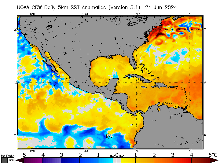
I am afraid that you will not be wrong. Hanna is in about as close of an ideal environment you will see right now. There is very low shear, if at all, very warm ssts, a very moist environment, and worse of all, she is moving slowly currently. She is already beginning the intensification stage, So today there is no telling just how intense she could get. There is virtually nothing I see standing in her way. to really get going.
I hopeand stress to everyone out there to really buckle up because Hanna I am afraid is about to deliver a pretty good pucnch on the Texas coast on Saturday.
3 likes
NEVER, EVER SAY NEVER in the tropics and weather in general, and most importantly, with life itself!!
________________________________________________________________________________________
Fay 2008 Beryl 2012 Debby 2012 Colin 2016 Hermine 2016 Julia 2016 Matthew 2016 Irma 2017 Dorian 2019
________________________________________________________________________________________
Fay 2008 Beryl 2012 Debby 2012 Colin 2016 Hermine 2016 Julia 2016 Matthew 2016 Irma 2017 Dorian 2019
Re: ATL: HANNA - Tropical Storm - Discussion
Perfect example of "Don't Believe The Models"
CIMSS showing a strong anticyclone just to the west.
GFS showing it stuck between two anticyclones with a strong jet overhead.
I don't see any evidence of an UL Jet on satellite.
A good point was made last night.
A lot of model data comes from commercial airlines.
Due to COVID and the limits of flights, data could be very limited.
BTW, tracking into an anticyclone is a sure recipe for intensification.
1 likes
-
USTropics
- Professional-Met

- Posts: 2732
- Joined: Sun Aug 12, 2007 3:45 am
- Location: Florida State University
Re: ATL: HANNA - Tropical Storm - Discussion
Some curved banding starting to appear within the CDO in the last few frames, signs Hanna is in the process of building an eyewall:

2 likes

Re: ATL: HANNA - Tropical Storm - Discussion
Wouldn't be surprised if it was close to a major hurricane by the end off the day
Seem like all the modal are playing catch up again
Seem like all the modal are playing catch up again
0 likes
Re: ATL: HANNA - Tropical Storm - Discussion
I thought they might have gone with a hurricane watch, but it is probably best to wait for data from the plane.
0 likes

Re: ATL: HANNA - Tropical Storm - Discussion
This looks like all the components are falling into place for Hanna. The only obstacle I can see is sometimes storms try and run before they can walk, and it can take a while to sort out all it’s convection. Only an observation I’ve had with a few WPac storms in perfect conditions.
2 likes
Re: ATL: HANNA - Tropical Storm - Discussion
BTW, I haven't seen any high-level drop missions.
I guess they are tied up with Douglas and Gonzo.
NOAA planes are doing LL missions into Hanna.
So, basically working blind knowing what's quantitatively going on in the upper troposphere.
CIMSS showing a totally clear path to the coast.
It'll hit a high CAPE pool just before landfall.
Troposphere will be saturated from sea surface to tropopause.
Very good chance for RI then.
0 likes
-
bob rulz
- Category 5
- Posts: 1711
- Age: 35
- Joined: Sat Jan 28, 2006 7:30 pm
- Location: Salt Lake City, Utah
Re: ATL: HANNA - Tropical Storm - Discussion
Chemmers wrote:Wouldn't be surprised if it was close to a major hurricane by the end off the day
Seem like all the modal are playing catch up again
I think a major hurricane by the end of the day is a BIG reach. This is still in the process of building a core. Could it be a major by landfall though? It's not like it can be completely ruled out, but I would still say that's a stretch.
3 likes
Re: ATL: HANNA - Tropical Storm - Discussion
I haven't seen a warm core this high in the atmosphere before.
At this latitude, that's likely at the tail end of the stratosphere.
Clear tell of how well this is being vented and the strong anticyclone overhead.

At this latitude, that's likely at the tail end of the stratosphere.
Clear tell of how well this is being vented and the strong anticyclone overhead.
2 likes
Re: ATL: HANNA - Tropical Storm - Discussion
Looks like they may have lost radar satellite data too.
Last was 11 hrs ago.
If I am correct, should have had 2 passes by then.
Last was 11 hrs ago.
If I am correct, should have had 2 passes by then.
0 likes
-
Shell Mound
- Category 5
- Posts: 2432
- Age: 33
- Joined: Thu Sep 07, 2017 3:39 pm
- Location: St. Petersburg, FL → Scandinavia
Re: ATL: HANNA - Tropical Storm - Discussion
Major U.S. Hurricane Landfalls in July, 1851–2019
21 Jul 1909 (TX): 100 kt / 959 mb
5 Jul 1916 (MS/AL): 105 kt / 950 mb
10 Jul 2005 (FL): 105 kt / 946 mb (DENNIS)
The main negative factor against Hanna’s reaching MH status pre-landfall, besides time, is the presence of some westerly mid- to upper-level shear, given the displacement of the UL anticyclone to the SW of the greatest LL convergence and hence convection, which also contributes to the slight tilt of the structure with height and the modest separation of the LLC from the MLC. Otherwise, the thermodynamic and synoptic environment is excellent for rapid intensification, given the dual outflow channels between upper lows to the SW and E of the system. However, the slow movement of the system while centred in a col could compensate somewhat and allow shear to subside in time as ridging builds to the NW and N of the system. Once vertical alignment takes place, expect rapid to explosive deepening. It’s not if, but when. If it happens in time, and Hanna continues to meander, than a Cat-3 or even Cat-4 at landfall is not out of the question.
Hanna: 120 kt / 939 mb at landfall in TX?
1 likes
CVW / MiamiensisWx / Shell Mound
The posts in this forum are NOT official forecasts and should not be used as such. They are just the opinion of the poster and may or may not be backed by sound meteorological data. They are NOT endorsed by any professional institution or STORM2K. For official information, please refer to products from the NHC and NWS.
Re: ATL: HANNA - Tropical Storm - Discussion
GCANE wrote:And no updates from Recon.
Recon is in the air and reporting
Time: 09:37:00Z
Coordinates: 27.667N 83.483W
Acft. Static Air Press: 464.0 mb
Acft. Geopotential Hgt: 6,493 m (21,302 ft)
D-value: 372 m
Flt. Lvl. Wind (30s): From 158° at 10 kts (From the SSE at 11.5 mph)
Air Temp: -8.8°C* (16.2°F*)
Dew Pt: -*
Peak (10s) Flt. Lvl. Wind: 10 kts (11.5 mph)
SFMR Peak (10s) Sfc. Wind: 14 kts (16.1 mph)
SFMR Rain Rate: 0 mm/hr
3 likes
Re: ATL: HANNA - Tropical Storm - Discussion
xironman wrote:GCANE wrote:And no updates from Recon.
Recon is in the air and reporting
Time: 09:37:00Z
Coordinates: 27.667N 83.483W
Acft. Static Air Press: 464.0 mb
Acft. Geopotential Hgt: 6,493 m (21,302 ft)
D-value: 372 m
Flt. Lvl. Wind (30s): From 158° at 10 kts (From the SSE at 11.5 mph)
Air Temp: -8.8°C* (16.2°F*)
Dew Pt: -*
Peak (10s) Flt. Lvl. Wind: 10 kts (11.5 mph)
SFMR Peak (10s) Sfc. Wind: 14 kts (16.1 mph)
SFMR Rain Rate: 0 mm/hr
See it now - thanks
0 likes
Who is online
Users browsing this forum: No registered users and 84 guests